 NOTE
Ignores Z and M
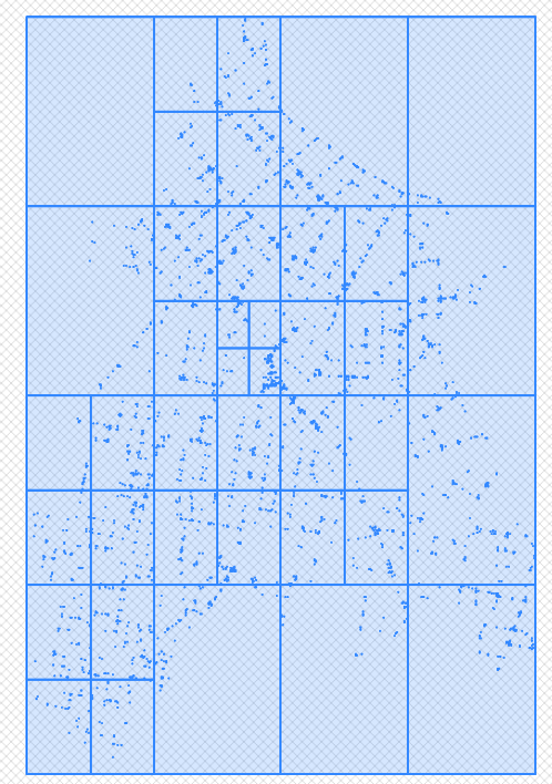
Uses _QuadTree to do the actual tesselation.
NOTE
Ignores Z and M
Uses _QuadTree to do the actual tesselation.
[ Top ] [ Functions ]
NAME
STMove -- Function which moves a geometry using the supplied delta X, Y, Z and M ordinate values.
SYNOPSIS
    Function STMove (
               @p_geometry geometry,
               @p_dX       float,
               @p_dY       float,
               @p_dZ       float,
               @p_dM       float,
               @p_round_xy int = 3,
               @p_round_zm int = 2
             )
     Returns geometry
USAGE
    SELECT [$(owner)].[STMove](geometry::ST_GeomFromText('LINESTRING(0.1 0.2,1.4 45.2)',0),-5.0,30.1,default,default,2,1).AsTextZM() as movedGeom;
    # movedGeom
    'LINESTRING(-4.9 30.2,-3.6 31.5)'
DESCRIPTION
    Function that moves the supplied geometry's ordinates the supplied x, y, z and m deltas.
    The computed ordinates of the new geometry are rounded to @p_round_xy/@p_round_zm number of decimal digits of precision.
INPUTS
    @p_geometry (geometry) - Supplied geometry of any type.
    @p_dX          (float) - X ordinate delta shift.
    @p_dy          (float) - Y ordinate delta shift.
    @p_dZ          (float) - Z ordinate delta shift.
    @p_dM          (float) - M ordinate delta shift.
    @p_round_xy      (int) - Decimal degrees of precision to which calculated XY ordinates are rounded.
    @p_round_zm      (int) - Decimal degrees of precision to which calculated ZM ordinates are rounded.
RESULT
moved geom (geometry) - Input geometry moved by supplied X and Y ordinate deltas.
AUTHOR
Simon Greener
HISTORY
Simon Greener - December 2017 - Original TSQL Coding for SQL Server.
COPYRIGHT
(c) 2008-2018 by TheSpatialDBAdvisor/Simon Greener
[ Top ] [ Functions ]
NAME
STReflect -- Function which reflects the supplied geometry about the supplied 2 point reflexion line.
SYNOPSIS
    Function STReflect (
               @p_geometry        geometry,
               @p_reflection_line geometry,
               @p_round_xy        int = 8,
               @p_round_zm        int = 8
             )
     Returns geometry
DESCRIPTION
    Function that reflects the supplied geometry about the supplied (2-Point) line of reflection.
    The computed ordinates of the new geometry are rounded to @p_round_xy/@p_round_zm number of decimal digits of precision.
INPUTS
    @p_geometry        (geometry) - Supplied geometry of any type to be reflected around @p_reflexion_line
    @p_reflection_line (geometry) - 2 Point reflexion line.
    @p_round_xy             (int) - Decimal degrees of precision to which calculated XY ordinates are rounded.
    @p_round_zm             (int) - Decimal degrees of precision to which calculated ZM ordinates are rounded.
RESULT
Reflected geom (geometry) - Input geometry reflected across/around reflextion line.
USAGE
    SELECT [$(Owner)].[STReflect] (
             geometry::STGeomFromText('POINT(1 -2)',0),
             geometry::STGeomFromText('LINESTRING(3 2,2 6)',0),
             2,2
           ).AsTextZM() as rPoint;

    rPoint
    POINT (6.65 -0.59)

    SELECT [$(Owner)].[STReflect] (
             geometry::STGeomFromText('LINESTRING(1 -2, 1.5 0)',0),
             geometry::STGeomFromText('LINESTRING(3 2,2 6)',0),
             2,2
           ).AsTextZM() as rLine;

    rLine
    LINESTRING (6.65 -0.59, 5.26 0.94)

    WITH data AS (
      SELECT geometry::STGeomFromText('POLYGON((1 4, 2 4, 1.5 3,1 4))',0) as polygon,
      geometry::STGeomFromText('LINESTRING(-5 0,5 0)',0) as rLine
    )
    SELECT [$(Owner)].[STReflect] (
             c.polygon,
             c.rLine,
             4,4
           ).AsTextZM() as rPolygon
      FROM data as c;
     GO

    rPolygon
    POLYGON ((1 -4, 2 -4, 1.5 -3, 1 -4))
AUTHOR
Simon Greener
HISTORY
Simon Greener - June 2020 - Original TSQL Coding for SQL Server.
COPYRIGHT
(c) 2008-2020 by TheSpatialDBAdvisor/Simon Greener
[ Top ] [ Functions ]
NAME
STRotate -- Function which rotates a geometry.
SYNOPSIS
    Function STRotate (
               @p_geometry geometry,
               @p_rX       float,
               @p_rY       float,
               @p_angle    float,
               @p_round_xy int,
               @p_round_zm int
             )
     Returns geometry
USAGE
    With data as (
    select 'Original' as name, geometry::STGeomFromText('POLYGON((1 1, 1 6, 11 6, 11 1, 1 1))',0) as geom
    )
    SELECT name, geom.STAsText() as rGeom
      FROM (select name, geom
              from data as d
            union all
            select '45' + CHAR(176) + ' rotate about 0,0' as name, [$(owner)].[STRotate](d.geom,0.0,0.0,45,3,3) as geomO
              from data as d
            union all
            select '45' + CHAR(176) + ' rotate about MBR centre' as name, [$(owner)].[STRotate](d.geom,(a.minx + a.maxx) / 2.0,(a.miny + a.maxy) / 2.0,45,3,3) as geom
              from data as d
                   cross apply
                   [$(owner)].[STGEOMETRY2MBR](d.geom) as a
          ) as f
    GO
    name    rGeom
    Original    POLYGON ((1 1, 1 6, 11 6, 11 1, 1 1))
    45° rotate about 0,0    POLYGON ((0 1.414, -3.536 4.95, 3.536 12.021, 7.071 8.485, 0 1.414))
    45° rotate about MBR centre    POLYGON ((4.232 -1.803, 0.697 1.732, 7.768 8.803, 11.303 5.268, 4.232 -1.803))
DESCRIPTION
    Function which rotates the supplied geometry around a supplied rotation point (X,Y) a required angle in degrees between 0 and 360.
    The computed ordinates of the new geometry are rounded to the appropriate decimal digits of precision.
INPUTS
    @p_geometry (geometry) - supplied geometry of any type.
    @p_rX       (float)    - X ordinate of rotation point.
    @p_rY       (float)    - Y ordinate of rotation point.
    @p_angle    (float)    - Rotation angle expressed in decimal degrees between 0 and 360.
    @p_round_xy (int)      - Decimal degrees of precision to which calculated XY ordinates are rounded.
    @p_round_zm (int)      - Decimal degrees of precision to which calculated XM ordinates are rounded.
RESULT
geometry -- Input geometry rotated by supplied values.
AUTHOR
Simon Greener
HISTORY
    Simon Greener - December 2017 - Original TSQL Coding for SQL Server.
  COPYRIGH
    (c) 2008-2018 by TheSpatialDBAdvisor/Simon Greener
[ Top ] [ Functions ]
NAME
STScale -- TSQL Function that moves a geometry object's ordinates using the supplied delta X, Y, Z and M.
SYNOPSIS
    Function STScale (@p_geometry geometry,
                      @p_xFactor  float,
                      @p_yFactor  float,
                      @p_zFactor  float,
                      @p_mFactor  float,
                      @p_round_xy int = 3,
                      @p_round_zm int = 2
                    )
     Returns geometry
USAGE
    -- XY
    SELECT [dbo].[STScale](
                    geometry::STGeomFromText('LINESTRING(0.1 0.2,1.4 45.2)',0),
                    -5.0,
                     3.2,
                     NULL,
                     NULL,
                     3,
                     2
           ).AsTextZM() as scaledGeom;

    scaledGeom
    LINESTRING (-0.5 0.64, -7 144.64)

    -- XYM
    SELECT [dbo].[STScale](
                    geometry::STGeomFromText('LINESTRING(0.1 0.2 NULL 1.0,1.4 45.2 NULL 45.02)',0),
                     NULL,
                     NULL,
                     NULL,
                     1.5,
                     3,
                     2
            ).AsTextZM() as scaledGeom;

     scaledGeom
     LINESTRING (0.1 0.2 NULL 1.5, 1.4 45.2 NULL 67.53)

    -- XYZM
    SELECT [dbo].[STScale](
                    geometry::STGeomFromText('LINESTRING(0.1 0.2 0.9 1.0,1.4 45.2 2.1 45.02)',0),
                     1.0,
                     1.0,
                     2.0,
                     1.5,
                     3,
                     2
            ).AsTextZM() as scaledGeom;

     scaledGeom
     LINESTRING (0.1 0.2 1.8 1.5, 1.4 45.2 4.2 67.53)
DESCRIPTION
    Function that scales the supplied geometry's ordinates using the supplied scale factors.
    The computed ordinates of the new geometry are rounded to the appropriate decimal digits of precision.
INPUTS
    @p_geometry (geometry) - supplied geometry of any type.
    @p_xFactor  (double)   - X ordinate scale factor.
    @p_yFactor  (double)   - Y ordinate scale factor.
    @p_zFactor  (double)   - Z ordinate scale factor.
    @p_mFactor  (double)   - M ordinate scale factor.
    @p_round_xy (int)      - Decimal degrees of precision to which calculated XY ordinates are rounded.
    @p_round_zm (int)      - Decimal degrees of precision to which calculated XM ordinates are rounded.
RESULT
geometry -- Input geometry scaled by supplied ordinate factor values.
AUTHOR
Simon Greener
HISTORY
Simon Greener - December 2017 - Original TSQL Coding for SQL Server.
COPYRIGHT
(c) 2008-2018 by TheSpatialDBAdvisor/Simon Greener
[ Top ] [ Functions ]
NAME
_BitShift -- Function which implements a left (<<) or right (>>) shift bitwise operation.
SYNOPSIS
    Function [dbo].[_BitShift] (
      @Num      BIGINT,
      @Shift    SMALLINT,
      @Circular BIT
    )
    Returns int
DESCRIPTION
    Function that bit shifts the input @num number.
    If @shift is Positive then a Right Shift is executed.
    If @shift is Negative then a Left Shift is executed.
    @Circular controls whether the shift is circular (wraps) or not.
INPUTS
    @Num      (BIGINT)   -- Number to be shifted.
    @Shift    (SMALLINT) -- Positive - Right Shift, Negative - Left Shift
    @Circular (BIT)      --  0 - Not Circular Shift, 1 - Circular Shift
RESULT
@NUM bit shifted to left or right.
EXAMPLE
    SELECT [dbo].[_BitShift] (16, 1, 0) as nShift;
    GO

    nShift
    8
AUTHOR
    https://slavasql.blogspot.com/2019/12/t-sql-bitwise-shifting.html
    Simon Greener
HISTORY
    https://slavasql.blogspot.com/2019/12/t-sql-bitwise-shifting.html
    Simon Greener           - November 2020 - Original Coding for SQL Server.
COPYRIGHT
(c) 2008-2020 by TheSpatialDBAdvisor/Simon Greener
[ Top ] [ Functions ]
NAME
LeftShift -- Function which implements a left (<<) shift bitwise operation.
SYNOPSIS
    Function [dbo].[LeftShift] (
      @Num   BIGINT,
      @Shift SMALLINT,
    )
     Returns int
DESCRIPTION
Function that left shifts the input @num number via a non-circular shift.
INPUTS
    @Num   (BIGINT)   -- Number to be shifted.
    @Shift (SMALLINT) -- Left Shift numbre of bits
RESULT
@NUM bit shifted to left by @s amount
EXAMPLE
    SELECT [dbo].[LeftShift] (16, 1) as lShift;
    GO

    nShift
    32
AUTHOR
Simon Greener
HISTORY
Simon Greener - November 2020 - Original Coding for SQL Server.
COPYRIGHT
(c) 2008-2020 by TheSpatialDBAdvisor/Simon Greener
[ Top ] [ Functions ]
NAME
RightShift -- Function which implements a right (>>) shift bitwise operation.
SYNOPSIS
    Function [dbo].[RightShift] (
      @n BIGINT,
      @s MALLINT,
    )
     Returns int
DESCRIPTION
Function that right shifts the input @num number via a non-circular shift.
INPUTS
    @N   (BIGINT) -- Number to be shifted.
    @S (SMALLINT) -- Right Shift Amount.
RESULT
@N bit shifted to right by @s amount
EXAMPLE
    SELECT [dbo].[RightShift] (16, 1) as rShift;
    GO

    rShift
    8
AUTHOR
Simon Greener
HISTORY
Simon Greener - November 2020 - Original Coding for SQL Server.
COPYRIGHT
(c) 2008-2020 by TheSpatialDBAdvisor/Simon Greener
[ Top ] [ Functions ]
NAME
DD2DMS -- Function converts a decimal degree floating point number to its string equivalent.
SYNOPSIS
    Function [$(cogoowner)].[DD2DMS] (
               @dDecDeg       Float,
               @pDegreeSymbol NVarChar(1),
               @pMinuteSymbol NVarChar(1),
               @pSecondSymbol NVarChar(1)
             )
     Returns nvarchar(50)
USAGE
     SELECT [$(cogoowner)].[DD2DMS](45.5083333333333,'^','''','"') as DMS;
     DMS
     45^30'30.00"

     SELECT [$(cogoowner)].[DD2DMS](45.5083333333333,CHAR(176),CHAR(39),'"') as DMS;
     DMS
     45°30'30.00"
DESCRIPTION
    Function that converts the supplied decimal degrees value to a string using the supplied symbols.
    Normalised degree value so that it is between 0 and 360.
    Alternate normalization to ensure values are between 0 and 360 degrees can be conducted via the STNormalizeBearing function.
NOTES
Useful for working with Google Earth
INPUTS
    @dDecDeg       (Float)       - Decimal degrees value.
    @pDegreeSymbol (NVarChar(1)) - Degrees symbol eg ^
    @pMinuteSymbol (NVarChar(1)) - Seconds symbol eg '
    @pSecondSymbol (NVarChar(1)) - Seconds symbol eg "
RESULT
DMS (string) : Decimal degrees string equivalent.
AUTHOR
Simon Greener
HISTORY
    Simon Greener - December 2011 - Original TSQL Coding for SQL Server.
    Simon Greener - November 2021 - Added normalisation of degree values to be between 0 and 360.
COPYRIGHT
    (c) 2012-2021 by TheSpatialDBAdvisor/Simon Greener
  LICENSE
    Creative Commons Attribution-Share Alike 2.5 Australia License.
    http://creativecommons.org/licenses/by-sa/2.5/au/
[ Top ] [ Functions ]
NAME
DMS2DD -- Function computes a decimal degree floating point number from individual degrees, minutes and seconds values.
SYNOPSIS
    Function DMS2DD(@p_dDeg  Int,
                    @p_dMin  Int,
                    @p_dSec  Float )
     Returns Float
USAGE
    SELECT [$(cogoowner)].[DMS2DD](45,30,30) as DD;
    DD
    45.5083333333333
DESCRIPTION
    Function that computes the decimal equivalent to the supplied degrees, minutes and seconds values.
    No checking of the values of each of the inputs is conducted: one can supply 456 minutes if one wants to!
NOTES
Normalization of the returned value to ensure values are between 0 and 360 degrees can be conducted via the STNormalizeBearing function.
INPUTS
    @p_dDeg (int)   : Non-NULL degree value (0-360)
    @p_dMin (int)   : Non-NULL minutes value (0-60)
    @p_dSec (float) : Non-NULL seconds value (0-60)
RESULT
DecimalDegrees (float) : Decimal degrees equivalent value.
AUTHOR
Simon Greener
HISTORY
Simon Greener - December 2011 - Original TSQL Coding for SQL Server.
COPYRIGHT
    (c) 2008-2021 by TheSpatialDBAdvisor/Simon Greener
  LICENSE
    Creative Commons Attribution-Share Alike 2.5 Australia License.
    http://creativecommons.org/licenses/by-sa/2.5/au/
[ Top ] [ Functions ]
NAME
DMSS2DD -- Function computes a decimal degree floating point number from individual degrees, minutes and seconds values encoded in supplied string.
SYNOPSIS
    Function DMSS2DD(@p_strDegMinSec nvarchar(100))
     Returns Float
USAGE
    SELECT [$(cogoowner)].[DMSS2DD]('43° 0'' 50.00"S') as DD;
    DD
    -43.0138888888889
DESCRIPTION
    The function parses the provided string (eg extracted from Google Earth) that contains DD MM SS.SS values, extracts and creates a single floating point decimal degrees value.
    No checking of the values of each of the inputs is conducted: one can supply 456 minutes if one wants to!
    The function honours N, S, E and W cardinal references.
NOTES
Normalization of the returned value to ensure values are between 0 and 360 degrees can be conducted via the STNormalizeBearing function.
INPUTS
@p_strDegMinSec (nvarchar(100)) : DD MM SS.SS description eg 43° 0'' 50.00"S
RESULT
DecimalDegrees (float) : Decimal degrees equivalent value.
AUTHOR
Simon Greener
HISTORY
Simon Greener - December 2011 - Original TSQL Coding for SQL Server.
COPYRIGHT
    (c) 2008-2021 by TheSpatialDBAdvisor/Simon Greener
  LICENSE
    Creative Commons Attribution-Share Alike 2.5 Australia License.
    http://creativecommons.org/licenses/by-sa/2.5/au/
[ Top ] [ Functions ]
NAME
STAddSegmentByCOGO - Returns a projected point given starting point, a bearing in Degrees, and a distance (geometry SRID units).
SYNOPSIS
    Function STAddSegmentByCOGO (
               @p_linestring geometry,
               @p_dBearing   float,
               @p_dDistance  float
               @p_round_xy   int = 3,
               @p_round_zm   int = 2
             )
     Returns float
USAGE
    SELECT [$(cogoowner)].[STAddSegmentByCOGO] (geometry::STGeomFromText('LINESTRING(0 0,10 0)',0),90,10,3,2).STAsText() as newSegment;
    newSegment
    LINESTRING (0 0,10 0,20 0)
DESCRIPTION
    Function that adds a new segment (two vertices) to an existing linestring's beginning or end.
    New point is created from a start or end coordinate, using a whole circle bearing (p_dBearing) and a distance (p_dDistance) in SRID Units.
    Returned point's XY ordinates are rounded to @p_round_xy decimal digits of precision.
INPUTS
    @p_linestring (geometry) - Linestring.
    @p_dBearing      (float) - Whole circle bearing between 0 and 360 degrees.
    @p_dDistance     (float) - Distance in SRID units from starting point to required point.
    @p_round_xy        (int) - XY ordinates decimal digitis of precision.
    @p_round_zm        (int) - ZM ordinates decimal digitis of precision.
RESULT
Modified line (geometry) - modified Linestring.
TODO
Z,M extrapolation.
AUTHOR
Simon Greener
HISTORY
Simon Greener - December 2017 - Original TSQL Coding for SQL Server.
COPYRIGHT
(c) 2008-2018 by TheSpatialDBAdvisor/Simon Greener
[ Top ] [ Functions ]
NAME
STArcToChordSeparation -- Returns the distance between the midpoint of the Arc and the Chord for an angle given the radius
SYNOPSIS
    Function STArcToChordSeparation (
               @p_dRadius Float,
               @p_dAngle  Float
             )
     Returns float
    SELECT [$(cogoowner)].[STArcToChordSeparation](100, 10);
DESCRIPTION
    Chords are needed when "stroking" a circularstring to a vertex-connected linestring.
    To do this, one needs to compute such parameters as arc length, chord length and arc to chord separation.
    The arc to chord separation is important in that large values create linestring segments that clearly diverge from the cicular arc.
    Different values therefore given different ascetic results.
    This function computes the arc to chord separation (meters or in srid distance units) given a radius and an
    angle (degrees 0..360) subtended at the centre of the circle defining the CircularString
NOTES
Assumes planar projection eg UTM.
INPUTS
    @p_dRadius          (float) : Radius of Circle.
    @p_dAngle           (float) : The Angle subtended at the centre of the circle in degrees between 0 and 360.
RESULT
separation distance (float) - ArcToChord separation distance.
AUTHOR
Simon Greener
HISTORY
Simon Greener - Feb 2015 - Converted to TSQL for SQL Server
COPYRIGHT
(c) 2008-2018 by TheSpatialDBAdvisor/Simon Greener
[ Top ] [ Functions ]
NAME
[STAvergeBearing] -- Function that computes average bearing of segments in linestring.
SYNOPSIS
    Function [STAvergeBearing] (
               @p_linestring geometry
             )
     Returns geometry
DESCRIPTION
    Function that computes the bearing of each and every segment of a linestring, and then averages the result across all segments.
    If @p_linestring contains CircularStrings the bearings will be from the startPoint to the midPoint, and the midPoint to the endPoint.
INPUTS
@p_linestring (geometry) - Supplied Linestring geometry.
RESULT
averge bearing (float) - Aveage of bearing of all segments in linestring.
EXAMPLE
    -- All testing includes reverse.
    -- Testing 4 Point Linestring All Points Collinear
    select [$(owner)].[STAvergeBearing] (geometry::STGeomFromText('LINESTRING(0 0,1 0,2 0,3 0)',0)  ) as avgBearing
    union all
    select [$(owner)].[STAvergeBearing] ([$(owner)].[STReverse](geometry::STGeomFromText('LINESTRING(0 0,1 0,2 0,3 0)',0),DEFAULT,DEFAULT)) as avgBearing
    go

    avgBearing
    90
    270

    --Non Collinear test ...

    select [$(owner)].[STAvergeBearing] ( geometry::STGeomFromText('LINESTRING(0 0, 1 0, 1 1, 10 0, 10 -10, 5 -5)',0) ) as avgBearing
    union all
    select [$(owner)].[STAvergeBearing] ( [$(owner)].[STReverse](geometry::STGeomFromText('LINESTRING(0 0, 1 0, 1 1, 10 0, 10 -10, 5 -5)',0),DEFAULT,DEFAULT)) as avgBearing
    GO

    avgBearing
    136.268038349182
    172.268038349182

    -- CircularString Test

    select [$(owner)].[STAverageBearing] (geometry::STGeomFromText('CIRCULARSTRING(0 0,1 1,2 0)',0)  ) as avgBearing;

    avgBearing
    90

    select [$(owner)].[STAverageBearing] (geometry::STGeomFromText('COMPOUNDCURVE((-2 -2,-1 -1,0 0),CIRCULARSTRING(0 0,1 1,2 0))',0) ) as avgBearing;

    avgBearing
    67.5
AUTHOR
Simon Greener
HISTORY
Simon Greener - October 2019 - Original TSQL Coding
COPYRIGHT
(c) 2008-2019 by TheSpatialDBAdvisor/Simon Greener
[ Top ] [ Functions ]
NAME
STAzimuth -- Returns a (Normalized) azimuth in Degrees between two non-geodetic (XY) coordinates
SYNOPSIS
    Function STBearing (
               @p_dE1 float,
               @p_dN1 float,
               @p_dE2 float,
               @p_dN2 float
             )
     Returns float
DESCRIPTION
    Function that computes the azimuth from the supplied start point (@p_dx1) to the supplied end point (@p_dx2).
    The result is expressed as a whole circle bearing in decimal degrees.
    This function is an alternate implemetation of STBearing whose results should always be the same.
INPUTS
    @p_dE1 (float) - X ordinate of start point.
    @p_dN1 (float) - Y ordinate of start point.
    @p_dE2 (float) - Z ordinate of start point.
    @p_dN2 (float) - M ordinate of start point.
RESULT
decimal degrees (float) - Azimuth between point 1 and 2 from 0-360.
EXAMPLE
    SELECT [$(cogoowner)].[STAzimuth](0,0,45,45) as Bearing;
    Bearing
    45
AUTHOR
Simon Greener
HISTORY
Simon Greener - December 2011 - Original TSQL Coding for SQL Server.
COPYRIGHT
(c) 2008-2018 by TheSpatialDBAdvisor/Simon Greener
[ Top ] [ Functions ]
NAME
STBearing -- Returns a (Normalized) bearing in Degrees between two non-geodetic (XY) coordinates
SYNOPSIS
    Function STBearing (
               @p_dE1 float,
               @p_dN1 float,
               @p_dE2 float,
               @p_dN2 float
             )
     Returns float
DESCRIPTION
    Function that computes the bearing from the supplied start point (@p_dx1) to the supplied end point (@p_dx2).
    The result is expressed as a whole circle bearing in decimal degrees.
INPUTS
    @p_dE1 (float) - X ordinate of start point.
    @p_dN1 (float) - Y ordinate of start point.
    @p_dE2 (float) - Z ordinate of start point.
    @p_dN2 (float) - M ordinate of start point.
RESULT
decimal degrees (float) - Bearing between point 1 and 2 from 0-360.
EXAMPLE
    SELECT [$(cogoowner)].[STBearing](0,0,45,45) as Bearing;
    GO

    Bearing
    45
AUTHOR
Simon Greener
HISTORY
Simon Greener - December 2011 - Original TSQL Coding for SQL Server.
COPYRIGHT
(c) 2008-2018 by TheSpatialDBAdvisor/Simon Greener
[ Top ] [ Functions ]
NAME
STBearingAlongLine -- Returns a (Normalized) bearing in Degrees along a non-geodetic linestring geometry's first and last point
SYNOPSIS
    Function STBearingAlongLine (
               @p_linestring geometry
             )
     Returns float
DESCRIPTION
    Function that computes the bearing from the supplied linestring's start and end points.
    The result is expressed as a whole circle bearing in decimal degrees.
INPUTS
@p_linestring (geometry) - LineString.
RESULT
decimal degrees (float) - Bearing between point 1 and 2 from 0-360.
EXAMPLE
    SELECT [$(cogoowner)].[STBearingAlongLine] (
             geometry::STGeomFromText('LINESTRING(0 0,45 45)',0)
           ) as Bearing;
    Bearing
    45
AUTHOR
Simon Greener
HISTORY
Simon Greener - December 2019 - Original TSQL Coding for SQL Server.
COPYRIGHT
(c) 2012-2019 by TheSpatialDBAdvisor/Simon Greener
[ Top ] [ Functions ]
NAME
STBearingBetweenPoints -- Returns a (Normalized) bearing in Degrees between two non-geodetic (XY) geometry points
SYNOPSIS
    Function STBearingBetweenPoints (
               @p_start_point geometry,
               @p_end_point   geometry
             )
     Returns float
DESCRIPTION
    Function that computes the bearing from the supplied start point to the supplied end point.
    The result is expressed as a whole circle bearing in decimal degrees.
INPUTS
    @p_start_point (geometry) - Start point.
    @p_end_point   (geometry) - End point.
RESULT
decimal degrees (float) - Bearing between point 1 and 2 from 0-360.
EXAMPLE
    SELECT [$(cogoowner)].[STBearingBetweenPoints] (
             geometry::Point(0,0,0),
             geometry::Point(45,45,0)
           ) as Bearing;

    Bearing
    45
AUTHOR
Simon Greener
HISTORY
Simon Greener - January 2008 - Original TSQL Coding for SQL Server.
COPYRIGHT
(c) 2008-2018 by TheSpatialDBAdvisor/Simon Greener
[ Top ] [ Functions ]
NAME
STCircle2Polygon -- Returns stroked Polygon shape from circle definition of centre XY and radius.
SYNOPSIS
    Function STCircle2Polygon (
               @p_dCentreX  Float,
               @p_dCentreY  Float,
               @p_dRadius   Float
               @p_iSegments int
               @p_srid      int,
               @p_round_xy  Int = 3
             )
     Returns geometry
DESCRIPTION
    Given the centre of a circle, its radius, this function creates:
     1. A POLYGON stroked to the supplied number of (chorded) segments if @p_iSegments <> 0.
        If @p_iSegments is negative an anti-clockwise polygon is created, otherwise clockwise.
     2. An anti-clockwise CURVEPOLYGON is @p_iSegments = 0;
NOTES
    Assumes planar projection eg UTM.
    Created polyon geometry has required ring rotation.
INPUTS
    @p_dCentreX  (float) : X Ordinate of centre of Circle
    @p_dCentreY  (float) : Y Ordinate of centre of Circle
    @p_dRadius   (float) : Radius of Circle
    @p_iSegments   (int) : Number of arc (chord) segments in circle (+ve clockwise, -ve anti-clockwise)
    @p_Srid        (int) : Spatial Reference Id of geometry
    @p_Round_xy    (int) : Precision of any XY ordinate value ie number of significant digits. If null then 3 is assumed (ie 1 mm): 3456.2345245 -> 3456.235.
RESULT
polygon (geometry) : Circle as stroked polygon.
EXAMPLE
    -- Stroked Circle
    SELECT [devdb].[cogo].[STCircle2polygon](100,100,10.0,8,0,3).STAsText() as circle;
    GO

    circle
    POLYGON ((110 100, 107.071 107.071, 100 110, 92.929 107.071, 90 100, 92.929 92.929, 100 90, 107.071 92.929, 110 100))

    -- As an actual Circle as
    SELECT [devdb].[cogo].[STCircle2polygon](100,100,10.0,0,0,3).STAsText() as circle
    go

    circle
    CURVEPOLYGON (CIRCULARSTRING (110 100, 100 90, 90 100, 100 110, 110 100))
AUTHOR
Simon Greener
HISTORY
Simon Greener - May 2011 - Converted to TSQL for SQL Server
COPYRIGHT
(c) 2008-2018 by TheSpatialDBAdvisor/Simon Greener
[ Top ] [ Methods ]
NAME
STCircularArcLengthToPoint - Supplied with a circular string and a point, this function computes the distance from the start of the arc to the supplied point.
SYNOPSIS
    Function [cogo].[STCircularArcLengthToPoint] (
               @p_circular_arc geometry,
               @p_point        geometry
             )
     Returns float
DESCRIPTION
    Supplied with a circular string and a point, this function computes the distance from the start of the arc to the supplied point.
    The point is assumed to be on the circular arc. If not, a function like STProjectPoint should be used to snap to point to the circular arc.
INPUTS
    @p_CircularArc (geometry) - Single CircularString geometry (3 points)
    @p_point       (geometry) - A point somewhere on the circular arc.
RESULT
Distance from 0 to length of circular arc.
EXAMPLE
    select [cogo].[STCircularArcLengthToPoint] (
                     geometry::STGeomFromText('CIRCULARSTRING (1966030.71379 1805247.139643, 1964880.172049 1805061.193503, 1965670.443144 1804096.597902)',2240),
                     geometry::STGeomFromText('POINT (1964852.8503 1804989.8914)',2240)) as aLength,
           geometry::STGeomFromText('CIRCULARSTRING (1966030.71379 1805247.139643, 1964880.172049 1805061.193503, 1965670.443144 1804096.597902)',2240).STLength() as oLength

    aLength          oLength
    1456.43998072914 2923.57364490401
AUTHOR
Simon Greener
HISTORY
    Simon Greener - June 2020 - Original TSQL coding.
    Simon Greener - August 2020 - Re-wrote to maximise use of SQL Server Spatial functions.
    Simon Greener - February 2021 - Re-wrote to be based on angles and length only.
COPYRIGHT
(c) 2008-2020 by TheSpatialDBAdvisor/Simon Greener
[ Top ] [ Methods ]
NAME
STCircularString2Circle - Supplied with a circular string this function creates its polygon (circle) equivalent with a single exterior ring.
SYNOPSIS
    Function [$(cogoowner)].[STCircularString2Circle] (
               @p_Circular_String geometry,
               @p_round_xy        integer = 3,
               @p_round_z         integer = 2
             )
     Returns float
DESCRIPTION
    Supplied with a circular string  this function closes the circular string creating a polygon with a single exterior ring.
    The resulting circle is constructed using the circular string's centre point and radius; its ordinates will not look like the original circular string's ordinates.
    Any measures are removed but any Z ordinates are retained.
PARAMETERS
    @p_Circular_String (geometry) - Single CircularString geometry (3 points)
    @p_round_xy         (integer) - Decimal degrees of precision for xy ordinates.
    @p_round_z          (integer) - Decimal degrees of precision for z ordinates.
RESULT
Distance from 0 to length of circular arc.
EXAMPLE
    select [$(owner)].[STCircularString2Circle] (geometry::STGeomFromText('CIRCULARSTRING (-9.39692621 3.42020143 1, 3.42020143 -9.39692621 1, 5 8.66025404 1)',0),4,3).AsTextZM() as circle;

    circle
    CURVEPOLYGON (CIRCULARSTRING (0 -10 1, 10 0 1, 0 10 1, -10 0 1, 0 -10 1))
AUTHOR
Simon Greener
HISTORY
Simon Greener - August 2020 - Original TSQL coding.
COPYRIGHT
(c) 2008-2020 by TheSpatialDBAdvisor/Simon Greener
[ Top ] [ Functions ]
NAME
STCircularStringAngleAtCentre - Supplied with a circular arc, this function computes the angle the arc makes at the centre of its circle.
SYNOPSIS
    Function cogo.STCircularStringAngleAtCentre (
               @p_circular_arc geometry
             )
     Returns float
DESCRIPTION
Supplied with a single CircularString this function computes the angle, in degrees, that the circular arc subtends at the centre of its circle.
INPUTS
@p_CircularArc (geometry) - Single CircularString geometry (3 points)
RESULT
Angle (float) -- In degrees.
EXAMPLE
    WITH data AS (
      SELECT geometry::STGeomFromText('CIRCULARSTRING(0 0,10 10, 20 0)',0) as cString
      UNION ALL
      SELECT geometry::STGeomFromText('CIRCULARSTRING(20 0,10 10, 0 0)',0) as cString
      UNION ALL
      SELECT geometry::STGeomFromText('CIRCULARSTRING(0 0,-10 -10, -20 0)',0) as cString
      UNION ALL
      SELECT geometry::STGeomFromText('CIRCULARSTRING(-20 0,-10 -10, 0 0)',0) as cString
      UNION ALL
      SELECT geometry::STGeomFromText('CIRCULARSTRING(0 0,10 10, 0 20)',0) as cString
      UNION ALL
      SELECT geometry::STGeomFromText('CIRCULARSTRING(0 20,10 10, 0 0)',0) as cString
      UNION ALL
      SELECT geometry::STGeomFromText('CIRCULARSTRING(0 0,-10 -10, 0 -20)',0) as cString
      UNION ALL
      SELECT geometry::STGeomFromText('CIRCULARSTRING(0 -20,-10 -10, 0 0)',0) as cString
    )
    SELECT cogo.STCircularStringAngleAtCentre(a.cString) as csAngle
      FROM data as a
    GO

    csAngle
    -------
    180
    -180
    180
    -180
    -180
    180
    -180
    180
AUTHOR
Simon Greener
HISTORY
    Simon Greener - May 2020 - Original TSQL coding.
    Simon Greener - Oct 2020 - Fixed rotation issue.
COPYRIGHT
(c) 2008-2020 by TheSpatialDBAdvisor/Simon Greener
[ Top ] [ Methods ]
NAME
STCircularStringAngleToPoint - Supplied with a circular string and a point, this function computes the (subtended) angle from the start of the arc to the supplied point.
SYNOPSIS
    Function [cogo].[STCircularStringAngleToPoint] (
               @p_circular_arc geometry,
               @p_point        geometry
             )
     Returns float
DESCRIPTION
    Supplied with a circular string and a point, this function computes the subtended angle from the start of the arc to the supplied point.
    The point is assumed to be on (snapped to) the circular arc.
    If not, a function like STProjectPoint should be used to snap to point to the circular arc.
INPUTS
    @p_CircularArc (geometry) - Single CircularString geometry (3 points)
    @p_point       (geometry) - A point somewhere on the circular arc.
RESULT
Distance from 0 to length of circular arc.
EXAMPLE
    select [cogo].[STCircularStringAngleToPoint] (
                     geometry::STGeomFromText('CIRCULARSTRING (1966030.71379 1805247.139643, 1964880.172049 1805061.193503, 1965670.443144 1804096.597902)',2240),
                     geometry::STGeomFromText('POINT (1964852.8503 1804989.8914)',2240)) as sAngle,
           [cogo].[STCircularStringAngleAtCentre](geometry::STGeomFromText('CIRCULARSTRING (1966030.71379 1805247.139643, 1964880.172049 1805061.193503, 1965670.443144 1804096.597902)',2240)) as arcAngle

    aLength          oLength
    1456.43998072914 2923.57364490401
AUTHOR
Simon Greener
HISTORY
Simon Greener - August 2020 - Original TSQL coding.
COPYRIGHT
(c) 2008-2020 by TheSpatialDBAdvisor/Simon Greener
[ Top ] [ Functions ]
NAME
STCogo2Line - Creates linestring from move, bearing and distance instructions supplied in the XML parameter.
SYNOPSIS
   Function [$(cogoowner)].[STCogo2Line] (
       @p_cogo     xml,
       @p_round_xy int = 3,
       @p_round_z  int = 2
    )
    Returns Geometry
EXAMPLE
    Print 'Generate XYZ linestring using ordinate string moveTo.';
    Declare @v_cogo xml;
    SET @v_cogo =
    '<Cogo srid="28356">
    <Segments>
    <Segment id="1"><MoveTo>10 10 -1</MoveTo><DegMinSec> 345°21''48.75"</DegMinSec><Distance>7.26992</Distance><DeltaZ>1</DeltaZ></Segment>
    <Segment id="2"><DegMinSec>  83° 2''4.652"</DegMinSec><Distance>151.712</Distance><DeltaZ>2</DeltaZ></Segment>
    <Segment id="3"><DegMinSec> 186°34''30.73"</DegMinSec><Distance>10.3924</Distance><DeltaZ>3</DeltaZ></Segment>
    </Segments>
    </Cogo>';
    select [cogo].[STCogo2Line] (@v_cogo, 3, 2).AsTextZM() as cogoLine
    GO
    LINESTRING(10 10 -1,8.163 17.034 0,158.755 35.432 2,157.565 25.108 5)
DESCRIPTION
    This function takes a set of bearings and distances supplied in XML format, and creates a linestring from it.
    The COGO bearings can be supplied as decimal degrees or as a text string sutable for use with DMSS2DD.
    If @p_start_point is supplied then its XY ordinates, and SRID, are used for the starting point of the line, otherwise 0,0 and 0 SRID.
    The final geometry will have its XY ordinates rounded to @p_round_xy of precision, similarly for Z.
    COGO XML Format:
      <Cogo srid={int}>
       <Segments>
         <Segment id="?">
           <MoveTo></MoveTo>
           <DegMinSec></DegMinSec>
           <Bearing></Bearing>
           <Distance></Distance>
           <DeltaZ></DeltaZ>
         <Segment id="?">
         <Segment>
           ....
         <Segment>
       </Segments>
      </Cogo>
    <moveTo> allows for a point object to be provided for the start point, or can denote a break between linestrings.
    <moveTo> should contain either a POINT() WKT object or the coordinate string part of a POINT() WKT object eg
       POINT(1 2 -1) -- XYZ
       1 2 -1
    <moveTo> associated with first <Segment> determines if linestring 2D or 3D.
    If <moveTo> missing for first <Segment>, linestring is 2D regardless as to whether any other <moveTo>s exist in any other <Segment>
    If linestring is XYZ then <DeltaZ> elements are expected.
    <DegMinSec> does not have to exist if <Bearing> (decimal degrees) exists.
    <DeltaZ> is optional, if not, a 3D <MoveTo> is expected for the first <Segment>
INPUTS
    @p_cogo     (xml) - MoveTos, Bearings, Distances and DeltaZ instructions
    @p_round_xy (int) - Rounding factor for XY ordinates.
    @p_round_z  (int) - Rounding factor for Z ordinate.
RESULT
    linestring geometry - New linestring geometry object.
  NOTE
    Measures not supported: see LRS functions.
AUTHOR
Simon Greener
HISTORY
Simon Greener - June 2018 - Original coding.
COPYRIGHT
(c) 2008-2017 by TheSpatialDBAdvisor/Simon Greener
[ Top ] [ Functions ]
NAME
STComputeArcLength -- Returns the length of the Circular Arc subtended by @p_dAngle (degrees between 0 and 360) at the centre of a circular of radius @p_dRadius.
SYNOPSIS
    Function STComputeArcLength (
                @p_dRadius Float,
                @p_dAngle  Float
             )
     Returns float
    SELECT [$(cogoowner)].[STComputeArcLength](100, 0.003);
DESCRIPTION
Returns the length of the chord subtended by the supplied angle (degrees between 0 and 360) at the centre of a circular with the given radius.
NOTES
Assumes planar projection eg UTM.
INPUTS
    @p_dRadius (float) : Radius of Circle.
    @p_dAngle  (float) : The Angle subtended at the centre of the circle in degrees between 0 and 360.
RESULT
ArcLength (float) : The length of the circular arc.
AUTHOR
Simon Greener
HISTORY
Simon Greener - Feb 2015 - Converted to TSQL for SQL Server
COPYRIGHT
(c) 2008-2018 by TheSpatialDBAdvisor/Simon Greener
[ Top ] [ Functions ]
NAME
STComputeChordLength -- Returns the length of the chord for an angle given the radius.
SYNOPSIS
    Function STComputeChordLength (
                @p_dRadius Float,
                @p_dAngle  Float
             )
     Returns float
    SELECT [$(cogoowner)].[STComputeChordLength](100, 0.003);
DESCRIPTION
Returns the length of the chord subtended by an angle (degrees between 0 and 360) at the centre of a circular of radius @p_dRadius.
NOTES
Assumes planar projection eg UTM.
INPUTS
    @p_dRadius   (float) : Radius of Circle.
    @p_dAngle    (float) : The Angle subtended at the centre of the circle in degrees between 0 and 360.
RESULT
ChordLength (float) : The length of the chord in metres.
AUTHOR
Simon Greener
HISTORY
Simon Greener - May 2011 - Converted to TSQL for SQL Server
COPYRIGHT
(c) 2008-2018 by TheSpatialDBAdvisor/Simon Greener
[ Top ] [ Functions ]
NAME
STComputeLengthToMidPoint - Returns the length of the arc defined by the first and second (mid) points of a CircularString.
SYNOPSIS
    Function STComputeLengthToMidPoint (
               @p_circular_arc geometry
             )
     Returns float (arc length)
DESCRIPTION
Supplied with a circular arc with 3 points, this function computes the arc length from the first to the second points.
NOTES
    Assumes planar projection eg UTM.
    Only supports SQL Server Spatial 2012 onwards as 2008 does not support CIRCULARSTRINGs
TODO
Support measuring arc length from 1st to 3rd or 2nd to 3rd point
INPUTS
@p_circular_arc (geometry) - A Single CircularString with 3 points.
RESULT
length (float) - The length of the arc in SRID units.
AUTHOR
Simon Greener
HISTORY
Simon Greener - January 2017 - Original TSQL coding.
COPYRIGHT
(c) 2008-2018 by TheSpatialDBAdvisor/Simon Greener
[ Top ] [ Functions ]
NAME
STComputeTangentPoint -- Computes point that would define a tandential line at the start or end of a circular arc
SYNOPSIS
    Function STComputeTangentPoint (
               @p_circular_arc geometry,
               @p_position     varchar(5) = 'START', -- or 'END'
               @p_round_xy     int = 12
             )
     Returns geometry
    SELECT [cogo].[STComputeTangentPoint](100, 0.003);
DESCRIPTION
    There is a need to be able to compute an angle between a linestring and a circularstring.
    To do this, one needs to compute a tangential line at the start or end of a circularstring.
    This function computes point that would define a tandential line at the start or end of a circular arc.
NOTES
    Assumes planar projection eg UTM.
    Only supports SQL Server Spatial 2012 onwards as 2008 does not support CircularString
TODO
    Enable creating of tangent at mid point of circularstring (@p_position=MID).
    Enable creating of tangent at a distance along the circularstring.
INPUTS
    @p_circular_arc (geometry) - CircularString.
    @p_position     (varchar5) - Requests tangent point for 'START' or 'END' of circular arc.
    @p_round_xy     (int)      - Decimal degrees of precision for XY ordinates.
RESULT
point (geometry) - A tangent point that combined with the start or end of the circularstring creates a tangential line.
AUTHOR
Simon Greener
HISTORY
Simon Greener - Feb 2015 - Converted to TSQL for SQL Server
COPYRIGHT
(c) 2012-2017 by TheSpatialDBAdvisor/Simon Greener
[ Top ] [ Functions ]
NAME
STCreateCircle -- Creates Circular polygon from Centre XY, Radius, Srid and Ordinate Round
SYNOPSIS
    Function STCreateCircle (
               @dCentreX Float,
               @dCentreY Float,
               @dRadius  Float
               @iSrid    int,
               @iRound   Int = 3
             )
     Returns geometry
DESCRIPTION
    Given a 3 points defining a circular arc this function computes the centre and radius of the circle of
    which it is a part of its circumference.
NOTES
    Assumes planar projection eg UTM.
    Only supports SQL Server Spatial 2012 onwards as 2008 does not support CURVEPOLYGONs
INPUTS
    dCentreX   (float) : X Ordinate of centre of Circle
    @dCentreY  (float) : Y Ordinate of centre of Circle
    @dRadius   (float) : Radius of Circle
    @dSrid       (int) : Spatial Reference Id of geometry
    @iRound      (int) : Float of decimal digits for ordinates.
RESULT
polygon (geometry) : Circle as CURVEPOLYGON object
AUTHOR
Simon Greener
HISTORY
Simon Greener - Oct 2015 - Original coding for TSQL.
COPYRIGHT
(c) 2008-2018 by TheSpatialDBAdvisor/Simon Greener
[ Top ] [ Functions ]
NAME
STCrossProductLength -- Computes cross product between two vectors subtended at centre.
SYNOPSIS
    Function STCrossProductLength (
               @dStartX  float,
               @dStartY  float,
               @dCentreX float,
               @dCentreY float,
               @dEndX    float,
               @dEndY    float
             )
     Returns float
DESCRIPTION
Computes cross product between vector Centre/Start and Centre/ENd
INPUTS
    @dStartX      (float) - X Ordinate of end of first vector
    @dStartY      (float) - Y Ordinate of end of first vector
    @dCentreX     (float) - X Ordinate of common end point of vectors
    @dCentreY     (float) - Y Ordinate of common end point of vectors
    @dEndX        (float) - X Ordinate of end of second vector
    @dEndY        (float) - Y Ordinate of end of second vector
RESULT
cross product (float) - FLoating point cross product value
AUTHOR
Simon Greener
HISTORY
Simon Greener - Feb 2011 - Converted to TSQL for SQL Server
COPYRIGHT
(c) 2008-2018 by TheSpatialDBAdvisor/Simon Greener
[ Top ] [ Functions ]
NAME
STDotProduct -- Computes Dot product between two vectors subtended at centre.
SYNOPSIS
    Function STDotProduct (
               @dStartX  float,
               @dStartY  float,
               @dCentreX float,
               @dCentreY float,
               @dEndX    float,
               @dEndY    float
             )
     Returns float
DESCRIPTION
Computes Dot product between vector Centre/Start and Centre/ENd
INPUTS
    @dStartX    (float) - X Ordinate of end of first vector
    @dStartY    (float) - Y Ordinate of end of first vector
    @dCentreX   (float) - X Ordinate of common end point of vectors
    @dCentreY   (float) - Y Ordinate of common end point of vectors
    @dEndX      (float) - X Ordinate of end of second vector
    @dEndY      (float) - Y Ordinate of end of second vector
RESULT
Dot product (float) - FLoating point Dot product value
AUTHOR
Simon Greener
HISTORY
Simon Greener - Feb 2011 - Converted to TSQL for SQL Server
COPYRIGHT
(c) 2008-2018 by TheSpatialDBAdvisor/Simon Greener
[ Top ] [ Functions ]
NAME
STEllipsoidParameters -- Given a SRID returns the semi major axis and flattening from the sys.spatial_reference_systems table.
SYNOPSIS
    Function STEllipsoidParameters (
               @p_srid integer
             )
     Returns geometry
DESCRIPTION
    Supplied with a valid geographic srid (@p_srid) this function extracts the ellipsoidal parameters from
    sys.spatial_reference_systems from the ELLOPSOID parameter of the well_known_text field.
PARAMETERS
@p_srid integer - Spatial reference identifier that exists in sys.spatial_reference_systems.
RESULT
semi-major axi, flattening (string) -- <semi-major,<flattening> eg "6378249.145, 293.4663077"
EXAMPLE
    select spatial_reference_id,
           [cogo].[STEllipsoidParameters](
               spatial_reference_id
           ) as a_f
      from sys.spatial_reference_systems
     where spatial_reference_id in (4283,4326,4222);
    GO

    spatial_reference_id a_f
    4222                 6378249.145, 293.4663077
    4283                 6378137, 298.257222101
    4326                 6378137, 298.257223563
AUTHOR
Simon Greener
HISTORY
Simon Greener - October 2019 - SQL Server TSQL original coding.
COPYRIGHT
(c) 2008-2019 by TheSpatialDBAdvisor/Simon Greener
[ Top ] [ Functions ]
NAME
STFindAngleBetween - Computes left or right angle between first and second linestrings in the direction from @p_line to @p_next_line
SYNOPSIS
    Function STFindAngleBetween
               @p_line      geometry
               @p_next_line geometry,
               @p_side      int = -1 -- Left -1; Right +1
             )
      Return Float
DESCRIPTION
    Supplied with a second linestring (@p_next_line) whose first point is the same as
    the last point of @p_line, this function computes the angle between the two linestrings
    on either the left (-1) or right (+1) side in the direction of the two segments.
NOTES
    Only supports CircularStrings from SQL Server Spatial 2012 onwards, otherwise supports LineStrings from 2008 onwards.
    @p_line must be first segment whose STEndPoint() is the same as @p_next_line STStartPoint(). No other combinations are supported.
INPUTS
    @p_line      (geometry) - A vector that touches the next vector at one end point.
    @p_next_line (geometry) - A vector that touches the previous vector at one end point.
    @p_side           (int) - The side whose angle is required;
                              A negative value instructs the function to compute the left angle;
                              and a positive value the right angle.
RESULT
angle (float) - Left or right side angle
AUTHOR
Simon Greener
HISTORY
Simon Greener - April 2018 - Original coding.
COPYRIGHT
(c) 2008-2018 by TheSpatialDBAdvisor/Simon Greener
[ Top ] [ Functions ]
NAME
STFindCircle -- Finds a circle's centre X and Y and Radius from three points.
SYNOPSIS
     Function STFindCircle (
                @p_X1 float, @p_Y1 float,
                @p_X2 float, @p_Y2 float,
                @p_X3 float, @p_Y3 float,
                @p_SRID int)
       Returns Geometry
DESCRIPTION
    Given a 3 points defining a circular arc this function computes the centre and radius of the circle of
    which it is a part of its circumference.
NOTES
    Returns geometry POINT with X = CX, Y = CY, Z = Radius.
    Returns -1 as value of all parameters if three points do not define a circle.
    Assumes planar projection eg UTM.
INPUTS
    @p_X1   (Float) : X ordinate of first point on circle
    @p_Y1   (Float) : Y ordinate of first point on circle
    @p_X2   (Float) : X ordinate of second point on circle
    @p_Y2   (Float) : Y ordinate of second point on circle
    @p_X3   (Float) : X ordinate of third point on circle
    @p_Y3   (Float) : Y ordinate of third point on circle
    @p_SRID (int)   : Planar SRID value.
RESULT
    Point (geometry) : X ordinate of centre of circle.
                       Y ordinate of centre of circle.
                       Z radius of circle.
                       SRID as supplied.
AUTHOR
Simon Greener
HISTORY
    Simon Greener - December 2017 - Original coding.
    Simon Greener - January 2020  -- Removed call to STMakePoint to speed up funtion.
COPYRIGHT
(c) 2012-2020 by TheSpatialDBAdvisor/Simon Greener
[ Top ] [ Functions ]
NAME
STFindCircleByPoint -- Finds the circle centre X and Y and Radius for supplied three points.
SYNOPSIS
     Function STFindCircleByPoint (
                 @p_point_1 geometry,
                 @p_point_2 geometry,
                 @p_point_3 geometry
              )
      Returns Geometry
DESCRIPTION
Given 3 points on circumference of a circle this function computes the centre and radius of the circle that defines it.
NOTES
    Returns geometry POINT with X = CX, Y = CY, Z = Radius.
    Returns -1 as value of all parameters if three points do not define a circle.
    Assumes planar projection eg UTM.
INPUTS
    @p_point_1 (geometry) - First point on circumference of circle
    @p_point_2 (geometry) - Second point on circumference of circle
    @p_point_3 (geometry) - Third point on circumference of circle
RESULT
Point (geometry) : With STX = CX, STY = CY, Z = Radius, STSrid = @p_circular_arc.STSrid
AUTHOR
Simon Greener
HISTORY
Simon Greener - June 2018 - Original coding.
COPYRIGHT
(c) 2008-2018 by TheSpatialDBAdvisor/Simon Greener
[ Top ] [ Functions ]
NAME
STFindCircleFromArc -- Finds the circle centre X and Y and Radius for supplied CircularString
SYNOPSIS
     Function STFindCircleFromArc (
                @p_circular_arc geometry
              )
      Returns Geometry
DESCRIPTION
Given a 3 point circular arc this function computes the centre and radius of the circle that defines it.
NOTES
    Returns geometry POINT with X = CX, Y = CY, Z = Radius.
    Returns -1 as value of all parameters if three points do not define a circle.
    Assumes planar projection eg UTM.
INPUTS
@p_circular_arc (geometry) : 3 Point Circular Arc geometry
RESULT
Point (geometry) : With STX = CX, STY = CY, Z = Radius, STSrid = @p_circular_arc.STSrid
AUTHOR
Simon Greener
HISTORY
    Simon Greener - December 2017 - Original coding.
    Simon Greener - May 2022 - Modified to use STFindCIrcularByPoint Original coding.
COPYRIGHT
(c) 2008-2018 by TheSpatialDBAdvisor/Simon Greener
[ Top ] [ Functions ]
NAME
STFindCircleFromCircularString -- Finds the circle centre X and Y and Radius for supplied CircularString
SYNOPSIS
     Function STFindCircleFromCircularString (
                @p_circular_arc geometry
              )
      Returns Geometry
DESCRIPTION
Given a 3 point circular arc this function computes the centre and radius of the circle that defines it.
NOTES
    Returns geometry POINT with X = CX, Y = CY, Z = Radius.
    Returns -1 as value of all parameters if three points do not define a circle.
    Assumes planar projection eg UTM.
INPUTS
@p_circular_arc (geometry) : 3 Point Circular Arc geometry
RESULT
Point (geometry) : With STX = CX, STY = CY, Z = Radius, STSrid = @p_circular_arc.STSrid
AUTHOR
Simon Greener
HISTORY
    Simon Greener - December 2017 - Original coding.
    Simon Greener - May 2022 - Change implementation
COPYRIGHT
(c) 2008-2018 by TheSpatialDBAdvisor/Simon Greener
[ Top ] [ Functions ]
NAME
STFindDeflectionAngle - Computes deflection angle between from line and to line.
SYNOPSIS
    Function STFindDeflectionAngle
               @p_from_line                   geometry,
               @p_to_line                     geometry,
               @p_circular_string_parameter_1 varchar(2),
               @p_circular_string_parameter_2 varchar(2)
             )
      Return Float
DESCRIPTION
    Two modes:
    1. If @p_from_line and @p_to_line are supplied the function generates the deflection angle between them.
       If @p_to_line is supplied its first point must be the same as the last point of @p_from_line.
    2. If only @p_from_line is supplied it must be a CIRCULARSTRING. The deflection angle is computed from both circular string parameters.
       For example 12 and 23 means the deflection angle is computed at the second point of the circular string going from the first point to the last (via the second).
    Where CicularStrings are involved (one or both) deflection angles can be computed between the CircularString points nominated by the two parameters1.
    So, if @p_from_line is a CircularString and 12 is provided for @p_circular_string_parameter_1, a line is created from point 1 to 2 and this is used to compute
    the deflection angle with @p_to_line. Normally one would expect all parameter_1/2 values to be defined from the intersection point but that is not enforced.
    Tangent based deflections are expected to be the norm when computing the deflection angle where CircularStrings are involved.
    While any NULL value for parameter_1/2 is replaced by T (tangential) it is not enforced.
    The parameter values are ignored when the associated geometry is a LineString.
NOTES
    Only supports CircularStrings from SQL Server Spatial 2012 onwards, otherwise supports LineStrings from 2008 onwards.
    @p_line must be first segment whose STEndPoint() is the same as @p_next_line STStartPoint(). No other combinations are supported.
INPUTS
    @p_from_line                   (geometry) - A linestring segment
    @p_to_line                     (geometry) - A second linestring segment whose direction is computed from the start linestring direction + deflection angle.
    @p_circular_string_parameter_1 (varchar2) - Defines points to be used for @p_from_line when it is a CircularString.
    @p_circular_string_parameter_2 (varchar2) - Defines points to be used for @p_to_line when it is a CircularString.
RESULT
angle (float) - Deflection angle in degrees.
AUTHOR
Simon Greener
HISTORY
    Simon Greener - April 2018   - Original coding.
    Simon Greener - October 2020 - Extended to support user choice for CircularString deflection line definition (T,12,13,23)
COPYRIGHT
(c) 2008-2020 by TheSpatialDBAdvisor/Simon Greener
[ Top ] [ Functions ]
NAME
STFindLineIntersection -- Finds intersection point between two simple, two ordinate, line segments.
SYNOPSIS
    Function STFindLineIntersection (
               @x11     float, @y11     float,
               @x12     float, @y12     float,
               @x21     float, @y21     float,
               @x22     float, @y22     float
             )
     Returns geometry
USAGE
    Print 'Crossed Lines ...';
    GO
    SELECT f.intersections.AsTextZM() as intersection,
           f.intersections.STGeometryN(1).AsTextZM() as iPoint,
           f.intersections.STGeometryN(2).AsTextZM() as iPointOnSegment1,
           f.intersections.STGeometryN(3).AsTextZM() as iPointOnSegment1
      FROM (SELECT [cogo].[STFindLineIntersection](0,0,10,10,0,10,10,0) as intersections ) as f;
     GO
     intersection                     iPoint      iPointOnSegment1 iPointOnSegment1
     -------------------------------- ----------- ---------------- ----------------
     MULTIPOINT ((5 5), (5 5), (5 5)) POINT (5 5) POINT (5 5)      POINT (5 5)

     Print 'Extended Intersection ...';
     GO
    SELECT f.intersections.AsTextZM() as intersection,
           f.intersections.STGeometryN(1).AsTextZM() as iPoint,
           f.intersections.STGeometryN(2).AsTextZM() as iPointOnSegment1,
           f.intersections.STGeometryN(3).AsTextZM() as iPointOnSegment1
      FROM (SELECT [cogo].[STFindLineIntersection](0,0,10,10,0,10,10,0) as intersections ) as f;
     GO
     intersection                     iPoint      iPointOnSegment1 iPointOnSegment1
     -------------------------------- ----------- ---------------- ----------------
     MULTIPOINT ((5 5), (5 5), (4 6)) POINT (5 5) POINT (5 5)      POINT (4 6)

     Print 'Parallel Lines (meet at single point)....';
     GO
     SELECT f.intersections.AsTextZM() as intersection,
            f.intersections.STGeometryN(1).AsTextZM() as iPoint,
            f.intersections.STGeometryN(2).AsTextZM() as iPointOnSegment1,
            f.intersections.STGeometryN(3).AsTextZM() as iPointOnSegment1
       FROM (SELECT [$(cogoowner)].[STFindLineIntersection] (0,0,10,0, 0,20,10,0) as intersections ) as f;
     GO
     intersection                        iPoint       iPointOnSegment1 iPointOnSegment1
     ----------------------------------- ------------ ---------------- ----------------
     MULTIPOINT ((10 0), (10 0), (10 0)) POINT (10 0) POINT (10 0)     POINT (10 0)

     Print 'Parallel Lines that do not meet at single point....';
     GO
     SELECT f.intersections.AsTextZM() as intersection,
            f.intersections.STGeometryN(1).AsTextZM() as iPoint,
            f.intersections.STGeometryN(2).AsTextZM() as iPointOnSegment1,
            f.intersections.STGeometryN(3).AsTextZM() as iPointOnSegment1
       FROM (SELECT [$(cogoowner)].[STFindLineIntersection] (0,0,10,0, 0,1,10,1) as intersections ) as f;
     GO
     intersection                        iPoint       iPointOnSegment1 iPointOnSegment1
     ----------------------------------- ------------ ---------------- ----------------
     MULTIPOINT ((10 0), (10 0), (10 0)) POINT (10 0) POINT (10 0)     POINT (10 0)
DESCRIPTION
    Finds intersection point between two lines:
      1. If first and second segments have a common point, it is returned for all three points.
      2. Point(1) is the point where the lines defined by the segments intersect.
      3. Point(2) is the point on segment 1 that is closest to segment 2 (can be Point(1) or Start/End point )
      4. Point(3) is the point on segment 2 that is closest to segment 1 (can be Point(1) or Start/End point )
      5. If the lines are parallel, all returned ordinates are set to @c_MaxFloat of -1.79E+308
      6. If the point of intersection is not on both segments, then this is almost certainly not the
         point where the two segments are closest.

     If the lines are parallel, all returned
     -------
     Method:
     Treat the lines as parametric where line 1 is:
       X = x11 + dx1 * t1
       Y = y11 + dy1 * t1
     and line 2 is:
       X = x21 + dx2 * t2
       Y = y21 + dy2 * t2
     Setting these equal gives:
       x11 + dx1 * t1 = x21 + dx2 * t2
       y11 + dy1 * t1 = y21 + dy2 * t2
     Rearranging:
       x11 - x21 + dx1 * t1 = dx2 * t2
       y11 - y21 + dy1 * t1 = dy2 * t2
       (x11 - x21 + dx1 * t1) *   dy2  = dx2 * t2 *   dy2
       (y11 - y21 + dy1 * t1) * (-dx2) = dy2 * t2 * (-dx2)
     Adding the equations gives:
       (x11 - x21) * dy2 + ( dx1 * dy2) * t1 +
       (y21 - y11) * dx2 + (-dy1 * dx2) * t1 = 0
     Solving for t1 gives:
       t1 * (dy1 * dx2 - dx1 * dy2) =
       (x11 - x21) * dy2 + (y21 - y11) * dx2
       t1 = ((x11 - x21) * dy2 + (y21 - y11) * dx2) /
            (dy1 * dx2 - dx1 * dy2)
     Now solve for t2.
     ----------
     @Note       : If 0 <= t1 <= 1, then the point lies on segment 1.
                 : If 0 <= t2 <= 1, then the point lies on segment 1.
                 : If dy1 * dx2 - dx1 * dy2 = 0 then the lines are parallel.
                 : If the point of intersection is not on both
                 : segments, then this is almost certainly not the
                 : point where the two segments are closest.
INPUTS
    @x11 (float) - X Ordinate of the start point for the first vector
    @y11 (float) - Y Ordinate of the start point for the first vector
    @x12 (float) - X Ordinate of the end point for the first vector
    @y12 (float) - Y Ordinate of the end point for the first vector
    @x21 (float) - X Ordinate of the start point for the second vector
    @y21 (float) - Y Ordinate of the start point for the second vector
    @x22 (float) - X Ordinate of the end point for the second vector
    @y22 (float) - Y Ordinate of the end point for the second vector
RESULT
    MultiPoint (geometry) - (iPoint)  Intersection point,
                            (iPoint1) Intersection point on linestring 1.
                            (iPoint2) Intersection point on linestring 2.
NOTES
Assumes planar projection eg UTM.
AUTHOR
Simon Greener
HISTORY
Simon Greener - May 2008 - Original TSQL Coding for SQL Server.
COPYRIGHT
(c) 2008-2018 by TheSpatialDBAdvisor/Simon Greener
[ Top ] [ Functions ]
NAME
STFindLineIntersectionBySegment -- Finds intersection point between two simple, two ordinate, line segments.
SYNOPSIS
    Function STFindLineIntersectionBySegment (
       @p_line_segment_1 geometry,
       @p_line_segment_2 geometry
    )
     Returns geometry;
USAGE
    SELECT [$(cogoowner)].[STFindLineIntersectionBySegment] (
                geometry::STLineFromText('LINESTRING(0 0,10 10)',0),
                geometry::STLineFromText('LINESTRING(0 10,10 0)',0)
           ).AsTextZM() as Intersection
    GO
    Intersection
    MULTIPOINT ((5 5), (5 5), (5 5))
DESCRIPTION
    Finds intersection point between two lines:
    Calls STFindLineIntersection so see its documentation.
INPUTS
    @p_line_segment_1 (geometry) - 2 Point LineString.
    @p_line_segment_2 (geometry) - 2 Point LineString.
RESULT
    MultiPoint (geometry) - (iPoint)  Intersection point,
                            (iPoint1) Intersection point on linestring 1.
                            (iPoint2) Intersection point on linestring 2.
NOTES
    Only Supports 2 Point LineStrings.
    Assumes planar projection eg UTM.
AUTHOR
Simon Greener
HISTORY
Simon Greener - May 2008 - Original TSQL Coding for SQL Server.
COPYRIGHT
(c) 2008-2018 by TheSpatialDBAdvisor/Simon Greener
[ Top ] [ Functions ]
NAME
STFindLineIntersectionDetails -- Interprets intersection that results from a call to STFindLineIntersectionBySegment with same parameter values.
SYNOPSIS
    Create Function STFindLineIntersectionDetails
       @p_line_segment_1 geometry,
       @p_line_segment_2 geometry
    )
     Returns varchar(max);
USAGE
    with data as (
    select c.IntValue as offset,
           geometry::STGeomFromText('LINESTRING (0.0 0.0, 20.0 0.0, 20.0 10.0)',0) as line
      from [$(owner)].[Generate_Series] (0,-25,-5) as c
    )
    select f.offset,
           [$(owner)].[STRound]([$(cogoowner)].[STFindLineIntersectionBySegment] (first_segment,second_segment),3,3,1,1).STAsText() as geom,
           [$(cogoowner)].[STFindLineIntersectionDetails](first_segment,second_segment) as reason
      from (select b.offset,
                   [$(owner)].[STOffsetSegment](                                                   a.geom,b.offset,8,8) as first_segment,
                   [$(owner)].[STOffsetSegment](lead(a.geom,1) over (partition by b.offset order by a.id),b.offset,8,8) as second_segment
              from data as b
                   cross apply
                   [$(owner)].[STSegmentLine] (b.line) as a
           ) as f
     where second_segment is not null
    order by offset;
    GO
    offset geom                                   reason
    -25    MULTIPOINT ((-5 25), (0 25), (-5 10))  Virtual Intersection Near Start 1 and End 2
    -20    MULTIPOINT ((0 20), (0 20), (0 10))    Virtual Intersection Within 1 and Near End 2
    -15    MULTIPOINT ((5 15), (5 15), (5 10))    Virtual Intersection Within 1 and Near End 2
    -10    MULTIPOINT ((10 10), (10 10), (10 10)) Intersection within both segments
     -5    MULTIPOINT ((15 5), (15 5), (15 5))    Intersection within both segments
      0    MULTIPOINT ((20 0), (20 0), (20 0))    Intersection at End 1 Start 2
DESCRIPTION
    Describes intersection point between two lines:
    Internal code is same as STFindLineIntersection with parameters from STFindLineIntersectionBySegment so see their documentation.
    Processes code that determines intersections as per STFindLineIntersection but determines nature of intersection ie whether physical, virtual, nearest point on segment etc.
INPUTS
    @p_line_segment_1 (geometry) - 2 Point LineString.
    @p_line_segment_2 (geometry) - 2 Point LineString.
RESULT
    Interpretation (varchar) - One of:
      Intersection at End 1 End 2
      Intersection at End 1 Start 2
      Intersection at Start 1 End 2
      Intersection at Start 1 Start 2
      Intersection within both segments
      Parallel
      Unknown
      Virtual Intersection Near End 1 and End 2
      Virtual Intersection Near End 1 and Start 2
      Virtual Intersection Near Start 1 and End 2
      Virtual Intersection Near Start 1 and Start 2
      Virtual Intersection Within 1 and Near End 2
      Virtual Intersection Within 1 and Near Start 2
      Virtual Intersection Within 2 and Near End 1
      Virtual Intersection Within 2 and Near Start 1
NOTES
Only Supports 2 Point LineStrings.
AUTHOR
Simon Greener
HISTORY
Simon Greener - March 2018 - Original TSQL Coding for SQL Server.
COPYRIGHT
(c) 2008-2018 by TheSpatialDBAdvisor/Simon Greener
[ Top ] [ Functions ]
NAME
FindPointBisector - Computes offset point on the bisector between two linestrings.
SYNOPSIS
    Function STFindPointBisector
               @p_line      geometry
               @p_next_line geometry,
               @p_offset    Float = 0.0,
               @p_round_xy  int   = 3,
               @p_round_z   int   = 2,
               @p_round_m   int   = 1
             )
      Return Geometry (Point)
DESCRIPTION
    Supplied with a second linestring (@p_next_line) whose first point is the same as
    the last point of @p_line, this function computes the bisector between the two linestrings
    and then creates a new vertex at a distance of @p_offset from the shared intersection point.
    If an @p_offset value of 0.0 is supplied, the intersection point is returned.
    If the @p_offset value is <> 0, the function computes a new position for the point at a
    distance of @p_offset on the left (-ve) or right (+ve) side of the linestrings.
    The returned vertex has its ordinate values rounded using the relevant decimal place values.
NOTES
Only supports CircularStrings from SQL Server Spatial 2012 onwards, otherwise supports LineStrings from 2008 onwards.
INPUTS
    @p_line      (geometry) - A vector that touches the next vector at one end point.
    @p_next_line (geometry) - A vector that touches the previous vector at one end point.
    @p_offset       (float) - The perpendicular distance to offset the point generated using p_ratio.
                              A negative value instructs the function to offet the point to the left (start-end),
                              and a positive value to the right.
    @p_round_xy       (int) - Number of decimal digits of precision for an X or Y ordinate.
    @p_round_z        (int) - Number of decimal digits of precision for an Z ordinate.
    @p_round_m        (int) - Number of decimal digits of precision for an M ordinate.
RESULT
point (geometry) - New point on bisection point or along bisector line with optional perpendicular offset.
AUTHOR
Simon Greener
HISTORY
    Simon Greener - January 2013 - Original coding.
    Simon Greener - December 2019 - Fixed bug with Z/M handling.
    Simon Greener - October   2020 - Added extra parameters required by modifications to STFindDeflectionAngle.
COPYRIGHT
(c) 2008-2018 by TheSpatialDBAdvisor/Simon Greener
[ Top ] [ Functions ]
NAME
STGeographicDistance -- Computes distance in meters along parallel latitude/medidian longitude or direct.
SYNOPSIS
    Function [$(cogoowner)].[STGeographicDistance] (
               @p_point1 geography,
               @p_point2 geography,
               @p_method varchar(20) = 'Latitude' -- Or Longitude or Point2Point
             )
     Returns float
DESCRIPTION
    Computes distance between two points either:
     1 Along parallel of latitude;
     2. Meridian of Longitude
     3. Or directly from point to point.
  NOTE
     Uses geography STDistance function.
INPUTS
    @p_point1 (geography) - Geographic point
    @p_point2 (geography) - Geographic point
    @p_method   (varchar) - Type of distance:  Latitude, Longitude, or Point2Point
RESULT
distance (float) - Distance in meters.
EXAMPLE
    with two_points as (
      select geography::Point(55.4748508,12.1603670,4268) as point1,
             geography::Point(55.4786191,12.1713976,4268) as point2
    )
    select srid, method, uom_distance, srs.unit_of_measure,
           uom_distance * CAST(srs.unit_conversion_factor as float) as meters
      from (select 'Longitude' as method,
                   point1.STSrid as srid,
                   [cogo].[STGeographicDistance] (point1,point2,'Longitude') as uom_distance
              from two_points
            union all
            select 'Latitude' as method,
                   point1.STSrid as srid,
                   [cogo].[STGeographicDistance] (point1,point2,'Latitude') as uom_distance
              from two_points
            union all
            select 'Point2Point' as method,
                   point1.STSrid as srid,
                   [cogo].[STGeographicDistance] (point1,point2,'Point2Point') as uom_distance
              from two_points
           ) as f
           inner join
           sys.spatial_reference_systems as srs
           on (srs.spatial_reference_id = f.srid)
    GO

    srid method      uom_distance     unit_of_measure meters
    4268 Longitude   1376.48851124913 US survey foot  419.554537886726
    4268 Latitude    2288.65879496564 US survey foot  697.584596787393
    4268 Point2Point 2670.61416540797 US survey foot  814.004826690991
AUTHOR
Simon Greener
HISTORY
Simon Greener - October 2019 - SQL Server TSQL Original Coding.
COPYRIGHT
(c) 2008-2019 by TheSpatialDBAdvisor/Simon Greener
[ Top ] [ Functions ]
NAME
STGreatCircleBearing -- Returns a (Normalized) bearing in Degrees between two lat/long coordinates
SYNOPSIS
    Function STGreatCircleBearing (
               @p_dLon1 float,
               @p_dLat2 float,
               @p_dLon1 float,
               @p_dLat2 float
             )
     Returns float
USAGE
    SELECT [GISDB].[$(owner)].[STGreatCircleBearing](0,0,45,45) as Great_Circle_Bearing;
    Great_Circle_Bearing
    35.2643896827547
DESCRIPTION
    Function that computes the bearing from the supplied start point (@p_dx1) to the supplied end point (@p_dx2).
    The result is expressed as a whole circle bearing in decimal degrees.
INPUTS
    @p_dLon1 (float) - Longitude of starting point.
    @p_dLat1 (float) - Latitude of starting point.
    @p_dLon2 (float) - Longitude of finish point.
    @p_dLat2 (float) - Latitude of finish point.
RESULT
decimal degrees -- Bearing from point 1 to 2 in range 0-360.
AUTHOR
Simon Greener
HISTORY
Simon Greener - December 2011 - Original TSQL Coding for SQL Server.
COPYRIGHT
(c) 2008-2018 by TheSpatialDBAdvisor/Simon Greener
[ Top ] [ Functions ]
NAME
STGreatCircleDistance -- Computes great circle distance between two lat/long coordinates
SYNOPSIS
    Function STGreatCircleDistance (
               @p_dLon1             float,
               @p_dLat2             float,
               @p_dLon1             float,
               @p_dLat2             float,
               @p_equatorial_radius Float = 6378137,      -- Default is WGS-84 in meters
               @p_flattening        Float = 298.257223563 -- Default is WGS-84 ellipsoid flattening factor
             )
     Returns float
USAGE
    SELECT well_known_text FROM sys.spatial_reference_systems where spatial_reference_id = 4326;
    well_known_text
    GEOGCS["WGS 84", DATUM["World Geodetic System 1984", ELLIPSOID["WGS 84", 6378137, 298.257223563]], PRIMEM["Greenwich", 0], UNIT["Degree", 0.0174532925199433]]

    select [GISDB].[$(owner)].[STGreatCircleDistance](0,0,45,45,6378137,298.257223563) as Great_Circle_Distance
    union all
    select [GISDB].[$(owner)].[STGreatCircleDistance](0,0,45,45,default,default)       as Great_Circle_Distance
    union all
    select geography::Point(0,0,4326).STDistance(geography::Point(45,45,4326))         as Great_Circle_Distance;

    Great_Circle_Distance
    6662444.94352008
    6662444.94352008
    6662473.57317356
DESCRIPTION
    Function that computes a great circle distance between the supplied start (@p_dx1) and end points (@p_dx2).
    The result is expressed in meters.
NOTES
Should be same as geographic::STPointFromText(
INPUTS
    @p_dLon1             (float) - Longitude of starting point.
    @p_dLat1             (float) - Latitude of starting point.
    @p_dLon2             (float) - Longitude of finish point.
    @p_dLat2             (float) - Latitude of finish point.
    @p_equatorial_radius (float) - Radius at equator: default is WGS-84 of 6378.137.
    @p_flattening        (float) - Ellipsoid flattening factor: Default is WGS-84
RESULT
distance -- Distance from point 1 to 2 in meters.
AUTHOR
Simon Greener
HISTORY
Simon Greener - December 2011 - Original TSQL Coding for SQL Server.
COPYRIGHT
(c) 2008-2018 by TheSpatialDBAdvisor/Simon Greener
[ Top ] [ Functions ]
NAME
STHaversine -- Returns bearing from start to end
SYNOPSIS
    Function STHaversine (
      @p_Start_point geography,
      @p_end_point   geography
    )
    Returns float
DESCRIPTION
INPUTS
    @p_Start_Point (geography) - Starting point.
    @p_End_Point   (geography) - End point.
RESULT
bearing (float).
EXAMPLE
    select cogo.sthaversine(
      geography::Point(-42.87936, 147.32941,4326), -- Hobart
      geography::Point(-37.814, 144.96332,4326)    -- Melbourne
    ) as bearing;

    bearing
    334.962161496277

    select cogo.sthaversine(
             geography::Point(-42.87936, 147.32941,4326),
             geography::Point(-37.814,   147.32941,4326)
    ) as bearing;

    bearing
    0

    select cogo.sthaversine(
             geography::Point(-42.87936, 147.32941,4326),
             geography::Point(-42.87936, 144.96332,4326)
    ) as bearing;

    bearing
    270
AUTHOR
Simon Greener
HISTORY
    JOSM.
    Simon Greener - November 2020 - Original TSQL Coding for SQL Server.
COPYRIGHT
(c) 2008-2020 by TheSpatialDBAdvisor/Simon Greener
[ Top ] [ Functions ]
NAME
STHaversineDistance -- Computes distance between two points using Haversine formula.
SYNOPSIS
    Function [cogo].[STHaversineDistance] (
       @p_point1 geography,
       @p_point2 geography
    )
    Returns float
DESCRIPTION
    Computes distance along the surface of the earth between two geographic points.

    Uses haversine formula: a = sin²(?f/2) + cosf1·cosf2 · sin²(??/2); d = 2 · atan2(va, v(a-1)).
SEE ALSO
[$(cogoowner)].[STGeographicDistance]
NOTES
    1. From: T Vincenty, "Direct and Inverse Solutions of Geodesics on the Ellipsoid with application of
    nested equations", Survey Review, vol XXIII no 176, 1975. www.ngs.noaa.gov/PUBS_LIB/inverse.pdf.
    2. Ellipsoid parameters are taken from sys.spatial_reference_systems.
    Is Spherical Math.
INPUTS
    @p_point1 (geography) - First Latitude/Longitude Point
    @p_point2 (geography) - Second Latitude/Longitude Point
RESULT
distance (float) - Distance between @p_point1 and @p_point2 in meters.
EXAMPLE
SELECT [$(cogoowner)].[STHaversineDistance] (
geography::Point(12.1603670,55.4748508,4326),
geography::Point(12.1713976,55.4786191,4326)) as meters;
GO
const p1 = new LatLon(52.205, 0.119);
const p2 = new LatLon(48.857, 2.351);
const d = p1.distanceTo(p2); -- 404.3Ã10³ m
const m = p1.distanceTo(p2, 3959); -- 251.2 mile
meters
1287.32279362667
AUTHOR
Simon Greener
HISTORY
    Chris Veness  - Original JavaScript coding
    Simon Greener - October 2019 - Ported to SQL Server TSQL.
COPYRIGHT
    (c) 2008-2019 by TheSpatialDBAdvisor/Simon Greener
    MIT Licence
[ Top ] [ Functions ]
NAME
STisClockwiseAngle - Supplied with a positive or negative angle this function returns 1 or 0 to indicate if Clockwise (+) or AntiClockwise (-)
SYNOPSIS
    Function STisClockwiseAngle (
               @p_angle float
             )
     Returns bit
DESCRIPTION
Supplied with an angle this function returns 1 if clockwise and 0 is anticlockwise.
INPUTS
@p_angle (float) - Angle in radians
RESULT
TrueFalse (bit) - 1 if clockwise and 0 is anticlockwise.
AUTHOR
Simon Greener
HISTORY
Simon Greener - December 2017 - Original TSQL coding.
COPYRIGHT
(c) 2008-2018 by TheSpatialDBAdvisor/Simon Greener
[ Top ] [ Functions ]
NAME
STisClockwiseArc - Supplied with a cicular arc that defines a circle, function returns 1 or 0 to indicate if circular string rotates Clockwise (+) or AntiClockwise (-)
SYNOPSIS
    Function STisClockwiseArc (
               @p_circular_arc geometry
             )
     Returns Int
DESCRIPTION
Supplied with a single CircularString this function returns 1 if CircularString is defecting to the right (clockwise) or -1 to the left (anticlockwise).
INPUTS
@p_CircularArc (geometry) - Single CircularString geometry (3 points)
RESULT
TrueFalse (bit) - 1 if clockwise and -1 is anticlockwise.
AUTHOR
Simon Greener
HISTORY
Simon Greener - January 2018 - Original TSQL coding.
COPYRIGHT
(c) 2008-2018 by TheSpatialDBAdvisor/Simon Greener
[ Top ] [ Functions ]
NAME
STLine2Cogo - Converts LineString into COGO XML structure for use in STCogo2Line.
SYNOPSIS
   Function STLine2Cogo (
       @p_linestring  geometry,
       @pDegreeSymbol NVarChar(1),
       @pMinuteSymbol NVarChar(1),
       @pSecondSymbol NVarChar(1)
    )
    Returns XML
EXAMPLE
    -- Write 2D with DMS string bearings
    SELECT [$(cogoowner)].[STLine2Cogo] (
              geometry::STGeomFromText('LINESTRING (10 10, 8.163 17.034, 158.755 35.432, 157.565 25.108)',0),
              CHAR(176),CHAR(39),'"')
    GO
    <Cogo srid="0">
      <Segments>
        <Segment>
          <MoveTo>POINT (10 10)</MoveTo>
          <DegMinSec> 345°21'48.75"</DegMinSec>
          <Distance>345.364</Distance>
        </Segment>
        <Segment>
          <DegMinSec>  83° 2'4.652"</DegMinSec>
          <Distance>83.0346</Distance>
        </Segment>
        <Segment>
          <DegMinSec> 186°34'30.73"</DegMinSec>
          <Distance>186.575</Distance>
        </Segment>
      </Segments>
    </Cogo>
DESCRIPTION
    This function converts each segment of a (multi)linestring into a COGO bearing and distance XML Segment.
    The COGO references are returning in the order they appear in the geometry object.
    The first point of the start of a LineString element is returned as a <MoveTo> element.
    If all three symbol parameters are NULL, <Bearing> elements are created holding decimal degrees, else <DegMinSec> elements are written.
  NOTE
    Measured lines are unsupported.
INPUTS
    @p_linestring  (geometry)    - A LINESTRING or MULTILINESTRING object.
    @pDegreeSymbol (NVarChar(1)) - Degrees symbol eg ^
    @pMinuteSymbol (NVarChar(1)) - Seconds symbol eg '
    @pSecondSymbol (NVarChar(1)) - Seconds symbol eg "
RESULT
COGO Object (XML);
AUTHOR
Simon Greener
HISTORY
Simon Greener - June 2018 - Original coding.
COPYRIGHT
(c) 2008-2017 by TheSpatialDBAdvisor/Simon Greener
[ Top ] [ Functions ]
NAME
STLine2CogoAsTable - Dumps all segment of supplied linestring geometry object to bearing and distance tuples.
SYNOPSIS
   Function STLine2CogoAsTable (
       @p_linestring  geometry,
       @pDegreeSymbol NVarChar(1),
       @pMinuteSymbol NVarChar(1),
       @pSecondSymbol NVarChar(1)
    )
    Returns @segments Table (
        segment_id int,          -- Unique integer
        element_id int,          -- If Linestring, 1, else part of MULTILINESTRING
        dms        varchar(100), -- Bearing expressed as DMS string
        bearing    float,        -- Bearing expressed as DD
        distance   float,        -- Length of segment
        deltaZ     float         -- delta Z along segment
    )
EXAMPLE
    SELECT t.*
      FROM [$(cogoowner)].[STLine2CogoAsTable](geometry::STGeomFromText('MULTILINESTRING((0 0,1 1,2 2),(100 100,110 110,130 130))',0),
                                               NULL,NULL,NULL) as t
     ORDER BY t.segment_id;
    GO
    segment_id element_id    dms          bearing distance         deltaZ
    1          1          45° 0'0.000" 45      1.4142135623731  NULL
    2          1          45° 0'0.000" 45      1.4142135623731  NULL
    3          2          45° 0'0.000" 45      14.142135623731  NULL
    4          2          45° 0'0.000" 45      28.2842712474619 NULL
DESCRIPTION
    This function converts each segment of a (multi)linestring into a COGO bearing and distance.
    The COGO references are returning in the order they appear in the geometry object.
INPUTS
    @p_linestring  (geometry)    - A LINESTRING or MULTILINESTRING object.
    @pDegreeSymbol (NVarChar(1)) - Degrees symbol eg ^
    @pMinuteSymbol (NVarChar(1)) - Seconds symbol eg '
    @pSecondSymbol (NVarChar(1)) - Seconds symbol eg "
RESULT
    Table (Array) of Points :
     segment_id  (int) - Unique segment id starting at first and ending at last regardless as to whether multilinestring.
     element_id  (int) - Identifier unique to each element eg MultiLineString first LINESTRING is 1, second is 2 etc.
     dms     (varchar) - DMS eg 149^10'11.1"
     bearing   (float) - DD eg 149.1334343
     distance  (float) - length of segment (if geodetic SRID will be in meters).
     deltaZ    (float) - end z ordinate minus start z ordinate for each segment.
AUTHOR
Simon Greener
HISTORY
Simon Greener - June 2018 - Original coding.
COPYRIGHT
(c) 2008-2017 by TheSpatialDBAdvisor/Simon Greener
[ Top ] [ Functions ]
NAME
STNormalizeBearing -- Function ensures supplied bearing is between 0 and 360.
SYNOPSIS
    Function STNormalizeBearing(@p_bearing float)
     Returns Float
USAGE
    SELECT [$(cogoowner)].[STNormalizeBearing](450.39494) as bearing;
    bearing
    90.39494
DESCRIPTION
Function that ensures supplied bearing is between 0 and 360 degrees (360 = 0).
INPUTS
@p_bearing (float) : Non-NULL decimal bearing.
RESULT
bearing (float) : Bearing between 0 and 360 degrees.
AUTHOR
Simon Greener
HISTORY
Simon Greener - December 2011 - Original TSQL Coding for SQL Server.
COPYRIGHT
    (c) 2008-2018 by TheSpatialDBAdvisor/Simon Greener
  LICENSE
    Creative Commons Attribution-Share Alike 2.5 Australia License.
    http://creativecommons.org/licenses/by-sa/2.5/au/
[ Top ] [ Functions ]
NAME
STOptimalCircleSegments -- Computes optimal number of chord segments to stroke circle as vertex-connected polygon.
SYNOPSIS
    Function STOptimalCircleSegments (
                @p_dRadius               Float,
                @p_dArcToChordSeparation Float
             )
     Returns int
    SELECT [$(cogoowner)].[STOptimalCircleSegments](100, 0.003);
DESCRIPTION
Returns the optimal integer number of circle segments for an arc-to-chord separation given the radius
NOTES
Assumes planar projection eg UTM.
INPUTS
    @p_dRadius               (float) : Radius of Circle
    @p_dArcToChordSeparation (float) : Distance between the midpoint of the Arc and the Chord in metres
RESULT
number of segments (int) : The optimal number of segments at the given arc2chord separation
AUTHOR
Simon Greener
HISTORY
Simon Greener - May 2011 - Converted to TSQL for SQL Server
COPYRIGHT
(c) 2008-2018 by TheSpatialDBAdvisor/Simon Greener
[ Top ] [ Functions ]
NAME
STOrientationIndexFilter -- A filter for computing the orientation index of three coordinates.
SYNOPSIS
Function STOrientationIndexFilter (
@p_pa geometry,
@p_pb geometry,
@p_pc geometry
)
Returns geometry
DESCRIPTION
If the orientation can be computed safely this routine returns the orientation index.
Otherwise, a value i > 1 is returned. In this case the orientation index must be computed using some other more robust method.
INPUTS
@p_pa (geometry) -- Point A
@p_pb (geometry) -- Point B
@p_pc (geometry) -- Point C
RESULT
orientation index (integer) -- The orientation index if it can be computed safely or index > 1 if the orientation index cannot be computed safely
NOTE
This is a port of the algorithm in JTS.
Uses an approach due to Jonathan Shewchuk, which is in the public domain.
EXAMPLE
with data as (
SELECT geometry::STGeomFromText('POLYGON ((0 0, 10 0, 10 10, 0 10, 0 0), (1 1, 1 9, 9 9, 9 1, 1 1))',0) as polygon
)
select 'Exterior' as Ring, [$(owner)].[STisCCW](d.polygon.STExteriorRing()) as isCCW from data as d
union all
select 'Interior' as Ring, [$(owner)].[STisCCW](d.polygon.STInteriorRingN(1)) as isCCW from data as d;
GO
Ring isCCW
Exterior 1
Interior 0
AUTHOR
Simon Greener
HISTORY
Martin Davis - Original Java coding for Java Topology Suite
Simon Greener - October 2019 - Ported to SQL Server TSQL.
COPYRIGHT
(c) 2008-2019 by TheSpatialDBAdvisor/Simon Greener
[ Top ] [ Functions ]
NAME
STPointFromBearingAndDistance -- Returns a projected point given starting point, a bearing in Degrees, and a distance (geometry SRID units).
SYNOPSIS
Function STPointFromBearingAndDistance (
@p_dStartE float,
@p_dStartN float,
@p_dBearing float,
@p_dDistance float
@p_round_xy int = 3,
@p_srid int = 0
)
Returns float
DESCRIPTION
Function that computes a new point given a starting coordinate, a whole circle bearing and a distance (SRID Units).
Returned point's XY ordinates are rounded to @p_round_xy decimal digits of precision.
@p_SRID is the SRID of the supplied start point.
INPUTS
@p_dStartE (float) - Easting of starting point.
@p_dStartN (float) - Northing of starting point.
@p_dBearing (float) - Whole circle bearing between 0 and 360 degrees.
@p_dDistance (float) - Distance in SRID units from starting point to required point.
@p_round_xy (int) - XY ordinates decimal digitis of precision.
@p_srid (int) - SRID associated with @p_dStartE/p_dStartN.
RESULT
point (geometry) - Point
EXAMPLE
SELECT [$(cogoowner)].[STPointFromBearingAndDistance] (0,0,45,100,3,0).STAsText() as endPoint;
GO
endPoint
POINT (70.711 70.711)
AUTHOR
Simon Greener
HISTORY
Simon Greener - December 2011 - Original TSQL Coding for SQL Server.
COPYRIGHT
(c) 2008-2018 by TheSpatialDBAdvisor/Simon Greener
[ Top ] [ Functions ]
NAME
STPointFromCOGO -- Returns a projected point given starting point, a bearing in Degrees, and a distance (geometry SRID units).
SYNOPSIS
Function STPointFromCOGO (
@p_Start_Point geometry,
@p_dBearing float,
@p_dDistance float
@p_round_xy int = 3
)
Returns geometry
DESCRIPTION
Is a wrapper function over STPointFromBearingAndDistance.
Function that computes a new point given a starting coordinate, a whole circle bearing and a distance (SRID Units).
Returned point's XY ordinates are rounded to @p_round_xy decimal digits of precision.
SRID of the returned geometry is the SRID supplied start point.
INPUTS
@p_Start_Point (geometry) - Starting point.
@p_dBearing (float) - Whole circle bearing between 0 and 360 degrees.
@p_dDistance (float) - Distance in SRID units from starting point to required point.
@p_round_xy (int) - XY ordinates decimal digitis of precision.
RESULT
point (geometry) - Point
EXAMPLE
SELECT [$(cogoowner)].[STPointFromCOGO] (geometry::Point(0,0,0),45,100,3).STAsText() as endPoint;
GO
endPoint
POINT (70.711 70.711)
AUTHOR
Simon Greener
HISTORY
Simon Greener - December 2011 - Original TSQL Coding for SQL Server.
COPYRIGHT
(c) 2008-2018 by TheSpatialDBAdvisor/Simon Greener
[ Top ] [ Functions ]
NAME
STResection - Computes resection point using Tienstra's Method from supplied parameters.
SYNOPSIS
Function [$(cogoowner)].[STResection] (
@p_point1 geometry,
@p_angle1 float,
@p_point2 geometry,
@p_angle2 float,
@p_point3 geometry,
@p_angle3 float,
@p_angle_type varchar(1) = 'I'
)
Returns geometry
NOTES
Input angles should be in degrees.
All three angles must add up to 360.0
Points must be supplied in clockwise order.
If resection point is on same circle as three input points, solution is indeterminate.
RESULT
point (geometry) - Result of resection
EXAMPLE
with data as (
select geometry::STGeomFromText('CIRCULARSTRING (0 0,10 10,20 0)',2274) as geom
)
SELECT [dev].[STResection] (
[lrs].[STFindPointByLength](a.geom,0,0,1,6,6), 90.0,
[lrs].[STFindPointByLength](a.geom,a.geom.STLength()/2.0,0,1,6,6),90.0,
[lrs].[STFindPointByLength](a.geom,a.geom.STLength(),0,1,6,6), 180.0,
'I'
).STAsText() as r
from data as a;
go
TODO
Still under development.
AUTHOR
Simon Greener
HISTORY
Simon Greener - February 2019 - Original TSQL coding
COPYRIGHT
(c) 2012-2019 by TheSpatialDBAdvisor/Simon Greener
LICENSE
Creative Commons Attribution-Share Alike 2.5 Australia License.
http://creativecommons.org/licenses/by-sa/2.5/au/
[ Top ] [ Functions ]
NAME
STSubtendedAngle - Returns the angle (radians) between three points.
SYNOPSIS
Function STSubtendedAngle (
@p_startX float,
@p_startY float,
@p_centreX float,
@p_centreY float,
@p_endX float,
@p_endY float
)
Returns float (angle in radians)
DESCRIPTION
Supplied with three points, this function computes the angle from the first to the third subtended by the seconds.
Angle could be positive or negative.
Result is radians.
NOTES
Assumes planar projection eg UTM.
Always choses smallest angle ie 90 not 270
INPUTS
@p_startX (float) - X ordinate of first point
@p_startY (float) - Y ordinate of first point
@p_centreX (float) - X ordinate of first point
@p_centreY (float) - Y ordinate of first point
@p_endX (float) - X ordinate of first point
@p_endY (float) - Y ordinate of first point
RESULT
angle (float) - Subtended angle in radians.
AUTHOR
Simon Greener
HISTORY
Simon Greener - December 2017 - Original TSQL coding.
COPYRIGHT
(c) 2008-2018 by TheSpatialDBAdvisor/Simon Greener
[ Top ] [ Functions ]
NAME
STSubtendedAngleByPoint - Returns the angle (radians) between three points.
SYNOPSIS
Function STSubtendedAngle (
@p_start geometry,
@p_centre geometry,
@p_end geometry
)
Returns float (angle in radians)
DESCRIPTION
Supplied with three points, this function computes the angle from the first to the third subtended by the second.
Angle could be positive or negative.
Result is radians.
NOTES
Assumes planar projection eg UTM.
Always choses smallest angle ie 90 not 270
INPUTS
@p_start (geometry) - First point
@p_centre (geometry) - Second point
@p_end (geometry) - Third point
RESULT
angle (float) - Subtended angle in radians.
AUTHOR
Simon Greener
HISTORY
Simon Greener - December 2017 - Original TSQL coding.
COPYRIGHT
(c) 2008-2018 by TheSpatialDBAdvisor/Simon Greener
[ Top ] [ Functions ]
NAME
STVincentyDirect -- Vincenty Direct Solution of Geodesics on the Ellipsoid
SYNOPSIS
Function [$(cogoowner)].[STVincentyDirect] (
@p_point geography,
@p_initialBearing float,
@p_distance float
)
Returns geography
DESCRIPTION
Computes a destination point given a start point, and initial bearing, and a distance.
Calculated on an ellipsoidal earth model using direct solution of geodesics on the ellipsoid devised by Thaddeus Vincenty.
NOTES
1. From: T Vincenty, "Direct and Inverse Solutions of Geodesics on the Ellipsoid with application of
nested equations", Survey Review, vol XXIII no 176, 1975. www.ngs.noaa.gov/PUBS_LIB/inverse.pdf.
2. Ellipsoid parameters are taken from sys.spatial_reference_systems.
3. The semi-major axis of the ellipse, a, becomes the equatorial radius of the ellipsoid:
the semi-minor axis of the ellipse, b, becomes the distance from the centre to either pole.
These two lengths completely specify the shape of the ellipsoid.
INPUTS
@p_point (geography) - Latitude/Longitude Point
@p_initialBearing (float) - Initial bearing in degrees from north.
@p_distance (float) - Distance along bearing in metres.
RESULT
point (geography) - Destination point, bearing and distance from @p_point.
EXAMPLE
select [$(cogoowner)].[STVincentyDirect](geography::Point(-42.5,147.23,4326),90.0,100.0).STAsText() as newPoint
GO
newPoint
POINT (147.23121655963791 -42.499999993543213)
select [$(cogoowner)].[STVincentyDirect](geography::Point(55.634269978244,12.051864414446,4326),0.0,10.0).STAsText() as newPoint
GO
newPoint
POINT (12.051864414446 55.634359797125562)
AUTHOR
Simon Greener
HISTORY
Mike Gavaghan (mike@gavaghan.org) - Original Java coding (originally called "STVincentyDirect")
Simon Greener - October 2019 - Ported to SQL Server TSQL.
COPYRIGHT
(c) 2008-2019 by TheSpatialDBAdvisor/Simon Greener
MIT Licence
[ Top ] [ Functions ]
NAME
STVincentyInverse -- Vincenty inverse calculation.
SYNOPSIS
Function [$(cogoowner)].[STVincentyInverse] (
@p_point1 geography,
@p_point2 geography
)
Returns float
DESCRIPTION
Computes distance in meters between two geographic points.
Vincenty Inverse Solution of Geodesics on the Ellipsoid (c) Chris Veness 2002-2019
www.movable-type.co.uk/scripts/latlong-ellipsoidal-vincenty.html
www.movable-type.co.uk/scripts/geodesy-library.html#latlon-ellipsoidal-vincenty
Distances & bearings between points, and destination points given start points & initial bearings,
calculated on an ellipsoidal earth model using direct solution of geodesics on the ellipsoid
devised by Thaddeus Vincenty.
SEE ALSO
[$(cogoowner)].[STGeographicDistance]
NOTES
1. From: T Vincenty, "Direct and Inverse Solutions of Geodesics on the Ellipsoid with application of
nested equations", Survey Review, vol XXIII no 176, 1975. www.ngs.noaa.gov/PUBS_LIB/inverse.pdf.
2. Ellipsoid parameters are taken from sys.spatial_reference_systems.
INPUTS
@p_point1 (geography) - First Latitude/Longitude Point
@p_point2 (geography) - Second Latitude/Longitude Point
RESULT
distance (float) - Distance between @p_point1 and @p_point2 in meters.
EXAMPLE
SELECT [$(cogoowner)].[STVincentyInverse] (
geography::Point(12.1603670,55.4748508,4326),
geography::Point(12.1713976,55.4786191,4326)) as meters;
GO
meters
1287.32279362667
AUTHOR
Simon Greener
HISTORY
Chris Veness - Original JavaScript coding
Simon Greener - October 2019 - Ported to SQL Server TSQL.
COPYRIGHT
(c) 2008-2019 by TheSpatialDBAdvisor/Simon Greener
MIT Licence
[ Top ] [ Functions ]
NAME
STSimilarityByArea -- Function that compares two polygons where their ordinates are not perfectly equal.
SYNOPSIS
Function STSimilarityByArea (
@p_geometry1 geometry,
@p_geometry2 geometry
)
Returns float
DESCRIPTION
Function that compares two polygons by measuring the degree of similarity between two polygon geometries using the area of intersection between the geometries.
The measure is normalized to lie in the range [0, 1]. Higher measures indicate a great degree of similarity.
INPUTS
@p_geometry1 (geometry) - First polygon
@p_geometry2 (geometry) - Second polygon
RESULT
Measure value btween 0 and 1.
EXAMPLE
with polygons as (
select geometry::STGeomFromText('POLYGON ((-164647.92 -1486881.52, -163875.03 -1486692.41, -164171.02 -1485530.06, -164171.02 -1485530.06, -164269.84 -1485141.98, -165838.38 -1485528.05, -165633.91 -1486298.35, -164844.56 -1486103.07, -164647.92 -1486881.52))',0) as polygon1,
geometry::STGeomFromText('POLYGON ((-164647.92 -1486881.52, -163875.03 -1486692.41, -164269.84 -1485141.98, -165838.38 -1485528.05, -165633.91 -1486298.35, -165633.91 -1486298.35, -165633.91 -1486298.35, -164844.56 -1486103.07, -164647.92 -1486881.52))',0) as polygon2
)
select [$(owner)].[STDetermine](a.polygon1,a.polygon2,0.99999) as determine,
[$(owner)].[STSimilarityByArea](a.polygon1,a.polygon2) as similarity
from polygons as a;
determine similarity
EQUALS 0.999998862272854
SEE ALSO
Java Topology Suite:
AreaSimilarityMeasure class
AUTHOR
Simon Greener
HISTORY
Simon Greener - May 2020 - Original TSQL Coding for SQL Spatial.
COPYRIGHT
(c) 2008-2020 by TheSpatialDBAdvisor/Simon Greener
[ Top ] [ Functions ]
NAME
STThinnessRatio -- Computes a measure of the thinness of a polygon (cf area/perimiter ratio)
SYNOPSIS
Function STThinnessRatio (
@p_polygon geometry
)
Returns float
DESCRIPTION
The Thinness Ratio describes the relation between a polygon's perimeter to its area using geometric
attributes of a circle as a basis for comparison.
INPUTS
@p_polygon (geometry) - Polygon for which a thinness ratio is computed.
RESULT
Thinness Ratio value between 0 and 1.
EXAMPLE
SELECT [dbo].[STThinnessRatio](
geometry::STGeomFromText('POLYGON ((-164647.92 -1486881.52,-163875.03 -1486692.41,-164171.02 -1485530.06,-164171.02 -1485530.06,-164269.84 -1485141.98,-165838.38 -1485528.05,-165633.91 -1486298.35,-164844.56 -1486103.07,-164647.92 -1486881.52))',0)
) as thinnessRatio;
thinnessRatio
0.585107530025662
SEE ALSO
A definition can be found in Microscope Image Processing, page 201.
AUTHOR
Simon Greener
HISTORY
Simon Greener - May 2020 - Original TSQL Coding for SQL Spatial.
Simon Greener - Dec 2020 - Added STExteriorRing() call.
COPYRIGHT
(c) 2008-2020 by TheSpatialDBAdvisor/Simon Greener
[ Top ] [ Functions ]
NAME
STPointGeomAsText -- Function that returns a formatted string representation of a point's ordinates rounded to supplied tolerances.
SYNOPSIS
Function STPointGeomAsText (
@p_point geometry,
@p_round_x int = 3,
@p_round_y int = 3,
@p_round_z int = 2,
@p_round_m int = 2
)
Returns varchar(max)
USAGE
SELECT [$(owner)].[STPointGeomAsText] (
geometry::STPointFromText('POINT (0.1232332 0.21121 0.1213 0.41)',0),
3, 2, 1
) as point;
GO
point
'0.123 0.211 0.12 0.4'
DESCRIPTION
This function returns a formatted string representation of a point with up to 4 ordinates.
The function is suitable for use in WKT text constructors as shown in the USAGE element of this documentation.
The function correctly rounds each ordinate using the supplied rounding factor.
This function is different from the standard .AsTextZM() as it also rounds the ordinates and does not return the POINT () elements.
NOTES
Wrapper over STPointAsText
INPUTS
@p_point (geometry) - Geometry Point
@p_round_xy (int) - XY Ordinates rounding factor.
@p_round_z (int) - Z Ordinate rounding factor.
@p_round_m (int) - M Ordinate rounding factor.
RESULT
formatted string (varchar max) - Formatted string.
AUTHOR
Simon Greener
HISTORY
Simon Greener - January 2008 - Original Coding for SQL Server.
COPYRIGHT
(c) 2008-2018 by TheSpatialDBAdvisor/Simon Greener
[ Top ] [ Functions ]
NAME
STToGeography - Given a geometry object returns a geography object.
SYNOPSIS
Function STToGeography (
@p_geom geometry,
@p_srid Int = NULL
)
Returns geography
EXAMPLE
SELECT [$(owner)].[STToGeography] (
geometry::STGeomFromText('LINESTRING(147.234 -43.2345, 148.234 -43.2345)',0),
4326
).STAsText()
as geog
GO
geog
LINESTRING(147.234 -43.2345, 148.234 -43.2345)
DESCRIPTION
Given valid geometry object this function converts it to a geography object, assigns @p_srid value and returns.
The @p_srid value should be a valid geography SRID.
Mainly useful for converting 2008 geometry objects with geographic data to 2012+ geography objects. * INPUTS
@p_geom (geometry) - A valid geometry object.
@p_srid (int) - Valid geographic SRID. If null, uses SRID associated with supplied geometry.
RESULT
geography (geography) - Geography object.
AUTHOR
Simon Greener
HISTORY
Simon Greener - Aug 20012 - Initial SQL Server 20012 implementation
COPYRIGHT
(c) 2008-2018 by TheSpatialDBAdvisor/Simon Greener
[ Top ] [ Functions ]
NAME
STToGeometry - Given a geography object returns a geometry object.
SYNOPSIS
Function STToGeometry (
@p_geog geography,
@p_srid Int = NULL
)
Returns geometry
EXAMPLE
SELECT [$(owner)].[STToGeometry] (
geography::STGeomFromText('LINESTRING(147.234 -43.2345, 148.234 -43.2345)',4326),
NULL
).STAsText() as geom;
GO
geom
LINESTRING (147.234 -43.2345, 148.234 -43.2345)
DESCRIPTION
Given valid geography object this function converts it to a geometry object, assigns @p_srid value and returns.
The @p_srid value should be a valid projected SRID.
Mainly useful for converting 2012 geography objects to geometry equalivalent to be able to use functions only available for geometry.
INPUTS
@p_geog (geography) - A valid geographic object.
@p_srid (int) - Valid projected SRID. If null, uses SRID associated with supplied geography
RESULT
geometry (geometry) - Geometry object.
AUTHOR
Simon Greener
HISTORY
Simon Greener - Aug 20012 - Initial SQL Server 20012 implementation
COPYRIGHT
(c) 2008-2018 by TheSpatialDBAdvisor/Simon Greener
[ Top ] [ Functions ]
NAME
STCollectionToLine -- Creates a linestring from supplied GeometryCollection geometry.
SYNOPSIS
Function STCollectionToLine (
@p_geometry_collection geometry
)
Returns geometry
DESCRIPTION
Function creates linestring from supplied LineStrings, CircularStrings or CompoundCurves in @p_geometry_collection.
This function expects adjoining lines to be adjacent in the GeometryCollection. If not, results cannot be guaranteed.
For non-adjacent lines, STUnion() may be a better option as it will create MultiLineStrings if necessary.
If GeometryCollection contains a MultiLineString or non linear geometries eg point, polygon, these are discarded.
INPUTS
@p_geometry_collection (geometry) - GeometryCollection containing valid geometry types.
RESULT
linestring -- LineString / Compound Curve from provided GeometryCollection's geometries.
EXAMPLE
SELECT [dbo].[STCollectionToLine](
geometry::STGeomFromText(
'GEOMETRYCOLLECTION(
LINESTRING (95.527 927.0584, 101.353 927.5064),
LINESTRING (95.527 927.0584, 95.0637 927.0228),
CIRCULARSTRING (95.0637 927.0228, 94.763 927.2202, 94.8779 927.5611),
COMPOUNDCURVE ((92.2642 886.8032, 98.0912 926.6942), CIRCULARSTRING (98.0912 926.6942, 97.4087 928.1788, 95.7749 928.1591), (95.7749 928.1591, 94.8779 927.5611)),
)',0
)
) as line
line
COMPOUNDCURVE (
(101.353 927.5064, 95.527 927.0584, 95.0637 927.0228),
CIRCULARSTRING (95.0637 927.0228, 94.763 927.2202, 94.8779 927.5611),
(94.8779 927.5611, 95.7749 928.1591),
CIRCULARSTRING (95.7749 928.1591, 97.4087 928.1788, 98.0912 926.6942),
(98.0912 926.6942, 92.2642 886.8032))
AUTHOR
Simon Greener
HISTORY
Simon Greener - February 2018 - Original TSQL Coding for SQL Server.
Simon Greener - October 2019 - Modified to support linestring and circularstring elements.
Simon Greener - February 2021 - Modified to use STAppendByDistance (and STConcatLines).
COPYRIGHT
(c) 2008-2021 by TheSpatialDBAdvisor/Simon Greener
[ Top ] [ Functions ]
NAME
STMakeCircularString -- Creates a three point Circular linestring.
SYNOPSIS
Function [$(owner)].[STMakeCircularString] (
@p_start_point geometry,
@p_mid_point geometry,
@p_end_point geometry,
@p_round_xy int = 8,
@p_round_z int = 8,
@p_round_m int = 8
)
Returns geometry
DESCRIPTION
Function creates a three point Circular linestring from supplied start, mid and end points.
The output linestring's XY ordinates are rounded to the supplied p_round_xy value.
The output linestring's Z ordinates are rounded to the supplied p_round_z value.
The output linestring's M ordinates are rounded to the supplied p_round_m value.
INPUTS
@p_start_point (geometry) - Not null start point.
@p_mid_point (geometry) - Not null start point.
@p_end_point (geometry) - Not null end point.
@p_round_xy (int) - XY ordinate precision.
@p_round_z (int) - Z ordinate precision.
@p_round_m (int) - M ordinate precision.
RESULT
circular linestring (geometry) - CircularString or LineString from start point, through mid point, to end point.
EXAMPLE
SELECT dbo.STMakeCircularString(
geometry::STGeomFromText('POINT EMPTY',28355),
geometry::Point(5,5,28355),
geometry::Point(10,10,28355),
1,1,null
).STAsText() as cline;
cline
CIRCULARSTRING EMPTY
SELECT dbo.STMakeCircularString(
geometry::Point(0,0,28355),
geometry::Point(5,5,28355),
geometry::Point(10,10,28355),
1,1,null
).STAsText() as cline;
cline
LINESTRING (0 0, 5 5, 10 10)
SELECT dbo.STMakeCircularString(
geometry::Point(0,0,28355),
geometry::Point(5,5,28355),
geometry::Point(10,0,28355),
1,1,null
).STAsText() as cline;
cline
CIRCULARSTRING (0 0, 5 5, 10 0)
NOTES
If @p_start_point, or @p_mid_point, or @p_end_point are null, a null result is returned.
If @p_start_point, or @p_mid_point, or @p_end_point have different SRIDS, a null result is returned.
If either @p_start_point, or @p_mid_point, or @p_end_point is Empty, an empty CircularString is returned.
If points are collinear (XY only) a LineString is returned.
Z is returned if ALL points have Z ordinates and all values are equal.
M is returned if ALL points have M ordinates.
AUTHOR
Simon Greener
HISTORY
Simon Greener - March 2018 - Original TSQL Coding for SQL Server.
Simon Greener - October 2021 - Added Empty test.
COPYRIGHT
(c) 2008-2018 by TheSpatialDBAdvisor/Simon Greener
[ Top ] [ Functions ]
NAME
STMakeEnvelope -- Function that constructs a 5 point polygon from supplied ordinates.
SYNOPSIS
Function [$(owner)].[STMakeEnvelope] (
@p_mbr_coords in varchar,
@p_srid in integer default null
)
Returns geometry
DESCRIPTION
NOTES
2D only.
INPUTS
@p_minx (float) - Lower left x ordinate.
@p_miny (float) - Lower left y ordinate.
@p_maxx (float) - Upper left x ordinate.
@p_maxy (float) - Upper left x ordinate.
@p_srid (integer) - geometry srid
RESULT
geometry (geometry) - Input coordinates converted to 5 point polygon.
EXAMPLE
SELECT [dbo].[STMakeEnvelope](0,0,1,1,null).STAsText() as mbr;
GO
mbr
POLYGON ((0 0, 1 0, 1 1, 0 1, 0 0))
AUTHOR
Simon Greener
HISTORY
Simon Greener - August 2019 - Original TSQL Coding.
COPYRIGHT
(c) 2008-2019 by TheSpatialDBAdvisor/Simon Greener
[ Top ] [ Functions ]
NAME
STMakeEnvelopeFromText -- Function that constructs a 5 point polygon from supplied string.
SYNOPSIS
Function [$(owner)].[STMakeEnvelopeFromText] (
@p_mbr_coords varchar,
@p_delim varchar(1) = ' ',
@p_srid integer = 0
)
Returns geometry
DESCRIPTION
NOTES
2D only.
INPUTS
@p_mbr_coords (varchar) - 2 coordinates, 4 ordinates
@p_delim (varchar) - delimiter separating ordinates
@p_srid (integer) - geometry srid
RESULT
geometry (geometry) - Input coordinates converted to 5 point polygon.
EXAMPLE
SELECT [dbo].[STMakeEnvelopeFromText]('0,0,1,1',',',0).STAsText() as mbr;
GO
mbr
POLYGON ((0 0, 1 0, 1 1, 0 1, 0 0))
AUTHOR
Simon Greener
HISTORY
Simon Greener - August 2019 - Original TSQL Coding.
COPYRIGHT
(c) 2008-2019 by TheSpatialDBAdvisor/Simon Greener
[ Top ] [ Functions ]
NAME
STMakeLine -- Creates a two point linestring.
SYNOPSIS
Function STMakeLine (
@p_start_point geometry,
@p_end_point geometry,
@p_round_xy int = 10,
@p_round_zm int = 10
)
Returns geometry
USAGE
SELECT [$(owner)].[STMakeLine](geometry::Point(0,0,0),geometry::Point(10,10,28355)) as line;
LINE
45
DESCRIPTION
Function creates a two point linestring from supplied start and end points.
The output linestring's XY ordinates are rounded to the supplied @p_round_xy value.
The output linestring's ZM ordinates are rounded to the supplied @p_round_zm value.
NOTES
If @p_start_point or @p_end_point are null, a null result is returned.
If @p_start_point or @p_end_point have different SRIDS, a null result is returned.
INPUTS
@p_start_point (geometry) - Not null start point.
@p_end_point (geometry) - Not null end point.
@p_round_xy (int) - XY ordinate precision.
@p_round_zm (int) - ZM ordinate precision.
RESULT
linestring (geometry) - LineString from start point to end point.
AUTHOR
Simon Greener
HISTORY
Simon Greener - December 2017 - Original TSQL Coding for SQL Server.
Simon Greener - February 2021 - Added support for LINESTRING EMPTY.
COPYRIGHT
(c) 2008-2018 by TheSpatialDBAdvisor/Simon Greener
[ Top ] [ Functions ]
NAME
STMakeLineFromMultiPoint -- Creates a linestring from supplied MULTIPOINT geometry.
SYNOPSIS
Function STMakeLineFromMultiPoint (
@p_points geometry
)
Returns geometry
USAGE
SELECT [$(owner)].STMakeLineFromMultiPoint(geometry::STGeomFromText('MULTIPOINT(((0,0),(10,10))',28355) as line;
LINE
LINESTRING(0 0,10 10)
DESCRIPTION
Function creates linestring from supplied points in @p_points (MultiPoint).
NOTES
Only MultiPoint input geometry supported.
INPUTS
@p_points (geometry) - Not null MultiPoint geometry.
RESULT
linestring -- LineString from provided multipoint geometry.
AUTHOR
Simon Greener
HISTORY
Simon Greener - December 2017 - Original TSQL Coding for SQL Server.
COPYRIGHT
(c) 2008-2018 by TheSpatialDBAdvisor/Simon Greener
LICENSE
Creative Commons Attribution-Share Alike 2.5 Australia License.
http://creativecommons.org/licenses/by-sa/2.5/au/
[ Top ] [ Functions ]
NAME
STMakeLineXY -- Creates a two point 2D XY linestring.
SYNOPSIS
Function STMakeLine (
@p_start_x float,
@p_start_y float,
@p_end_x float,
@p_end_y float,
@p_srid int = 0,
@p_round_xy int = 10
)
Returns geometry
USAGE
SELECT [$(owner)].STMakeLineXY(0,0,10,10,28355).STAsText() as line;
LINE
LINESTRING (0 0,10 10)
DESCRIPTION
Function creates a two point 2D linestring from supplied start and end XY values.
The output linestring's XY ordinates are rounded to the supplied @p_round_xy value.
NOTES
If any of @p_start_x/y or @p_end_x/y are null, a null result is returned.
INPUTS
@p_start_x (float) - Start X ordinate
@p_start_y (float) - Start Y ordinate
@p_end_x (float) - End X ordinate
@p_end_y (float) - End Y ordinate
@p_srid (int) - Srid
@p_round_xy (int) - rounding value for ordinates.
RESULT
linestring (geometry) - LineString from start point to end point.
AUTHOR
Simon Greener
HISTORY
Simon Greener - December 2017 - Original TSQL Coding for SQL Server.
COPYRIGHT
(c) 2008-2018 by TheSpatialDBAdvisor/Simon Greener
[ Top ] [ Functions ]
NAME
STMakePoint -- Creates a point from input ordinates.
SYNOPSIS
Function STMakePoint (
@p_x float,
@p_y float,
@p_z float,
@p_m float,
@p_srid int = 0
)
Returns geometry
USAGE
SELECT f.point.AsTextZM() as point, f.point.STSrid as srid
FROM (SELECT [$(owner)].[STMakePoint](1,2,3,4,28355) as point) as f;
point srid
POINT (1 2 3 4) 28355
DESCRIPTION
Function creates a point from the supplied ordinates.
NOTES
Extends supplied non-OGC static function Point.
Alternative to extended WKT constructor:
INPUTS
@p_x (float) - Not null X Ordinate.
@p_y (float) - Not null Y Ordinate.
@p_z (float) - Not null Z Ordinate.
@p_m (float) - Not null M Ordinate.
RESULT
Point - Geometry point.
AUTHOR
Simon Greener
HISTORY
Simon Greener - December 2017 - Original TSQL Coding for SQL Server.
Simon Greener - February 2021 - Added support for POINT EMPTY
COPYRIGHT
(c) 2008-2018 by TheSpatialDBAdvisor/Simon Greener
LICENSE
Creative Commons Attribution-Share Alike 2.5 Australia License.
http://creativecommons.org/licenses/by-sa/2.5/au/
[ Top ] [ Functions ]
NAME
STMakePolygonGeog -- Function that constructs a 5 point polygon from supplied geographic points.
SYNOPSIS
Function [$(owner)].[STMakePolygonGeog] (
@p_point1 geography,
@p_point2 geography,
@p_point3 geography,
@p_point4 geography
)
Returns geography
DESCRIPTION
Creates an polygon with a single exterior ring with the supplied 4 coordinates
Coordinates should all have the same SRID and be in CCW order.
Srids have to be the same.
NOTES
2D only.
INPUTS
@p_point1 (geography) - First coordinate of polygon
@p_point2 (geography) - Seconed coordinate of polygon
@p_point3 (geography) - Third coordinate of polygon
@p_point4 (geography) - Fourth coordinate of polygon
RESULT
geography (geography) - Input coordinates converted to 5 point polygon.
EXAMPLE
SELECT [$(owner)].[STMakePolygonGeog](0,0,1,1,null).STAsText() as mbr;
GO
mbr
POLYGON ((0 0, 1 0, 1 1, 0 1, 0 0))
AUTHOR
Simon Greener
HISTORY
Simon Greener - November 2020 - Original TSQL Coding.
COPYRIGHT
(c) 2008-2020 by TheSpatialDBAdvisor/Simon Greener
[ Top ] [ Functions ]
NAME
STAddZ -- Function that adds elevation (Z) ordinates to the supplied linestring.
SYNOPSIS
Function STAddZ (
@p_linestring geometry,
@p_start_z float,
@p_end_z float,
@p_round_xy int = 3,
@p_round_zm int = 2
)
Returns geometry
USAGE
SELECT [$(owner)].[STAddZ] (
geometry::STGeomFromText('LINESTRING(0 0,0.5 0.5,1 1)',0),
1.232,
1.523,
3,
2
).AsTextZM() as LineWithZ;
MeasureLine
LINESTRING (0 0 1.232,0.5 0.5 1 1 1.523)
DESCRIPTION
Function that add elevation values to the ordinates of the supplied p_linestring.
Supports LineString, CircularString, CompoundCurve geometries
If geometry already has elevation/Z values is returned unchanged.
Start Point is assigned @p_start_Z and End Point is assigned @p_end_Z.
If @p_start_Z or @p_end_Z is null, the original linestring is returned.
Intermediate Points' measure values are calculated based on length calculations.
The updated coordinate's XY ordinates are rounded to p_round_xy number of decimal digits of precision.
The updated coordinate's ZM ordinates are rounded to p_round_ZM number of decimal digits of precision.
INPUTS
@p_linestring (geometry) - Supplied Linestring geometry.
@p_start_z (float) - New Start Z Value.
@p_end_z (float) - New End Z value.
@p_round_xy (int) - Decimal degrees of precision to which calculated XY ordinates are rounded.
@p_round_zm (int) - Decimal degrees of precision to which calculated ZM ordinates are rounded.
RESULT
linestring with Z (geometry) - Input linestring with measures applied.
AUTHOR
Simon Greener
HISTORY
Simon Greener - December 2017 - Original TSQL Coding for SQL Spatial.
COPYRIGHT
(c) 2008-2017 by TheSpatialDBAdvisor/Simon Greener
[ Top ] [ Functions ]
NAME
STAppend -- Appends second linestring to end of first linestring.
SYNOPSIS
Function [$(lrsowner)].[STAppend] (
@p_linestring1 geometry,
@p_linestring2 geometry,
@p_round_xy int = 3,
@p_round_zm int = 2
)
Returns geometry
DESCRIPTION
Given two linestrings, this function appends the second to the first, though their direction could change (eg Start/Start Point relationship).
While one can use STUnion() for this, STUnion does not handle geometries with Z and M.
This function specifically supports Z and M for LRS type operations.
The input geometry objects must conform to the following:
1. Normally, both linestrings should be either a CircularString or a Linestring.
2. A CompoundCurve is supported only when it is supplied as @p_linestring1.
3. A MultiLineString can only be supplied via @p_linestring1.
4. A LineString can only be supplied via @p_linestring2 when @p_linestring1 is a MultiLineString.
5. Two supplied MultiLineString geometries are not currently supported.
6. Both linestring parameters must have the same SRID
7. Both linestring parameters must have the same Coordinate Dimension ie XYZ=XYZ, XYM=XYM or XYZM=XYZM.
8. Both linestring parameters geometries must be valid.
It is up to the caller to ensure these conditions are met.
For optimal performance one should append a smaller second geometry (@p_linestring2) to a larger @p_linestring1.
NOTES
Supports Linestrings with CircularString elements.
INPUTS
@p_linestring1 (geometry) - Linestring geometry possibly with elevation (Z) and measures (M).
@p_linestring2 (geometry) - Linestring geometry possibly with elevation (Z) and measures (M).
@p_round_xy (int) - Decimal degrees of precision to which calculated XY ordinates are rounded.
@p_round_zm (int) - Decimal degrees of precision to which calculated ZM ordinates are rounded.
RESULT
appended line (geometry) - New line with second appended to first
AUTHOR
Simon Greener
HISTORY
Simon Greener - January 2018 - Original Coding.
COPYRIGHT
(c) 2008-2018 by TheSpatialDBAdvisor/Simon Greener
[ Top ] [ Functions ]
NAME
STAppendByDistance -- Appends second linestring to end of first linestring, compares points by distance
SYNOPSIS
Function [$(owner)].[STAppendByDistance] (
@p_linestring1 geometry,
@p_linestring2 geometry,
@p_epsilon float = 0.00001
)
Returns geometry
DESCRIPTION
Given two linestring geometries this function appends the second to the first, though their direction could change (eg Start/Start Point relationship).
The input geometry objects must conform to the following:
1. The first geometry parameter can be a CircularString, Linestring, MultiLineString, CompoundCurve or GeometryCollection
2. If 1 is a GeometryCollection only the linestring geometries within it are considered.
3. The second parameter must only be a single linestring: LineString, CircularString or CompoundCurve.
4. Both linestring parameters must have the same SRID.
5. Both linestring parameters must have the same Coordinate Dimension ie XYZ=XYZ, XYM=XYM or XYZM=XYZM.
6. Both linestring parameters geometries must be valid.
While points are compared using a distance value via which points are rounded to the epsilon value
converted to a decimal digits of precision to maximise the chance of point matching between two geometries.
INPUTS
@p_linestring1 (geometry) - Linestring geometry possibly with elevation (Z) and measures (M).
@p_linestring2 (geometry) - Linestring geometry possibly with elevation (Z) and measures (M).
@p_epsilon (float) - Distance between two points to be equal
RESULT
appended line (geometry) - New line with second appended to first
AUTHOR
Simon Greener
HISTORY
Simon Greener - January 2018 - Original Coding.
COPYRIGHT
(c) 2008-2021 by TheSpatialDBAdvisor/Simon Greener
[ Top ] [ Functions ]
NAME
STCollectionAppend -- Appends geometry to end of the geometry collection.
SYNOPSIS
Function [$(owner)].[STCollectionAppend] (
@p_collection geometry,
@p_geometry geometry,
@p_position integer = 0,
@p_exists integer = 0
)
Returns geometry
DESCRIPTION
While the geometry::CollectionAggregate does the same as this,
adding geometry objects to a GeometryCollection in a more programmatic environment.
Normally, the first parameter, @p_collection should be a GeometryCollection,
If it is not, the function converts it to a GeometryCollection.
The second parameter should be a single geometry eg Polygon, LineString, Point.
If it is a GeometryCollection all its elements are appended.
Both parameters must have the same SRID and coordinate dimensionality ie XY, XYZ etc
The @p_position parameter indicates whether @p_geometry should be added to the beginning (0)
or end (1) of @p_collection.
If @p_exists = 1 and the @p_geometry is already in @p_collection it is not added, otherwise it is added.
INPUTS
@p_collection (geometry) - Normally a GeometryCollection.
@p_geometry (geometry) - Normally a single geometry object.
@p_position (Integer) - Write at start (0) or end (1)
@p_exists (integer) - If 1 and @p_geometry already (anwhere) in @p_collection it is not added
RESULT
Appended collection (geometry) - New GeometryCollection with geometry appended
NOTES
See STCollectionInsertN
EXAMPLE
declare @p_collection geometry = geometry::STGeomFromText('GEOMETRYCOLLECTION (
LINESTRING (0.2764 -0.6972, -0.2236 -0.4472),
CIRCULARSTRING (-0.2236 -0.4472, -0.4866 -0.1149, -0.4 0.3),
LINESTRING (-0.4 0.3, 1.1 2.3),
LINESTRING (1.1 2.3, 2.6 4.3),
CIRCULARSTRING (2.6 4.3, 2.9646 4.4987, 3.3536 4.3536),
LINESTRING (3.6205 4.0867, 3.8143 4.1642))',0),
@p_geometry geometry = geometry::STGeomFromText('LINESTRING (3.6205 4.0867, 3.8143 4.1642)',0),
@v_collection geometry;
PRINT 'Do not allow duplicates to exist';
select @v_collection = [$(owner)].[STCollectionAppend](@p_collection,@p_geometry,1,1);
execute [$(owner)].[STCollectionPrint] @v_collection ;
PRINT 'Now allow duplicates to exist';
select @v_collection = [$(owner)].[STCollectionAppend](@p_collection,@p_geometry,1,0);
execute [$(owner)].[STCollectionPrint] @v_collection
GO
Do not allow duplicates to exist
1,LINESTRING (0.2764 -0.6972, -0.2236 -0.4472)
2,CIRCULARSTRING (-0.2236 -0.4472, -0.4866 -0.1149, -0.4 0.3)
3,LINESTRING (-0.4 0.3, 1.1 2.3)
4,LINESTRING (1.1 2.3, 2.6 4.3)
5,CIRCULARSTRING (2.6 4.3, 2.9646 4.4987, 3.3536 4.3536)
6,LINESTRING (3.6205 4.0867, 3.8143 4.1642)
Now allow duplicates to exist
1,LINESTRING (0.2764 -0.6972, -0.2236 -0.4472)
2,CIRCULARSTRING (-0.2236 -0.4472, -0.4866 -0.1149, -0.4 0.3)
3,LINESTRING (-0.4 0.3, 1.1 2.3)
4,LINESTRING (1.1 2.3, 2.6 4.3)
5,CIRCULARSTRING (2.6 4.3, 2.9646 4.4987, 3.3536 4.3536)
6,LINESTRING (3.6205 4.0867, 3.8143 4.1642)
7,LINESTRING (3.6205 4.0867, 3.8143 4.1642)
AUTHOR
Simon Greener
HISTORY
Simon Greener - March 2020 - Original Coding.
COPYRIGHT
(c) 2008-2020 by TheSpatialDBAdvisor/Simon Greener
[ Top ] [ Functions ]
NAME
STCollectionAppendGeog -- Appends geography to end of the geography collection.
SYNOPSIS
Function [$(owner)].[STCollectionAppendGeog] (
@p_collection geography,
@p_geography geography,
@p_position integer = 0,
@p_exists integer = 0
)
Returns geography
DESCRIPTION
While the geography::CollectionAggregate does the same as this,
adding geography objects to a GEOMETRYCOLLECTION in a more programmatic environment.
Normally, the first parameter, @p_collection should be a GEOMETRYCOLLECTION,
If it is not, the function converts it to a GEOMETRYCOLLECTION.
The second parameter should be a single geography eg Polygon, LineString, Point.
If it is a GEOMETRYCOLLECTION all its elements are appended.
Both parameters must have the same SRID and coordinate dimensionality ie XY, XYZ etc
The @p_position parameter indicates whether @p_geography should be added to the beginning (0)
or end (1) of @p_collection.
If @p_exists = 1 and the @p_geography is already in @p_collection it is not added, otherwise it is added.
INPUTS
@p_collection (geography) -- Normally a GeometryCollection.
@p_geography (geography) -- Normally a single geography object.
@p_position (Integer) -- Write at start (0) or end (1)
@p_exists (integer) -- If 1 and @p_geography already (anwhere) in @p_collection it is not added
RESULT
Appended collection (geography) - New GEOMETRYCOLLECTION with geography appended
NOTES
See STCollectionInsertN
EXAMPLE
declare @p_collection geography = geography::STGeomFromText('GEOMETRYCOLLECTION (
LINESTRING (0.2764 -0.6972, -0.2236 -0.4472),
CIRCULARSTRING (-0.2236 -0.4472, -0.4866 -0.1149, -0.4 0.3),
LINESTRING (-0.4 0.3, 1.1 2.3),
LINESTRING (1.1 2.3, 2.6 4.3),
CIRCULARSTRING (2.6 4.3, 2.9646 4.4987, 3.3536 4.3536),
LINESTRING (3.6205 4.0867, 3.8143 4.1642))',0),
@p_geography geography = geography::STGeomFromText('LINESTRING (3.6205 4.0867, 3.8143 4.1642)',0),
@v_collection geography;
PRINT 'Do not allow duplicates to exist';
select @v_collection = [$(owner)].[STCollectionAppendGeog](@p_collection,@p_geography,1,1);
execute [$(owner)].[STCollectionPrint] @v_collection ;
PRINT 'Now allow duplicates to exist';
select @v_collection = [$(owner)].[STCollectionAppendGeog](@p_collection,@p_geography,1,0);
execute [$(owner)].[STCollectionPrint] @v_collection
GO
Do not allow duplicates to exist
1,LINESTRING (0.2764 -0.6972, -0.2236 -0.4472)
2,CIRCULARSTRING (-0.2236 -0.4472, -0.4866 -0.1149, -0.4 0.3)
3,LINESTRING (-0.4 0.3, 1.1 2.3)
4,LINESTRING (1.1 2.3, 2.6 4.3)
5,CIRCULARSTRING (2.6 4.3, 2.9646 4.4987, 3.3536 4.3536)
6,LINESTRING (3.6205 4.0867, 3.8143 4.1642)
Now allow duplicates to exist
1,LINESTRING (0.2764 -0.6972, -0.2236 -0.4472)
2,CIRCULARSTRING (-0.2236 -0.4472, -0.4866 -0.1149, -0.4 0.3)
3,LINESTRING (-0.4 0.3, 1.1 2.3)
4,LINESTRING (1.1 2.3, 2.6 4.3)
5,CIRCULARSTRING (2.6 4.3, 2.9646 4.4987, 3.3536 4.3536)
6,LINESTRING (3.6205 4.0867, 3.8143 4.1642)
7,LINESTRING (3.6205 4.0867, 3.8143 4.1642)
AUTHOR
Simon Greener
HISTORY
Simon Greener - March 2020 - Original Coding.
COPYRIGHT
(c) 2008-2020 by TheSpatialDBAdvisor/Simon Greener
[ Top ] [ Functions ]
NAME
STCollectionDeleteN -- Updates geometry at specified position in the geometry collection.
SYNOPSIS
Function [$(owner)].[STCollectionDeleteN] (
@p_collection geometry,
@p_position integer
)
Returns geometry
DESCRIPTION
The first parameter @p_collection should be a GeometryCollection,
If it is not, @p_collection is returned.
The @p_position parameter indicates which geometry object in @p_collection should be deleted.
@p_position = 0 is same as @p_position = 1.
@p_position = -1 is same as @p_collection.STNumGeometries().
If a deletion causes the GeometryCollection to have no memebers, GEOMETRYCOLLECTION(GEOMETRYCOLLECTION EMPTY) is returned.
INPUTS
@p_collection (geometry) - Normally a GeometryCollection.
@p_position (Integer) - Delete geometry at start (0), end (-1), or between 1 and @p_collection.STNumGeometries()
RESULT
Appended collection (geometry) - New GeometryCollection with geometry updated
EXAMPLE
WITH data AS (
SELECT geometry::STGeomFromText('GEOMETRYCOLLECTION(POINT(2 3 4),LINESTRING(2 3 4,3 4 5),POLYGON((326000.0 5455000.0,327000.0 5455000.0,326500.0 5456000.0,326000.0 5455000.0)))',0) AS GC
)
SELECT gs.IntValue as position,
[dbo].[STCollectionDeleteN] (
a.GC,
gs.IntValue).AsTextZM() as geomC
FROM data as a
CROSS APPLY
dbo.Generate_Series(-1,a.gc.STNumGeometries(),1) as gs
GO
position geomC
-1 GEOMETRYCOLLECTION (POINT (2 3 4), LINESTRING (2 3 4, 3 4 5))
0 GEOMETRYCOLLECTION (LINESTRING (2 3 4, 3 4 5), POLYGON ((326000 5455000, 327000 5455000, 326500 5456000, 326000 5455000)))
1 GEOMETRYCOLLECTION (LINESTRING (2 3 4, 3 4 5), POLYGON ((326000 5455000, 327000 5455000, 326500 5456000, 326000 5455000)))
2 GEOMETRYCOLLECTION (POINT (2 3 4), POLYGON ((326000 5455000, 327000 5455000, 326500 5456000, 326000 5455000)))
3 GEOMETRYCOLLECTION (POINT (2 3 4), LINESTRING (2 3 4, 3 4 5))
SELECT [dbo].[STCollectionDeleteN] (
geometry::STGeomFromText('GEOMETRYCOLLECTION(POINT(2 3 4))',0),
1
).STAsText() as geomC;
GO
geomC
GEOMETRYCOLLECTION (GEOMETRYCOLLECTION EMPTY)
AUTHOR
Simon Greener
HISTORY
Simon Greener - September 2020 - Original Coding.
COPYRIGHT
(c) 2008-2020 by TheSpatialDBAdvisor/Simon Greener
[ Top ] [ Functions ]
NAME
STCollectionExtract -- Extracts all geometries of specified geometey type from the geometry collection.
SYNOPSIS
Function [$(owner)].[STCollectionExtract] (
@p_collection geometry,
@p_rtype integer
)
Returns geometry
DESCRIPTION
The first parameter, @p_collection must be a GeometryCollection.
If it is not, nothing is returned
The second parameter should be one of 1,2 or 3 which mean:
1: Point
2: LineString
3. Polygon
If @p_collection is not a GeometryCollection, the geometry is returned if it is of the correct type, as a GeometryCollection.
If any geometry in @p_collection is in its Multi form, the individual/atomic elements (geometries) are returned.
So, a MultiPoint returns as many Points as exist within the MultiPoint etc
INPUTS
@p_collection (geometry) - Normally a GeometryCollection.
@p_type (Integer) - 1 (point), 2 (linestring), or 3 (polygon).
RESULT
GeometryCollection containing only geometries of type @p_type.
EXAMPLE
WITH data as (
select geometry::STGeomFromText('GEOMETRYCOLLECTION(POINT(0 0),LINESTRING(0 1,1 0),POLYGON((0 0,1 0,1 1,0 1,0 0)),MULTIPOLYGON(((0 0,1 0,1 1,0 1,0 0)),((1 1,2 0,2 2,1 2,1 1))))',0) as geom
union all
select geom from [$(owner)].[STExplode](geometry::STGeomFromText('GEOMETRYCOLLECTION(POINT(0 0),LINESTRING(0 1,1 0),POLYGON((0 0,1 0,1 1,0 1,0 0)),MULTIPOLYGON(((0 0,1 0,1 1,0 1,0 0)),((1 1,2 0,2 2,1 2,1 1))))',0)) as geom
)
SELECT f.original_geometry_type,
case f.extract_type when 1 then 'Point' when 2 then 'LineString' when 3 then 'Polygon' end as requested_type,
f.geom.AsTextZM() as geom
FROM (SELECT gtype.IntValue as extract_type,
d.geom.STGeometryType() as original_geometry_type,
[$(owner)].[STCollectionExtract](d.geom,gtype.IntValue) as geom
FROM data as d
cross apply
[$(owner)].[generate_series](1,3,1) as gtype
) as f
GO
original_geometry_type requested_type geom
GeometryCollection Point GEOMETRYCOLLECTION (POINT (0 0))
GeometryCollection LineString GEOMETRYCOLLECTION (LINESTRING (0 1, 1 0))
GeometryCollection Polygon GEOMETRYCOLLECTION (POLYGON ((0 0, 1 0, 1 1, 0 1, 0 0)), POLYGON ((0 0, 1 0, 1 1, 0 1, 0 0)), POLYGON ((1 1, 2 0, 2 2, 1 2, 1 1)))
Point Point GEOMETRYCOLLECTION (POINT (0 0))
Point LineString GEOMETRYCOLLECTION EMPTY
Point Polygon GEOMETRYCOLLECTION EMPTY
LineString Point GEOMETRYCOLLECTION EMPTY
LineString LineString GEOMETRYCOLLECTION (LINESTRING (0 1, 1 0))
LineString Polygon GEOMETRYCOLLECTION EMPTY
Polygon Point GEOMETRYCOLLECTION EMPTY
Polygon LineString GEOMETRYCOLLECTION EMPTY
Polygon Polygon GEOMETRYCOLLECTION (POLYGON ((0 0, 1 0, 1 1, 0 1, 0 0)))
Polygon Point GEOMETRYCOLLECTION EMPTY
Polygon LineString GEOMETRYCOLLECTION EMPTY
Polygon Polygon GEOMETRYCOLLECTION (POLYGON ((0 0, 1 0, 1 1, 0 1, 0 0)))
Polygon Point GEOMETRYCOLLECTION EMPTY
Polygon LineString GEOMETRYCOLLECTION EMPTY
Polygon Polygon GEOMETRYCOLLECTION (POLYGON ((1 1, 2 0, 2 2, 1 2, 1 1)))
AUTHOR
Simon Greener
HISTORY
Simon Greener - March 2020 - Original Coding.
Simon Greener - September 2020 - Changed return type to GeometryCollection.
COPYRIGHT
(c) 2008-2020 by TheSpatialDBAdvisor/Simon Greener
[ Top ] [ Functions ]
NAME
STCollectionInsertN -- Inserts geometry at specified position in the geometry collection.
SYNOPSIS
Function [$(owner)].[STCollectionInsertN] (
@p_collection geometry,
@p_geometry geometry,
@p_position integer
)
Returns geometry
DESCRIPTION
The first parameter, @p_collection should be a GeometryCollection,
The second parameter should be a single geometry eg Polygon, LineString, Point.
If the first is not a GeometryCollection but the last is, they are swapped.
If the first and second are GeometryCollections, the contents of the second is added to the first at the required position.
Both parameters must have the same SRID and coordinate dimensionality ie XY, XYZ etc
The @p_position parameter indicates where @p_geometry should be inserted within the GeometryCollection.
A geometry can be added to the beginning is position is 0 or 1.
If position is -1 the geometry is added to the end.
All inserts occur before the geometry at the specified position.
INPUTS
@p_collection (geometry) - Normally a GeometryCollection.
@p_geometry (geometry) - Normally a single geometry object.
@p_position (Integer) - Position within the GeoemtryCollection the geometry is to be written.
Insert at start (0 or 1) or end (-1)
RESULT
Geometry Collection (geometry) - New GeometryCollection with geometry inserted in required position.
AUTHOR
Simon Greener
HISTORY
Simon Greener - March 2020 - Original Coding.
Simon Greener - September 2020 - Made more generic than just Appending.
COPYRIGHT
(c) 2008-2020 by TheSpatialDBAdvisor/Simon Greener
[ Top ] [ Functions ]
NAME
STCollectionInsertNGeog -- Inserts geography at specified position in the geography collection.
SYNOPSIS
Function [$(owner)].[STCollectionInsertNGeog] (
@p_collection geography,
@p_geography geography,
@p_position integer
)
Returns geography
DESCRIPTION
The first parameter, @p_collection should be a GEOMETRYCOLLECTION,
The second parameter should be a single geography eg Polygon, LineString, Point.
If the first is not a GEOMETRYCOLLECTION but the last is, they are swapped.
If the first and second are GEOMETRYCOLLECTIONs, the contents of the second is added to the first at the required position.
Both parameters must have the same SRID and coordinate dimensionality ie XY, XYZ etc
The @p_position parameter indicates where @p_geography should be inserted within the GEOMETRYCOLLECTION.
A geography can be added to the beginning is position is 0 or 1.
If position is -1 the geography is added to the end.
All inserts occur before the geography at the specified position.
INPUTS
@p_collection (geography) - Normally a GEOMETRYCOLLECTION.
@p_geography (geography) - Normally a single geography object.
@p_position (Integer) - Position within the GeoemtryCollection the geography is to be written.
Insert at start (0 or 1) or end (-1)
RESULT
geography Collection (geography) - New GEOMETRYCOLLECTION with geography inserted in required position.
AUTHOR
Simon Greener
HISTORY
Simon Greener - March 2020 - Original Coding.
Simon Greener - September 2020 - Made more generic than just Appending.
COPYRIGHT
(c) 2008-2020 by TheSpatialDBAdvisor/Simon Greener
[ Top ] [ Functions ]
NAME
STCollectionPrint -- Prints geometries in supplied geometry collection.
SYNOPSIS
Function [$(owner)].[STCollectionPrint] (
@p_collection geometry
)
DESCRIPTION
Iterates over geometry collection printing out each geometry as AsTextZM() with position within geometryCollection
INPUTS
@p_collection (geometry) - Normally a GeometryCollection.
RESULT
Position and AsTextZM for each geometry is printed.
EXAMPLE
declare @p_collection geometry = geometry::STGeomFromText('GEOMETRYCOLLECTION (LINESTRING (0.2764 -0.6972, -0.2236 -0.4472), CIRCULARSTRING (-0.2236 -0.4472, -0.4866 -0.1149, -0.4 0.3), LINESTRING (-0.4 0.3, 1.1 2.3), LINESTRING (1.1 2.3, 2.6 4.3), CIRCULARSTRING (2.6 4.3, 2.9646 4.4987, 3.3536 4.3536), LINESTRING (3.6205 4.0867, 3.8143 4.1642))',0);
execute [$(owner)].[STCollectionPrint] @p_collection
GO
1,LINESTRING (0.2764 -0.6972, -0.2236 -0.4472)
2,CIRCULARSTRING (-0.2236 -0.4472, -0.4866 -0.1149, -0.4 0.3)
3,LINESTRING (-0.4 0.3, 1.1 2.3)
4,LINESTRING (1.1 2.3, 2.6 4.3)
5,CIRCULARSTRING (2.6 4.3, 2.9646 4.4987, 3.3536 4.3536)
6,LINESTRING (3.6205 4.0867, 3.8143 4.1642)
AUTHOR
Simon Greener
HISTORY
Simon Greener - September 2020 - Original Coding.
COPYRIGHT
(c) 2008-2020 by TheSpatialDBAdvisor/Simon Greener
[ Top ] [ Functions ]
NAME
STCollectionUpdateN -- Updates geometry at specified position in the geometry collection.
SYNOPSIS
Function [$(owner)].[STCollectionUpdateN] (
@p_collection geometry,
@p_geometry geometry,
@p_position integer
)
Returns geometry
DESCRIPTION
The first parameter, @p_collection should be a GeometryCollection,
If it is not, @p_collection is returned.
The second parameter should be a single geometry eg Polygon, LineString, Point.
If it is a GeometryCollection all its elements are appended.
Both parameters must have the same SRID and coordinate dimensionality ie XY, XYZ etc
The @p_position parameter indicates whether @p_geometry should be added to the beginning (0)
or end (-1) of @p_collection, if position is of an existing geometry it is replaced.
INPUTS
@p_collection (geometry) - Normally a GeometryCollection.
@p_geometry (geometry) - Normally a single geometry object.
@p_position (Integer) - Write at start (0) or end (1)
RESULT
Appended collection (geometry) - New GeometryCollection with geometry updated
AUTHOR
Simon Greener
HISTORY
Simon Greener - September 2020 - Original Coding.
COPYRIGHT
(c) 2008-2020 by TheSpatialDBAdvisor/Simon Greener
[ Top ] [ Functions ]
NAME
STConcatLines -- Appends second linestring to end of first linestring.
SYNOPSIS
Function [STConcatLines] (
@p_linestring1 geometry,
@p_linestring2 geometry
)
Returns geometry
DESCRIPTION
Given two linestring geometries this function appends the second to the first.
The input geometry objects must conform to the following:
1. Both geometries must be single linestring objects ie a CircularString, Linestring or CompoundCurve
2. Last point of @p_linestring1 must be the same as the first point of @p_linestring2.
It is up to the calling function to ensure this is the case.
3. Both linestring parameters must have the same SRID.
4. Both linestring parameters must have the same Coordinate Dimension ie XYZ=XYZ, XYM=XYM or XYZM=XYZM.
5. Both linestring parameters geometries must be valid.
INPUTS
@p_linestring1 (geometry) - Single linear geometry
@p_linestring2 (geometry) - Single linear geometry.
RESULT
appended line (geometry) - New line with second appended to first
TOBEDONE
Stop repeat of last/first coordinate when both geometries are CompoundCurves.
CALLEDBY
Designed to be used with AppendByDistance.
DEPENDS
[dbo].[STCoordDim]
AUTHOR
Simon Greener
HISTORY
Simon Greener - January 2018 - Original Coding.
Simon Greener - February 2021 - Added call to dbo.STCoordDim
COPYRIGHT
(c) 2008-2021 by TheSpatialDBAdvisor/Simon Greener
[ Top ] [ Functions ]
NAME
STConvertToLineString -- Creates a (multi)linestring from supplied GeometryCollection geometry's (multi)linestring objects.
SYNOPSIS
Function STConvertToLineString (
@p_geometry_collection geometry
)
Returns geometry
USAGE
SELECT [dbo].STConvertToLineString(geometry::STGeomFromText('GEOMETRYCOLLECTION(LINESTRING(0 0,1 1),MULTILINESTRING((3 3,8 8),(9 9,20 20)))'',0) as line;
LINE
LINESTRING(0 0,10 10)
DESCRIPTION
Function creates linestring from linestrings within supplied @p_geometry_collection (GeometryCollection).
NOTES
Only LineString/MultiLinestring/CircularString/CompoundString geometries within @p_geometry_collection supported
INPUTS
@p_geometry_collection (geometry) - Not null GeometryCollection containing some linear geometry types.
RESULT
(Multi)LineString -- (Multi)LineString from provided GeometryCollection's linear geometries.
EXAMPLE
With gc As (
select geometry::STGeomFromText('GEOMETRYCOLLECTION(POINT(0 0), POLYGON((0 0,10 0,10 10,0 10,0 0)) )',0) as geom
union all
select geometry::STGeomFromText('GEOMETRYCOLLECTION (MULTILINESTRING((0 0,20 0),(20 20,0 20,0 0)))', 0) as geom
union all
select geometry::STGeomFromText('GEOMETRYCOLLECTION(LINESTRING(0 0,20 0,20 20,0 20,0 0), POINT(0 0), POLYGON((0 0,10 0,10 10,0 10,0 0)) )',0) as geom
union all
select geometry::STGeomFromText('GEOMETRYCOLLECTION(LINESTRING(0 0,20 0,20 20,0 20,0 0),LINESTRING(1 1,2 2),LINESTRING(3 3,19 19),POINT(0 0), POLYGON((0 0,10 0,10 10,0 10,0 0)) )',0) as geom
union all
select geometry::STGeomFromText('GEOMETRYCOLLECTION(MULTILINESTRING((0 0,20 0),(20 20,0 20,0 0)), LINESTRING(1 1,2 2),LINESTRING(3 3,19 19),POINT(0 0),POLYGON((0 0,10 0,10 10,0 10,0 0)) )',0) as geom
)
select [dbo].[STConvertToLineString](geom).STAsText() as geomWKT
from gc as a
go
geomWKT
---------------------------------------------------------------------------
LINESTRING EMPTY
MULTILINESTRING ((0 0, 20 0), (20 20, 0 20, 0 0))
LINESTRING (0 0, 20 0, 20 20, 0 20, 0 0)
MULTILINESTRING ((0 0, 20 0, 20 20, 0 20, 0 0), (1 1, 2 2), (3 3, 19 19))
MULTILINESTRING ((0 0, 20 0), (20 20, 0 20, 0 0), (1 1, 2 2), (3 3, 19 19))
AUTHOR
Simon Greener
HISTORY
Simon Greener - August 2018 - Original TSQL Coding for SQL Server.
Simon Greener - October 2019 - Fixed bug with single MultiLineString in Geometry Collection.
COPYRIGHT
(c) 2008-2019 by TheSpatialDBAdvisor/Simon Greener
[ Top ] [ Functions ]
NAME
STDelete -- Function which deletes one or more coordinates from the supplied geometry.
SYNOPSIS
Function STDelete (
@p_geometry geometry,
@p_point_list varchar(max)
@p_round_xy int = 3,
@p_round_zm int = 2
)
Returns geometry
USAGE
SELECT STDelete(STGeomFromText('LINESTRING(0.1 0.2,1.4 45.2,120 394.23)',0),'2',3,2).STAsText() as deleteGeom;
# deleteGeom
'LINESTRING(0.1 0.2,120 394.23)'
DESCRIPTION
Function that removes one or more coordinates from the supplied geometry.
The function does not process POINT or GEOMETRYCOLLECTION geometries.
The list of points to be deleted is supplied as a comma separated string of point numbers.
The point numbers are from 1 to the total number of points in a WKT representation of the object.
Point numbers do not refer to specific points within a specific sub-geometry eg point number 1 in the 2nd interiorRing in a polygon object.
INPUTS
@p_geometry (geometry) - supplied geometry of any type.
@p_point_line (varchar) - Comma separated list of point numbers from 1 to the total number in a geometry's WKT representation.
@p_round_xy (int) - Rounding value for XY ordinates.
@p_round_zm (int) - Rounding value for ZM ordinates.
RESULT
modified geom (geometry) - With referenced points deleted.
NOTES
May throw error message STGeomFromText error if point deletion invalidates the geometry.
TODO
Support for CircularString and CompundCurve objects.
AUTHOR
Simon Greener
HISTORY
Simon Greener - December 2017 - Original Coding for MySQL.
COPYRIGHT
(c) 2008-2018 by TheSpatialDBAdvisor/Simon Greener
[ Top ] [ Functions ]
NAME
STDeleteN -- Function which deletes referenced coordinate from the supplied geometry.
SYNOPSIS
Function STDeleteN (
@p_geometry geometry,
@p_position int,
@p_round_xy int = 3,
@p_round_zm int = 2
(
Returns geometry
USAGE
SELECT STDeleteN(STGeomFromText('LINESTRING(0.1 0.2,1.4 45.2,120 394.23)',0),2,3,2).STAsText() as deleteGeom;
# deleteGeom
'LINESTRING(0.1 0.2,120 394.23)'
DESCRIPTION
Function that removes a single, nominated, coordinates from the supplied geometry.
The function does not process POINT or GEOMETRYCOLLECTION geometries.
The point to be deleted is supplied as a single integer.
The point number can be supplied as -1 (last number), or 1 to the total number of points in a WKT representation of the object.
A point number does not refer to a specific point within a specific sub-geometry eg point number 1 in the 2nd interiorRing in a polygon object.
INPUTS
@p_geometry (geometry) - supplied geometry of any type.
@p_position (int) - Valid point number in geometry.
@p_round_xy (int) - Rounding value for XY ordinates.
@p_round_zm (int) - Rounding value for ZM ordinates.
RESULT
modified geom (geometry) - With referenced point deleted.
NOTES
May throw error message STGeomFromText error if point deletion invalidates the geometry.
AUTHOR
Simon Greener
HISTORY
Simon Greener - December 2017 - Original Coding for MySQL.
COPYRIGHT
(c) 2008-2018 by TheSpatialDBAdvisor/Simon Greener
[ Top ] [ Functions ]
NAME
STDensify -- Implements a basic geometry densification algorithm.
SYNOPSIS
Function [$(owner)].[STDensify](
@p_geometry geometry,
@p_distance Float,
@p_round_xy int = 10,
@p_round_zm int = 10
)
Returns geometry
DESCRIPTION
This function add vertices to an existing vertex-to-vertex described (m)linestring or (m)polygon sdo_geometry.
New vertices are added in such a way as to maintain existing vertices, that is, no existing vertices are removed.
Densification occurs on a single vertex-to-vertex segment basis.
If segment length is < p_distance no vertices are added.
The implementation does not guarantee that the added vertices will be exactly p_distance apart; mostly they will be < @p_distance..
The implementation honours 3D and 4D shapes and averages these dimension values for the new vertices.
The function does not support compound objects or objects with circles, or described by arcs.
Any non (m)polygon/(m)linestring shape is simply returned as it is.
ARGUMENTS
@p_geometry (geometry) - (M)Linestring or (m) polygon.
@p_distance (Float) - The desired optimal distance between added vertices.
@p_round_xy (int) - Decimal degrees of precision to which calculated XY ordinates are rounded.
@p_round_zm (int) - Decimal degrees of precision to which ZM ordinates are compared.
RESULT
geometry (T_GEOMETRY) -- Densified geometry.
EXAMPLE
-- Densify 2D line into 4 segments
with data as (
select geometry::STGeomFromText('LINESTRING(0 0,10 10)',0) as geom
)
select [dbo].[STDensify](a.geom,a.geom.STLength()/4.0,3,2).AsTextZM() as dGeom
from data as a;
dGeom
LINESTRING (0 0, 2.5 2.5, 5 5, 7.5 7.5, 10 10)
-- Distance between all vertices is < 4.0
select [dbo].[STDensify](geometry::STGeomFromText('LINESTRING (5 5, 5 7, 7 7, 7 5, 5 5)',0),4.0,3,2).AsTextZM() as dGeom;
dGeom
LINESTRING (5 5, 5 7, 7 7, 7 5, 5 5)
-- Simple Straight line.
select [$(owner)].[STDensify] (geometry::STGeomFromText('LINESTRING(100 100,900 900.0)',0),125.0,3,2).AsTextZM() as dGeom;
DGeom
LINESTRING (100 100, 188.889 188.889, 277.778 277.778, 366.667 366.667, 455.556 455.556, 544.444 544.444, 633.333 633.333, 722.222 722.222, 811.111 811.111, 900 900)
-- LineString with Z
select [dbo].[STDensify] (geometry::STGeomFromText('LINESTRING(100 100 1.0,900 900.0 9.0)',0),125.0,3,2).AsTextZM() as dGeom;
dGeom
LINESTRING (100 100 1, 180 180 1.8, 260 260 2.6, 340 340 3.4, 420 420 4.2, 500 500 5, 580 580 5.8, 660 660 6.6, 740 740 7.4, 820 820 8.2, 900 900 9)
-- LineStrings with ZM
select [dbo].[STDensify] (geometry::STGeomFromText('LINESTRING(100.0 100.0 -4.56 0.99, 110.0 110.0 -6.73 1.1)',0),2.5,3,2).AsTextZM() as dGeom;
dGeom
LINESTRING (100 100 -4.56 0.99, 101.667 101.667 -4.92 1.01, 103.333 103.333 -5.28 1.03, 105 105 -5.64 1.04, 106.667 106.667 -6.01 1.06, 108.333 108.333 -6.37 1.08, 110 110 -6.73 1.1)
GEOM
LINESTRING (1100.765 964.286, 1107.568 939.343, 1114.371 914.399, 1121.173 889.456, 1127.976 864.513, 1134.779 839.569, 1141.582 814.626, 1148.384 789.683, 1155.187 764.739, 1161.99 739.796, 1139.881 723.923,
1117.772 708.05, 1095.663 692.177, 1073.554 676.304, 1051.446 660.431, 1029.337 644.558, 1007.228 628.685, 985.119 612.812, 963.01 596.939, 941.032 610.675, 919.054 624.411, 897.076 638.148,
875.098 651.884, 853.12 665.62, 831.142 679.356, 809.164 693.093, 787.186 706.829, 765.208 720.565, 743.23 734.301, 721.252 748.038, 699.274 761.774, 677.296 775.51, 653.203 787.131, 629.11
798.753, 605.017 810.374, 580.924 821.995, 556.831 833.617, 532.738 845.238, 508.645 856.859, 484.552 868.481, 460.459 880.102, 434.63 869.26, 408.801 858.418, 382.972 847.576, 357.143
836.735, 331.314 825.893, 305.485 815.051, 279.656 804.209, 253.827 793.367, 242.53 770.043, 231.232 746.72, 219.935 723.396, 208.637 700.073, 197.34 676.749, 186.042 653.426, 174.745
630.102, 185.459 603.571, 196.173 577.041, 206.888 550.51, 217.602 523.98, 228.316 497.449, 253.543 500.85, 278.77 504.252, 303.996 507.653, 329.223 511.054, 354.45 514.456, 379.677
517.857, 404.903 521.258, 430.13 524.66, 455.357 528.061, 479.244 520.64, 503.131 513.219, 527.017 505.798, 550.904 498.377, 574.791 490.956, 598.678 483.534, 622.565 476.113, 646.452 468.692,
670.338 461.271, 694.225 453.85, 718.112 446.429, 717.262 420.493, 716.411 394.558, 715.561 368.622, 714.711 342.687, 713.86 316.751, 713.01 290.816, 698.66 270.089, 684.311 249.362,
669.962 228.635, 655.612 207.908, 641.263 187.181, 626.913 166.454, 612.564 145.727, 598.214 125, 573.271 120.181, 548.327 115.363, 523.384 110.544, 498.441 105.726, 473.497 100.907,
448.554 96.089, 423.611 91.27, 398.667 86.452, 373.724 81.633, 351.858 94.935, 329.992 108.236, 308.126 121.538, 286.261 134.84, 264.395 148.142, 242.529 161.443, 220.663 174.745,
198.797 188.047, 176.931 201.348, 155.065 214.65, 133.2 227.952, 111.334 241.254, 89.468 254.555, 67.602 267.857)
-- MultiLineString.
select [dbo].[STDensify](geometry::STGeomFromText('MULTILINESTRING ((0 0, 5 5, 10 10),(20 20, 25 25, 30 30))',0),2.1,3,2).AsTextZM() as dGeom;
dGeom
MULTILINESTRING ((0 0, 1.25 1.25, 2.5 2.5, 3.75 3.75, 5 5, 6.25 6.25, 7.5 7.5, 8.75 8.75, 10 10), (20 20, 21.25 21.25, 22.5 22.5, 23.75 23.75, 25 25, 26.25 26.25, 27.5 27.5, 28.75 28.75, 30 30))
-- Polygon
select [dbo].[STDensify](
geometry::STGeomFromText('POLYGON((0 0,20 0,20 20,0 20,0 0),(10 10,10 11,11 11,11 10,10 10),(5 5,5 7,7 7,7 5,5 5))',0),
4.0,
3,2
).AsTextZM() as dGeom;
dGeom
POLYGON ((0 0, 4 0, 8 0, 12 0, 16 0, 20 0, 20 4, 20 8, 20 12, 20 16, 20 20, 16 20, 12 20, 8 20, 4 20, 0 20, 0 16, 0 12, 0 8, 0 4, 0 0), (10 10, 10 11, 11 11, 11 10, 10 10), (5 5, 5 7, 7 7, 7 5, 5 5))
-- MultiPolygon
select [dbo].[STDensify](
geometry::STGeomFromText('MULTIPOLYGON(((100 100,110 100,110 110,100 110,100 100)),((0 0,20 0,20 20,0 20,0 0),(10 10,10 11,11 11,11 10,10 10),(5 5,5 7,7 7,7 5,5 5)))',0),
4.0,
3,2
).AsTextZM() as dGeom;
dGeom
MULTIPOLYGON (((100 100, 103.333 100, 106.667 100, 110 100, 110 103.333, 110 106.667, 110 110, 106.667 110, 103.333 110, 100 110, 100 106.667, 100 103.333, 100 100)),
((0 0, 4 0, 8 0, 12 0, 16 0, 20 0, 20 4, 20 8, 20 12, 20 16, 20 20, 16 20, 12 20, 8 20, 4 20, 0 20, 0 16, 0 12, 0 8, 0 4, 0 0), (10 10, 10 11, 11 11, 11 10, 10 10), (5 5, 5 7, 7 7, 7 5, 5 5)))
NOTES
Only supports stroked (m)linestrings and (m)polygon rings.
AUTHOR
Simon Greener
HISTORY
Simon Greener - June 2006 - Original coding in Oracle.
Simon Greener - April 2019 - Port to SQL Server Spatial
COPYRIGHT
(c) 2005-2018 by TheSpatialDBAdvisor/Simon Greener
[ Top ] [ Functions ]
NAME
STExtend -- Function which extends the supplied linestring required distance at its start/end or both.
SYNOPSIS
Function STExtend (
@p_linestring geometry,
@p_extend_length float,
@p_end int,
@p_keep int,
@p_round_xy int = 3,
@p_round_zm int = 2
)
Returns geometry
USAGE
SELECT [$(owner)].[STExtend](geometry::ST_GeomFromText('LINESTRING(0.1 0.2,1.4 45.2)',0),5.0,'START',1,2,1).AsTextZM() as extendedGeom;
# extendedGeom
'LINESTRING(-4.9 30.2,-3.6 31.5)'
DESCRIPTION
Function that extends the supplied linestring at either its start or end (p_end), in the direction of a line formed by the
first and second vertices (if START) or last and second last vertices (if END). @p_end value of BOTH means line is extended at both ends.
If @p_keep is set to 1, the start or end vertex is kept and a new vertex added at the extended length from the start/end.
If @p_keep is 0, the actual first or last vertex is moved.
The computed ordinates of the new geometry are rounded to @p_round_xy/@p_round_zm number of decimal digits of precision.
NOTES
MultiLinestrings and CircularString linestrings are not supported.
Assumes planar projection eg UTM.
INPUTS
@p_linestring (geometry) - Supplied geometry of type LINESTRING only.
@p_extend_length (float) - Length to extend linestring in SRID units.
@p_end (varchar5) - START means extend line at the start; END means extend at the end and BOTH means extend at both START and END of line.
@p_keep (int) - Keep existing first/last vertex and add new (1) vertices, or move (0) existing start/end vertex.
@p_round_xy (int) - Round XY ordinates to supplied decimal digits of precision.
@p_round_zm (int) - Round ZM ordinates to supplied decimal digits of precision.
RESULT
linestring (geometry) - Input geometry extended as instructed.
AUTHOR
Simon Greener
HISTORY
Simon Greener - December 2017 - Original TSQL Coding for SQL Server.
COPYRIGHT
(c) 2008-2018 by TheSpatialDBAdvisor/Simon Greener
[ Top ] [ Functions ]
NAME
STGeogRound -- Function which rounds the Long/Lat ordinates of the supplied geography.
SYNOPSIS
Function [$(owner)].[STGeogRound] (
@p_geometry geography,
@p_round_lat int = 8,
@p_round_long int = 8,
@p_round_z int = 2,
@p_round_m int = 2
)
Returns geography
DESCRIPTION
The result of many geoprocessing operations in any spatial type can be geometries
with ordinates (X, Y etc) that have far more decimal digits of precision than the initial geometry.
Additionally, some input GIS formats, such as shapefiles (which has no associated precision model),
when loaded, can show far more decimal digits of precision in the created ordinates misrepresenting
the actual accuracy of the data.
STGeogRound takes a geography object and some specifications of the precision of any X, Y, Z or M ordinates,
applies those specifications to the geography and returns the corrected geometry.
The @p_round_ll/@p_round_zm values are decimal digits of precision, which are used in TSQL's ROUND function
to round each ordinate value.
NOTES
Is wrapper over [STRound]
PARAMETERS
@p_geometry (geometry) - supplied geometry of any type.
@p_round_lat (int) - Decimal degrees of precision to which Lat ordinate is rounded.
@p_round_long (int) - Decimal degrees of precision to which Long ordinate is rounded.
@p_round_z (int) - Decimal degrees of precision to which Z ordinate is rounded.
@p_round_m (int) - Decimal degrees of precision to which M ordinate is rounded.
RESULT
geometry -- Input geometry moved by supplied X and Y ordinate deltas.
EXAMPLE
-- Geography
SELECT [$(owner)].[STGeogRound](
geography::STGeomFromText('LINESTRING(141.29384764892390 -43.93834736282 234.82756,
141.93488793487934 -44.02323872332 235.26384)',
4326),
7,7
1,1
)
).AsTextZM() as rGeog
rGeom
LINESTRING (141.2938476 -43.9383474 234.8, 141.9348879 -44.0232387 235.3)
AUTHOR
Simon Greener
HISTORY
Simon Greener - November 2019 - Original Coding for SQL Server.
COPYRIGHT
(c) 2008-2018 by TheSpatialDBAdvisor/Simon Greener
[ Top ] [ Functions ]
NAME
STInsertN -- Function which inserts new coordinate (p_point) at position @p_position in the supplied geometry.
SYNOPSIS
Function STInsertN (
@p_geometry geometry,
@p_point geometry,
@p_position int,
@p_round_xy int = 3,
@p_round_zm int = 2
)
Returns geometry
USAGE
SELECT STInsertN(
STGeomFromText ('LINESTRING(0 0,2 2)',0),
STPointFromText('POINT(1 1)',0),
2,
1,1).AsTextZM() as newGeom;
# newGeom
'LINESTRING(0 0,1 1,2 2)'
DESCRIPTION
Function that inserts the coordinate @p_point into position @p_position in the supplied geometry.
@p_position Values:
1. null -> defaults to 1;
2. -1 -> maximum number of points ie STNumPoints(p_geometry)
3. Greater than STNumPoints(p_geometry) -> maximum number of points ie STNumPoints(p_geometry)
The inserted coordinate's ordinates are rounded to @p_round_xy number of decimal digits of precision.
NOTES
This version is for SQL Server 2008 only.
INPUTS
@p_geometry (geometry) - Supplied geometry of any type.
@p_point (geometry) - Insert coordinate
@p_position (int) - Coordinate position in @p_geometry: between 1 and STNumPoints.
@p_round_xy (int) - Decimal degrees of precision to which calculated XY ordinates are rounded.
@p_round_zm (int) - Decimal degrees of precision to which calculated ZM ordinates are rounded.
RESULT
geometry -- Input geometry with coordinate inserted.
AUTHOR
Simon Greener
HISTORY
Simon Greener - December 2017 - Original Coding for MySQL.
COPYRIGHT
(c) 2008-2018 by TheSpatialDBAdvisor/Simon Greener
[ Top ] [ Functions ]
NAME
STInsertN -- Function which inserts new coordinate (p_point) at position @p_position in the supplied geometry.
SYNOPSIS
Function STInsertN (
@p_geometry geometry,
@p_point geometry,
@p_position int,
@p_round_xy int,
@p_round_zm int
)
Returns geometry
DESCRIPTION
Function that inserts the coordinate @p_point into position @p_position in the supplied geometry.
@p_position Values:
1. null -> defaults to 1;
2. -1 -> maximum number of points ie STNumPoints(p_geometry)
3. Greater than STNumPoints(p_geometry) -> maximum number of points ie STNumPoints(p_geometry)
The inserted coordinate's ordinates are rounded to @p_round_xy number of decimal digits of precision.
NOTES
This version is for SQL Server versions from 2012 onwards.
INPUTS
@p_geometry (geometry) - Supplied geometry of any type.
@p_point (geometry) - Insert coordinate
@p_position (int) - Coordinate position in @p_geometry: between 1 and STNumPoints.
@p_round_xy (int) - Decimal degrees of precision to which calculated XY ordinates are rounded.
@p_round_zm (int) - Decimal degrees of precision to which calculated ZM ordinates are rounded.
RESULT
geometry -- Input geometry with coordinate inserted.
EXAMPLE
SELECT STInsertN(
STGeomFromText ('LINESTRING(0 0,2 2)',0),
STPointFromText('POINT(1 1)',0),
2,
1,1 ).AsTextZM() as newGeom;
# updatedGeom
'LINESTRING(0 0,1 1,2 2)'
AUTHOR
Simon Greener
HISTORY
Simon Greener - December 2017 - Original Coding for MySQL.
COPYRIGHT
(c) 2008-2018 by TheSpatialDBAdvisor/Simon Greener
[ Top ] [ Functions ]
NAME
STIsCollinear -- Function that checks if a linestring's points ALL lie on straight line.
SYNOPSIS
Function [$(owner)].[STIsCollinear] (
@p_linestring geometry,
@p_collinear_threshold float = -1
)
Returns geometry
DESCRIPTION
Function that checks if a line is straight as defined by points that are all collinear.
Threshold is applied to deflection angle between a pair of segments.
If deflection angle <= threshold then the two linestring pairs are considered to be
collinar (ie deflection angle = 0.)
ALL segments in a linestring have to be collinear for the line to be classified as collinear.
INPUTS
@p_linestring (geometry) - Supplied Linestring geometry.
@p_collinear_threshold (float) - Deflection tolerance between a pair of segments.
RESULT
boolean (bit) - 1 (true) if collinear, 0 otherwise.
NOTES
Uses [location].[STFindDeflectionAngle]
EXAMPLE
SELECT [$(owner)].[STIsCollinear] (
geometry::STGeomFromText('LINESTRING(0 0,0.5 0.5,1 1)',0),
0.5
) as is_collinear;
is_collinear
---------------------------------------------
1
AUTHOR
Simon Greener
HISTORY
Simon Greener - October 2019 - Original TSQL Coding
Simon Greener - September 2020 - Added 2 point linestring test; modified deflection angle test.
Simon Greener - October 2020 - Added extra parameters required by modifications to STFindDeflectionAngle.
COPYRIGHT
(c) 2008-2020 by TheSpatialDBAdvisor/Simon Greener
[ Top ] [ Functions ]
NAME
STIsCompound -- Tests if supplied geometry has circularString elements.
SYNOPSIS
Function STIsCompound (
@p_geometry geometry
)
Returns geometry
USAGE
SELECT [$(owner)].[STIsCompound](geometry::STGeomFromText('
CURVEPOLYGON(
COMPOUNDCURVE(
CIRCULARSTRING(0 5,5 0,10 5,5 10,0 5)
)
)',0)) as isCompound
GO
isCompound
1
DESCRIPTION
Function that checks if the supplied geometry is described by CircularString elements.
NOTES
While will run in SQL Server 2008 (always 0), is aimed at 2012 onwards.
INPUTS
@p_geometry (geometry) - Any geometry object.
RESULT
true/false (bit) - 1 (True) or 0 (False)
AUTHOR
Simon Greener
HISTORY
Simon Greener - December 2012 - Original TSQL Coding for SQL Server.
COPYRIGHT
(c) 2008-2018 by TheSpatialDBAdvisor/Simon Greener
[ Top ] [ Functions ]
NAME
STIsGeo -- Tests if referenced schema/table/column is of type geography (1) or geometry (0).
SYNOPSIS
Function STIsGeo (
@schema_name nvarchar(128),
@object_name nvarchar(128),
@column_name nvarchar(128)
)
Returns integer
USAGE
SELECT [$(owner)].[STIsGeo]('dbo','Table','Column') as isGeo;
GO
isGeo
geography
DESCRIPTION
Function that checks the SQL Server metadata and returns whether the referenced column contains geographic or geometry objects.
NOTES
While will run in SQL Server 2008 (always geometry), is aimed at 2012 onwards.
INPUTS
@schema_name nvarchar(128) - Schema name
@object_name nvarchar(128) - Table/View name
@column_name nvarchar(128) - Column name
RESULT
result (integer) - no geography/geometry (-1), geography (1), geometry (0)
AUTHOR
Simon Greener
HISTORY
Simon Greener - December 2012 - Original TSQL Coding for SQL Server.
COPYRIGHT
(c) 2008-2017 by TheSpatialDBAdvisor/Simon Greener
[ Top ] [ Functions ]
NAME
STMulti -- Function that return @p_geometry as a MULTI* geometry
SYNOPSIS
Function STMulti (
@p_geometry geometry
)
Returns geometry
DESCRIPTION
Returns @p_geometry as a MULTI* geometry.
For example: POINT -> MULTIPOINT
If @p_geometry is already a MULTI*, it is returned unchanged.
For example: MULTIPOINT -> MULTIPOINT
MULTI returned only contains 1 geometry so STNumGeometries will return 1.
NOTES
CircularString input geometry is returned as a GEOMETRYCOLLECTION as it
cannot be returned as a MUTLICURVE as it is not instantiable. Additionally,
one cannot construct a MULTILINESTRING containing it MUTLILINESTRING(CIRCULARSTRING(....)).
INPUTS
@p_geometry (geometry) - supplied geometry of any type.
RESULT
geometry (geometry) - Input geometry converted to MULTI geometry.
EXAMPLE
SELECT f.mGeom.AsTextZM() as mGeom, f.mGeom.STNumGeometries() as numGeometries
FROM (SELECT [dbo].[STMulti](geometry::STPointFromText('POINT(0 0)',0)) as mGeom
UNION ALL
SELECT [dbo].[STMulti](geometry::STGeomFromText ('POLYGON ((0 0,10 0,10 10,0 10,0 0))',0)) as mgeom
UNION ALL
SELECT [dbo].[STMulti](geometry::STGeomFromText ('LINESTRING(0 0,10 10,20 20)',0)) as mgeom
UNION ALL
SELECT [dbo].[STMulti](geometry::STGeomFromText('CIRCULARSTRING(9.962 -0.872,10.1 0,9.962 0.872)',0)) as mgeom
) as f;
GO
mGeom numGeometries
MULTIPOINT ((0 0)) 1
MULTIPOLYGON (((0 0, 10 0, 10 10, 0 10, 0 0))) 1
MULTILINESTRING ((0 0, 10 10, 20 20)) 1
GEOMETRYCOLLECTION (CIRCULARSTRING (9.962 -0.872, 10.1 0, 9.962 0.872)) 1
AUTHOR
Simon Greener
HISTORY
Simon Greener - August 2019 - Original TSQL Coding.
COPYRIGHT
(c) 2008-2019 by TheSpatialDBAdvisor/Simon Greener
[ Top ] [ Functions ]
NAME
STOrientRings -- Function which fixes the ring orientation of a (multi)polygon
SYNOPSIS
Function STOrientRings (
@p_polygon geometry
@p_round_xy int,
@p_round_xy int
)
Returns geometry
DESCRIPTION
Function that checks and re-orients the rings of a (Multi)Polygon.
Exterior Rings are set to CCW orientation; Inner Rings are set to CW orientation.
INPUTS
@p_polygon (geometry) - Supplied geometry of supported type.
@p_round_xy (int) - Decimal degrees of precision to which calculated XY ordinates are rounded.
@p_round_zm (int) - Decimal degrees of precision to which calculated ZM ordinates are rounded.
RESULT
corrected geom (geometry) - Input geometry with Rings correctly oriented.
EXAMPLES
-- Polygon with invalid CW Exterior Ring and CCW Interior Ring
with data as (
select geography::STGeomFromText('
POLYGON ((
153.08750064001225 -26.498820885928716,
153.09098567437266 -26.499067232738476,
153.09045461074626 -26.502002142475508,
153.08707345078014 -26.502112025491613,
153.08750064001225 -26.498820885928716),(
153.0876919409080017 -26.5013199459790556,
153.08989557348490962 -26.50138254917726144,
153.09025032494139396 -26.49968808927912178,
153.0880258246317851 -26.4995545357896134,
153.0876919409080017 -26.5013199459790556))',4326) as geom
)
select geography::STGeomFromText(
[dbo].[STOrientRings](
geometry::STGeomFromText(a.geom.STAsText(),4326),
8,8
).STAsText(),
4326
).STBuffer(50).STArea() as area
from data as a;
GO
area
184181.893342495
-- MultiPolygon with all rings incorrectly ordered.
with data as (
select geography::STGeomFromText('
MULTIPOLYGON (
((
153.08750064001225 -26.498820885928716,
153.09098567437266 -26.499067232738476,
153.09045461074626 -26.502002142475508,
153.08707345078014 -26.502112025491613,
153.08750064001225 -26.498820885928716
),(
153.0876919409080017 -26.5013199459790556,
153.08989557348490962 -26.50138254917726144,
153.09025032494139396 -26.49968808927912178,
153.0880258246317851 -26.4995545357896134,
153.0876919409080017 -26.5013199459790556
)),((
153.09750064001225 -26.498820885928716,
153.10098567437266 -26.499067232738476,
153.10045461074626 -26.502002142475508,
153.09707345078014 -26.502112025491613,
153.09750064001225 -26.498820885928716
),(
153.0976919409080017 -26.5013199459790556,
153.09989557348490962 -26.50138254917726144,
153.10025032494139396 -26.49968808927912178,
153.0980258246317851 -26.4995545357896134,
153.0976919409080017 -26.5013199459790556))
)',4326) as geom
)
select geography::STGeomFromText(
[dbo].[STOrientRings](
geometry::STGeomFromText(a.geom.STAsText(),4326),
8,8
).STAsText(),
4326
).STBuffer(50).STArea() as area
from data as a;
GO
area
368363.786691189
AUTHOR
Simon Greener
HISTORY
Simon Greener - December 2022 - Original TSQL Coding for SQL Server.
COPYRIGHT
(c) 2008-2022 by TheSpatialDBAdvisor/Simon Greener
[ Top ] [ Functions ]
NAME
STReduce -- Function which extends the first or last vertex connected segment of a linestring.
SYNOPSIS
Function STReduce (
@p_linestring geometry,
@p_reduction_length float,
@p_end varchar(5),
@p_round_xy int = 3,
@p_round_zm int = 2
)
Returns geometry
USAGE
SELECT [$(owner)].[STReduce](geometry::ST_GeomFromText('LINESTRING(0.1 0.2,1.4 45.2)',0),5.0,'START',2,1).AsTextZM() as reducedGeom;
# reducedGeom
'LINESTRING(-4.9 30.2,-3.6 31.5)'
DESCRIPTION
Function that shortens the supplied linestring at either its start or end (p_end) the required length.
The function can apply the reduction at either ends (or both).
The function will remove existing vertices as the linestring is shortened.
If the linestring reduces to nothing, an error will be thrown by STGeomFromText.
Any computed ordinates of the new geometry are rounded to @p_round_xy/@p_round_zm number of decimal digits of precision.
NOTES
MultiLinestrings and CircularString linestrings are not supported.
Assumes planar projection eg UTM.
INPUTS
@p_linestring (geometry) - Supplied geometry of type LINESTRING only.
@p_reduction_length (float) - Length to reduce linestring by in SRID units.
@p_end (varchar5) - START means reduce line at its start; END means extend at its end and BOTH means extend at both START and END of line.
@p_round_xy (int) - Round XY ordinates to supplied decimal digits of precision.
@p_round_zm (int) - Round ZM ordinates to supplied decimal digits of precision.
RESULT
linestring (geometry) - Input geometry extended as instructed.
AUTHOR
Simon Greener
HISTORY
Simon Greener - December 2017 - Original TSQL Coding for SQL Server.
Simon Greener - February 2020 - Fixed bug with reduction ratio.
COPYRIGHT
(c) 2012-2017 by TheSpatialDBAdvisor/Simon Greener
LICENSE
Creative Commons Attribution-Share Alike 2.5 Australia License.
http://creativecommons.org/licenses/by-sa/2.5/au/
[ Top ] [ Functions ]
NAME
STRemoveCollinearPoints -- Function that removes unnecessary points that lie on straight line between adjacent points.
SYNOPSIS
Function [$(owner)].[STRemoveCollinearPoints] (
@p_linestring geometry,
@p_collinear_threshold float = -1,
@p_round_xy int = 3,
@p_round_z int = 2,
@p_round_m int = 2
)
Returns geometry
USAGE
SELECT [$(owner)].[STRemoveCollinearPoints] (
geometry::STGeomFromText('LINESTRING(0 0,0.5 0.5,1 1)',0),
0.5,
3,
2,2
).AsTextZM() as LineWithCollinearPointsRemoved;
LineWithCollinearPointsRemoved
---------------------------------------------
LINESTRING (0 0,1 1)
DESCRIPTION
Function that checks each triple of adjacent points and removes middle one if collinear with start and end point.
Collinearity is determined by computing the deflection angle (degrees) at the mid point and comparing it to the @p_collinear_threshold parameter value (degrees).
If the collinear threshold value is < the deflection angle, the mid point is removed.
The updated coordinate's XY ordinates are rounded to p_round_xy number of decimal digits of precision.
The updated coordinate's Z ordinate is rounded to @p_round_Z number of decimal digits of precision.
The updated coordinate's M ordinate is rounded to @p_round_M number of decimal digits of precision.
INPUTS
@p_linestring (geometry) - Supplied Linestring geometry.
@p_round_xy (int) - Decimal degrees of precision to which calculated XY ordinates are rounded.
@p_round_z (int) - Decimal degrees of precision to which any calculated Z ordinates is rounded.
@p_round_m (int) - Decimal degrees of precision to which any calculated M ordinates is rounded.
RESULT
Modified linestring (geometry) - Input linestring with any collinear points removed.
AUTHOR
Simon Greener
HISTORY
Simon Greener - February 2018 - Original TSQL Coding for SQL Spatial.
COPYRIGHT
(c) 2008-2018 by TheSpatialDBAdvisor/Simon Greener
[ Top ] [ Functions ]
NAME
STRemoveDuplicatePointsByDistance -- Function which removes duplicate points from a geometry.
SYNOPSIS
Function [$(owner)].[STRemoveDuplicatePointsByDistance] (
@p_geometry geometry,
@p_distance float,
@p_round_z int = 2,
@p_round_m int = 2
)
Returns geometry
DESCRIPTION
Function that removes any duplicate vertices in the supplied (and supported) geometry.
When two adjacent points are compared by using the supplied distance.
If geometry has Z or M ordinates these are used in any distance comparison ie If same 2D distance the they are equal only if z and m ordinates are also equal.
If a LineString reduces to a single Point a LINESTRING EMPTY is returned.
If a MultiLineString element reduces to a single point the element is removed. If all elements are removed MULTILINESTRING EMPTY is returned.
If a Polygon or MultiPolygon element (ring) reduces to < 4 points the element is removed. If all elements (rings) are removed POLYGON EMPTY or MULTIPOLYGON EMPTY is returned.
INPUTS
@p_geometry (geometry) - Supplied geometry
@p_distance (float) - Distance within which two points are considered to be the same.
@p_round_z (int) - Decimal degrees of precision to which Z ordinates are compared.
@p_round_m (int) - Decimal degrees of precision to which M ordinates are compared.
RESULT
fixed line (geometry) - Corrected input geometry.
NOTE
1. Will process geometries regardless as to Validity because some LineStrings etc with duplicate vertices cause STIsValid() to return 1 but
others can cause IsValidDetailed() to report "24406: Not valid because curve (0) degenerates to a point." which this function should fix.
2. Does not support processing of Points, GeometryCollections, CircularStrings, CompoundCurves, CurvePolygons
3. Does not guarantee a valid geometry is returned eg if linestring collapses to a point.
EXAMPLE
-- Points, GeometryCollections, CircularStrings, CompoundCurves, CurvePolygons are not processed
select [$(owner)].[STRemoveDuplicatePointsByDistance](geometry::STGeomFromText('POINT(0 0)',0),0.5,1,1).AsTextZM() as geom;
GO
POINT (0 0)
select [$(owner)].[STRemoveDuplicatePointsByDistance](geometry::STGeomFromText('GEOMETRYCOLLECTION(POINT(0 0),POINT(1 1),LINESTRING(0 0,10 10))',0),0.5,1,1).AsTextZM() as geom;
GO
geom
GEOMETRYCOLLECTION (POINT (0 0), POINT (1 1), LINESTRING (0 0, 10 10))
select [$(owner)].[STRemoveDuplicatePointsByDistance](geometry::STGeomFromText('CIRCULARSTRING(0 0,10 10,20 0,30 -10, 40 0)',0),0.5,1,1).AsTextZM() as geom;
GO
geom
CIRCULARSTRING (0 0, 10 10, 20 0, 30 -10, 40 0)
select [$(owner)].[STRemoveDuplicatePointsByDistance](geometry::STGeomFromText('COMPOUNDCURVE(CIRCULARSTRING(0 0,10 10,20 0,30 -10, 40 0),(40 0,50 0))',0),0.5,1,1).AsTextZM() as geom;
GO
geom
COMPOUNDCURVE (CIRCULARSTRING (0 0, 10 10, 20 0, 30 -10, 40 0), (40 0, 50 0))
select [$(owner)].[STRemoveDuplicatePointsByDistance](geometry::STGeomFromText('CURVEPOLYGON(CIRCULARSTRING(1 3, 3 5, 4 7, 7 3, 1 3))',0),1.5,1,1).AsTextZM() as geom;
go
geom
CURVEPOLYGON (CIRCULARSTRING (1 3, 3 5, 4 7, 7 3, 1 3))
-- Supported geometries.
select [dbo].[STRemoveDuplicatePointsByDistance](geometry::STGeomFromText('LINESTRING(1 1.001,1 1)',0),0.5,1,1).AsTextZM() as geom;
GO
geom
LINESTRING EMPTY
select [dbo].[STRemoveDuplicatePointsByDistance](geometry::STGeomFromText('LINESTRING(1 1.001,1 1,1 1,2 2)',0),0.5,1,1).AsTextZM() as geom;
GO
geom
LINESTRING (1 1.001, 2 2)
select [dbo].[STRemoveDuplicatePointsByDistance](geometry::STGeomFromText('LINESTRING(1 1.001 1,1 1 2,1 1 2,2 2 3)',0),0.5,1,1).AsTextZM() as geom;
GO
geom
LINESTRING (1 1.001 1, 1 1 2, 2 2 3)
select [dbo].[STRemoveDuplicatePointsByDistance](geometry::STGeomFromText('MULTIPOINT(1 1.001,1 1)',0),2,1,1).AsTextZM() as geom;
GO
geom
MULTIPOINT((1 1.001))
select [dbo].[STRemoveDuplicatePointsByDistance](geometry::STGeomFromText('MULTIPOINT((1 1.001),(1 1),(1 1),(2 2))',0),1.4,1,1).AsTextZM() as geom;
GO
geom
MULTIPOINT ((1 1.001), (2 2))
select [dbo].[STRemoveDuplicatePointsByDistance](geometry::STGeomFromText('MULTILINESTRING((0 0,1 1,2 2),(3 3,4 4))',0),1.5,1,1).AsTextZM() as geom;
GO
geom
MULTILINESTRING ((0 0, 2 2))
select [dbo].[STRemoveDuplicatePointsByDistance](geometry::STGeomFromText('MULTILINESTRING((0 0,1 1),(3 3,5 5,7 7))',0),1.5,1,1).AsTextZM() as geom;
GO
geom
MULTILINESTRING ((3 3, 5 5, 7 7))
select [dbo].[STRemoveDuplicatePointsByDistance](geometry::STGeomFromText('MULTILINESTRING((0 0,1 1),(3 3,4 4))',0),1.5,1,1).AsTextZM() as geom;
GO
geom
MULTILINESTRING EMPTY
select [dbo].[STRemoveDuplicatePointsByDistance](geometry::STGeomFromText('POLYGON((0.5 0.1,1 0.1,1 1,0.5 0.1))',0),1.5,1,1).AsTextZM() as geom;
GO
geom
POLYGON EMPTY
select [dbo].[STRemoveDuplicatePointsByDistance](geometry::STGeomFromText('POLYGON((0 0,10 0,10 10,0 10,0 0),(0.5 0.1,1 1,1 0.1,0.5 0.1))',0),1.5,1,1).AsTextZM() as geom;
GO
geom
POLYGON ((0 0, 10 0, 10 10, 0 10, 0 0))
select [dbo].[STRemoveDuplicatePointsByDistance](geometry::STGeomFromText('MULTIPOLYGON(((0 0,10 0,10 10,0 10,0 0)),((0.5 0.1,1 1,1 0.1,0.5 0.1)))',0),10,1,1).AsTextZM() as geom;
GO
geom
MULTIPOLYGON EMPTY
select [dbo].[STRemoveDuplicatePointsByDistance](geometry::STGeomFromText('MULTIPOLYGON(((0 0,10 0,10 10,0 10,0 0)),((0.5 0.1,1 1,1 0.1,0.5 0.1)))',0),1.5,1,1).AsTextZM() as geom;
GO
geom
MULTIPOLYGON (((0 0, 10 0, 10 10, 0 10, 0 0)))
select [dbo].[STRemoveDuplicatePointsByDistance](geometry::STGeomFromText('MULTIPOLYGON(((0.5 0.1,1 1,1 0.1,0.5 0.1)),((0 0,10 0,10 10,0 10,0 0)))',0),1.5,1,1).AsTextZM() as geom;
GO
geom
MULTIPOLYGON (((0 0, 10 0, 10 10, 0 10, 0 0)))
select [dbo].[STRemoveDuplicatePointsByDistance](geometry::STGeomFromText('MULTIPOLYGON(((10 10,11 10,11 11,10 11,10 10)),((0 0,20 0,20 20,0 20,0 0),(0.5 0.1,1 1,1 0.1,0.5 0.1)))',0),1.5,1,1).AsTextZM() as geom;
GO
geom
MULTIPOLYGON (((0 0, 20 0, 20 20, 0 20, 0 0)))
AUTHOR
Simon Greener
HISTORY
Simon Greener - February 2021 - Original TSQL Coding from original STRemoveDuplicatePoints
COPYRIGHT
(c) 2008-2021 by TheSpatialDBAdvisor/Simon Greener
[ Top ] [ Functions ]
NAME
STRemoveSpikes -- Function that removes spikes and unnecessary points that lie on straight line between adjacent points.
SYNOPSIS
Function [$(owner)].[STRemoveSpikes] (
@p_linestring geometry,
@p_angle_threshold float = 0.5,
@p_round_xy int = 3,
@p_round_z int = 2,
@p_round_m int = 2
)
Returns geometry
USAGE
with data as (
select geometry::STGeomFromText('LINESTRING(0 0,1 0,2 0,2.1 0,2.2 10.0,2.3 0,3 0)',0) as geom
)
select 'Angle Threshold' as test, [dbo].[STRemoveSpikes](a.geom,3.0,3,2,2).AsTextZM() as result from data as a
union all
select 'Original Line' as test, c.geom.AsTextZM() from data as c
go
test result
Angle Threshold LINESTRING (0 0, 1 0, 2 0, 2.1 0, 2.3 0, 3 0)
Original Line LINESTRING (0 0, 1 0, 2 0, 2.1 0, 2.2 10, 2.3 0, 3 0)
DESCRIPTION
Calls STRemoveSpikesByWKT.
NOTES
The function only processes linestrings and multilinestrings not CircularStrings or CompoundCurves.
INPUTS
@p_linestring (geometry) - Supplied Linestring geometry.
@p_angle_threshold (float) - Smallest subtended angle allowed. If mid point angle is < @p_angle_threshold the mid-point is removed.
@p_round_xy (int) - Decimal degrees of precision to which calculated XY ordinates are rounded.
@p_round_z (int) - Decimal degrees of precision to which calculated ZM ordinates are rounded.
@p_round_m (int) - Decimal degrees of precision to which calculated ZM ordinates are rounded.
RESULT
Modified linestring (geometry) - Input linestring with any spikes removed
AUTHOR
Simon Greener
HISTORY
Simon Greener - February 2018 - Original TSQL Coding for SQL Spatial.
COPYRIGHT
(c) 2008-2018 by TheSpatialDBAdvisor/Simon Greener
[ Top ] [ Functions ]
NAME
STRemoveSpikesAsGeog -- Function that removes spikes and unnecessary points that lie on straight line between adjacent points.
SYNOPSIS
Function [$(owner)].[STRemoveSpikesAsGeog] (
@p_linestring geography,
@p_angle_threshold float = 0.5,
@p_round_xy int = 3,
@p_round_z int = 2,
@p_round_m int = 2
)
Returns geometry
USAGE
With WKT as (
select 'LINESTRING(148.60735 -35.157845 356 0, 148.60724 -35.157917 87 87, 148.60733 -35.157997 9 96, 148.60724 -35.157917 5 101)' as lWkt
)
select 'L' as id, [dbo].[STRemoveSpikesAsGeog] (geography::STGeomFromText(a.lWkt,4283),10.0,8,2,2).AsTextZM() as sLine from wkt as a
union all
select 'O' as id, geography::STGeomFromText(lWkt,4283).AsTextZM() as line from wkt as a
GO
id sLine
L LINESTRING (148.60735 -35.157845 356 0, 148.60724 -35.157917 87 87)
O LINESTRING (148.60735 -35.157845 356 0, 148.60724 -35.157917 87 87, 148.60733 -35.157997 9 96, 148.60724 -35.157917 5 101)
DESCRIPTION
Calls STRemoveSpikesByWKT.
NOTES
The function only processes linestrings and multilinestrings not CircularStrings or CompoundCurves.
INPUTS
@p_linestring (geography) - Supplied Linestring geography.
@p_angle_threshold (float) - Smallest subtended angle allowed. If mid point angle is < @p_angle_threshold the mid-point is removed.
@p_round_xy (int) - Decimal degrees of precision to which calculated XY ordinates are rounded.
@p_round_z (int) - Decimal degrees of precision to which calculated ZM ordinates are rounded.
@p_round_m (int) - Decimal degrees of precision to which calculated ZM ordinates are rounded.
RESULT
Modified linestring (geography) - Input linestring with any spikes removed
AUTHOR
Simon Greener
HISTORY
Simon Greener - February 2018 - Original TSQL Coding for SQL Spatial.
COPYRIGHT
(c) 2008-2018 by TheSpatialDBAdvisor/Simon Greener
[ Top ] [ Functions ]
NAME
STRemoveSpikesByWKT -- Function that removes spikes and unnecessary points that lie on straight line between adjacent points.
SYNOPSIS
Function [$(owner)].[STRemoveSpikesByWKT] (
@p_linestring varchar(max),
@p_srid int,
@p_angle_threshold float = 0.5,
@p_round_xy int = 3,
@p_round_z int = 1,
@p_round_m int = 3
)
Returns varchar(max)
USAGE
with data as (
select 'LINESTRING(0 0,1 0,2 0,2.1 0,2.2 10.0,2.3 0,3 0)' as geomWKT
)
select 'Angle Threshold' as test, [$(owner)].[STRemoveSpikesByWKT](a.geomWKT,0,3.0,3,2,2) as rsWKT from data as a
union all
select 'Original Line' as test, c.geomWKT from data as c
go
test rsWKT
--------------- ---------------------------------------------
Angle Threshold LINESTRING (0 0, 1 0, 2 0, 2.1 0, 2.3 0, 3 0)
DESCRIPTION
This function tests rolling 3 point line segments to detect spikes.
Spikes are detected where the subtended angle between the segments is less
than a user provided threshold value (degrees), @p_angle_threshold, the mid point is removed.
The updated coordinate's XY ordinates are rounded to p_round_xy number of decimal digits of precision.
The updated coordinate's Z ordinate is rounded to p_round_Z number of decimal digits of precision.
The updated coordinate's M ordinate is rounded to p_round_M number of decimal digits of precision.
NOTES
The function only processes linestrings not CircularStrings or CompoundCurves.
The function additionally removes any duplicate points from the input linestring cf STRemoveDuplicatePoints
INPUTS
@p_linestring (varchar max) - Supplied Linestring geography.
@p_srid (int) - Srid of @p_linetsring WKT
@p_angle_threshold (float) - Smallest subtended angle allowed. If mid point angle is < @p_angle_threshold the mid-point is removed.
@p_round_xy (int) - Decimal degrees of precision to which calculated XY ordinates are rounded.
@p_round_z (int) - Decimal degrees of precision to which calculated ZM ordinates are rounded.
@p_round_m (int) - Decimal degrees of precision to which calculated ZM ordinates are rounded.
RESULT
Linestring WKT (varchar max) - Input linestring with any spikes removed
AUTHOR
Simon Greener
HISTORY
Simon Greener - February 2018 - Original TSQL Coding for SQL Spatial.
COPYRIGHT
(c) 2008-2018 by TheSpatialDBAdvisor/Simon Greener
[ Top ] [ Functions ]
NAME
STReverse -- Function which reverses the vertices of a linestring and parts/vertices of multilinestring.
SYNOPSIS
Function STReverse (
@p_geometry geometry,
@p_round_xy int = 3,
@p_round_zm int = 2
)
Returns geometry
SYNOPSIS
select id, action, geom
from (select 'Before' as action, id, geom.STAsText() as geom
from (select 1 as id, geometry::STGeomFromText('LINESTRING(0 0, 10 0)',0) as geom
union all
select 2 as id, geometry::STGeomFromText('MULTILINESTRING((1 1,2 2), (3 3, 4 4))',0) as geom
union all
select 3 as id, geometry::STGeomFromText('MULTIPOINT((1 1),(2 2),(3 3),(4 4))',0) as geom
) as data
union all
select 'After' as action, id, STReverse(geom).STAsText() as geom
from (select 1 as id, geometry::STGeomFromText('LINESTRING(0 0, 10 0)',0) as geom
union all
select 2 as id, geometry::STGeomFromText('MULTILINESTRING((1 1,2 2), (3 3, 4 4))',0) as geom
union all
select 3 as id, geometry::STGeomFromText('MULTIPOINT((1 1),(2 2),(3 3),(4 4))',0) as geom
) as data
) as f
order by id, action desc;
id action geom
---- ------ --------------------------------------
1 Before LINESTRING(0 0,10 0)
1 After LINESTRING(10 0,0 0)
2 Before MULTILINESTRING((1 1,2 2),(3 3,4 4))
2 After MULTILINESTRING((4 4,3 3),(2 2,1 1))
3 Before MULTIPOINT((1 1),(2 2),(3 3),(4 4))
3 After MULTIPOINT((4 4),(3 3),(2 2),(1 1))
DESCRIPTION
Function that reverses the coordinates of the following:
1. MultiPoint
2. LineString
3. CircularString (2012)
4. CompoundCurve (2012)
5. MultiLineString
If the geometry is a MultiLineString, the parts, and then their vertices are reversed.
INPUTS
@p_geometry (geometry) - Supplied geometry of supported type.
@p_round_xy (int) - Decimal degrees of precision to which calculated XY ordinates are rounded.
@p_round_zm (int) - Decimal degrees of precision to which calculated ZM ordinates are rounded.
RESULT
reversed geom (geometry) - Input geometry with parts and vertices reversed.
NOTES
Function STGeomFromText if reversal processing invalidates the geometry.
AUTHOR
Simon Greener
HISTORY
Simon Greener - December 2011 - Original TSQL Coding for SQL Server.
COPYRIGHT
(c) 2008-2018 by TheSpatialDBAdvisor/Simon Greener
[ Top ] [ Functions ]
NAME
STRound -- Function which rounds the ordinates of the supplied geometry.
SYNOPSIS
Function [dbo].[STRound] (
@p_geometry geometry,
@p_round_x int = 3,
@p_round_y int = 3,
@p_round_z int = 2,
@p_round_m int = 2
)
Returns geometry
DESCRIPTION
The result of many geoprocessing operations in any spatial type can be geometries
with ordinates (X, Y etc) that have far more decimal digits of precision than the initial geometry.
Additionally, some input GIS formats, such as shapefiles (which has no associated precision model),
when loaded, can show far more decimal digits of precision in the created ordinates misrepresenting
the actual accuracy of the data.
STRound takes a geometry object and some specifications of the precision of any X, Y, Z or M ordinates,
applies those specifications to the geometry and returns the corrected geometry.
The @p_round_* values are expressed as decimal digits of precision, which are used in TSQL's ROUND function
to round each ordinate value.
PARAMETERS
@p_geometry (geometry) - supplied geometry of any type.
@p_round_x (int) - Decimal degrees of precision to which X ordinate is rounded.
@p_round_y (int) - Decimal degrees of precision to which Y ordinate is rounded.
@p_round_z (int) - Decimal degrees of precision to which Z ordinate is rounded.
@p_round_m (int) - Decimal degrees of precision to which M ordinate is rounded.
RESULT
geometry -- Input geometry moved by supplied X and Y ordinate deltas.
EXAMPLE
-- Geometry
-- Point
SELECT [dbo].[STRound](geometry::STPointFromText('POINT(0.345 0.282)',0),1,1,0,0).STAsText() as RoundGeom
UNION ALL
-- MultiPoint
SELECT [dbo].[STRound](geometry::STGeomFromText('MULTIPOINT((100.12223 100.345456),(388.839 499.40400))',0),3,3,1,1).STAsText() as RoundGeom
UNION ALL
-- Linestring
SELECT [dbo].[STRound](geometry::STGeomFromText('LINESTRING(0.1 0.2,1.4 45.2)',0),2,2,1,1).STAsText() as RoundGeom
UNION ALL
-- LinestringZ
SELECT [dbo].[STRound](geometry::STGeomFromText('LINESTRING(0.1 0.2 0.312,1.4 45.2 1.5738)',0),2,2,1,1).AsTextZM() as RoundGeom
UNION ALL
-- Polygon
SELECT [dbo].[STRound](geometry::STGeomFromText('POLYGON((0 0,10 0,10 10,0 10,0 0))',0),2,2,1,1).STAsText() as RoundGeom
UNION ALL
-- MultiPolygon
SELECT [dbo].[STRound](
geometry::STGeomFromText('MULTIPOLYGON (((160 400, 200.00000000000088 400.00000000000045, 200.00000000000088 480.00000000000017, 160 480, 160 400)), ((100 200, 180.00000000000119 300.0000000000008, 100 300, 100 200)))',0),
2,2,1,1).STAsText() as RoundGeom
RoundGeom
POINT (0.3 0.3)
MULTIPOINT ((100.122 100.345), (388.839 499.404))
LINESTRING (0.1 0.2, 1.4 45.2)
LINESTRING (0.1 0.2 0.3, 1.4 45.2 1.6)
POLYGON ((0 0, 10 0, 10 10, 0 10, 0 0))
MULTIPOLYGON (((160 400, 200 400, 200 480, 160 480, 160 400)), ((100 200, 180 300, 100 300, 100 200)))
-- Geography
SELECT [dbo].STToGeography(
[dbo].[STRound](
[dbo].STToGeometry(
geography::STGeomFromText('LINESTRING(141.29384764892390 -43.93834736282 234.82756,
141.93488793487934 -44.02323872332 235.26384)',
4326),
4326
),
6,7,
3,1
),
4326
).AsTextZM() as rGeom;
rGeom
LINESTRING (141.293848 -43.9383474 234.828, 141.934888 -44.0232387 235.264)
AUTHOR
Simon Greener
HISTORY
Simon Greener - December 2017 - Original Coding for SQL Server.
Simon Greener - November 2019 - Modified to allow for 4 ordinate precision parameters (support Geography)
COPYRIGHT
(c) 2008-2019 by TheSpatialDBAdvisor/Simon Greener
[ Top ] [ Functions ]
NAME
STSetZ -- Function that adds or updates (replaces) Z value of supplied geometry.
SYNOPSIS
Function STSetZ (
@p_geometry geometry,
@p_z float,
@p_round_xy int = 3,
@p_round_zm int = 2
)
Returns geometry
USAGE
SELECT STSetZ(
STPointFromText('POINT(0 0)',0),
1,
3, 2
).AsTextZM() as updatedPoint;
# updatedPoint
'POINT(0 0 1)'
DESCRIPTION
Function that adds/updates Z ordinate of the supplied @p_geometry.
If single point, it is updated and returned.
If Linestring/MultiLinestring, all Z ordinates are set to the supplied value.
The updated coordinate's XY ordinates are rounded to @p_round_xy number of decimal digits of precision.
The updated coordinate's ZM ordinates are rounded to @p_round_ZM number of decimal digits of precision.
INPUTS
@p_point (geometry) - Supplied geometry.
@p_z (float) - Z value.
@p_round_xy (int) - Decimal degrees of precision to which calculated XY ordinates are rounded.
@p_round_zm (int) - Decimal degrees of precision to which calculated ZM ordinates are rounded.
RESULT
point with Z (geometry) - Input point geometry with Z set to @p_Z.
AUTHOR
Simon Greener
HISTORY
Simon Greener - December 2017 - Original TSQL Coding for SQL Spatial.
COPYRIGHT
(c) 2008-2018 by TheSpatialDBAdvisor/Simon Greener
[ Top ] [ Functions ]
NAME
STSmoothTile -- Smooths polygon created from raster to segment conversion
SYNOPSIS
Function STSmoothTile(
@p_geometry geometry,
@p_precision integer = 3
)
Returns GEOMETRY
DESCRIPTION
A polygon created from raster to vector conversion, will have many vertices falling
along the same straight line but whose sides will be "stepped".
This function removes coincident points on a side so that a side will be defined by
only a start and end vertex. The stepped sides will be replaced with vertices in the
midpoint of each step so that any consistent stepped side will be replaced by a single line.
PARAMETERS
@p_geometry (geometry) - LineString, MultiLineString, Polygon or MultiPolygon.
@p_precision (integer) - Precision of ordinates of any calculated points.
RESULT
geometry (GEOMETRY) -- Grid shaped linestrings replaced by straight lines.
NOTES
Supports LineStrings, MultiLineStrings, Polygons and MultiPolygons.
Uses:
[$(owner)].[STNumDims]
[$(owner)].[generate_series]
[$(owner)].[STNumRings]
EXAMPLE
SELECT [$(owner)].[STSmoothTile](
geometry::STGeomFromText('LINESTRING(0 0,1 0,1 1,2 1,2 2,3 2,3 3,3 6,0 6,0 2)',0),
3).AsTextZM() as geom;
geom
LINESTRING (0.5 0, 3 2.5, 3 4.5, 1.5 6, 0 4)
SELECT [$(owner)].[STSmoothTile](geometry::STGeomFromText('POLYGON ((12.5 2.5, 17.5 2.5, 17.5 7.5, 12.5 7.5, 12.5 2.5))',0),3).AsTextZM() as geom;
geom
POLYGON ((15 2.5, 17.5 5, 15 7.5, 12.5 5, 15 2.5))
SELECT [$(owner)].[STSmoothTile](geometry::STGeomFromText('POLYGON ((0 0, 9 0, 9 9, 0 9, 0 0), (2.5 2.5, 2.5 7.5, 7.5 7.5, 7.5 2.5, 2.5 2.5))',0),3).AsTextZM() as geom;
geom
POLYGON ((4.5 0, 9 4.5, 4.5 9, 0 4.5, 4.5 0), (2.5 5, 5 7.5, 7.5 5, 5 2.5, 2.5 5))
select [$(owner)].[STSmoothTile](geometry::STGeomFromText(
'MULTIPOLYGON (((12.5 2.5, 17.5 2.5, 17.5 7.5, 12.5 7.5, 12.5 2.5)), ((10 0, 19 0, 19 9, 10 9, 10 0), (11 1, 11 8, 18 8, 18 1, 11 1)), ((0 0, 9 0, 9 9, 0 9, 0 0), (2.5 2.5, 2.5 7.5, 7.5 7.5, 7.5 2.5, 2.5 2.5)))',0),3);
geom
LINESTRING (0.5 0, 3 2.5, 3 4.5, 1.5 6, 0 4)
AUTHOR
Simon Greener
HISTORY
Simon Greener - January 2013 - Original Coding (Oracle)
Simon Greener - April 2020 - Port to SQL Server
COPYRIGHT
(c) 2008-2020 by TheSpatialDBAdvisor/Simon Greener
[ Top ] [ Functions ]
NAME
STSwapOrdinates -- Allows for swapping ordinate pairs in a geometry.
SYNOPSIS
Function STSwapOrdinates (
@p_geometry geometry,
@p_swap varchar(2) = 'XY'
)
Returns geometry
DESCRIPTION
Sometimes the ordinates of a geometry can be swapped such as latitude for X
and Longitude for Y when it should be reversed. This function allows for the
swapping of pairs of ordinates controlled by the @p_swap parameter.
Also supports Z and M ordinate values.
INPUTS
@p_geometry (geometry) - Supplied geometry.
@p_swap (varchar 2) - The ordinate pair to swap: XY, XZ, XM, YZ, YM or ZM
RESULT
altered geom (geometry) - Changed Geometry;
EXAMPLE
SELECT [$(owner)].[STSwapOrdinates] (
geometry::STPointFromText('POINT(143.282374 20.293874)',4326),
'XY'
).AsTextZM() as correctedOrdinates;
correctedOrdinates
POINT (20.293874 143.282374)
AUTHOR
Simon Greener
HISTORY
Simon Greener - August 2009 - Original TSQL Coding for SQL Spatial.
COPYRIGHT
(c) 2008-2018 by TheSpatialDBAdvisor/Simon Greener
[ Top ] [ Functions ]
NAME
STTo2D -- Function that removes any Z or M ordinates from the @p_geometry
SYNOPSIS
Function [$(owner)].[STTo2D] (
@p_geometry geometry
)
Returns geometry
USAGE
SELECT [$(owner)].[STTo2D](
STGeomFromText ('POLYGON(0 0,10 0,10 10,0 10,0 0)',0)
).AsTextZM() as 2DGeom;
# 2DGeom
'POLYGON(1 1,10 0,10 10,0 10,1 1)'
DESCRIPTION
Function that removes all Z and M ordinates from the input @p_geometry.
INPUTS
@p_geometry (geometry) - supplied geometry of any type.
RESULT
geometry (geometry) - 2D version of input geometry
NOTES
Supports versions of SQL Server without STRING_AGG (< 2017)
AUTHOR
Simon Greener
HISTORY
Simon Greener - January 2019 - Original TSQL Coding for SQL Spatial.
COPYRIGHT
(c) 2012-2019 by TheSpatialDBAdvisor/Simon Greener
LICENSE
Creative Commons Attribution-Share Alike 2.5 Australia License.
http://creativecommons.org/licenses/by-sa/2.5/au/
[ Top ] [ Functions ]
NAME
STTo2D -- Function that removes any Z or M ordinates from the @p_geometry
SYNOPSIS
Function [$(owner)].[STTo2D] (
@p_geometry geometry
)
Returns geometry
USAGE
SELECT [$(owner)].[STTo2D](
STGeomFromText ('POLYGON(0 0,10 0,10 10,0 10,0 0)',0)
).AsTextZM() as 2DGeom;
# 2DGeom
'POLYGON(1 1,10 0,10 10,0 10,1 1)'
DESCRIPTION
Function that removes all Z and M ordinates from the input @p_geometry.
INPUTS
@p_geometry (geometry) - supplied geometry of any type.
RESULT
geometry (geometry) - 2D version of input geometry
NOTES
Supports versions of SQL Server with STRING_AGG (>= 2017)
AUTHOR
Simon Greener
HISTORY
Simon Greener - January 2019 - Original TSQL Coding for SQL Spatial.
COPYRIGHT
(c) 2012-2019 by TheSpatialDBAdvisor/Simon Greener
LICENSE
Creative Commons Attribution-Share Alike 2.5 Australia License.
http://creativecommons.org/licenses/by-sa/2.5/au/
[ Top ] [ Functions ]
NAME
STTruncate -- Function which truncates the ordinates of the supplied geometry.
SYNOPSIS
Function [dbo].[STTruncate] (
@p_geometry geometry,
@p_decimal_places_x int = 3,
@p_decimal_places_y int = 3,
@p_decimal_places_z int = 2,
@p_decimal_places_m int = 2
)
Returns geometry
DESCRIPTION
The result of many geoprocessing operations in any spatial type can be geometries
with ordinates (X, Y etc) that have far more decimal digits of precision than the initial geometry.
Additionally, some input GIS formats, such as shapefiles (which has no associated precision model),
when loaded, can show far more decimal digits of precision in the created ordinates misrepresenting
the actual accuracy of the data.
STTruncate takes a geometry object and some specifications of the precision of any X, Y, Z or M ordinates,
applies those specifications to the geometry and returns the corrected geometry.
The @p_decimal_places_* values are expressed as decimal digits of precision, which are used in TSQL's ROUND function
to truncate each ordinate value.
PARAMETERS
@p_geometry (geometry) - supplied geometry of any type.
@p_decimal_places_x (int) - Decimal degrees of precision to which X ordinate is truncated.
@p_decimal_places_y (int) - Decimal degrees of precision to which Y ordinate is truncated.
@p_decimal_places_z (int) - Decimal degrees of precision to which Z ordinate is truncated.
@p_decimal_places_m (int) - Decimal degrees of precision to which M ordinate is truncated.
RESULT
geometry -- Input geometry ordinates truncated using supplied decimal digits of precision.
EXAMPLE
-- Geometry
-- Point
SELECT [dbo].[STTruncate](geometry::STPointFromText('POINT(0.345 0.282)',0),1,1,0,0).STAsText() as RoundGeom
UNION ALL
-- MultiPoint
SELECT [dbo].[STTruncate](geometry::STGeomFromText('MULTIPOINT((100.12223 100.345456),(388.839 499.40400))',0),3,3,1,1).STAsText() as RoundGeom
UNION ALL
-- Linestring
SELECT [dbo].[STTruncate](geometry::STGeomFromText('LINESTRING(0.1 0.2,1.4 45.2)',0),2,2,1,1).STAsText() as RoundGeom
UNION ALL
-- LinestringZ
SELECT [dbo].[STTruncate](geometry::STGeomFromText('LINESTRING(0.1 0.2 0.312,1.4 45.2 1.5738)',0),2,2,1,1).AsTextZM() as RoundGeom
UNION ALL
-- Polygon
SELECT [dbo].[STTruncate](geometry::STGeomFromText('POLYGON((0 0,10 0,10 10,0 10,0 0))',0),2,2,1,1).STAsText() as RoundGeom
UNION ALL
-- MultiPolygon
SELECT [dbo].[STTruncate](
geometry::STGeomFromText('MULTIPOLYGON (((160 400, 200.00000000000088 400.00000000000045, 200.00000000000088 480.00000000000017, 160 480, 160 400)), ((100 200, 180.00000000000119 300.0000000000008, 100 300, 100 200)))',0),
2,2,1,1).STAsText() as RoundGeom
RoundGeom
POINT (0.3 0.2)
MULTIPOINT ((100.122 100.345), (388.838 499.403))
LINESTRING (0.1 0.2, 1.39 45.2)
LINESTRING (0.1 0.2 0.3, 1.39 45.2 1.5)
POLYGON ((0 0, 10 0, 10 10, 0 10, 0 0))
MULTIPOLYGON (((160 400, 200 400, 200 480, 160 480, 160 400)), ((100 200, 180 300, 100 300, 100 200)))
-- Geography
SELECT [dbo].STToGeography(
[dbo].[STTruncate](
[dbo].STToGeometry(
geography::STGeomFromText('LINESTRING(141.29384764892390 -43.93834736282 234.82756,
141.93488793487934 -44.02323872332 235.26384)',
4326),
4326
),
6,7,
3,1
),
4326
).AsTextZM() as rGeom;
rGeom
LINESTRING (141.293847 -43.9383473 234.827, 141.934887 -44.0232387 235.263)
AUTHOR
Simon Greener
HISTORY
Simon Greener - December 2022 - Original Coding for SQL Server.
COPYRIGHT
(c) 2008-2022 by TheSpatialDBAdvisor/Simon Greener
[ Top ] [ Functions ]
NAME
STUpdate -- Function that updates (replaces) all geometry points that are equal to the supplied point with the replacement point.
SYNOPSIS
Function STUpdate (
@p_geometry geometry,
@p_point geometry,
@p_replace_point geometry,
@p_round_xy int = 3,
@p_round_zm int = 2
)
Returns geometry
USAGE
SELECT STUpdate(
STGeomFromText ('POLYGON(0 0,10 0,10 10,0 10,0 0)',0),
STPointFromText('POINT(0 0)',0),
STPointFromText('POINT(1 1)',0),
1
).AsTextZM() as updatedGeom;
# updatedGeom
'POLYGON(1 1,10 0,10 10,0 10,1 1)'
DESCRIPTION
Function that updates all coordinates that equal @p_point with the supplied @p_replace_point.
The @p_round_xy value is used when comparing geometry point's XY ordinates to @p_point's.
The updated coordinate's XY ordinates are rounded to @p_round_xy number of decimal digits of precision.
The updated coordinate's ZM ordinates are rounded to @p_round_ZM number of decimal digits of precision.
INPUTS
@p_geometry (geometry) - supplied geometry of any type.
@p_point (geometry) - Original coordinate to be replaced.
@p_replace_point (geometry) - Replacement coordinate
@p_round_xy (int) - Decimal degrees of precision to which calculated XY ordinates are rounded.
@p_round_zm (int) - Decimal degrees of precision to which calculated ZM ordinates are rounded.
RESULT
geometry (geometry) - Input geometry with one or more coordinate replaced.
AUTHOR
Simon Greener
HISTORY
Simon Greener - December 2017 - Original TSQL Coding for SQL Spatial.
COPYRIGHT
(c) 2008-2018 by TheSpatialDBAdvisor/Simon Greener
[ Top ] [ Functions ]
NAME
STUpdateN -- Function which updates the coordinate at position @p_position in the supplied geometry.
SYNOPSIS
Function STUpdateN (
@p_geometry geometry,
@p_replace_pt float,
@p_position int,
@p_round_xy int = 3,
@p_round_zm int = 2
)
Returns geometry
USAGE
SELECT STUpdateN(
STGeomFromText ('LINESTRING(0 0,2 2)',0),
STPointFromText('POINT(1 1)',0),
2,
2, 1 ).STAsText() as updatedGeom;
# updatedGeom
'LINESTRING(0 0,1 1)'
DESCRIPTION
Function that updates coordinate identified by @p_position with the new point (@p_replace_point) in the supplied geometry.
@p_position Values:
1. null -> defaults to 1;
2. -1 -> maximum number of points ie STNumPoints(p_geometry)
3. Greater than STNumPoints(p_geometry) -> maximum number of points ie STNumPoints(p_geometry)
The updated coordinate's ordinates are rounded to @p_round_xy number of decimal digits of precision.
INPUTS
@p_geometry (geometry) - supplied geometry of any type.
@p_replace_point (geoemtry) - Replacement coordinate
@p_position (int) - Coordinate position in @p_geometry: between 1 and STNumPoints.
@p_round_xy (int) - Decimal degrees of precision to which calculated XY ordinates are rounded.
@p_round_zm (int) - Decimal degrees of precision to which calculated zm ordinates are rounded.
RESULT
updated geom (geometry) - Input geometry with coordinate replaced.
AUTHOR
Simon Greener
HISTORY
Simon Greener - December 2017 - Original Coding for MySQL.
COPYRIGHT
(c) 2008-2018 by TheSpatialDBAdvisor/Simon Greener
[ Top ] [ Functions ]
NAME
ST_Average -- Averages ordinates of 2 Points
SYNOPSIS
CREATE FUNCTION dbo.ST_Average(
@p_first_point geometry,
@p_second_point geometry
)
RETURNS boolean
ARGUMENTS
@p_first_point (geometry) -- point
@p_second_point (geometry) -- point
RESULT
point (geometry - Average of two points
DESCRIPTION
This function takes two points and averages the ordinates.
If points have different ordinate dimensions, 2D point is returned.
EXAMPLE
select ST_AsText(spdba.ST_Average('POINT(-1 -1)'::geometry,'POINT(1 1)'::geometry)) as aPoint;
aPoint
POINT(0 0)
select ST_AsText(spdba.ST_Average('POINTZ(-1 -1 1)'::geometry,'POINTZ(1 1 2)'::geometry)) as aPoint;
aPoint
POINT(0 0 1.5)
select ST_AsText(spdba.ST_Average('POINTM(-1 -1 1)'::geometry,'POINTM(1 1 2)'::geometry)) as aPoint;
aPoint
POINT(0 0 1.5)
AUTHOR
Simon Greener
HISTORY
Simon Greener - April 2019, Original Coding
COPYRIGHT
(c) 2005-2019 by TheSpatialDBAdvisor/Simon Greener
[ Top ] [ Functions ]
NAME
STCentroid -- Wrapper that creates centroid geometry for any multipoint, (multi)line or (multi)Polygon object.
SYNOPSIS
Function ST_Centroid (
@p_geometry geometry,
@p_multi_Mode int = 2,
@p_area_x_start int = 0,
@p_area_x_ordinate_seed Float = 0,
@p_line_position_ratio Float = 0.5,
@p_round_xy int = 3,
@p_round_zm int = 2
)
Returns geometry
DESCRIPTION
This function creates a single centroid by calling the Centroid_P, Centroid_L or Centroid_A functions
according to @p_geometry.STGeometryType().
INPUTS
@p_geometry (geometry) - Geometry object.
@p_multi_mode (int) - Maps to STCentroid_L/@p_multiLineStringMode or STCentroid_P/@p_multiPolygonMode.
@p_area_x_start (int) - Maps to STCentroid_A/@p_area_x_start.
@p_area_x_ordinate_seed (Float) - Maps to STCentroid_A/@p_seed_x.
@p_line_position_ratio (Float) - Maps to STCentroid_L/@p_position_as_ratio.
@p_round_xy (int) - Ordinate rounding precision for XY ordinates.
@p_round_zm (int) - Ordinate rounding precision for ZM ordinates.
RESULT
centroid(s) (geometry) - Centroid of input object.
AUTHOR
Simon Greener
HISTORY
Simon Greener - Jan 2013 - Original coding.
COPYRIGHT
(c) 2008-2018 by TheSpatialDBAdvisor/Simon Greener
[ Top ] [ Functions ]
NAME
STCentroid_A - Generates centroid for a polygon or multiPolygon geometry object.
SYNOPSIS
Function STCentroid_A (
@p_geometry geometry,
@p_multiPolygonMode int = 2,
@p_area_x_start int = 0,
@p_seed_x Float = NULL,
@p_round_xy int = 3,
@p_round_zm int = 2
)
Returns geometry
DESCRIPTION
This function creates a centroid for a Polygon or MultiPolygon geometry object.
The standard geometry.STCentroid() function does not guarantee that the centroid it generates falls inside a polygon.
This function ensures that the centroid of any arbitrary polygon falls within the polygon.
IF @p_geometry is MultiPolygon four modes are available that control the creation of the centroid(s).
0 = All (A multiPoint object is created one for each part)
1 = First (First Polygon @p_geometry.STGeometryN(1) is used).
2 = largest (Largest Polygon part of MultiPolygon is used).
3 = smallest (Smallest Polygon part of MultiPolygon is used).
The function works by computing a X ordinate for which a Y ordinate will be found that falls within the polygon.
The X ordinate position can be controlled by the @p_area_x_start parameter as follows:
0 = Average (Use average of X ordinates of Area's vertices for starting X centroid calculation).
1 = MBR (Compute and use the Centre X ordinate of the MBR of the geometry object).
2 = User (Use the user supplied starting @p_seed_X).
INPUTS
@p_geometry (geometry) - Point or Multipoint geometry object.
@p_multiPolygonMode (int) - Mode controlling centroid(s) generation when @p_geometry is MultiLineString.
@p_area_x_start (int) - How to determine the starting X ordinate.
@p_seed_x (Float) - If @p_area_x_start = 2 then user must supply a value.
@p_round_xy (int) - Ordinate rounding precision for XY ordinates.
@p_round_zm (int) - Ordinate rounding precision for ZM ordinates.
RETURN
centroid(s) (geometry) - One or more centroid depending on input.
AUTHOR
Simon Greener
HISTORY
Simon Greener - July 2008 - Original coding.
COPYRIGHT
(c) 2008-2018 by TheSpatialDBAdvisor/Simon Greener
[ Top ] [ Functions ]
NAME
STCentroid_L - Generates centroid for a Linestring or multiLinestring geometry object.
SYNOPSIS
Function STCentroid_L (
@p_geometry geometry,
@p_multiLineStringMode int = 2,
@p_position_as_ratio Float = 0.5,
@p_round_xy int = 3,
@p_round_zm int = 2
)
Returns geometry
DESCRIPTION
This function creates a centroid for a Linestring or MultiLineString geometry object.
IF @p_geometry is MultiLineString four modes are available that control the creation of the centroid(s).
0 = All (A multiPoint object is created one for each part)
1 = First (First linestring @p_geometry.STGeometryN(1) is used).
2 = largest (Longest linestring part of MultiLineString is used).
3 = smallest (Shortest linestring part of MultiLineString is used).
The position of the centroid for a single linestring is computed at exactly 1/2 way along its length (0.5).
The position can be varied by supplying a @p_position_as_ratio value other than 0.5.
INPUTS
@p_geometry (geometry) - LineString or MultiLineString geometry object.
@p_multiLineStringMode (int) - Mode controlling centroid(s) generation when @p_geometry is MultiLineString/GeometryCollection.
@p_position_as_ratio (float) - Position along linestring where centroid location is computed.
@p_round_xy (int) - Ordinate rounding precision for XY ordinates.
@p_round_zm (int) - Ordinate rounding precision for ZM ordinates.
RETURN
centroid(s) (geometry) - One or more centroid depending on input.
TOBEDONE
Support for MultiLineStrings within GeometryCollections.
AUTHOR
Simon Greener
HISTORY
Simon Greener - July 2008 - Original coding.
Simon Greener - August 2018 - Support for GeometryCollection
COPYRIGHT
(c) 2008-2018 by TheSpatialDBAdvisor/Simon Greener
[ Top ] [ Functions ]
NAME
STCentroid_P - Generates centroid for a point (itself) or multipoint.
SYNOPSIS
Function STCentroid_P (
@p_geometry geometry,
@p_round_xy int = 3,
@p_round_zm int = 2
)
Returns geometry
DESCRIPTION
This function creates centroid of multipoint via averaging of ordinates.
INPUTS
@p_geometry (geometry) - Point or Multipoint geometry object.
@p_round_xy (int) - Ordinate rounding precision for XY ordinates.
@p_round_zm (int) - Ordinate rounding precision for ZM ordinates.
RETURN
centroid (geometry) - The centroid.
AUTHOR
Simon Greener
HISTORY
Simon Greener - July 2008 - Original coding.
COPYRIGHT
(c) 2008-2018 by TheSpatialDBAdvisor/Simon Greener
[ Top ] [ Functions ]
NAME
STCheckRadii -- Checks if radius of any three points in a linestring are less than the desired amount.
SYNOPSIS
Function [$(owner)].[STCheckRadii] (
@p_geom geometry,
@p_min_radius Float,
@p_precision int
)
Returns geometry
DESCRIPTION
Function that checks vertices in a linestring/multilinestring to see if
the circular arc they describe have radius less than the provided amount.
Each set of three vertices (which could be overlapping) that fail the test
are written to a single MultiPoint object. If no circular arcs in the linestring
describe a circle with radius less than the required amount a NULL geometry is returned.
If another other than a (Multi)linestring is provided it is returned as is.
NOTES
Supports Linestrings with CircularString elements.
Supplied geometry must not be geographic: function only guaranteed for projected data.
Does not honour dimensions over 2.
INPUTS
@p_linestring (geometry) - Projected Linestring geometry
@p_min_radius (Float) - A not null value that describes the minimum radiue of any arc within the linestring.
@p_precision (int) - Decimal degrees of precision to which calculated XY ordinates are rounded.
RESULT
points (geometry) - For (m)linestrings the point triplets have a radius less than required;
For CircularString itself if radius less than required, otherwise null
EXAMPLE
SELECT [$(owner)].[STCheckRadii](geometry::STGeomFromText('LINESTRING(0.0 0.0,10.0 0.0,10.0 10.0)',0),10.0,3).STAsText() as failingPoints;
failingPoints
MULTILINESTRING ((0 0, 10 0, 10 10))
SELECT [$(owner)].[STCheckRadii](geometry::STGeomFromText('MULTILINESTRING((0.0 0.0,10.0 0.0,10.0 10.0),(20.0 0.0,30.0 0.0,30.0 10.0,35 15))',0), 15.0,3).STAsText() as failingPoints;
failingPoints
MULTILINESTRING ((0 0, 10 0, 10 10), (20 0, 30 0, 30 10), (30 0, 30 10, 35 15))
with data as (
select geometry::STGeomFromText('CIRCULARSTRING(0.0 0.0,10.0 10.0,20.0 0.0)',0) as circulararc
)
select gs.IntValue as requiredMinRadius,
[$(cogoowner)].[STFindCircleFromArc](circularArc).Z as ArcRadius,
[$(owner)].[STCheckRadii](
circulararc,
gs.IntValue,
3).STAsText() as failingArc
from data as a
cross apply
[$(owner)].[generate_series](5,15,5) as gs;
requiredMinRadius ArcRadius failingArc
5 10 NULL
10 10 NULL
15 10 CIRCULARSTRING (0 0, 10 10, 20 0)
AUTHOR
Simon Greener
HISTORY
Simon Greener - January 2018 - Original Coding.
COPYRIGHT
(c) 2008-2018 by TheSpatialDBAdvisor/Simon Greener
[ Top ] [ Functions ]
NAME
STCollectionDeduplicate - Removes from GeometryCollection all geometries that are equal and of the desired type.
SYNOPSIS
Function STCollectionDeduplicate
@p_collection geometry, -- GeometryCollection
@p_geom_type integer = 0, -- 0:All, 1:Point, 2:Line, 3:geom
@p_similarity float = 1.0 -- See $(owner).STSimilarityByArea
)
RETURNS geometry
DESCRIPTION
The input to this function is a GeometryCollection containing any type of geometry.
The GeometryCollection is processed for equality, with only one geometry being kept.
@p_geom_type allows the user to instruct the function to filter any geometry type
that is not the desired type:
0 - All types are processed.
1 - Only points are compared and returned.
2 - Only LineStrings are compared and returned.
3 - Only Polygons are compared and returned.
If @p_similarity is <> 1 then its value determines the amount of difference allowed
before two polygons are considered to be equal.
INPUTS
@p_collection (geometry) - Non-null GeometryCollection instance.
@p_geom_type (Integer) - Geometry Types to be processed and returned.
@p_similarity (float) - Area Similarity measure 0..1
RESULT
GeometryCollection in which all duplicates have been removed.
EXAMPLE
With geometryCollection as (
select geometry::STGeomFromText(
'GEOMETRYCOLLECTION(POLYGON ((-164647.92 -1486881.52, -163875.03 -1486692.41, -164269.84 -1485141.98, -165838.38 -1485528.05, -165633.91 -1486298.35, -164844.56 -1486103.07, -164647.92 -1486881.52)),
POLYGON ((-164647.92 -1486881.52, -164844.56 -1486103.07, -165633.91 -1486298.35, -165428.42 -1487072.49, -164647.92 -1486881.52)),
POINT(0 0),
POINT(0 0),
POINT(1 1),
LINESTRING(0 0,1 1),
LINESTRING(0 0,1 1),
LINESTRING(0 1,1 1)
)',0) as geom
)
SELECT geom_type,
sourceNumGeom,
rGeom.STNumGeometries() as resultNumGeom,
rGeom.STAsText() as rGeom
FROM (SELECT gType.IntValue as geom_type,
b.geom.STNumGeometries() as sourceNumGeom,
[$(owner)].[STCollectionDeduplicate] (b.geom,gType.IntValue,0.99999) as rGeom
FROM geometryCollection as b
cross apply
[$(owner)].[generate_series](0,3,1) as gType
) as f;
GO
geom_type sourceNumGeom resultNumGeom rGeom
0 8 6 GEOMETRYCOLLECTION (POLYGON ((-164647.92 -1486881.52, -163875.03 -1486692.41, -164269.84 -1485141.98, -165838.38 -1485528.05, -165633.91 -1486298.35, -164844.56 -1486103.07, -164647.92 -1486881.52)), POLYGON ((-164647.92 -1486881.52, -164844.56 -1486103.07, -165633.91 -1486298.35, -165428.42 -1487072.49, -164647.92 -1486881.52)), POINT (0 0), POINT (1 1), LINESTRING (0 0, 1 1), LINESTRING (0 1, 1 1))
1 8 2 GEOMETRYCOLLECTION (POINT (0 0), POINT (1 1))
2 8 2 GEOMETRYCOLLECTION (LINESTRING (0 0, 1 1), LINESTRING (0 1, 1 1))
3 8 2 GEOMETRYCOLLECTION (POLYGON ((-164647.92 -1486881.52, -163875.03 -1486692.41, -164269.84 -1485141.98, -165838.38 -1485528.05, -165633.91 -1486298.35, -164844.56 -1486103.07, -164647.92 -1486881.52)), POLYGON ((-164647.92 -1486881.52, -164844.56 -1486103.07, -165633.91 -1486298.35, -165428.42 -1487072.49, -164647.92 -1486881.52)))
AUTHOR
Simon Greener
HISTORY
Simon Greener - March 2020 - Original coding.
Simon Greener - September 2020 - Changed to return single GeometryCollection
COPYRIGHT
(c) 2008-2020 by TheSpatialDBAdvisor/Simon Greener
[ Top ] [ Functions ]
NAME
STCollectionForce -- Converts input geometry to GeometryCollection with a twist.
SYNOPSIS
Function [dbo].[STCollectionForce] (
@p_collection geometry,
@p_flag integer = 0
)
Returns geometry
DESCRIPTION
This function converts a geometry object to a geometryCollection.
Extracts the rings of a Polygon returning them as a GeometryCollection or MultiLineString.
Polygons rings as polygons can only be returned in a GeometryCollection.
Polygon rings can be converted to LineStrings and returned in a GeometryCollection with no checking of validity by SQL Server Spatial.
Polygon rings can be converted to LineStrings and returned in a MultiLineStrings but are subject to validition by SQL Server Spatial.
NOTES
1. Supports CompoundCurves in polygon rings
2. See PostGIS's ST_ForceCollection
PARAMETERS
@p_collection (geometry) - Must be a Polygon geometry.
@p_flag (integer) - 0 means polygons/linestrings etc will be returned as a GeometryCollection,
- 1 means polygons will be linestrings
- 2 means linestrings will be multilinestrings.
RESULT
collection (geometry) - Either MultiLineString or GeometryCollection.
EXAMPLE
select [dbo].[STCollectionForce](
geometry::STGeomFromText('POLYGON ((0 800,150 800,150 900,0 900,0 800), (98 886,94 887,109 899,98 886))',0),
0
).AsTextZM() as gCollection;
GO
gCollection
GEOMETRYCOLLECTION (POLYGON ((0 800, 150 800, 150 900, 0 900, 0 800)), POLYGON ((98 886, 94 887, 109 899, 98 886)))
select [dbo].[STCollectionForce](
geometry::STGeomFromText('POLYGON ((0 800,150 800,150 900,0 900,0 800), (98 886,94 887,109 899,98 886))',0),
1
).AsTextZM() as gCollection;
GO
gCollection
GEOMETRYCOLLECTION (LINESTRING (0 800, 150 800, 150 900, 0 900, 0 800), LINESTRING (98 886, 94 887, 109 899, 98 886))
select [dbo].[STCollectionForce](
geometry::STGeomFromText('POLYGON ((97.705 885.823, 93.766 886.819, 109.224 898.931, 97.705 885.823))',0),
2
).STAsText() as gCollection;
gCollection
MULTILINESTRING ((97.705 885.823, 93.766 886.819, 109.224 898.931, 97.705 885.823))
-- All in one
select param1.IntValue as p_flag,
[dbo].[STCollectionForce](
geometry::STGeomFromText('POLYGON ((0 800,150 800,150 900,0 900,0 800), (98 886,94 887,109 899,98 886))',0),
param1.IntValue
).STAsText() as gCollection
from [dbo].[Generate_Series](0,2,1) as param1;
p_flag gCollection
0 GEOMETRYCOLLECTION (POLYGON ((0 800, 150 800, 150 900, 0 900, 0 800)), POLYGON ((98 886, 94 887, 109 899, 98 886)))
1 GEOMETRYCOLLECTION (LINESTRING (0 800, 150 800, 150 900, 0 900, 0 800), LINESTRING (98 886, 94 887, 109 899, 98 886))
2 MULTILINESTRING ((0 800, 150 800, 150 900, 0 900, 0 800), (98 886, 94 887, 109 899, 98 886))
AUTHOR
Simon Greener
HISTORY
Simon Greener - Oct 2019 - Original coding (Oracle).
COPYRIGHT
(c) 2012-2019 by TheSpatialDBAdvisor/Simon Greener
LICENSE
Creative Commons Attribution-Share Alike 2.5 Australia License.
http://creativecommons.org/licenses/by-sa/2.5/au/
[ Top ] [ Functions ]
NAME
STDetermine - Determines all possible spatial relations between two geometry instances.
SYNOPSIS
Function [$(owner)].[STDetermine] (
@p_geometry1 geometry,
@p_geometry2 geometry,
@p_equals_similarity_measure float = 1
)
Returns varchar(500)
DESCRIPTION
Compares the first geometry against the second using all the instance comparison methods:
Returns comma separated string containing tokens representing each method: STContains -> CONTAINS.
If p_equals_similarity_measure is <> 1 then its value determines the amount of difference allowed
before two polygons are considered to be equal.
INPUTS
@p_geometry1 (geometry) - Non-null geometry instance.
@p_geometry2 (geometry) - Non-null geometry instance.
@p_equals_similarity_measure (float) - Area Similarity measure = 1
RESULT
Relation found (varchar) - If two simple geometries, a single string is returned with a textual description of the relationship.
Relations found (varchar) - If first is GeometryCollection, all geometries in the collection are compared to second geometry: a comma separated string containing tokens representing each relationship is returned.
AUTHOR
Simon Greener
HISTORY
Simon Greener - March 2020 - Original coding.
COPYRIGHT
(c) 2008-2020 by TheSpatialDBAdvisor/Simon Greener
[ Top ] [ Functions ]
NAME
STDump -- Extracts the subelements that describe the input geometry.
SYNOPSIS
Function [$(owner)].[STDump](
@p_geometry geometry
)
Returns @geometries TABLE
(
id integer,
geom geometry
)
DESCRIPTION
This function allows a user to extract the subelements of the supplied geometry.
Some geometries have no subelements: eg Point, LineString
The subelements of a geometry change depending on the geometry type:
1. A MultiPoint only has one or more Point subelements;
2. A MultiLineString only more than one LineString subelements;
3. A Polygon has zero one or more inner rings and only one outer ring;
4. A MultiPolygon has zero one or more inner rings and one or more outer rings;
Some subelements can have subelements when they are Compound:
1. A CircularCurve can be described by one or more three point circular arcs.
If subelements exist they are extracted and returned.
NOTES
This version is for versions of SQL Server from 2012 onwards.
This version is a wrapper over STExtract to mirror the PostGIS function.
INPUTS
@p_geometry (geometry) - (Multi)geometry or geometryCollection object.
EXAMPLE
-- MultiPoint
SELECT d.id, d.geom.AsTextZM() as geom
FROM [$(owner)].[STDump] (geometry::STGeomFromText('MULTIPOINT((0 0),(10 0),(10 10),(0 10),(0 0))',0)) as d;
GO
id geom
1 POINT (0 0)
2 POINT (10 0)
3 POINT (10 10)
4 POINT (0 10)
5 POINT (0 0)
-- Polygon with hole
SELECT d.id, d.geom.AsTextZM() as geom
FROM [$(owner)].[STDump] (geometry::STGeomFromText('POLYGON ((0 0, 10 0, 10 10, 0 10, 0 0),(1 1, 9 1,9 9,1 9,1 1))',0)) as d;
GO
id geom
1 POLYGON ((0 0, 10 0, 10 10, 0 10, 0 0))
2 POLYGON ((1 1, 9 1, 9 9, 1 9, 1 1))
-- 2 Polygons, one with hole.
SELECT d.id, d.geom.AsTextZM() as geom
FROM [$(owner)].[STDump] (geometry::STGeomFromText('MULTIPOLYGON(((0 0, 10 0, 10 10, 0 10, 0 0),(1 1, 9 1,9 9,1 9,1 1)),((100 100,110 100,110 110, 100 110,100 100)))',0)) as d;
GO
id geom
1 POLYGON ((0 0, 10 0, 10 10, 0 10, 0 0))
2 POLYGON ((1 1, 9 1, 9 9, 1 9, 1 1))
3 POLYGON ((100 100, 110 100, 110 110, 100 110, 100 100))
SELECT d.id, d.geom.AsTextZM() as geom
FROM [$(owner)].[STDump] (geometry::STGeomFromText('GEOMETRYCOLLECTION (POLYGON ((100 200, 180 300, 100 300, 100 200)), LINESTRING (100 200, 100 75), POINT (100 0))',0)) as d;
GO
id geom
1 POLYGON ((100 200, 180 300, 100 300, 100 200))
2 LINESTRING (100 200, 100 75)
3 POINT (100 0)
-- MultiLineString
SELECT d.id, d.geom.AsTextZM() as geom
FROM [$(owner)].[STDump] (geometry::STGeomFromText('MULTILINESTRING((0 0,5 5,10 10,11 11,12 12),(100 100,200 200))',0)) as d;
GO
id geom
1 LINESTRING (0 0, 5 5, 10 10, 11 11, 12 12)
2 LINESTRING (100 100, 200 200)
-- geometryCollection
SELECT d.id, d.geom.AsTextZM() as geom
FROM [$(owner)].[STDump] (geometry::STGeomFromText('GEOMETRYCOLLECTION (COMPOUNDCURVE(CIRCULARSTRING (3 6.32, 0 7, -3 6.32),(-3 6.32, 0 0, 3 6.32)))',0)) as d;
GO
id geom
1 CIRCULARSTRING (3 6.32, 0 7, -3 6.32)
2 LINESTRING (-3 6.32, 0 0)
3 LINESTRING (0 0, 3 6.32)
RESULT
Array of subelements:
id - Unique identifier ordered from first element to las.
geom - Geometry representation of element.
AUTHOR
Simon Greener
HISTORY
Simon Greener - July 2019
COPYRIGHT
(c) 2008-2019 by TheSpatialDBAdvisor/Simon Greener
[ Top ] [ Functions ]
NAME
STDumpPoints - Dumps all vertices of supplied geometry object to ordered array.
SYNOPSIS
Function [$(owner)].[STDumpPoints] (
@p_geometry geometry
)
Returns @Points Table (
uid int,
pid int,
mid int,
rid int,
x float,
y float,
z float,
m float,
point geometry
)
EXAMPLE
-- Points from multipolygon
SELECT e.[uid], e.[mid], e.[rid], e.[pid], e.[x], e.[y], e.[z], e.[m]
FROM [$(owner)].[STDumpPoints] (
geometry::STGeomFromText(
'MULTIPOLYGON( ((200 200, 400 200, 400 400, 200 400, 200 200)),
((0 0, 100 0, 100 100, 0 100, 0 0),(40 40,60 40,60 60,40 60,40 40)) )',0)
) as e
GO
uid mid rid pid x y z m
1 1 1 1 200 200 NULL NULL
2 1 1 2 400 200 NULL NULL
3 1 1 3 400 400 NULL NULL
4 1 1 4 200 400 NULL NULL
5 1 1 5 200 200 NULL NULL
6 2 1 1 0 0 NULL NULL
7 2 1 2 100 0 NULL NULL
8 2 1 3 100 100 NULL NULL
9 2 1 4 0 100 NULL NULL
10 2 1 5 0 0 NULL NULL
11 2 2 1 40 40 NULL NULL
12 2 2 2 60 40 NULL NULL
13 2 2 3 60 60 NULL NULL
14 2 2 4 40 60 NULL NULL
15 2 2 5 40 40 NULL NULL
DESCRIPTION
This function extracts the fundamental points that describe a geometry object.
NOTES
This is a wrapper function over STVertices
INPUTS
@p_geometry (geometry) - Any non-point geometry object
RESULT
Table (Array) of Points :
uid (int) - Unique Point identifier across whole geometry
pid (int) - Point identifier with element/subelement (1 to Number of Points in element).
mid (int) - Unique identifier that describes the geometry object's elements (eg linestring in MultiLineString).
rid (int) - SubElement or Ring identifier.
x (float) - Start Point X Ordinate
y (float) - Start Point Y Ordinate
z (float) - Start Point Z Ordinate
m (float) - Start Point M Ordinate
point (geometry) - x,y,z,m as geometry
AUTHOR
Simon Greener
HISTORY
Simon Greener - January 2008 - Original coding.
COPYRIGHT
(c) 2008-2018 by TheSpatialDBAdvisor/Simon Greener
[ Top ] [ Functions ]
NAME
STDumpRings -- Dumps the rings of a CurvePolygon, Polygon or MultiPolygon
SYNOPSIS
Function [dbo].[STDumpRings] (
@p_geometry geometry
)
Returns @rings TABLE
(
gid integer,
sid integer,
geom geometry
)
DESCRIPTION
This function allows a user to extract all the rings of the supplied (multi)polygon.
This function is a wrapper over STExtract.
INPUTS
@p_geometry (geometry) - CurvePolygon, Polygon or MultiPolygon geometry object.
RESULT
Array of subelements:
gid - Unique ring identifier starting at first and ending at last in order exist within (multi)polygon
rid - Ring id within polygon element (id)
geom - Geometry representation of subelement.
NOTES
Depends on STExtract.
EXAMPLE
-- Polygon with one exterior ring and two interior rings
SELECT t.gid, t.rid, t.geom.STAsText() as geom
FROM [dbo].[STDumpRings](geometry::STGeomFromText('POLYGON((0 0,20 0,20 20,0 20,0 0),(10 10,10 11,11 11,11 10,10 10),(5 5,5 7,7 7,7 5,5 5))',0)) as t
GO
gid rid geom
1 1 POLYGON ((0 0, 20 0, 20 20, 0 20, 0 0))
1 2 POLYGON ((10 10, 10 11, 11 11, 11 10, 10 10))
1 3 POLYGON ((5 5, 5 7, 7 7, 7 5, 5 5))
-- Multi Polygon with 3 exterior rings, with one with 2 interior rings
select d.gid,d.rid,d.geom.STAsText() as geom
from [dbo].[STDumpRings](geometry::STGeomFromText(
'MULTIPOLYGON (((0 0,20 0,20 20,0 20,0 0),(10 10,10 11,11 11,11 10,10 10),(5 5,5 7,7 7,7 5,5 5)),
((80 80, 100 80, 100 100, 80 100, 80 80)),
((110 110, 150 110, 150 150, 110 150, 110 110)))',0)) as d
GO
gid rid geom
1 1 POLYGON ((0 0, 20 0, 20 20, 0 20, 0 0))
1 2 POLYGON ((10 10, 10 11, 11 11, 11 10, 10 10))
1 3 POLYGON ((5 5, 5 7, 7 7, 7 5, 5 5))
2 1 POLYGON ((80 80, 100 80, 100 100, 80 100, 80 80))
3 1 POLYGON ((110 110, 150 110, 150 150, 110 150, 110 110))
-- Single Polygon with exterior ring only
select d.gid,d.rid,d.geom.STAsText() as geom
from [dbo].[STDumpRings](geometry::STGeomFromText(
'CURVEPOLYGON(COMPOUNDCURVE((0 -23.43778, 0 23.43778),CIRCULARSTRING(0 23.43778, -45 23.43778, -90 23.43778),(-90 23.43778, -90 -23.43778),CIRCULARSTRING(-90 -23.43778, -45 -23.43778, 0 -23.43778)))',0)) as d
GO
gid rid geom
1 1 CURVEPOLYGON (COMPOUNDCURVE ((0 -23.43778, 0 23.43778), CIRCULARSTRING (0 23.43778, -45 23.43778, -90 23.43778), (-90 23.43778, -90 -23.43778), CIRCULARSTRING (-90 -23.43778, -45 -23.43778, 0 -23.43778)))
AUTHOR
Simon Greener
HISTORY
Simon Greener - Jan 2013 - Original coding.
Simon Greener - Jan 2015 - Port to TSQL SQL Server
Simon Greener - July 2019 - Modfied to return only id and geom and no subelements.
Simon Greener - October 2019 - Modfied to use STExplode; return more geom/ring identifiers.
COPYRIGHT
(c) 2008-2019 by TheSpatialDBAdvisor/Simon Greener
[ Top ] [ Functions ]
NAME
STExplode -- STExplode is a wrapper function over STExtract with sub_element parameter set to 1
SYNOPSIS
Function [$(owner)].[STExplode] (
@p_geometry geometry,
)
Returns @geometries TABLE
(
gid integer,
sid integer,
geom geometry
)
DESCRIPTION
This function calls STExtract with @p_sub_geom set to 2.
This ensures all possible elements and subelements of a geometry are extracted.
NOTES
This version is for versions of SQL Server from 2012 onwards.
INPUTS
@p_geometry (geometry) - Polygon or Multipolygon geometry object.
EXAMPLE
SELECT t.gid, t.sid, t.geom.STAsText() as geom
FROM [$(owner)].[STExplode] (
GEOMETRY::STGeomFromText (
'CURVEPOLYGON(
COMPOUNDCURVE(
(0 -23.43778, 0 23.43778),
CIRCULARSTRING(0 23.43778, -45 23.43778, -90 23.43778),
(-90 23.43778, -90 -23.43778),
CIRCULARSTRING(-90 -23.43778, -45 -23.43778, 0 -23.43778)
)
)',0)) as t;
GO
gid sid geom
--- --- -------------------------------------------
1 1 LINESTRING (0 -23.43778, 0 23.43778)
1 2 CIRCULARSTRING (0 23.43778, -45 23.43778, -90 23.43778)
1 3 LINESTRING (-90 23.43778, -90 -23.43778)
1 4 CIRCULARSTRING (-90 -23.43778, -45 -23.43778, 0 -23.43778)
RESULT
Array of subelements:
gid - Geometry Identifier (for multigeomemtry objects, the individual high level geometry objects it describes).
sid - Sub Element Identifier
geom - Geometry representation of subelement.
AUTHOR
Simon Greener
HISTORY
Simon Greener - Jan 2013 - Original coding.
Simon Greener - Jan 2015 - Port to TSQL SQL Server
COPYRIGHT
(c) 2008-2018 by TheSpatialDBAdvisor/Simon Greener
[ Top ] [ Functions ]
NAME
STExtract -- Extracts the subelements that describe the input geometry.
SYNOPSIS
Function [$(owner)].[STExtract] (
@p_geometry geometry,
@p_sub_geom int = 0
)
Returns @geometries TABLE
(
gid integer,
sid integer,
geom geometry
)
DESCRIPTION
This function allows a user to extract the subelements of the supplied geometry.
Some geometries have no subelements: eg Point, LineString
The subelements of a geometry change depending on the geometry type:
1. A MultiPoint only has one or more Point subelements;
2. A MultiLineString only more than one LineString subelements;
3. A Polygon has zero one or more inner rings and only one outer ring;
4. A MultiPolygon has zero one or more inner rings and one or more outer rings;
Some subelements can have subelements when they are Compound:
1. A CircularCurve can be described by one or more three point circular arcs.
If @p_sub_geom is set to 1, any subelements of a subelement are extracted.
NOTES
This version is for SQL Server 2008 only.
INPUTS
@p_geometry (geometry) - Polygon or Multipolygon geometry object.
@p_sub_geom (float) - Extract elements (individual circular arcs) of a compound subelement.
EXAMPLE
SELECT t.*
FROM [$(owner)].[STExtract](geometry::STGeomFromText('POLYGON((0 0,20 0,20 20,0 20,0 0),(10 10,10 11,11 11,11 10,10 10),(5 5,5 7,7 7,7 5,5 5))',0),0).AsTextZM() as t
GO
RESULT
Array of subelements:
gid - Geometry Identifier (for multigeomemtry objects, the individual high level geometry objects it describes).
sid - Sub Element Identifier
geom - Geometry representation of subelement.
AUTHOR
Simon Greener
HISTORY
Simon Greener - Jan 2013 - Original coding.
Simon Greener - Jan 2015 - Port to TSQL SQL Server
COPYRIGHT
(c) 2008-2018 by TheSpatialDBAdvisor/Simon Greener
[ Top ] [ Functions ]
NAME
STExtract -- Extracts the subelements that describe the input geometry.
SYNOPSIS
Function [$(owner)].[STExtract] (
@p_geometry geometry,
@p_sub_geom int = 0
)
Returns @geometries TABLE
(
gid integer,
sid integer,
geom geometry
)
DESCRIPTION
This function allows a user to extract the subelements of the supplied geometry.
Some geometries have no subelements: eg Point, LineString
The subelements of a geometry change depending on the geometry type:
1. A MultiPoint only has one or more Point subelements;
2. A MultiLineString only more than one LineString subelements;
3. A Polygon has zero one or more inner rings and only one outer ring;
4. A MultiPolygon has zero one or more inner rings and one or more outer rings;
Some subelements can have subelements when they are Compound:
1. A CircularCurve can be described by one or more three point circular arcs.
If @p_sub_geom is set to 0, only single geometry elements of a multi geometry are extracted.
If @p_sub_geom is set to 1, any subelements (eg ring) of a geometry (eg polygon) are extracted.
If @p_sub_geom is set to 2, any subelements (CIRCULARSTRING) of a subelement (COMPOUNDCURVE) are extracted.
NOTES
This version is for versions of SQL Server from 2012 onwards.
INPUTS
@p_geometry (geometry) - Polygon or Multipolygon geometry object.
@p_sub_geom (float) - Extract elements (individual circular arcs) of a compound subelement.
EXAMPLE
SELECT e.gid, sid, geom.AsTextZM() as egeom
FROM [$(owner)].[STExtract] (
geometry::STGeomFromText('GEOMETRYCOLLECTION (POLYGON ((100 200, 180 300, 100 300, 100 200)), LINESTRING (100 200, 100 75), POINT (100 0))',0),0) as e;
GO
gid sid egeom
--- --- ----------------------------------------------
1 0 POLYGON ((100 200, 180 300, 100 300, 100 200))
2 0 LINESTRING (100 200, 100 75)
3 0 POINT (100 0)
SELECT e.gid, sid, geom.AsTextZM() as egeom
FROM [$(owner)].[STExtract] (geometry::STGeomFromText('MULTILINESTRING((0 0,5 5,10 10,11 11,12 12),(100 100,200 200))',0),1) as e;
GO
gid sid egeom
--- --- ------------------------------------------
1 0 LINESTRING (0 0, 5 5, 10 10, 11 11, 12 12)
2 0 LINESTRING (100 100, 200 200)
SELECT e.gid, sid, geom.AsTextZM() as egeom
FROM [$(owner)].[STExtract] (
geometry::STGeomFromText('GEOMETRYCOLLECTION (COMPOUNDCURVE(CIRCULARSTRING (3 6.32, 0 7, -3 6.32),(-3 6.32, 0 0, 3 6.32)))',0),
1
) as e;
GO
gid sid egeom
--- --- -------------------------------------
1 1 CIRCULARSTRING (3 6.32, 0 7, -3 6.32)
1 2 LINESTRING (-3 6.32, 0 0)
1 3 LINESTRING (0 0, 3 6.32)
RESULT
Array of subelements:
gid - Geometry Identifier (for multigeomemtry objects, the individual high level geometry objects it describes).
sid - Sub Element Identifier
geom - Geometry representation of subelement.
AUTHOR
Simon Greener
HISTORY
Simon Greener - Jan 2013 - Original coding.
Simon Greener - Jan 2015 - Port to TSQL SQL Server
COPYRIGHT
(c) 2008-2018 by TheSpatialDBAdvisor/Simon Greener
[ Top ] [ Functions ]
NAME
STExtractPolygon -- Extracts polygons from GeometryCollection
SYNOPSIS
Function [$(owner)].[STExtractPolygon] (
@p_geometry geometry
)
Returns geometry
DESCRIPTION
This function allows a user to extract polygons from a GeometryCollection.
Useful where result of an STIntersection between two polygons results in points, lines and polygons.
If input is already a polygon it is returned unchanged.
INPUTS
@p_geometry (geometry) - CurvePolygon, Polygon, MultiPolygon or GeometryCollection geometry objects.
NOTES
Depends on STExtract.
EXAMPLE
-- Result of STIntersection() between two overlapping polygons can result in points, lines and polygons.
-- Extract only polygons...
WITH data As (
SELECT geometry::STGeomFromText('POLYGON ((100.0 0.0, 400.0 0.0, 400.0 480.0, 160.0 480.0, 160.0 400.0, 240.0 400.0,240.0 300.0, 100.0 300.0, 100.0 0.0))',0) as geoma,
geometry::STGeomFromText('POLYGON ((-175.0 0.0, 100.0 0.0, 0.0 75.0, 100.0 75.0, 100.0 200.0, 200.0 325.0, 200.0 525.0, -175.0 525.0, -175.0 0.0))',0) as geomb
)
SELECT CAST('POLY A' as varchar(12)) as source, d.geoma.AsTextZM() as geoma from data as d
union all
SELECT 'POLY B' as source, d.geomb.AsTextZM() as geomb from data as d
union all
SELECT 'Intersection' as source, d.geoma.STIntersection(d.geomb).AsTextZM() as geom FROM data as d
union all
SELECT 'RESULT' as source, [$(owner)].[STExtractPolygon](d.geoma.STIntersection(d.geomb)).AsTextZM() as geom FROM data as d;
GO
source geoma
------------ -----------------------------------------------------------------------------------------------------------------------------------------------------------------------------
POLY A POLYGON ((100 0, 400 0, 400 480, 160 480, 160 400, 240 400, 240 300, 100 300, 100 0))
POLY B POLYGON ((-175 0, 100 0, 0 75, 100 75, 100 200, 200 325, 200 525, -175 525, -175 0))
Intersection GEOMETRYCOLLECTION (POLYGON ((160 400, 200 400, 200 480, 160 480, 160 400)), POLYGON ((100 200, 180 300, 100 300, 100 200)), LINESTRING (100 200, 100 75), POINT (100 0))
RESULT MULTIPOLYGON (((160 400, 200 400, 200 480, 160 480, 160 400)), ((100 200, 180 300, 100 300, 100 200)))
RESULT
(multi)polygon - Polygon or MultiPolygon object including CUrvePolygons..
AUTHOR
Simon Greener
HISTORY
Simon Greener - Jan 2013 - Original coding.
Simon Greener - Jan 2015 - Port to TSQL SQL Server
COPYRIGHT
(c) 2008-2018 by TheSpatialDBAdvisor/Simon Greener
[ Top ] [ Functions ]
NAME
STFilterRings -- Removes rings from polygon/multipolygon below supplied area.
SYNOPSIS
Function [$(owner)].[STFilterRings] (
@p_geometry geometry,
@p_area float
)
Returns geometry
DESCRIPTION
This function allows a user to remove the inner rings of a polygon/multipolygon based on an area value.
Will remove both outer and inner rings.
INPUTS
@p_geometry (geometry) - Polygon or Multipolygon geometry object.
@p_area (float) - Area in square SRID units below which an inner ring is removed.
EXAMPLE
SELECT [$(owner)].[STFilterRings](geometry::STGeomFromText('POLYGON((0 0,20 0,20 20,0 20,0 0),(10 10,10 11,11 11,11 10,10 10),(5 5,5 7,7 7,7 5,5 5))',0),2).AsTextZM() as geom
GO
geom
------------------------------------------------------------------
POLYGON ((0 0, 20 0, 20 20, 0 20, 0 0), (5 5, 5 7, 7 7, 7 5, 5 5))
RESULT
(multi)polygon (geometry) -- Input geometry with rings possibly filtered out.
NOTES
Depends on STExtract function.
AUTHOR
Simon Greener
HISTORY
Simon Greener - Jan 2013 - Original coding.
Simon Greener - Jan 2015 - Port to TSQL SQL Server
COPYRIGHT
(c) 2008-2018 by TheSpatialDBAdvisor/Simon Greener
[ Top ] [ Functions ]
NAME
STFindClosestSegment -- This function detects and returns all segments that are the same distance from @p_point.
SYNOPSIS
Function [$(owner)].[STFindClosestSegment] (
@p_linestring geometry,
@p_point geometry,
@p_first bit = 0,
@p_round_xy int = 3,
@v_round_zm int = 2
)
Returns @Segments TABLE
(
id int,
multi_tag varchar(100),
element_id int,
element_tag varchar(100),
subelement_id int,
subelement_tag varchar(100),
segment_id int,
sx float,
sy float,
sz float,
sm float,
mx float,
my float,
mz float,
mm float,
ex float,
ey float,
ez float,
em float,
z_range float,
m_range float,
length float,
startLength float,
closestDistance float,
segment geometry
)
DESCRIPTION
This function breaks the input @p_linestring into its fundamental 2 Point LineStrings
The function then uses the SQL Server Spatial ShortestDistanceTo to compute the closest distance to the whole line.
It then analyses all the segments of the LineString to find the segment(s) that are closest to the provided @p_point.
Returns segment(s) closest to supplied @p_point.
If @p_first is 1 then only the first segment is returned, otherwise all segments that are exactly the same distance from @p_point are returned.
NOTES
Supports Linestrings and MultiLineStrings.
If string contains CircularStrings eg CompoundCurves use STFilterLineSegment.
This function is optimised for this one function.
For more flexible segment processing use STSegmentize or STFilterLineSegment.
INPUTS
@p_linestring (geometry) - Linestring geometry.
@p_point (geometry) - Point for which the closest segment is required.
@p_first (bit) - If 1, processing stops when the first segment is closest; otherwise keeps looking.
@p_round_xy (int) - Decimal degrees of precision to which calculated XY ordinates are rounded.
@v_round_zm (int) - Decimal degrees of precision to which calculated ZM ordinates are rounded.
RESULT
Table (Array) of Individual Line Segments:
id (int) - Unique identifier starting at segment 1.
multi_tag (varchar100) - WKT Tag if Multi geometry eg MULTILINESTRING/MULTICURVE/MULTIPOLYGON.
element_id (int) - Top level element identifier eg 1 for first polygon in multiPolygon.
element_tag (varchar100) - WKT Tag for first element eg POLYGON if part of MULTIPOlYGON.
subelement_id (int) - SubElement identifier of subelement of element with parts eg OuterRing of Polygon
subelement_tag (varchar100) - WKT Tag for first subelement of element with parts eg OuterRing of Polygon
segment_id (int) - Unique identifier starting at segment 1 for each element.
sx (float) - Start Point X Ordinate
sy (float) - Start Point Y Ordinate
sz (float) - Start Point Z Ordinate
sm (float) - Start Point M Ordinate
mx (float) - Mid Point X Ordinate (Only if CircularString)
my (float) - Mid Point Y Ordinate (Only if CircularString)
mz (float) - Mid Point Z Ordinate (Only if CircularString)
mm (float) - Mid Point M Ordinate (Only if CircularString)
ex (float) - End Point X Ordinate
ey (float) - End Point Y Ordinate
ez (float) - End Point Z Ordinate
em (float) - End Point M Ordinate
z_range (float) - Elevation Range ie EndZ - StartZ
m_range (float) - Measure Range ie EndM - StartM
length (float) - Length of this segment in SRID units
startLength (float) - Cumulative Length (from start of geometry) at the start of this segment in SRID units
closestDistance (float) - The actual distance.
segment (geometry) - Geometry representation of segment.
EXAMPLE
WITH data AS (
SELECT geometry::STGeomFromText('LINESTRING(3 6.3246, 0 7, -3 6.3246, 0 0, 3 6.3246)',0) as linestring
)
SELECT segment_id, segment.STAsText() as segment
FROM data as f
CROSS APPLY
[$(owner)].[STFindClosestSegment](
f.linestring,
geometry::Point(3.29,-0.56,0),
1,3,2
) as g;
GO
id segment
4 LINESTRING (0 0, 3 6.3246)
-- Check by using another function.
WITH data AS (
SELECT geometry::STGeomFromText('LINESTRING(3 6.3246, 0 7, -3 6.3246, 0 0, 3 6.3246)',0) as linestring
)
SELECT v.id,
v.segment.STAsText() as segment
FROM data as a
CROSS APPLY
[$(owner)].[STFilterLineSegment] (
/* @p_geometry */ a.linestring,
/* @p_filter */ 'CLOSEST',
/* @p_point */ geometry::Point(3.29,-0.56,0),
/* @p_filter_value */ NULL,
/* @p_start_value */ NULL,
/* @p_end_value */ NULL,
/* @p_first */ 1,
/* @p_round_xy */ 3,
/* @p_round_zm */ 2,
/* @p_tolerance */ 0.0001
) as v;
GO
id segment
4 LINESTRING (0 0, 3 6.3246)
AUTHOR
Simon Greener
HISTORY
Simon Greener - December 2020 - Original TSQL Coding for SQL Server.
COPYRIGHT
(c) 2008-2020 by TheSpatialDBAdvisor/Simon Greener
[ Top ] [ Functions ]
NAME
[STFitCircularString] -- Creates a CompooundCurve/CircularString betwen the two supplied tangents.
SYNOPSIS
Function [$(cogoowner)].[STFitCircularString] (
@p_tangent1 geometry,
@p_tangent2 geometry,
@p_round_xy integer = 4,
@p_distance_tolerance float = 0.00005
)
Returns geometry
DESCRIPTION
This function fits a circular string between the two supplied tangenent lines at their acute point of intersection.
If lines are parallel a half circle is created at the end/start pointL end-start assumed to be at same end.
NOTES
Function expects 2 point linestring segment
CircularString is drawn at End of first tangent and start of next.
INPUTS
@p_tangent1 (geometry) - Must be a simple LineString which is a tangent of the required circularstring.
@p_tangent2 (geometry) - Must be a single linestring which is a tangent of the required circularstring.
@p_round_xy (integer) - Ordinate precision
@p_distance_tolerance (float) - Distance between two points treated as equals (def 0.00005)
RESULT
offset segment (geometry) - On left or right side of supplied segment at required distance.
EXAMPLE
select [cogo].[STFitCircularString] (
geometry::STGeomFromText('LINESTRING (95.775 928.159, 94.878 927.561)',0).STEndPoint(),
geometry::STGeomFromText('LINESTRING (95.527 927.058, 101.353 927.506)',0).STStartPoint()
).STAsText() as fitted_curve
fitted_curve
COMPOUNDCURVE ((95.527 927.058, 95.06391707 927.02239046), CIRCULARSTRING (95.06391707 927.02239046, 94.76299041 927.21990886, 94.878 927.561))
AUTHOR
Simon Greener
HISTORY
Simon Greener - January 2010 - Original coding.
COPYRIGHT
(c) 2008-2021 by TheSpatialDBAdvisor/Simon Greener
[ Top ] [ Functions ]
NAME
[STFitCircularString] -- Fits sa circularString between the three points that define tangents.
SYNOPSIS
Function [$(cogoowner)].[STFitCircularString] (
@p_point1 geometry,
@p_point2 geometry,
@p_iPoint geometry
)
Returns geometry
DESCRIPTION
This function fitx a circular string between the three suoplied points.
@p_iPoint is the intersection point of two imaginaty tangenets whose end points are @p_point1 and @p_point2.
The
NOTES
A Segment is defined as a simple two point LineString geometry or three point CircularString geometry.
INPUTS
@p_linestring (geometry) - Must be a simple LineString or CircularString.
@p_offset (float) - if < 0 then linestring is created on left side of original; if > 0 then offset linestring it to right side of original.
@p_round_xy (int) - Rounding factor for XY ordinates.
@p_round_zm (int) - Rounding factor for ZM ordinates.
RESULT
offset segment (geometry) - On left or right side of supplied segment at required distance.
EXAMPLE
select [cogo].[STFitCircularString] (
geometry::STGeomFromText('LINESTRING (95.775 928.159, 94.878 927.561)',0).STEndPoint(),
geometry::STGeomFromText('LINESTRING (95.527 927.058, 101.353 927.506)',0).STStartPoint(),
geometry::STGeomFromText('MULTIPOINT ((93.9405058207216 926.936003880481), (94.878 927.561), (95.527 927.058))',0).STGeometryN(1)
).STAsText() as fitted_curve
fitted_curve
COMPOUNDCURVE ((95.527 927.058, 95.06391707 927.02239046), CIRCULARSTRING (95.06391707 927.02239046, 94.76299041 927.21990886, 94.878 927.561))
AUTHOR
Simon Greener
HISTORY
Simon Greener - January 2010 - Original coding.
COPYRIGHT
(c) 2008-2021 by TheSpatialDBAdvisor/Simon Greener
[ Top ] [ Functions ]
NAME
STFlipVectors - Turns linestring and polygon rings into vectors and then flips each vector until all point in the same direction.
SYNOPSIS
Function STFlipVectors (
@p_geometry geometry
)
Returns geometry
EXAMPLE
With gc As (
select geometry::STGeomFromText(
'GEOMETRYCOLLECTION(
POLYGON((10 0,20 0,20 20,10 20,10 0)),
POLYGON((20 0,30 0,30 20,20 20,20 0)),
POINT(0 0))',0) as geom
)
select v.sx,v.sy,v.ex,v.ey,count(*)
from gc as a
cross apply
[$(owner)].[STVectorize] (
[$(owner)].[STFlipVectors] ( a.geom )
) as v
group by v.sx,v.sy,v.ex,v.ey
go
DESCRIPTION
This function extracts all vectors from supplied linestring/polygon rings, and then flips each vector until all point in the same direction.
This function is useful for such operations as finding "slivers" between two polygons that are supposed to share a boundary.
Once the function has flipped the vectors the calling function can analyse the vectors to do things like find duplicate segment
which are part of a shared boundaries that are exactly the same (no sliver).
INPUTS
@p_geometry (geometry) - Any geometry containing linestrings.
RETURN
geometry (GeometryCollection) - The set of flipped vectors.
AUTHOR
Simon Greener
HISTORY
Simon Greener - August 2018 - Original coding.
COPYRIGHT
(c) 2008-2018 by TheSpatialDBAdvisor/Simon Greener
[ Top ] [ Functions ]
NAME
STGeogDetermine - Determines all possible spatial relations between two geography instances.
SYNOPSIS
Function [dbo].[STGeogDetermine] (
@p_geography1 geography,
@p_geography2 geography,
@p_equals_similarity_measure float = 1
)
Returns varchar(500)
DESCRIPTION
Compares the first geography against the second using all the instance comparison methods:
Returns comma separated string containing tokens representing each method: STContains -> CONTAINS.
If p_equals_similarity_measure is <> 1 then its value determines the amount of difference allowed
before two polygons are considered to be equal.
INPUTS
@p_geography1 (geography) - Non-null geography instance.
@p_geography2 (geography) - Non-null geography instance.
@p_equals_similarity_measure (float) - Area Similarity measure = 1
RESULT
Relation found (varchar) - If two simple geometries, a single string is returned with a textual description of the relationship.
Relations found (varchar) - If first is GeometryCollection, all geometries in the collection are compared to second geography: a comma separated string containing tokens representing each relationship is returned.
AUTHOR
Simon Greener
HISTORY
Simon Greener - March 2020 - Original coding.
COPYRIGHT
(c) 2008-2020 by TheSpatialDBAdvisor/Simon Greener
[ Top ] [ Functions ]
NAME
STIsQuadrilateral - Checks to see if supplied geometry is a quadrilateral.
SYNOPSIS
Function STIsQuadrilateral (
@p_polygon geometry,
@p_precision integer = 3
)
Returns bit
DESCRIPTION
Some geometric processing cannot, or should not, be carried out on quadrilateral geometries.
For example, passing a 5 point polygon into STLineToCurve that is a square not a stroked square (impossible).
The quadrilateral polygon geometries this function detects are:
1. Square,
2. Rectangle,
3. Rhomboid,
4. Isosceles Trapezium,
4. Parallelogram.
The function detects any of the above at any angle.
Detection is done via comparing sides or diagonals (to desired precision)
NOTE
The function does not detect Irregular Quadrilaterals.
INPUTS
@p_polygon (geometry) - A 5 point polygon
@p_precision (integer) - Precision of length of a side or diagonal
RESULT
True if is a Quadrilateral geometry, 0 otherwise.
EXAMPLE
with data as (
select 'Square' as qType, geometry::STGeomFromText('POLYGON((50 0,65 0,65 15,50 15,50 0))',0) as geom
union all
select 'Rectangle' as qType, geometry::STGeomFromText('POLYGON((80 0,110 0,110 10,80 10,80 0))',0)
union all
select 'Isosceles Trapezium' as qType, geometry::STGeomFromText('POLYGON ((80 -20, 100 -20, 95 -10, 85 -10, 80 -20))',0)
union all
select 'Rhombus' as qType, geometry::STGeomFromText('POLYGON((20 0,40 10, 20 20,0 10, 20 0))',0)
union all
select 'Rectangle at Angle' as qType, geometry::STGeomFromText('POLYGON ((72.929 -15.355, 83.536 -4.749, 72.929 5.858, 62.322 -4.749, 72.929 -15.355))',0)
union all
select 'Complicated Polygon' as qType, geometry::STGeomFromText('POLYGON ((24.23 -10.83, 32.17 -12.89, 22.13 -29.44, 47.39 -35.11, 65.19 -21.21, 46.66 -27.6, 53.1 -12.5, 37.91 -17.61, 44.3 -4.65, 32.04 1.44, 24.23 -10.83))',0)
)
select qType, [dbo].[STIsQuadrilateral](geom,1) as isQuadrilateral
from data as a;
GO
qType isQuadrilateral
Square 1
Rectangle 1
Isosceles Trapezium 1
Rhombus 1
Rectangle at Angle 1
Complicated Polygon 0
AUTHOR
Simon Greener
HISTORY
Simon Greener - September 2020 - Original coding.
COPYRIGHT
(c) 2008-2020 by TheSpatialDBAdvisor/Simon Greener
[ Top ] [ Functions ]
NAME
STLineToCurve - Converts LineString into a CompoundCurve by identifying CircularCurve and LineString elements
SYNOPSIS
Function STLineToCurve (
@p_linestring geometry,
@p_mode varchar(1) = 'A',
@p_precision integer = 7
)
Returns geometry
DESCRIPTION
Functions such as CurveToLineWithTolerance convert CircularStrings within geometries in to "stroked" linestrings.
Similarly, STBuffer converts CircularStrings into stroked linestrings (although see BufferWithCurves Extended Instance Method).
STBuffer on a point creates a stroked polygon when a CompoundCurve could have been created.
This function processes the points in the supplied geometry (LineString and Polygon geometries only)
looking for CircularCurve and LineString elements.
CircularCurve elements are indentified by the arc (@p_mode = A) joining 3 points, or the radius (@p_mode = R)
of the circle subtended by three point.
Since the function is looking for a CircularString where the original CircularString was stroked, this function
only looks at a group 2 or more adjacent 3 Point CircularStrings with the same arc length/radius properties.
Due to floating point precision issues, the computed lengths/radius are compared to @p_precision decimal digits of precision.
If a LineString with 2 points is supplied, it is returned immediately.
NOTES
The identification circularStrings in stroked linestrings is not trivial.
The generation of a "correct" result, in an ideal world, should return the original CircularString/CompoundCurve/CurvePolygon object,
if that object is known, but it may not be.
The use of arc length and radius are surrogates for identifying CircularStrings.
Where a CircularString has been stroked in to many, many segments, discovery of a CircularString that covers all the
segments can be imprecise.
The use of @p_mode = 'R' is particularly problematic as the calculation of the centre and radius of the CircularString is
subject to floating point math imprecision.
Use of @p_mode = 'A' generally produces lengths that are much closer to the points that form the CircularString.
Trial an error may be required to generate a desireable result.
PARAMETERS
@p_linestring (geometry) - A LINESTRING object. If MULTILINESTRING it must contain only one linestring; if MULTIPOLYGON must contain only one polygon object.
@p_mode (varchar) - When A arc lengths are used to detect CircularStrings; R means Radius is used.
@p_precision (integer) - Precision of length or radius value in a potential CircularCurve
RESULT
CompoundCurve geometry object.
EXAMPLE
-- Single XY CircularString
SELECT [$(owner)].[STCircularStringN](
[$(owner)].[STLineToCurve] (
geometry::STGeomFromText('CIRCULARSTRING (1959337.812152 1810150.709975, 1959800.948046 1809780.201259, 1959794.24909657 1809727.72196814)',2240)
.CurveToLineWithTolerance (0.001,1),
'A',
7
),
1
).STAsText() as geom;
GO
geom
CIRCULARSTRING (1959337.812152 1810150.709975, 1959684.75101279 1810067.32450068, 1959794.24909657 1809727.72196814)
-- Two CircularStrings
SELECT [$(owner)].[STLineToCurve] (geometry::STGeomFromText('COMPOUNDCURVE (
CIRCULARSTRING (1959800.948046 1809780.201259 NULL 593.1033, 1959331.637007 1809638.172918 NULL 1239.7613, 1959288.41099 1809829.602421 NULL 1441.074),
CIRCULARSTRING (1959288.41099 1809829.602421 NULL 1441.074, 1958621.495302 1809841.952712 NULL 2514.72, 1958769.698788 1810527.393835 NULL 4725.4505)
)',2240).CurveToLineWithTolerance (0.001,1),'A',7).STAsText() as geom;
GO
geom
COMPOUNDCURVE (
CIRCULARSTRING (1959800.948046 1809780.201259, 1959518.13891003 1809529.54303213, 1959288.41099 1809829.602421),
CIRCULARSTRING (1959288.41099 1809829.602421, 1958604.75879402 1809863.09218102, 1958769.698788 1810527.393835))
-- Line,CircularString,Line,CircularString,Line
SELECT [$(owner)].[STLineToCurve] (geometry::STGeomFromText('COMPOUNDCURVE (
(1959337.812152 1810150.709975 NULL 0, 1959800.948046 1809780.201259 NULL 593.1033),
CIRCULARSTRING (1959800.948046 1809780.201259 NULL 593.1033, 1959331.637007 1809638.172918 NULL 1239.7613, 1959288.41099 1809829.602421 NULL 1441.074),
(1959288.41099 1809829.602421 NULL 1441.074, 1958856.150822 1810237.162008 NULL 2035.1731),
CIRCULARSTRING (1958856.150822 1810237.162008 NULL 2035.1731, 1958621.495302 1809841.952712 NULL 2514.72, 1958769.698788 1810527.393835 NULL 4725.4505),
(1958769.698788 1810527.393835 NULL 4725.4505, 1959331.637007 1810694.122757 NULL 5311.6016)
)',2240).CurveToLineWithTolerance (0.001,1),'A',7).STAsText() as geom
GO
geom
COMPOUNDCURVE (
(1959337.812152 1810150.709975, 1959800.948046 1809780.201259),
CIRCULARSTRING (1959800.948046 1809780.201259, 1959518.13891003 1809529.54303213, 1959288.41099 1809829.602421),
(1959288.41099 1809829.602421, 1958856.150822 1810237.162008),
CIRCULARSTRING (1958856.150822 1810237.162008, 1957921.84311059 1810116.84933037, 1958769.698788 1810527.393835),
(1958769.698788 1810527.393835, 1959331.637007 1810694.122757))
AUTHOR
Simon Greener
HISTORY
Simon Greener - September 2020 - Original coding.
Simon Greener - October 2021 - Changed handling of multi objects with single element.
COPYRIGHT
(c) 2008-2020 by TheSpatialDBAdvisor/Simon Greener
[ Top ] [ Functions ]
NAME
STMergeCompoundCurveElements - Scans input CompoundCurve merging adjacent CircularStrings/LineStrings
Function [$(owner)].[STMergeCompoundCurveElements] (
@p_linestring geometry
)
Returns geometry
DESCRIPTION
Function takes a CompundCurve which contains adjacent CircularString or LineString pairs and
merges to create a single CircularString or LineString component.
INPUTS
@p_geometry (geometry) - CompundCurve which contains adjacent CircularString or LineString pairs
RESULT
CompoundCurve (geometry) - CompoundCurve
EXAMPLE
select [dbo].[STMergeCompoundCurveElements] (geometry::STGeomFromText('COMPOUNDCURVE(CIRCULARSTRING(0 0,5 5,10 0),CIRCULARSTRING(10 0,15 -5, 20 0))',0)).STAsText() as geom;
go
geom
COMPOUNDCURVE (CIRCULARSTRING (0 0, 5 5, 10 0, 15 -5, 20 0))
declare @v_linestring geometry = geometry::STGeomFromText('COMPOUNDCURVE (
CIRCULARSTRING (2172207.1209 256989.8612, 2172337.52737624 257437.964868409, 2172663.831673 257771.623755),
(2172663.831673 257771.623755, 2173053.905662 258011.323979),
CIRCULARSTRING (2173053.905662 258011.323979, 2173287.01136425 258189.963583234, 2173478.707188 258412.456477),
CIRCULARSTRING (2173478.707188 258412.456477, 2173748.77927612 258973.841139415, 2173828.656546 259591.669023),
(2173828.656546 259591.669023, 2173758.293992 261836.179864),
CIRCULARSTRING (2173758.293992 261836.179864, 2173725.7839669 262165.546280591, 2173649.531592 262487.609494),
(2173649.531592 262487.609494, 2173560.781426 262776.413808),
CIRCULARSTRING (2173560.781426 262776.413808, 2173487.32788596 263024.518797157, 2173420.504432 263274.491064),
(2173420.504432 263274.491064, 2173069.137254 264662.682722),
(2173069.137254 264662.682722, 2172750.151745 265922.939936))', 2274);
select [dbo].[STMergeCompoundCurveElements] (@v_linestring).STAsText() as geom;
GO
geom
COMPOUNDCURVE (
CIRCULARSTRING (2172207.1209 256989.8612, 2172337.52737624 257437.964868409, 2172663.831673 257771.623755),
(2172663.831673 257771.623755, 2173053.905662 258011.323979),
CIRCULARSTRING (2173053.905662 258011.323979, 2173287.01136425 258189.963583234, 2173478.707188 258412.456477, 2173748.77927612 258973.841139415, 2173828.656546 259591.669023),
(2173828.656546 259591.669023, 2173758.293992 261836.179864),
CIRCULARSTRING (2173758.293992 261836.179864, 2173725.7839669 262165.546280591, 2173649.531592 262487.609494),
(2173649.531592 262487.609494, 2173560.781426 262776.413808),
CIRCULARSTRING (2173560.781426 262776.413808, 2173487.32788596 263024.518797157, 2173420.504432 263274.491064),
(2173420.504432 263274.491064, 2173069.137254 264662.682722, 2172750.151745 265922.939936))
NOTES
The shared point between two CircularString pairs (or LineString pairs) is not tested for equality.
The last vertex of the first CircularString (LineString) is maintained with the first vertex of the
second CircularString (LineString) removed.
The reason is that if the vertex was different the object would not be a single CompoundCurve LineString.
AUTHOR
Simon Greener
HISTORY
Simon Greener - October 2021 - Original TSQL Coding for SQL Server.
COPYRIGHT
(c) 2008-2021 by TheSpatialDBAdvisor
[ Top ] [ Functions ]
NAME
STOffsetLine -- Creates a line at a fixed offset from the input line.
SYNOPSIS
Function [$(owner)].[STOffsetLine] (
@p_linestring geometry,
@p_distance float,
@p_round_xy int = 3,
@p_round_zm int = 2
)
Returns geometry
DESCRIPTION
This function creates a parallel line at a fixed offset to the supplied line.
Supports simple linestrings and multilinestrings.
To create a line on the LEFT of the linestring (direction start to end) supply a negative p_distance;
a +ve value will create a line on the right side of the linestring.
Where the linestring either crosses itself or starts and ends at the same point, the result may not be as expected.
The final geometry will have its XY ordinates rounded to @p_round_xy of precision.
Support M ordinates is experimental: where supported the final geometry has its M ordinates rounded to @p_round_zm of precision.
NOTES
Does not currently support circular strings or compoundCurves.
Uses STOneSidedBuffer.
Z and M ordinates are not supported and where exist will be removed.
INPUTS
@p_linestring (geometry) - Must be a (Multi)linestring geometry.
@p_distance (float) - if < 0 then linestring is created on left side of original; if > 0 then offset linestring it to right side of original.
@p_round_xy (int) - Rounding factor for XY ordinates.
@p_round_zm (int) - Rounding factor for ZM ordinates.
RESULT
linestring (geometry) - On left or right side of supplied line at required distance.
AUTHOR
Simon Greener
HISTORY
Simon Greener - Jan 2013 - Original coding (Oracle).
Simon Greener - Nov 2017 - Original coding for SQL Server.
Simon Greener - Oct 2019 - Large scale rewrite. Rename from STParallel to STOffsetLine.
COPYRIGHT
(c) 2012-2017 by TheSpatialDBAdvisor/Simon Greener
LICENSE
Creative Commons Attribution-Share Alike 2.5 Australia License.
http://creativecommons.org/licenses/by-sa/2.5/au/
[ Top ] [ Functions ]
NAME
STOffsetSegment -- Creates a line at a fixed offset from the input 2 point LineString or 3 point CircularString.
SYNOPSIS
Function STOffsetSegment (
@p_linestring geometry,
@p_offset float,
@p_round_xy int = 3,
@p_round_zm int = 2
Returns geometry
EXAMPLE
WITH data AS (
SELECT geometry::STGeomFromText('CIRCULARSTRING (3 6.3 1.1 0, 0 7 1.1 3.1, -3 6.3 1.1 9.3)',0) as segment
UNION ALL
SELECT geometry::STGeomFromText('LINESTRING (-3 6.3 1.1 9.3, 0 0 1.4 16.3)',0) as segment
)
SELECT 'Before' as text, d.segment.AsTextZM() as rGeom from data as d
UNION ALL
SELECT 'After' as text, [$(owner)].STOffsetSegment(d.segment,1,3,2).AsTextZM() as rGeom from data as d;
GO
DESCRIPTION
This function creates a parallel line at a fixed offset to the supplied 2 point LineString or 3 point CircularString.
To create a line on the LEFT of the segment (direction start to end) supply a negative @p_distance;
a +ve value will create a line on the right side of the segment.
The final geometry will have its XY ordinates rounded to @p_round_xy of precision, and its ZM ordinates rounded to @p_round_zm of precision.
NOTES
A Segment is defined as a simple two point LineString geometry or three point CircularString geometry.
INPUTS
@p_linestring (geometry) - Must be a simple LineString or CircularString.
@p_offset (float) - if < 0 then linestring is created on left side of original; if > 0 then offset linestring it to right side of original.
@p_round_xy (int) - Rounding factor for XY ordinates.
@p_round_zm (int) - Rounding factor for ZM ordinates.
RESULT
offset segment (geometry) - On left or right side of supplied segment at required distance.
AUTHOR
Simon Greener
HISTORY
Simon Greener - Jan 2013 - Original coding (Oracle).
Simon Greener - Nov 2017 - Original coding for SQL Server.
Simon Greener - June 2020 - Fix bug with circularString offset for acute/obtuse circle angles
COPYRIGHT
(c) 2008-2020 by TheSpatialDBAdvisor/Simon Greener
[ Top ] [ Functions ]
NAME
STOneSidedBuffer -- Creates a square buffer to left or right of a linestring.
SYNOPSIS
Function STOneSidedBuffer (
@p_linestring geometry,
@p_buffer_distance Float,
@p_square int = 1,
@p_round_xy int = 3,
@p_round_zm int = 2
)
Returns geometry
DESCRIPTION
This function creates a square buffer to left or right of a linestring.
To create a buffer to the LEFT of the linestring (direction start to end) supply a negative p_buffer_distance;
a +ve value will create a buffer on the right side of the linestring.
Square ends can be created by supplying a positive value to @p_square parameter.
A value of 0 will create a rounded end at the start or end point.
Where the linestring either crosses itself or starts and ends at the same point, the result may not be as expected.
The final geometry will have its XY ordinates rounded to @p_round_xy of precision.
Support for Z and M ordinates is experimental: where supported the final geometry has its ZM ordinates rounded to @p_round_zm of precision.
NOTES
Supports circular strings and compoundCurves.
Is a 2D function, so any Z and M ordinates are lost.
Only supports single linestrings like LineString, CircularString and CompoundCurve.
Is an input linestring is not Simple (geomSTIsSimple()=0) the results will most likely be wrong.
Complex linestrings and large offset distances will most likely not return a clean result due to the nature of the algorithm
TOBEDONE
Better handling of non Simple linestrings.
Create implementation based on linear offsets.
INPUTS
@p_linestring (geometry) - Must be a linestring geometry.
@p_distance (float) - if < 0 then left side buffer; if > 0 then right sided buffer.
@p_square (int) - 0 = no (round mitre); 1 = yes (square mitre)
@p_round_xy (int) - Rounding factor for XY ordinates.
@p_round_zm (int) - Rounding factor for ZM ordinates.
RESULT
polygon (geometry) - Result of one sided buffering of a linestring.
AUTHOR
Simon Greener
HISTORY
Simon Greener - Jan 2013 - Original coding (Oracle).
Simon Greener - Nov 2017 - Original coding for SQL Server.
Simon Greener - Oct 2019 - Improvements to handle disppearing segments.
COPYRIGHT
(c) 2012-2019 by TheSpatialDBAdvisor/Simon Greener
LICENSE
Creative Commons Attribution-Share Alike 2.5 Australia License.
http://creativecommons.org/licenses/by-sa/2.5/au/
[ Top ] [ Functions ]
NAME
STOverlay -- Overlays polygons in a GeometryCollection to remove all overlaps
SYNOPSIS
FUNCTION [$(owner)].[STOverlay] (
@p_polygon_collection geometry,
@p_similarity float = 1.0,
@p_thinness float = 0.0,
@p_round_xy integer = 3,
@p_loops integer = 5
)
Returns @polygons TABLE(
id integer,
polygon geometry
)
DESCRIPTION
Overlays polygons in a GeometryCollection to remove all overlaps.
The @p_similarity input parameter is measure of the sameness/equality of two polygons with slightly different coordinate values.
This function is iterative in nature. The @p_loops parameter is the number of passes the function takes over the input Collection until correct. (Default 5)
INPUTS
@p_polygon_collection (geometry) -- A geometry Collection containing overlapping polygons.
@p_similarity (float) -- Measure of similarity of polygons in collection (Default 1.0)
@p_thinness (float) -- Measure of the thinness of a polygon (cf area/perimiter ratio)
@p_round_xy (integer) -- Ordingte rounding value for resultant polygons (Default 3)
@p_loops (integer) -- The procedure is iterative in nature. This is the number of passes the function takes over the input Collection until correct. (Default 5)
RESULT
Returns @polygons TABLE(id integer, polygon geometry) -- Individual polygons that do not overlap any other polygon.
EXAMPLE
with data as (
select geometry::STGeomFromText(
'GEOMETRYCOLLECTION(
POLYGON((1 1,9 1,9 9,1 9,1 1)),
POLYGON((3 3,8 3,8 8,3 8,3 3)),
POLYGON((1 1,3 1,3 3,1 3,1 1)),
POLYGON((2 2,4 2,4 4,2 4,2 2)),
POLYGON((9 9,10 9,10 10,9 10,9 9)),
POLYGON((2 6,3 6,3 8,2 8,2 6)),
POLYGON((5 6,6 6,6 7,5 7,5 6)),
POLYGON((3.5 1.5,4.5 1.5,4.5 3.5,3.5 3.5,3.5 1.5)))',0) as geom
)
select p.id, polygon.STAsText() as polygon
from data as a cross apply [$(owner)].[STOverlay](a.geom,0.99999,0.0,3,5) as p;
GO
id polygon
1 POLYGON ((4 3, 4.5 3, 4.5 3.5, 4 3.5, 4 3))
2 POLYGON ((3.5 3, 4 3, 4 3.5, 3.5 3.5, 3.5 3))
3 POLYGON ((3.5 1.5, 4.5 1.5, 4.5 3, 4 3, 4 2, 3.5 2, 3.5 1.5))
4 POLYGON ((3.5 2, 4 2, 4 3, 3.5 3, 3.5 2))
5 POLYGON ((2 2, 3 2, 3 3, 2 3, 2 2))
6 POLYGON ((2 3, 3 3, 3 4, 2 4, 2 3))
7 POLYGON ((3 2, 3.5 2, 3.5 3, 3 3, 3 2))
8 POLYGON ((3 3, 3.5 3, 3.5 3.5, 4 3.5, 4 4, 3 4, 3 3))
9 POLYGON ((3 1, 9 1, 9 9, 1 9, 1 3, 2 3, 2 4, 3 4, 3 6, 2 6, 2 8, 3 8, 8 8, 8 3, 4.5 3, 4.5 1.5, 3.5 1.5, 3.5 2, 3 2, 3 1))
10 POLYGON ((2 6, 3 6, 3 8, 2 8, 2 6))
11 POLYGON ((4.5 3, 8 3, 8 8, 3 8, 3 4, 4 4, 4 3.5, 4.5 3.5, 4.5 3))
12 POLYGON ((5 6, 6 6, 6 7, 5 7, 5 6))
13 POLYGON ((1 1, 3 1, 3 2, 2 2, 2 3, 1 3, 1 1))
14 POLYGON ((9 9, 10 9, 10 10, 9 10, 9 9))
NOTES
Depends on [$(owner)].[STDetermine]
AUTHOR
Simon Greener
HISTORY
Simon Greener - January 2020 - Original TSQL Coding for SQL Server.
Simon Greener - November 2020 - Additional Debugging.
Simon Greener - December 2020 - Improved disjoint processing.
COPYRIGHT
(c) 2008-2020 by TheSpatialDBAdvisor/Simon Greener
[ Top ] [ Functions ]
NAME
STSegmentize - Dumps all segments of supplied geometry object to SQL rowset with optional filtering
SYNOPSIS
Function [$(owner)].[STSegmentize] (
@p_geometry geometry,
@p_filter varchar(20), -- ALL, X, Y, Z, CLOSEST, FURTHEST, ID, LENGTH, MEASURE, LENGTH_RANGE, MEASURE_RANGE, or Z_RANGE.';
@p_point geometry,
@p_filter_value float,
@p_start_value float,
@p_end_value float
)
Returns Table
DESCRIPTION
This function segments the supplied geometry into 2-point linestrings or 3 point CircularStrings.
The returned data includes all the metadata about the segmented linestring:
- Segment identifiers (ie from 1 through n);
- Start/Mid/End Coordinates as ordinates;
- Length of segment.
- Geometry representation of segment.
The function can also filter the (@p_filter) generated segments as follows:
- MISSPELL/NULL/ALL -- The default ie returns all segments unfiltered,
- X -- Returns segments whose X range (min/max) contains the supplied value,
- Y -- Returns segments whose Y range (min/max) contains the supplied value,
- Z -- Returns segments whose Z range (min/max) contains the supplied value,
- CLOSEST -- Returns segment(s) closest to supplied @p_point
- FURTHEST -- Returns segment(s) furtherest away from supplied @p_point
- ID -- Returns segment with nominated ID (segment from start)
- LENGTH -- Returns segment whose length straddles the supplied value (starting from 0)
- MEASURE -- Returns segment whose m range (sm/em) straddles the supplied value
- LENGTH_RANGE -- Returns segments that cover the supplied @p_start_value/@p_end_value length values
- MEASURE_RANGE -- Returns segments that cover the supplied @p_start_value/@p_end_value measure values
- Z_RANGE -- Returns segments that cover the supplied @p_start_value/@p_end_value Z values
NOTES
- Function supports COMPOUNDCURVES and CIRCULARSTRINGs
- COMPOUNDCURVES are broken in to the component elements, with each processed accordingly
- CIRCULARSTRINGs are broken into individual CIRCULARSTRING sub-elements (segments).
- If measure of supplied linestring is descending, the @p_start_value/@p_end_values must also be decreasing.
INPUTS
@p_geometry geometry -- Any non-point geometry object
@p_filter varchar(20) -- ALL, X, Y, Z, M, CLOSEST, FURTHEST, ID, LENGTH, MEASURE, LENGTH_RANGE, or MEASURE_RANGE.
@p_point geometry -- Point for use with CLOSEST/FURTHEST
@p_filter_value float -- For X, Y, M, CLOSEST, FURTHEST, ID (CAST TO integer), LENGTH, MEASURE
@p_start_value float -- Min range value for use with LENGTH_RANGE, or MEASURE_RANGE.
@p_end_value float -- Max range value for use with LENGTH_RANGE, or MEASURE_RANGE.
@p_round_xy int -- Decimal degrees of precision to which calculated XY ordinates are rounded.
@p_round_zm int -- Decimal degrees of precision to which calculated ZM ordinates are rounded.
RESULT
SQL Select statement with the following.
id (int) - Unique identifier starting at segment 1.
max_id (int) - Id of last segment.
hierarchy (varchar(max)) - Hierarchically organised STGeometryTypes from start of @p_geometry
element_id (int) - Top level element identifier eg 1 for first polygon in multiPolygon.
sub_element_id (int) - SubElement identifier of subelement of element with parts eg OuterRing of Polygon
segment_id (int) - Unique identifier for all segments of a specific element.
sx (float) - Start Point X Ordinate
sy (float) - Start Point Y Ordinate
sz (float) - Start Point Z Ordinate
sm (float) - Start Point M Ordinate
mx (float) - Mid Point X Ordinate (Only if CircularString)
my (float) - Mid Point Y Ordinate (Only if CircularString)
mz (float) - Mid Point Z Ordinate (Only if CircularString)
mm (float) - Mid Point M Ordinate (Only if CircularString)
ex (float) - End Point X Ordinate
ey (float) - End Point Y Ordinate
ez (float) - End Point Z Ordinate
em (float) - End Point M Ordinate
measure_range (float) - Measure range for each segment (if -ve descending measures)
z_range (float) - Z range for each segment (if -ve descending measures)
cumulative_measure(float) - Cumulative measure (could descend or ascend in value)
segment_length (float) - Length of this segment in SRID units
start_length (float) - Length at start vertex of segment
cumulative_length (float) - Sum Length from start of @p_geometry
closest_distance (float) - Distance from supplied @p_point to segment
min_distance (float) - Distance from supplied @p_point to closest segment
max_distance (float) - Distance from supplied @p_point to furthest segment
segment (geometry) - Geometry representation of segment.
next_segment (geometry) - Segment following on from current (ie id 2 when id 1)
EXAMPLE
SELECT v.*
FROM [$(owner)].[STSegmentize] (
geometry::STGeomFromText('CIRCULARSTRING (0 0, 0 4,3 6.3246, 5 5, 6 3, 5 0,0 0)',0),
'ALL',
NULL,
NULL,
NULL,
NULL
) as v;
GO
id element_id sub_element_id segment_id sx sy sz sm mx my mz mm ex ey ez em segment_length cumulative_length segment
1 1 1 1 0 0 NULL NULL 0 4 NULL NULL 3 6.3246 NULL NULL 8.07248268970323 8.07248268970323 0x....
2 1 1 2 3 6.3246 NULL NULL 5 5 NULL NULL 6 3 NULL NULL 4.68822179023796 12.7607044799412 0x....
3 1 1 3 6 3 NULL NULL 5 0 NULL NULL 0 0 NULL NULL 8.83208735675195 21.5927918366931 0x....
AUTHOR
Simon Greener
HISTORY
Simon Greener - November 2019, Complete re-write of original
COPYRIGHT
(c) 2008-2019 by TheSpatialDBAdvisor/Simon Greener
[ Top ] [ Functions ]
NAME
STSegmentLine - Segments the supplied linestring into 2-point linestrings or 3 point CircularStrings.
SYNOPSIS
Function STSegmentLine(
@p_geometry geometry
)
Returns @geometries TABLE
(
id int,
multi_tag varchar(100),
element_id int,
element_tag varchar(100),
subelement_id int,
subelement_tag varchar(100),
segment_id int,
sx float,
sy float,
sz float,
sm float,
mx float,
my float,
mz float,
mm float,
ex float,
ey float,
ez float,
em float,
length float,
startLength float,
measureRange float,
geom geometry
)
DESCRIPTION
This function segments the supplied linestring into 2-point linestrings or 3 point CircularStrings.
The returned data includes all the metadata about the segmented linestring:
* WKT tags;
* Segment identifiers (ie from 1 through n);
* Start/Mid/End Coordinates as ordinates;
* Segment length and cumulative length from start;
* Measure range for segment (endM - startM)
* Geometry representation of segment.
NOTES
Supports LineString (2008), MultiLineString (2008), CircularString (2012) and CompoundCurve (2012) geometry types.
This version supports CircularString/CompoundCurve geometry types available from SQL Server 2012 onwards.
INPUTS
@p_geometry (geometry) - Linear geometry types.
EXAMPLE
SELECT t.*
FROM [$(owner)].[STSegmentLine](geometry::STGeomFromText('POLYGON((0 0,20 0,20 20,0 20,0 0),(10 10,10 11,11 11,11 10,10 10),(5 5,5 7,7 7,7 5,5 5))',0)) as t
GO
RESULT
Table (Array) of segments:
id (int) - Unique identifier starting at segment 1.
multi_tag (varchar100) - WKT Tag if Multi geometry eg MULTILINESTRING/MULTICURVE/MULTIPOLYGON.
element_id (int) - Top level element identifier eg 1 for first polygon in multiPolygon.
element_tag (varchar100) - WKT Tag for first element eg POLYGON if part of MULTIPOlYGON.
subelement_id (int) - SubElement identifier of subelement of element with parts eg OuterRing of Polygon
subelement_tag (varchar100) - WKT Tag for first subelement of element with parts eg OuterRing of Polygon
segment_id (int) - Unique identifier starting at segment 1 for each element.
sx (float) - Start Point X Ordinate
sy (float) - Start Point Y Ordinate
sz (float) - Start Point Z Ordinate
sm (float) - Start Point M Ordinate
mx (float) - Mid Point X Ordinate (Only if CircularString)
my (float) - Mid Point Y Ordinate (Only if CircularString)
mz (float) - Mid Point Z Ordinate (Only if CircularString)
mm (float) - Mid Point M Ordinate (Only if CircularString)
ex (float) - End Point X Ordinate
ey (float) - End Point Y Ordinate
ez (float) - End Point Z Ordinate
em (float) - End Point M Ordinate
length (float) - Length of this segment in SRID units
startLength (float) - Cumulative Length (from start of geometry) at the start of this segment in SRID units
measureRange (float) - Measure Range ie EndM - StartM
geom (geometry) - Geometry representation of segment.
AUTHOR
Simon Greener
HISTORY
Simon Greener - Dec 2017 - TSQL SQL Server
COPYRIGHT
(c) 2008-2018 by TheSpatialDBAdvisor/Simon Greener
[ Top ] [ Functions ]
NAME
STSnapPointToGeom -- Function that snaps @p_point to @p_geom returning result of ShortestLineTo if within supplied distance.
SYNOPSIS
Function [dbo].[STSnapPointToGeom] (
@p_point geometry,
@p_geom geometry,
@p_snap_within float,
@p_round_xy int = 3,
)
Returns varchar(max)
DESCRIPTION
This function is a wrapper over ShortestLineTo.
Given a point and a geometry the function computes the shortest distance from the point to the distance.
If that distance is < a user supplied @p_snap_within distance, the snap point is returned.
If the distance is > the user supplied @p_snap_within distance the original point is returned.
The function rounds each ordinate using the supplied rounding factor.
PARAMETERS
@p_point (geometry) - The point the caller wants snapped to @p_geom.
@p_geom (geometry) - A geometry the caller wants @p_point snapped to
@p_snap_within (float) - If the distance from @p_point to the snapped point is less than this value, the snapped point is returned.
@p_round_xy (int) - X Ordinate rounding factor.
RESULT
Point (geometry) - @p_point is it is not within @p_snap_distance, otherwise the snap point geometry is returned.
EXAMPLE
select [dbo].[STSnapPointToGeom](
geometry::STGeomFromText('POINT (2172251.39758337 257358.817891138)',2274),
geometry::STGeomFromText('LINESTRING(2171796.8166267127 257562.7279690057, 2171785.1539784111 257183.20449278614, 2172044.2970194966 256905.68157368898)', 2274),
NULL,
3
).STAsText() as geom;
POINT (2171914.725 257044.443)
select [dbo].[STSnapPointToGeom](
geometry::STGeomFromText('POINT (3 0)',0),
geometry::STGeomFromText('POLYGON((-1 -1, 1 -1, 1 1,-1 1, -1 -1))', 0),
NULL,
3
).STAsText() as GEOM;
GEOM
POINT (1 0)
select [dbo].[STSnapPointToGeom](
geometry::STGeomFromText('POINT (0 0)',0),
geometry::STGeomFromText('POLYGON((-1 -1, 1 -1, 1 1,-1 1, -1 -1))', 0).STExteriorRing(),
NULL,
3
).STAsText() as GEOM;
GEOM
POINT (0 -1)
select snap_within.IntValue as snap_within_distance,
[dbo].[STSnapPointToGeom](
geometry::STGeomFromText('POINT (2172251.39758337 257358.817891138)',2274),
geometry::STGeomFromText('CIRCULARSTRING (2171796.8166267127 257562.7279690057, 2171785.1539784111 257183.20449278614, 2172044.2970194966 256905.68157368898)', 2274),
snap_Within.IntValue,
3
).AsTextZM() as sPoint
from [dbo].[Generate_Series](100,600,100) as snap_within;
snap_within_distance sPoint
100 POINT (2172251.398 257358.818)
200 POINT (2172251.398 257358.818)
300 POINT (2172251.398 257358.818)
400 POINT (2172251.398 257358.818)
500 POINT (2171795.01 257158.984)
600 POINT (2171795.01 257158.984)
AUTHOR
Simon Greener
HISTORY
Simon Greener - January 2020 - Original Coding for SQL Server.
COPYRIGHT
(c) 2008-2020 by TheSpatialDBAdvisor/Simon Greener
[ Top ] [ Functions ]
NAME
STSquareBuffer -- Creates a square buffer to left or right of a linestring.
SYNOPSIS
Function STSquareBuffer (
@p_linestring geometry,
@p_buffer_distance Float,
@p_round_xy int = 1,
@p_round_zm int = 2
)
Returns geometry
DESCRIPTION
This function buffers a linestring creating a square mitre at the end where a normal buffer creates a round mitre.
Where the linestring either crosses itself or starts and ends at the same point, the result may not be as expected.
NOTES
Supports circular strings and compoundCurves.
Recommended value for @p_round_xy for data exprssed in meters/feet is 1.
INPUTS
p_linestring (geometry) - Must be a linestring geometry.
p_distance (float) - Buffer distance.
p_round_xy (int) - Rounding factor for XY ordinates.
p_round_zm (int) - Rounding factor for ZM ordinates.
RESULT
polygon (geometry) - Result of square buffering a linestring.
EXAMPLE
SELECT [dbo].[STSquareBuffer] (geometry::STGeomFromText('LINESTRING(2173369.79254475 259887.575230554 NULL 2600,2173381.122467 259911.320734575 NULL 2626.3106)',2274), 100, 1, 1).STAsText() as Geom
GO
Geom
POLYGON ((2173460.8 259846.2, 2173471.3 259868.1, 2173471.3 259868.1, 2173471.3 259868.1, 2173290.1 259952.7, 2173290.1 259952.7,
2173290.1 259952.7, 2173279.6 259930.8, 2173279.6 259930.8, 2173279.6 259930.8, 2173460.8 259846.2, 2173460.8 259846.2, 2173460.8 259846.2))
SELECT [dbo].[STSquareBuffer] (geometry::STGeomFromText(
'COMPOUNDCURVE ((2172150.6845635027 258351.6130952388 NULL 7500, 2171796.8166267127 257562.7279690057 NULL 8364.6171999999933),
CIRCULARSTRING (2171796.8166267127 257562.7279690057 NULL 8364.6171999999933, 2171785.1539784111 257183.20449278614 NULL 0, 2172044.2970194966 256905.68157368898 NULL 9143.7173000000039),
(2172044.2970194966 256905.68157368898 NULL 9143.7173000000039, 2172405.6545540541 256740.52740873396 NULL 9541.0274000000063),
CIRCULARSTRING (2172405.6545540541 256740.52740873396 NULL 9541.0274000000063, 2172647.6470565521 256579.20296130711 NULL 0, 2172826.9283746332 256350.1960671097 NULL 10125.168300000005),
(2172826.9283746332 256350.1960671097 NULL 10125.168300000005, 2172922.0147634745 256178.15253089368 NULL 10321.740000000005))', 2274),
500, 1, 1).AsTextZM() as rGeom;
GO
rGeom
POLYGON ((2172484.2 255936.7, 2172484.2 255936.7, 2172484.2 255936.7, 2172484.2 255936.7, 2173358.8 256421.5, 2173358.8 256421.5, 2173358.8 256421.5, 2173264.5 256592.1, 2173264.5 256592.1,
2173264.5 256592.1, 2173236.4 256640.7, 2173206.3 256688.2, 2173174.4 256734.4, 2173140.7 256779.4, 2173105.2 256823, 2173068 256865.1, 2173029.2 256905.7, 2172988.8 256944.8,
2172946.8 256982.2, 2172903.5 257017.9, 2172858.7 257051.9, 2172812.6 257084.1, 2172765.3 257114.4, 2172716.8 257142.8, 2172667.3 257169.3, 2172616.7 257193.8, 2172613.5 257195.3,
2172613.5 257195.3, 2172253.7 257359.7, 2172606.9 258147, 2172606.9 258147, 2172607 258147.3, 2171693.5 258554.1, 2171340.6 257767.4, 2171340.6 257767.4, 2171340.6 257767.4,
2171340.6 257767.4, 2171321.8 257722.5, 2171305.2 257676.7, 2171290.8 257630.2, 2171278.7 257583.1, 2171268.9 257535.4, 2171261.5 257487.3, 2171256.4 257438.8, 2171253.7 257390.2,
2171253.3 257341.6, 2171255.4 257292.9, 2171259.8 257244.4, 2171266.5 257196.2, 2171275.6 257148.4, 2171287 257101.1, 2171300.7 257054.4, 2171316.7 257008.4, 2171334.9 256963.2,
2171355.3 256919, 2171377.8 256875.9, 2171402.4 256833.8, 2171429 256793.1, 2171457.5 256753.7, 2171488 256715.7, 2171520.2 256679.2, 2171554.2 256644.4, 2171589.9 256611.2,
2171627.1 256579.9, 2171665.9 256550.4, 2171706 256522.8, 2171747.4 256497.2, 2171790 256473.6, 2171833.7 256452.2, 2171835.9 256451.2, 2171836.1 256451.1, 2171836.2 256451,
2171836.5 256450.9, 2171836.5 256450.9, 2172197.8 256285.8, 2172197.8 256285.8, 2172197.8 256285.8, 2172227.4 256270.8, 2172255.7 256253.5, 2172282.6 256234, 2172307.8 256212.4,
2172331.2 256188.9, 2172352.7 256163.6, 2172372.1 256136.7, 2172389.3 256108.3, 2172389.3 256108.3, 2172484.2 255936.7))
AUTHOR
Simon Greener
HISTORY
Simon Greener - Jan 2013 - Original coding (Oracle).
Simon Greener - Nov 2017 - Original coding for SQL Server.
Simon Greener - Sep 2020 - Added STRemovedDuplicatePoints.
Simon Greener - Oct 2021 - Removed STRemovedDuplicatePoints.
COPYRIGHT
(c) 2012-2021 by TheSpatialDBAdvisor/Simon Greener
LICENSE
Creative Commons Attribution-Share Alike 2.5 Australia License.
http://creativecommons.org/licenses/by-sa/2.5/au/
[ Top ] [ Functions ]
NAME
STVectorize - Dumps all vertices of supplied geometry object to ordered array.
SYNOPSIS
Function STVectorize (
@p_geometry geometry
)
Returns @Vector Table (
id int,
element_id int,
subelement_id int,
vector_id int,
sx float,
sy float,
sz float,
sm float,
mx float,
my float,
mz float,
mm float,
ex float,
ey float,
ez float,
em float,
length float,
geom geometry
)
EXAMPLE
SELECT e.[id], e.[element_id], e.[subelement_id], e.[vector_id],
e.[sx], e.[sy], e.[ex], e.[ey],
e.length, geom.STAsText() as geomWKT
FROM [$(owner)].[STVectorize] (geometry::STGeomFromText(
'MULTIPOLYGON( ((200 200, 400 200, 400 400, 200 400, 200 200)),
((0 0, 100 0, 100 100, 0 100, 0 0),(40 40,60 40,60 60,40 60,40 40)) )',0)) as e
GO
id element_id subelement_id vector_id sx sy ex ey length geomWKT
-- ---------- ------------- --------- -- -- -- -- ------ -------
1 1 1 1 200 200 400 200 200 LINESTRING (200 200, 400 200)
2 1 1 2 400 200 400 400 200 LINESTRING (400 200, 400 400)
3 1 1 3 400 400 200 400 200 LINESTRING (400 400, 200 400)
4 1 1 4 200 400 200 200 200 LINESTRING (200 400, 200 200)
5 2 1 1 0 0 100 0 100 LINESTRING (0 0, 100 0)
6 2 1 2 100 0 100 100 100 LINESTRING (100 0, 100 100)
7 2 1 3 100 100 0 100 100 LINESTRING (100 100, 0 100)
8 2 1 4 0 100 0 0 100 LINESTRING (0 100, 0 0)
9 2 2 1 40 40 60 40 20 LINESTRING (40 40, 60 40)
10 2 2 2 60 40 60 60 20 LINESTRING (60 40, 60 60)
11 2 2 3 60 60 40 60 20 LINESTRING (60 60, 40 60)
12 2 2 4 40 60 40 40 20 LINESTRING (40 60, 40 40)
DESCRIPTION
This function segments the supplied geometry into 2-point linestrings or 3 point CircularStrings.
The returned data includes all the metadata about the segmented linestring:
- Segment identifiers (ie from 1 through n);
- Start/Mid/End Coordinates as ordinates;
- Length of vector.
- Geometry representation of segment.
INPUTS
@p_geometry (geometry) - Any non-point geometry object
RESULT
Table (Array) of Vectors:
id (int) - Unique identifier starting at segment 1.
element_id (int) - Top level element identifier eg 1 for first polygon in multiPolygon.
subelement_id (int) - SubElement identifier of subelement of element with parts eg OuterRing of Polygon
vector_id (int) - Unique identifier for all segments of a specific element.
sx (float) - Start Point X Ordinate
sy (float) - Start Point Y Ordinate
sz (float) - Start Point Z Ordinate
sm (float) - Start Point M Ordinate
mx (float) - Mid Point X Ordinate (Only if CircularString)
my (float) - Mid Point Y Ordinate (Only if CircularString)
mz (float) - Mid Point Z Ordinate (Only if CircularString)
mm (float) - Mid Point M Ordinate (Only if CircularString)
ex (float) - End Point X Ordinate
ey (float) - End Point Y Ordinate
ez (float) - End Point Z Ordinate
em (float) - End Point M Ordinate
length (float) - Length of this segment in SRID units
geom (geometry) - Geometry representation of segment.
AUTHOR
Simon Greener
HISTORY
Simon Greener - January 2008, Original Coding; January 2017 - Support for Circular Curve objects and subobjects.
COPYRIGHT
(c) 2008-2017 by TheSpatialDBAdvisor/Simon Greener
(c) 2008-2018 by TheSpatialDBAdvisor/Simon Greener
[ Top ] [ Functions ]
NAME
STVertices - Dumps all vertices of supplied geometry object to ordered array.
SYNOPSIS
Function [$(Owner)].[STVertices] (
@p_geometry geometry
)
Returns Table
EXAMPLE
SELECT e.[uid],e.[mid],e.[rid],e.[pid],
e.[x],e.[y],e.[z],e.[m],e.[point].STAsText() as point
FROM [$(Owner)].[STVertices] (
geometry::STGeomFromText(
'MULTIPOLYGON( ((200 200, 400 200, 400 400, 200 400, 200 200)),
((0 0, 100 0, 100 100, 0 100, 0 0),(40 40,60 40,60 60,40 60,40 40)) )',0)) as e
GO
uid mid rid pid x y z m point
--- --- --- --- --- --- ---- ---- ---------------
1 1 1 1 200 200 NULL NULL POINT (200 200)
2 1 1 2 400 200 NULL NULL POINT (400 200)
3 1 1 3 400 400 NULL NULL POINT (400 400)
4 1 1 4 200 400 NULL NULL POINT (200 400)
5 1 1 5 200 200 NULL NULL POINT (200 200)
6 2 1 1 0 0 NULL NULL POINT (0 0)
7 2 1 2 100 0 NULL NULL POINT (100 0)
8 2 1 3 100 100 NULL NULL POINT (100 100)
9 2 1 4 0 100 NULL NULL POINT (0 100)
10 2 1 5 0 0 NULL NULL POINT (0 0)
11 2 2 1 40 40 NULL NULL POINT (40 40)
12 2 2 2 60 40 NULL NULL POINT (60 40)
12 2 2 3 60 60 NULL NULL POINT (60 60)
14 2 2 4 40 60 NULL NULL POINT (40 60)
15 2 2 5 40 40 NULL NULL POINT (40 40)
DESCRIPTION
This function extracts the fundamental points that describe a geometry object.
The points are returning in the order they appear in the geometry object.
INPUTS
@p_geometry (geometry) - Any non-point geometry object
RESULT
Table (Array) of the following:
uid (int) - Point identifier unique across the whole geometry object.
pid (int) - Point identifier with element/subelement (1 to Number of Points in element).
mid (int) - Unique identifier that describes the geometry object's multipart elements (eg linestring in MultiLineString).
rid (int) - SubElement or Ring identifier.
x (float) - Point X Ordinate
y (float) - Point Y Ordinate
z (float) - Point Z Ordinate
m (float) - Point M Ordinate
point (geometry) - Point as geometry
AUTHOR
Simon Greener
HISTORY
Simon Greener - January 2008 - Original coding.
Simon Greener - July 2022 - Fixed ZM bug in generated point.
COPYRIGHT
(c) 2008-2022 by TheSpatialDBAdvisor/Simon Greener
[ Top ] [ Functions ]
NAME
STCircularStringN-- Extracts CircularString from input CircularString that has more than one Circular String in it.
SYNOPSIS
Function [$(owner)].[STCircularStringN] (
@p_geometry geometry,
@p_stringN
)
Returns geometry
DESCRIPTION
A CircularString can have more than one string encoded within it.
For example if a circularString has 3 points it only has one circularString in it.
If a circularString has 5 points then it has two CircularStrings in it (Point 3 if end of first and start of second).
This function extracts each string but it is checked for validity before being returned.
If the string is invalid (collinear) null is returned by [$(owner)].[STNumCircularStrings]
INPUTS
@p_geometry (geometry) -- CircularString
@p_stringN (integer) -- CircularString element within @p_geometry 1..NumCircularStrings
RESULT
circularSting (geometry) -- Circular String described by 3 points.
NOTE
Uses [$(owner)].[STNumCircularStrings]
EXAMPLE
with data as (
select geometry::STGeomFromText('CIRCULARSTRING (0 0, 0 4,3 6.3246, 5 5, 6 3, 5 0,0 0)',0) as p_geometry
)
SELECT NumStrings.IntValue as curveN,
[$(owner)].[STCircularStringN](a.p_geometry, NumStrings.IntValue).AsTextZM() as cString
FROM data as a
cross apply
[$(owner)].[generate_series](1,[$(owner)].[STNumCircularStrings](p_geometry),1) as NumStrings;
GO
CurveN cString
1 CIRCULARSTRING (0 0, 0 4, 3 6.3246)
2 CIRCULARSTRING (3 6.3246, 5 5, 6 3)
3 CIRCULARSTRING (6 3, 5 0, 0 0)
AUTHOR
Simon Greener
HISTORY
Simon Greener - November 2019 - Ported to SQL Server TSQL from PostgreSQL
COPYRIGHT
(c) 2008-2019 by TheSpatialDBAdvisor/Simon Greener
[ Top ] [ Functions ]
NAME
STCoordDim -- Function that returns the coordinate dimension of a geometry point.
SYNOPSIS
Function STCoordDim (
@p_point geometry,
)
Returns int
USAGE
SELECT STCoordDim (
STPointFromText('POINT(0 0)',0)
).AsTextZM() as coordDim;
# coordDim
2
DESCRIPTION
This function returns the coordinate dimension of a geometry point.
If only XY ordinates, 2 is returned.
If only XYZ or XYM ordinates, 3 is returned.
If XYZM ordinates, 4 is returned.
NOTES
Whether an ordinate exists is determined by whether it has a non-null value.
INPUTS
@p_point (geometry) - Supplied point geometry.
RESULT
dimensionality (int) - 2,3 or 4.
AUTHOR
Simon Greener
HISTORY
Simon Greener - December 2017 - Original TSQL Coding for SQL Spatial.
COPYRIGHT
(c) 2008-2018 by TheSpatialDBAdvisor/Simon Greener
[ Top ] [ Functions ]
NAME
STCoordDim -- Function that returns the coordinate dimension of a geometry point.
SYNOPSIS
Function STCoordDim (
@p_point geometry,
)
Returns int
USAGE
SELECT STCoordDim (
STPointFromText('POINT(0 0)',0)
) as coordDim;
# coordDim
2
DESCRIPTION
This function returns the coordinate dimension of a geometry point.
If only XY ordinates, 2 is returned.
If only XYZ or XYM ordinates, 3 is returned.
If XYZM ordinates, 4 is returned.
NOTES
Uses HasZ and HasM extended methods to determine whether an ordinate exists.
INPUTS
@p_point (geometry) - Supplied point geometry.
RESULT
dimensionality (int) - 2,3 or 4.
AUTHOR
Simon Greener
HISTORY
Simon Greener - December 2017 - Original TSQL Coding for SQL Spatial.
COPYRIGHT
(c) 2008-2018 by TheSpatialDBAdvisor/Simon Greener
[ Top ] [ Functions ]
NAME
STCoordDimFromWKT -- Function that returns the coordinate dimension of a point
SYNOPSIS
Function [dbo].[STCoordDimFromWKT] (
@p_geometry nvarchar
)
Returns int
DESCRIPTION
This function returns the coordinate dimension of a geometry or geography point.
If only XY ordinates, 2 is returned.
If only XYZ or XYM ordinates, 3 is returned.
If XYZM ordinates, 4 is returned.
NOTES
Processes commas in WKT
INPUTS
@p_geometry (nvarchar) - Supplied point geometry/geography as text
RESULT
dimensionality (int) - 2,3 or 4.
EXAMPLE
SELECT [dbo].[STCoordDimFromWKT] ('POINT(0 0)') as coordDim;
# coordDim
2
SELECT [dbo].[STCoordDimFromWKT] ('POINT(0 0 1)') as coordDim;
# coordDim
3
SELECT [dbo].[STCoordDimFromWKT] ('POINT(0 0 NULL 1)') as coordDim;
# coordDim
3
SELECT [dbo].[STCoordDimFromWKT] ('POINT(0 0 1 2)') as coordDim;
# coordDim
4
SELECT [dbo].[STCoordDimFromWKT] ('LINESTRING(0 0 1 2,1 1 2 2)') as coordDim;
# coordDim
4
AUTHOR
Simon Greener
HISTORY
Simon Greener - October 2021 - Original TSQL Coding for SQL Spatial.
COPYRIGHT
(c) 2008-2021 by TheSpatialDBAdvisor/Simon Greener
[ Top ] [ Functions ]
NAME
STEndPoint - Function which returns last point in supplied geometry.
SYNOPSIS
Function STEndPoint (
@p_geometry geometry
)
Returns geometry
USAGE
SELECT STEndPoint (
ST_GeomFromText('LINESTRING(0.1 0.2,1.4 45.2)',0)
).STAsText() as endPoint;
# endPoint
'POINT(1.4 45.2)'
DESCRIPTION
Function that returns last point in the supplied geometry.
INPUTS
@p_geometry (geometry) - supplied geometry of any type.
RESULT
point (geometry) - Last point in Geometry
AUTHOR
Simon Greener
HISTORY
Simon Greener - December 2017 - Original Coding for SQL Server.
COPYRIGHT
(c) 2008-2018 by TheSpatialDBAdvisor/Simon Greener
[ Top ] [ Functions ]
NAME
STEquals -- Checks if all XYZM ordinates of two points are equal.
SYNOPSIS
Function [$(owner)].[STEquals] (
@p_point1 geometry,
@p_point2 geometry,
@p_round_xy int = 3,
@p_round_z int = 2,
@p_round_m int = 2
)
Returns geometry
DESCRIPTION
Standqard STIsEquals() function only processes XY ordinates of a point.
This function checks XY but also Z and M.
Decimal digits of precision are used in the comparison.
The input geometry objects must conform to the following:
1. Both must be of geometry type point
2. Both must have the same SRID
3. Both must have the same Coordinate Dimension ie XYZ=XYZ, XYM=XYM or XYZM=XYZM.
It is up to the caller to ensure these conditions are met.
ARGUMENTS
@p_point1 (geometry) - Point geometry possibly with elevation (Z) and measures (M).
@p_point2 (geometry) - Point geometry possibly with elevation (Z) and measures (M).
@p_round_xy (int) - Decimal degrees of precision to which calculated XY ordinates are rounded.
@p_round_z (int) - Decimal degrees of precision to which Z ordinates are compared.
@p_round_m (int) - Decimal degrees of precision to which M ordinates are compared.
RESULT
1/0 (bit) - True is 1 and False is 0
NOTES
Supports Linestrings with CircularString elements.
EXAMPLE
select [dbo].[STEquals](geometry::STGeomFromText('POINT(-4 -4 0 1)',0), geometry::STGeomFromText('POINT(-4 -4 0 1)',1), 3,2,2) as isEquals
union all
select [dbo].[STEquals](geometry::STGeomFromText('POINT(-4.00003 -4.0001 0 1)',0), geometry::STGeomFromText('POINT(-4 -4 0 1)',0),3,2,2) as isEquals
union all
select [dbo].[STEquals](geometry::STGeomFromText('POINT(-4 -4 0 1)',0), geometry::STGeomFromText('POINT(-4 -4 0 1)',0), 3,2,2)
union all
select [dbo].[STEquals](geometry::STGeomFromText('POINT(-4 -4 NULL 1)',0), geometry::STGeomFromText('POINT(-4 -4 NULL 1)',0), 3,2,2)
union all
select [dbo].[STEquals](geometry::STGeomFromText('POINT(-4 -4 NULL 1.1236)',0), geometry::STGeomFromText('POINT(-4 -4 NULL 1.124)',0), 3,2,2)
union all
select [dbo].[STEquals](geometry::STGeomFromText('POINT(-4 -4 NULL 1.126)',0), geometry::STGeomFromText('POINT(-4 -4 NULL 1.124)',0), 3,2,2)
GO
isEquals
0
1
1
1
1
0
AUTHOR
Simon Greener
HISTORY
Simon Greener - January 2018 - Original Coding.
COPYRIGHT
(c) 2008-2018 by TheSpatialDBAdvisor/Simon Greener
[ Top ] [ Functions ]
NAME
STEquals -- Checks if all XYZM ordinates of two points are equal.
SYNOPSIS
Function [$(owner)].[STEqualsByDistance] (
@p_point1 geometry,
@p_point2 geometry,
@p_epsilon float = 0.0000001,
@p_round_z integer = 3,
@p_round_m integer = 3
)
Returns geometry
DESCRIPTION
Standard STIsEquals() function compares XYZM ordinates of the points.
This function checks XY through a distance comparision, and then compares Z and M directly.
Instead of comparing XY ordinates using decimal digits of precision.
The input geometry objects must conform to the following:
1. Both must be of geometry type point
2. Both must have the same SRID
3. Both must have the same Coordinate Dimension ie XYZ=XYZ, XYM=XYM or XYZM=XYZM.
It is up to the caller to ensure these conditions are met.
The default @p_epsilon is 0.0000001
ARGUMENTS
@p_point1 (geometry) - Point geometry possibly with elevation (Z) and measures (M).
@p_point2 (geometry) - Point geometry possibly with elevation (Z) and measures (M).
@p_epsilon (float) - Smallest distance between points that determines equality.
@p_round_z (integer) - For comparing Z ordinate values
@p_round_m (integer) - For comparing M ordinate values
RESULT
1/0 (bit) - True is 1 and False is 0
NOTES
Supports Linestrings with CircularString elements.
SEE ALSO
[dbo].[STEquals]
EXAMPLE
with data as (
select geometry::STGeomFromText('POINT(-4.001 -4.001 0 1)',0) as p1,
geometry::STGeomFromText('POINT(-4 -4 0 1)',0) as p2
)
select a.p1.STDistance(a.p1) as dist,
[dbo].[STEquals](a.p1,a.p2,3,2,2) as equals,
[dbo].[STEqualsByDistance](a.p1,a.p2,0.00001,2,2) as dEquals
from data as a;
dist equals dEquals
0 0 1
AUTHOR
Simon Greener
HISTORY
Simon Greener - June 2020 - Original Coding.
Simon Greener - August 2020 - Fixed handling of Z and M values
COPYRIGHT
(c) 2008-2020 by TheSpatialDBAdvisor/Simon Greener
[ Top ] [ Functions ]
NAME
STGeometryTypes -- Extracts all geometry type keywords from a geometry (and its sub-elements)
SYNOPSIS
Function [$(owner)].[STGeometryTypes](
@p_geometry geometry
)
Returns geometry
DESCRIPTION
Returns list of geometry types (from OGC STGeometryType function)
that describe the contents of the passed in geometry.
All complex geometries are "exploded" to extract sub element geometry types
Geography objects can be processed by converting to geometry using
dbo.STToGeometry() function.
ARGUMENTS
@p_geometry (geometry) - Any valid geomtery
RESULT
string -- list of geometry types are appear (in order) in geometry.
EXAMPLE
-- Simple geometry
select dbo.[STGeometryTypes](geometry::STGeomFromText('POINT(0 1 2)',0)) as gtypes;
go
gtypes
POINT
-- Single CurvePolygon with one interior ring
select [$(owner)].[STGeometryTypes](geometry::STGeomFromText('CURVEPOLYGON(CIRCULARSTRING(0 5, 5 0, 0 -5, -5 0, 0 5), (-2 2, 2 2, 2 -2, -2 -2, -2 2))',0)) as gtypes;
GO
gtypes
CURVEPOLYGON,CIRCULARSTRING
-- GeometryCollection
select [$(owner)].[STGeometryTypes](
geometry::STGeomFromText(
'GEOMETRYCOLLECTION(
LINESTRING(0 0,20 0,20 20,0 20,0 0),
CURVEPOLYGON(
COMPOUNDCURVE(
(0 -23.43778, 0 23.43778),
CIRCULARSTRING(0 23.43778, -45 23.43778, -90 23.43778),
(-90 23.43778, -90 -23.43778),
CIRCULARSTRING(-90 -23.43778, -45 -23.43778, 0 -23.43778))),
COMPOUNDCURVE(
CIRCULARSTRING(-90 -23.43778, -45 -23.43778, 0 -23.43778),
(0 -23.43778, 0 23.43778)))',0)) as gTypes;
GO
gTypes
GEOMETRYCOLLECTION,LINESTRING,CURVEPOLYGON,COMPOUNDCURVE,CIRCULARSTRING,CIRCULARSTRING,COMPOUNDCURVE,CIRCULARSTRING
AUTHOR
Simon Greener
HISTORY
Simon Greener - April 2019 - SQL Server Spatial
COPYRIGHT
(c) 2005-2018 by TheSpatialDBAdvisor/Simon Greener
[ Top ] [ Functions ]
NAME
STHasDuplicateVertices -- Function which checks if duplicate points exist within a geometry.
SYNOPSIS
Function [$(owner)].[STHasDuplicateVertices] (
@p_geometry geometry
@p_round_xy int = -1,
@p_round_z int = -1,
@p_round_m int = -1
)
Returns int
DESCRIPTION
Function that checks if there are any duplicate vertices within the supplied geometry.
If @p_round_xy is -1, the function compares two adjacent points using the system STEquals function.
If @_round_xy > -1 then the function compares two adjacent points using the STEquals in this api.
INPUTS
@p_geometry (geometry) - Supplied geometry
@p_round_xy (int) = Decimal digits of precision for comparing X and Y ordinates.
@p_round_z (int) - Decimal digits of precision for comparing Z ordinates.
@p_round_m (int) - Decimal digits of precision for comparing M ordinates.
RESULT
1 if duplicate vertices exist, 0 if not.
NOTE
1. [$(owner)].[STHasDuplicateVerticesByDistance] compares vertices using STEqualsByDistance.
EXAMPLE
select [$(owner)].[STHasDuplicateVertices](geometry::STGeomFromText('LINESTRING(0 0,1 1,1 1,1 1,2 2)',0),-1,-1,-1) as hasDV;
GO
hasDV
1
select [$(owner)].[STHasDuplicateVertices](geometry::STGeomFromText('LINESTRING(0 0,1 1.001,1 1.0005,1 1,2 2)',0),3,2,1) as hasDV
GO
hasDV
1
select [$(owner)].[STHasDuplicateVertices](geometry::STGeomFromText('POLYGON((0 0,1 0,1 0,1 1,0 1,0 0))',0),-1,-1,-1) as hasDV
GO
hasDV
1
select [$(owner)].[STHasDuplicateVertices](geometry::STGeomFromText('POLYGON((0 0,1 0,1 1,0 1,0 0))',0),-1,-1,-1) as hasDV
GO
hasDV
0
select [$(owner)].[STHasDuplicateVertices](geometry::STGeomFromText('COMPOUNDCURVE(CIRCULARSTRING (3 6.3246, 0 7, -3 6.3246),(-3 6.3246, 0 0, 3 6.3246))',0),-1,-1,-1) as hasDV;
GO
hasDV
0
select [$(owner)].[STHasDuplicateVertices](geometry::STGeomFromText('CURVEPOLYGON(CIRCULARSTRING(0 5, 5 0, 0 -5, -5 0, 0 5), (-2 2, -1 2, -0.999 2, 2 2, 2 -2, -2 -2, -2 2))',0),2,3,3) as hasDV;
GO
hasDV
1
AUTHOR
Simon Greener
HISTORY
Simon Greener - October 2021 - Original TSQL Coding
COPYRIGHT
(c) 2008-2021 by TheSpatialDBAdvisor/Simon Greener
[ Top ] [ Functions ]
NAME
STHasDuplicateVerticesByDistance -- Function which checks if duplicate points exist within a geometry.
SYNOPSIS
Function [$(owner)].[STHasDuplicateVerticesByDistance] (
@p_geometry geometry,
@p_tolerance float
@p_round_z int = 3,
@p_round_m int = 3
)
Returns int
DESCRIPTION
Function that checks if there are any duplicate vertices within the supplied geometry.
Two vertices are equal if the distance between then is <= @p_tolerance and their Z/M ordinates are equal (if exist)
The function compares two adjacent points using the STEqualsByDistance function in this api.
INPUTS
@p_geometry (geometry) - Supplied geometry
@p_tolerance (float) - Distance between two vertices
@p_round_z (int) - Decimal digits of precision for comparing Z ordinates.
@p_round_m (int) - Decimal digits of precision for comparing M ordinates.
RESULT
1 if duplicate vertices exist, 0 if not.
NOTE
1. [$(owner)].[STHasDuplicateVertices] provides for direct coordinate comparison.
EXAMPLE
select [$(owner)].[STHasDuplicateVerticesByDistance](geometry::STGeomFromText('LINESTRING(0 0,1 1,1 1,1 1,2 2)',0),0.001,3,3) as hasDV;
GO
hasDV
1
select [$(owner)].[STHasDuplicateVerticesByDistance](geometry::STGeomFromText('LINESTRING(0 0,1 1.001,1 1.0005,1 1,2 2)',0),0.00001,3,3) as hasDV;
GO
hasDV
0
select [$(owner)].[STHasDuplicateVerticesByDistance](geometry::STGeomFromText('LINESTRING(0 0 1.1,1 1.001 1.2,1 1.0005 1.3,1 1 1.1,2 2 1.2)',0),0.00001,3,3) as hasDV;
GO
hasDV
0
select [$(owner)].[STHasDuplicateVerticesByDistance](geometry::STGeomFromText('POLYGON((0 0,1 0,1 0,1 1,0 1,0 0))',0),-1,-1,-1) as hasDV;
GO
hasDV
1
select [$(owner)].[STHasDuplicateVerticesByDistance](geometry::STGeomFromText('POLYGON((0 0,1 0,1 1,0 1,0 0))',0),-1,-1,-1) as hasDV;
GO
hasDV
1
select [$(owner)].[STHasDuplicateVerticesByDistance](geometry::STGeomFromText('COMPOUNDCURVE(CIRCULARSTRING (3 6.3246, 0 7, -3 6.3246),(-3 6.3246, 0 0, 3 6.3246))',0),-1,-1,-1) as hasDV;
GO
hasDV
0
select [$(owner)].[STHasDuplicateVerticesByDistance](geometry::STGeomFromText('CURVEPOLYGON(CIRCULARSTRING(0 5, 5 0, 0 -5, -5 0, 0 5), (-2 2, -1 2, -0.9 2, 2 2, 2 -2, -2 -2, -2 2))',0),0.1,3,3) as hasDV;
GO
hasDV
1
AUTHOR
Simon Greener
HISTORY
Simon Greener - October 2021 - Original TSQL Coding
COPYRIGHT
(c) 2008-2021 by TheSpatialDBAdvisor/Simon Greener
[ Top ] [ Functions ]
NAME
STIsCCW -- Computes whether a LinearRing is oriented counter-clockwise.
SYNOPSIS
Function STIsCCW (
@p_ring geometry
)
Returns bit
DESCRIPTION
The linestring is assumed to have the first and last points equal ie is a LinearRing.
This will handle coordinate lists which contain repeated points.
This algorithm is only guaranteed to work with valid rings.
If the ring is invalid (e.g. self-crosses or touches), the computed result may not be correct.
INPUTS
@p_ring (geometry) -- LineString whose start/end points are the same (LinearRing)
RESULT
true/false (bit) -- True (1) if the ring is oriented counter-clockwise false (0) otherwise.
NOTE
This is a port of the algorithm in JTS.
EXAMPLE
with data as (
SELECT geometry::STGeomFromText('POLYGON ((0 0, 10 0, 10 10, 0 10, 0 0), (1 1, 1 9, 9 9, 9 1, 1 1))',0) as polygon
)
select 'Exterior' as Ring, [$(owner)].[STisCCW](d.polygon.STExteriorRing()) as isCCW from data as d
union all
select 'Interior' as Ring, [$(owner)].[STisCCW](d.polygon.STInteriorRingN(1)) as isCCW from data as d;
GO
Ring isCCW
Exterior 1
Interior 0
AUTHOR
Simon Greener
HISTORY
Martin Davis - Original Java coding for Java Topology Suite
Simon Greener - October 2019 - Ported to SQL Server TSQL.
COPYRIGHT
(c) 2008-2019 by TheSpatialDBAdvisor/Simon Greener
[ Top ] [ Functions ]
NAME
STIsPseudoMultiCurve -- Checks if supplied @p_geometry is a GeometryCollection object containing only LineString, CircularString and CompoundCurve elements.
SYNOPSIS
Function [$(owner)].[STIsPseudoMultiCurve] (
@p_geometry geometry
)
Returns bit
DESCRIPTION
This function checks if the supplied @p_geometry is a GeometryCollection object containing only LineString, CircularString and CompoundCurve elements.
One cannot create a MultiLineString object where an element is a CircularString or CompoundCurve.
Any attempt to do so causes the GeometryType to be set to GeometryCollection rather than MultiLineString or MultiCurve.
If these sorts of GeometryCollection objects are not supported, it is impossible to represent a MultiLine object with a mix of CircularCurve and LineString types.
Function returns 1 (true) if provided geometry is a pseudo MultiCurve (or MultiLineString)
INPUTS
@p_geometry (geometry) - GeometryCollection or MultiLineString.
RESULT
1/0 (bit) - 1 (true) if pseudo MultiCurve, 0 (false) otherwise.
EXAMPLE
-- This is how SQL Server merges a LineString and a CircularString that do not touch
--
SELECT geometry::STGeomFromText('LINESTRING(0 0 0 5.6, 5 5 0 6.3,5 10 0 9.6)',0)
.STUnion(
geometry::STGeomFromText('CIRCULARSTRING(-0.5 -0.5 0 5.6,-0.2 -0.4 0 5.5, -0.1 -0.1 0 5.65)',0)
).AsTextZM() as MultiCurve;
GO
MultiCurve
--------------------------------------------------------------------------------------------------
GEOMETRYCOLLECTION (LINESTRING (5 10, 5 5, 0 0), CIRCULARSTRING (-0.5 -0.5, -0.2 -0.4, -0.1 -0.1))
-- Note that STUnion removes Z and M ordinates
-- Now put result through STIsPseudoMultiCurve
--
SELECT [$(owner)].STIsPseudoMultiCurve ( geometry::STGeomFromText('GEOMETRYCOLLECTION (LINESTRING (5 10, 5 5, 0 0), CIRCULARSTRING (-0.5 -0.5, -0.2 -0.4, -0.1 -0.1))',0)) as isMultiCurve
GO
isMultiCurve
------------
1
AUTHOR
Simon Greener
HISTORY
Simon Greener - January 2018 - Original coding for SQL Server
COPYRIGHT
(c) 2008-2018 by TheSpatialDBAdvisor/Simon Greener
[ Top ] [ Functions ]
NAME
STNumCircularStrings-- Returns number of CircularString elements in provided geometry
SYNOPSIS
Function [$(owner)].[STNumCircularStrings] (
@p_geometry geometry
)
Returns geometry
DESCRIPTION
A number of geometry types can have CircularStrings within them.
Each CircularString can have more than one 3-point string encoded within it.
This function counts the number of individual circularStrings
(inluding within a single CircularString element) within the provided geometry.
INPUTS
@p_geometry (geometry) -- Geometry
RESULT
NumCircularStrings (integer) -- Number of 3-point CircularStrings within @p_geometry.
EXAMPLE
SELECT [dbo].[STNumCircularStrings] (geometry::STGeomFromText('POINT(0 0)',0)) as numStrings;
numStrings
0
SELECT [dbo].[STNumCircularStrings] (geometry::STGeomFromText('CIRCULARSTRING(-90 -23.43778, -45 -23.43778, 0 -23.43778)',0)) as numStrings;
numStrings
1
SELECT [dbo].[STNumCircularStrings] (geometry::STGeomFromText('CIRCULARSTRING(0 4, 4 0, 8 4, 4 8, 0 4)',0)) as numStrings;
numStrings
2
SELECT [dbo].[STNumCircularStrings] (geometry::STGeomFromText('COMPOUNDCURVE(CIRCULARSTRING(-90 -23.43778, -45 -23.43778, 0 -23.43778), (0 -23.43778, 0 23.43778))',0)) as numStrings;
numStrings
1
SELECT [dbo].[STNumCircularStrings] (geometry::STGeomFromText('CURVEPOLYGON(CIRCULARSTRING(0 4, 4 0, 8 4, 4 8, 0 4), CIRCULARSTRING(2 4, 4 2, 6 4, 4 6, 2 4))',0)) as numStrings;
numStrings
4
SELECT [dbo].[STNumCircularStrings] (geometry::STGeomFromText('CURVEPOLYGON(COMPOUNDCURVE((0 -23.43778, 0 23.43778),CIRCULARSTRING(0 23.43778, -45 23.43778, -90 23.43778),(-90 23.43778, -90 -23.43778),CIRCULARSTRING(-90 -23.43778, -45 -23.43778, 0 -23.43778)))',0)) as numStrings;
numStrings
2
SELECT [dbo].[STNumCircularStrings] (geometry::STGeomFromText('GEOMETRYCOLLECTION(CIRCULARSTRING(-90 -23.43778, -45 -23.43778, 0 -23.43778), LINESTRING(0 0,20 0,20 20,0 20,0 0), CURVEPOLYGON(COMPOUNDCURVE((0 -23.43778, 0 23.43778), CIRCULARSTRING(0 23.43778, -45 23.43778, -90 23.43778), (-90 23.43778, -90 -23.43778), CIRCULARSTRING(-90 -23.43778, -45 -23.43778, 0 -23.43778))), COMPOUNDCURVE(CIRCULARSTRING(-90 -23.43778, -45 -23.43778, 0 -23.43778), (0 -23.43778, 0 23.43778)))',0)) as numStrings;
numStrings
4
AUTHOR
Simon Greener
HISTORY
Simon Greener - November 2019 - Ported to SQL Server TSQL from PostgreSQL
Simon Greener - November 2021 - Replaced STExtract with faster native methods
COPYRIGHT
(c) 2008-2021 by TheSpatialDBAdvisor/Simon Greener
[ Top ] [ Functions ]
NAME
STCoordDim -- Function that returns the coordinate dimension of a geometry object.
SYNOPSIS
Function STNumDims (
@p_point geometry,
)
Returns int
USAGE
SELECT [$(owner)].[STNumDims] (
) as coordDim;
coordDim
3
DESCRIPTION
This function processes geometry types other than a point (STCoordDim)
If only XY ordinates, 2 is returned.
If only XYZ or XYM ordinates, 3 is returned.
If XYZM ordinates, 4 is returned.
INPUTS
@p_geometry (geometry) - Supplied geometry.
RESULT
dimensionality (int) - 2,3 or 4.
AUTHOR
Simon Greener
HISTORY
Simon Greener - December 2017 - Original TSQL Coding for SQL Spatial.
COPYRIGHT
(c) 2008-2018 by TheSpatialDBAdvisor/Simon Greener
[ Top ] [ Functions ]
NAME
STNumRings -- Function that returns a count of the number of rings of the supplied polygon object.
SYNOPSIS
Function STNumRings (
@p_geometry geometry,
)
Returns int
USAGE
SELECT [$(owner)].[STNumRings](geometry::STGeomFromText('POLYGON((0 0,20 0,20 20,0 20,0 0),(10 10,10 11,11 11,11 10,10 10),(5 5,5 7,7 7,7 5,5 5))',0)) as numRings
NumRings
3
DESCRIPTION
This function returns the number of rings describing the supplied polygon geometry object.
Supports Polygon, MultiPolygon and CurvePolygon objects.
INPUTS
@p_geometry (geometry) - Supplied polygon geometry.
RESULT
Number of Rings (int) - N where N = 1 or more.
AUTHOR
Simon Greener
HISTORY
Simon Greener - December 2012 - Original TSQL Coding for SQL Spatial.
COPYRIGHT
(c) 2008-2018 by TheSpatialDBAdvisor/Simon Greener
[ Top ] [ Functions ]
NAME
STNumTiles -- Calculates the number of grids that would cover the supplied MBR (LL/UR) given the size of a grid cell.
SYNOPSIS
Function STNumTiles (
@p_ll_x float,
@p_ll_y float,
@p_ur_x float,
@p_ur_y float,
@p_GridSize_X float,
@p_GridSize_Y float
)
Returns int
USAGE
SELECT [$(owner)].[STNumTiles] (149.911044572819, -27.0987879643185, 153.205876564311, -24.0798390343147, 0.00225, 0.00225) / 4 as numGridCells;
GO
numGridCells
491507
DESCRIPTION
This function calculates the number of grids that would cover the supplied MBR (LL/UR) given the size of a tile (grid cell).
NOTES
See also STGeometry2MBR
INPUTS
@p_ll_x (float) - X ordinate of lower left corner of envelope/MBR to be gridded.
@p_ll_y (float) - Y ordinate of lower left corner of envelope/MBR to be gridded.
@p_ur_x (float) - X ordinate of upper right corner of envelope/MBR to be gridded.
@p_ur_y (float) - Y ordinate of upper right corner of envelope/MBR to be gridded.
@p_GridSize_X (float) - Size of grid cell in X ordinate dimension
@p_GridSize_Y (float) - Size of grid cell in Y ordinate dimension
RESULT
Number of grid cells (int) - N where N = 1 or more.
AUTHOR
Simon Greener
HISTORY
Simon Greener - December 2012 - Original TSQL Coding for SQL Spatial.
COPYRIGHT
(c) 2008-2018 by TheSpatialDBAdvisor/Simon Greener
[ Top ] [ Functions ]
NAME
ST_Start_Point -- Function which returns first point in supplied geometry.
SYNOPSIS
Function STStartPoint (
@p_geometry geometry
)
Returns geometry
USAGE
SELECT STStartPoint(
ST_GeomFromText('LINESTRING(0.1 0.2,1.4 45.2)',0)
).STAsText() as startPoint;
# startPoint
'POINT(0.1 0.2)'
DESCRIPTION
Function that returns first point in supplied geometry.
INPUTS
@p_geometry (geometry) - supplied geometry of any type.
RESULT
point (geometry) - First point in Geometry
AUTHOR
Simon Greener
HISTORY
Simon Greener - December 2017 - Original Coding for SQL Server.
COPYRIGHT
(c) 2008-2018 by TheSpatialDBAdvisor/Simon Greener
[ Top ] [ Functions ]
NAME
STHasCircularString - Supplied with a circular string this function creates its polygon (circle) equivalent with a single exterior ring.
SYNOPSIS
Function [$(cogoowner)].[STHasCircularString] (
@p_geometry geometry
)
Returns float
DESCRIPTION
Supplied with a circular string this function checks if it contains a circular string.
If so, true is returned, otherwise false.
PARAMETERS
@p_geometry (geometry) - Single CircularString geometry (3 points)
RESULT
(1) True or (o) False.
EXAMPLE
select [$(owner)].[STHasCircularString] (
geometry::STGeomFromText('CIRCULARSTRING (-9.39692621 3.42020143 1, 3.42020143 -9.39692621 1, 5 8.66025404 1)',0)
) as HasArc;
HasArc
1
AUTHOR
Simon Greener
HISTORY
Simon Greener - August 2020 - Original TSQL coding.
COPYRIGHT
(c) 2008-2020 by TheSpatialDBAdvisor/Simon Greener
[ Top ] [ Functions ]
NAME
STAsEWKT -- Implements an method to create Extended Well Known Text (EWKT) strings from the input @p_geometry.
SYNOPSIS
Function [dbo].[STAsEWKT] (
@p_geometry geometry
)
Returns varchar(max)
DESCRIPTION
Implements an export method that writes Extended Well Known Text (EWKT) from @p_geometry.
Writes SRID=nnn; prefix and ZM suffixes to geometry type..
Export WKT or PostGIS-style EWKT.
NOTES
A description of the EWKT structure is available in the PostGIS documentation.
PARAMETERS
@p_geometry (geometry) -- Any valid or empty geometry object.
RESULT
EWKT (varchar(max) -- EWKT string describing @p_geometry.
EXAMPLE
SET @result = [devdb].[dbo].[STAsEWKT](geometry::STGeomFromText('POINT (1 2)',0));
GO
----------
POINT(1 2)
(1 row affected)
SET @result = [devdb]. [$(owner)].[STAsEWKT](geometry::STGeomFromText('POINT (1 2)',2274));
GO
--------------------
SRID=2274;POINT(1 2)
(1 row affected)
SET @result = [devdb]. [$(owner)].[STAsEWKT](geometry::STGeomFromText('POINT (1 2 3)',0));
GO
-------------
POINTZ(1 2 3)
(1 row affected)
SET @result = [devdb]. [$(owner)].[STAsEWKT](geometry::STGeomFromText('POINT (1 2 3)',2274));
GO
-----------------------
SRID=2274;POINTZ(1 2 3)
(1 row affected)
SET @result = [devdb]. [$(owner)].[STAsEWKT](geometry::STGeomFromText('POINT (1 2 NULL 3)',2274));
GO
----------------------------
SRID=2274;POINTM(1 2 3)
(1 row affected)
SET @result = [devdb]. [$(owner)].[STAsEWKT](geometry::STGeomFromText('POINT (1 2 1.2 3)',2274));
GO
----------------------------
SRID=2274;POINTZM(1 2 1.2 3)
(1 row affected)
AUTHOR
Simon Greener
HISTORY
Simon Greener - January 2020 - Original coding.
COPYRIGHT
(c) 2005-2019 by TheSpatialDBAdvisor/Simon Greener
[ Top ] [ Functions ]
NAME
STGeomFromEWKT -- Implements an import method for Extended Well Known Text including EWKT with SRID, Z and M ordinates..
SYNOPSIS
Function [dbo].[STGeomFromEWKT] (
@p_ewkt varchar(max)
)
Returns geometry
DESCRIPTION
Implements an import method for Extended Well Known Text including EWKT with SRID=, Z and M ordinates..
Returns valid geometry object if input is valid.
Imports any WKT or PostGIS-style EWKT.
Supports EWKT like "POINT EMPTY".
NOTES
A description of the EWKT structure is available in the PostGIS documentation.
RESULT
geometry (geometry) -- geometry containing a valid geometry with SRID, 2, 3 or 4 dimensions.
EXAMPLE
select [dbo].[STGeomFromEWKT]('POINT EMPTY').AsTextZM() as geom;
geom
-----------
POINT EMPTY
(1 row affected)
select [dbo].[STGeomFromEWKT]('MULTIPOINT EMPTY').AsTextZM() as geom;
geom
----------------
MULTIPOINT EMPTY
(1 row affected)
select [dbo].[STGeomFromEWKT]('LINESTRING EMPTY').AsTextZM() as geom;
geom
----------------
LINESTRING EMPTY
(1 row affected)
select [dbo].[STGeomFromEWKT]('CIRCULARSTRING EMPTY').AsTextZM() as geom;
geom
--------------------
CIRCULARSTRING EMPTY
(1 row affected)
select [dbo].[STGeomFromEWKT]('MULTILINESTRING EMPTY').AsTextZM() as geom;
geom
---------------------
MULTILINESTRING EMPTY
(1 row affected)
select [dbo].[STGeomFromEWKT]('POLYGON EMPTY').AsTextZM() as geom;
geom
-------------
POLYGON EMPTY
(1 row affected)
select [dbo].[STGeomFromEWKT]('MULTIPOLYGON EMPTY').AsTextZM() as geom;
geom
------------------
MULTIPOLYGON EMPTY
(1 row affected)
select [dbo].[STGeomFromEWKT]('COMPOUNDCURVE EMPTY').AsTextZM() as geom;
geom
-------------------
COMPOUNDCURVE EMPTY
(1 row affected)
select [dbo].[STGeomFromEWKT]('GEOMETRYCOLLECTION EMPTY').AsTextZM() as geom;
geom
------------------------
GEOMETRYCOLLECTION EMPTY
(1 row affected)
select [dbo].[STGeomFromEWKT]('POINT(1 2)').AsTextZM() as geom;
geom
-----------
POINT (1 2)
(1 row affected)
select [dbo].[STGeomFromEWKT]('POINTZ(1 2 3)').AsTextZM() as geom;
geom
-------------
POINT (1 2 3)
(1 row affected)
select [dbo].[STGeomFromEWKT]('POINTM(1 2 3)').AsTextZM() as geom;
geom
------------------
POINT (1 2 NULL 3)
(1 row affected)
select [dbo].[STGeomFromEWKT]('POINTZM(1 2 3 4)').AsTextZM() as geom;
geom
---------------
POINT (1 2 3 4)
(1 row affected)
select [dbo].[STGeomFromEWKT]('LineString (1 2,4 5,3 4,4 6,5 7,6 7)').AsTextZM() as geom;
geom
-----------------------------------------
LINESTRING (1 2, 4 5, 3 4, 4 6, 5 7, 6 7)
(1 row affected)
select [dbo].[STGeomFromEWKT]('SRID=2274;LINESTRING (1 2,4 5,3 4,4 6,5 7,6 7)').AsTextZM() as geom;
geom
-----------------------------------------
LINESTRING (1 2, 4 5, 3 4, 4 6, 5 7, 6 7)
(1 row affected)
select [dbo].[STGeomFromEWKT]('SRID=2274;LINESTRINGZ (1 2 3,3 4 5,4 6 6,5 7 7,6 7 8)').AsTextZM() as geom;
geom
----------------------------------------------
LINESTRING (1 2 3, 3 4 5, 4 6 6, 5 7 7, 6 7 8)
(1 row affected)
select [dbo].[STGeomFromEWKT]('SRID=2274;LINESTRINGM (1 2 3,3 4 5,4 6 6,5 7 7,6 7 8)').AsTextZM() as geom;
geom
-----------------------------------------------------------------------
LINESTRING (1 2 NULL 3, 3 4 NULL 5, 4 6 NULL 6, 5 7 NULL 7, 6 7 NULL 8)
(1 row affected)
select [dbo].[STGeomFromEWKT]('MULTILINESTRING ((1 2 3,4 5 6,3 4 5),(4 5 6,5 6 7, 5 6 7))').AsTextZM() as geom;
geom
--------------------------------------------------------------
MULTILINESTRING ((1 2 3, 4 5 6, 3 4 5), (4 5 6, 5 6 7, 5 6 7))
(1 row affected)
select [dbo].[STGeomFromEWKT]('MULTILINESTRING Z ((1 2 3,4 5 6,3 4 5),(4 5 6,5 6 7, 5 6 7))').AsTextZM() as geom;
geom
--------------------------------------------------------------
MULTILINESTRING ((1 2 3, 4 5 6, 3 4 5), (4 5 6, 5 6 7, 5 6 7))
(1 row affected)
select [dbo].[STGeomFromEWKT]('MULTILINESTRING M ((1 2 3,4 5 6,3 4 5),(4 5 6,5 6 7, 5 6 7))').AsTextZM() as geom;
geom
--------------------------------------------------------------------------------------------
MULTILINESTRING ((1 2 NULL 3, 4 5 NULL 6, 3 4 NULL 5), (4 5 NULL 6, 5 6 NULL 7, 5 6 NULL 7))
(1 row affected)
select [dbo].[STGeomFromEWKT]('SRID=2287;MULTILINESTRING ZM ((1 2 3,4 5 6,3 4 5),(4 5 6,5 6 7, 5 6 7))').AsTextZM() as geom;
geom
--------------------------------------------------------------------------------------------
MULTILINESTRING ((1 2 NULL 3, 4 5 NULL 6, 3 4 NULL 5), (4 5 NULL 6, 5 6 NULL 7, 5 6 NULL 7))
(1 row affected)
select [dbo].[STGeomFromEWKT]('POLYGON((0 0 1,10 0 1,10 10 1,0 10 1,0 0 1))').AsTextZM() as geom;
geom
-------------------------------------------------
POLYGON ((0 0 1, 10 0 1, 10 10 1, 0 10 1, 0 0 1))
(1 row affected)
select [dbo].[STGeomFromEWKT]('POLYGONZ((0 0 1,10 0 1,10 10 1,0 10 1,0 0 1))').AsTextZM() as geom;
geom
-------------------------------------------------
POLYGON ((0 0 1, 10 0 1, 10 10 1, 0 10 1, 0 0 1))
(1 row affected)
select [dbo].[STGeomFromEWKT]('POLYGONM((0 0 1,10 0 1,10 10 1,0 10 1,0 0 1))').AsTextZM() as geom;
geom
--------------------------------------------------------------------------
POLYGON ((0 0 NULL 1, 10 0 NULL 1, 10 10 NULL 1, 0 10 NULL 1, 0 0 NULL 1))
(1 row affected)
select [dbo].[STGeomFromEWKT]('POLYGONZM((0 0 NULL 1, 10 0 NULL 1, 10 10 NULL 1, 0 10 NULL 1, 0 0 NULL 1))').AsTextZM() as geom;
geom
--------------------------------------------------------------------------
POLYGON ((0 0 NULL 1, 10 0 NULL 1, 10 10 NULL 1, 0 10 NULL 1, 0 0 NULL 1))
(1 row affected)
select [dbo].[STGeomFromEWKT]('GEOMETRYCOLLECTION (POINT(0 0 1), LINESTRING(10 0 1, 10 10 1, 0 10 1))').AsTextZM() as geom;
geom
------------------------------------------------------------------------
GEOMETRYCOLLECTION (POINT (0 0 1), LINESTRING (10 0 1, 10 10 1, 0 10 1))
(1 row affected)
select [dbo].[STGeomFromEWKT]('GEOMETRYCOLLECTION Z(POINT(0 0 1), LINESTRING(10 0 1, 10 10 1, 0 10 1))').AsTextZM() as geom;
geom
------------------------------------------------------------------------
GEOMETRYCOLLECTION (POINT (0 0 1), LINESTRING (10 0 1, 10 10 1, 0 10 1))
(1 row affected)
select [dbo].[STGeomFromEWKT]('GEOMETRYCOLLECTION M(POINT(0 0 1), LINESTRING(10 0 1, 10 10 1, 0 10 1))').AsTextZM() as geom;
geom
--------------------------------------------------------------------------------------------
GEOMETRYCOLLECTION (POINT (0 0 NULL 1), LINESTRING (10 0 NULL 1, 10 10 NULL 1, 0 10 NULL 1))
(1 row affected)
select [dbo].[STGeomFromEWKT]('COMPOUNDCURVE M((2173369.79254475 259887.575230554 2600,2173381.122467 259911.320734575 2626.3106),CIRCULARSTRING (2173381.122467 259911.320734575 2626.3106,2173433.84355779 259955.557426129 0,2173501.82006501 259944.806018785 2768.24))').AsTextZM() as geom
geom
------------------------------------------------------------------------------------------------------------------------------------------------------------------------------------------------------------------------------------------------------------------------
COMPOUNDCURVE ((2173369.79254475 259887.575230554 NULL 2600, 2173381.122467 259911.320734575 NULL 2626.3106), CIRCULARSTRING (2173381.122467 259911.320734575 NULL 2626.3106, 2173433.84355779 259955.557426129 NULL 0, 2173501.82006501 259944.806018785 NULL 2768.24))
(1 row affected)
AUTHOR
Simon Greener
HISTORY
Simon Greener - January 2020 - Original coding.
COPYRIGHT
(c) 2005-2019 by TheSpatialDBAdvisor/Simon Greener
[ Top ] [ Functions ]
NAME
STFilterLineSegment -- This function detects and returns all segments (2 point linestring, 3 point circularString) that fall within the defined by the range @p_start_value .. @p_end_value .
SYNOPSIS
Function [lrs].[STFilterLineSegment] (
@p_linestring geometry,
@p_filter varchar(100), -- ALL, ID, X, Y, Z, M, CLOSEST, LENGTH, MEASURE, LENGTH_RANGE, MEASURE_RANGE or Z_RANGE.';
@p_point geometry,
@p_filter_value float,
@p_start_value Float,
@p_end_value Float,
@p_first bit = 1,
@p_round_xy int = 3,
@p_round_zm int = 2
@p_tolerance float = 0.0001
)
Returns @Segments TABLE
(
id int,
multi_tag varchar(100),
element_id int,
element_tag varchar(100),
subelement_id int,
subelement_tag varchar(100),
segment_id int,
sx float,
sy float,
sz float,
sm float,
mx float,
my float,
mz float,
mm float,
ex float,
ey float,
ez float,
em float,
length2start float,
length float,
cumulativeLength float,
measureRange float,
shortestDistance float,
segment geometry
)
DESCRIPTION
Given a start and end length, this function breaks the input @p_linestring into its fundamental 2 Point LineString or 3 Point CircularStrings.
If then analyses each segment to see if it falls within the range defined by @p_start_value .. @p_end_value.
If the segment falls within the range, it is returned.
If a segment's end point = @p_start_value then it is not returned but the next segment, whose StartPoint = @p_start_value is returned.
The function can also filter the (@p_filter) generated segments as follows:
- MISSPELL/NULL/ALL -- The default ie returns all segments unfiltered,
- ID -- Returns segment with nominated ID (segment from start)
- X -- Returns segments whose X range (min/max) contains the supplied value,
- Y -- Returns segments whose Y range (min/max) contains the supplied value,
- Z -- Returns segments whose Z range (min/max) contains the supplied value,
- CLOSEST -- Returns segment(s) closest to supplied @p_point
- LENGTH -- Returns segment whose length straddles the supplied value (starting from 0)
- M or MEASURE -- Returns segment whose m range (sm/em) straddles the supplied value
- LENGTH_RANGE -- Returns segments that cover the supplied @p_start_value/@p_end_value length values
- MEASURE_RANGE -- Returns segments that cover the supplied @p_start_value/@p_end_value measure values
- Z_RANGE -- Returns segments that cover the supplied @p_start_value/@p_end_value Z values
NOTES
Supports linestrings with CircularString elements.
INPUTS
@p_geometry geometry -- Any non-point geometry object
@p_filter varchar(20) -- ALL, X, Y, Z, M, CLOSEST, FURTHEST, ID, LENGTH, MEASURE, LENGTH_RANGE, or MEASURE_RANGE.
@p_point geometry -- Point for use with CLOSEST/FURTHEST
@p_filter_value float -- For X, Y, M, CLOSEST, FURTHEST, ID (CAST TO integer), LENGTH, MEASURE
@p_start_value float -- Min range value for use with LENGTH_RANGE, or MEASURE_RANGE.
@p_end_value float -- Max range value for use with LENGTH_RANGE, or MEASURE_RANGE.
@p_first bit -- ????
@p_round_xy int -- Decimal degrees of precision to which calculated XY ordinates are rounded when conducting comparisons.
Or, if LENGTH, CLOSEST, and LENGTH_RANGE filtering, this value is used when comparing lengths
@p_round_zm int -- Decimal degrees of precision to which calculated ZM ordinates are rounded when conducting comparisons
@p_tolerance float -- Distance within which two points are equal
RESULT
Table (Array) of Indivitual Line Segments:
id (int) - Unique identifier starting at segment 1.
multi_tag (varchar100) - WKT Tag if Multi geometry eg MULTILINESTRING/MULTICURVE/MULTIPOLYGON.
element_id (int) - Top level element identifier eg 1 for first polygon in multiPolygon.
element_tag (varchar100) - WKT Tag for first element eg POLYGON if part of MULTIPOlYGON.
subelement_id (int) - SubElement identifier of subelement of element with parts eg OuterRing of Polygon
subelement_tag (varchar100) - WKT Tag for first subelement of element with parts eg OuterRing of Polygon
segment_id (int) - Unique identifier starting at segment 1 for each element.
sx (float) - Start Point X Ordinate
sy (float) - Start Point Y Ordinate
sz (float) - Start Point Z Ordinate
sm (float) - Start Point M Ordinate
mx (float) - Mid Point X Ordinate (Only if CircularString)
my (float) - Mid Point Y Ordinate (Only if CircularString)
mz (float) - Mid Point Z Ordinate (Only if CircularString)
mm (float) - Mid Point M Ordinate (Only if CircularString)
ex (float) - End Point X Ordinate
ey (float) - End Point Y Ordinate
ez (float) - End Point Z Ordinate
em (float) - End Point M Ordinate
length2start (float) - Length from start of linestring to start point of segment (cumulative_length - length).
length (float) - Length of this segment in SRID units
cumulativeLength (float) - Cumulative Length (from start of geometry) at the start of this segment in SRID units
measureRange (float) - Measure Range ie EndM - StartM
shortestDistance (float) - If @p_filter = 'CLOSEST' this value holds that distance otherwise NULL.
segment (geometry) - Geometry representation of segment.
EXAMPLE
select v.shortestDistance, v.cumulativeLength, v.segment.STAsText() as segment
from [dbo].[STFilterLineSegment] ( geometry::STGeomFromText('LINESTRING(0 0, 1 1, 2 2, 3 3)',0),'CLOSEST',geometry::Point(1,1,0),NULL,NULL,NULL,NULL,4,4,0.0001 ) as v;
GO
shortestDistance cumulativeLength segment
0 1.4142135623731 LINESTRING (0 0, 1 1)
select v.shortestDistance, v.cumulativeLength, v.segment.STAsText() as segment
from [dbo].[STFilterLineSegment] ( geometry::STGeomFromText('LINESTRING(0 1 2 2.1, 2 3 2.1 3.4, 4 5 2.3 5.4, 6 7 2.2 6.7)',0),'CLOSEST',geometry::Point(10,10,0),NULL,NULL,NULL,NULL,4,4,0.0001 ) as v;
GO
shortestDistance cumulativeLength segment
5 8.48528137423857 LINESTRING (4 5, 6 7)
select v.shortestDistance, v.cumulativeLength, v.segment.STAsText() as segment
from [dbo].[STFilterLineSegment] ( geometry::STGeomFromText('MULTILINESTRING((0 0,1 1,1 2),(2 3,3 2,5 4))',0),'CLOSEST',geometry::Point(10,10,0),NULL,NULL,NULL,NULL,4,4,0.0001 ) as v;
GO
shortestDistance cumulativeLength segment
7.81024967590665 6.65685424949238 LINESTRING (3 2, 5 4)
select v.shortestDistance, v.cumulativeLength, v.segment.STAsText() as segment
from [dbo].[STFilterLineSegment] ( geometry::STGeomFromText('CIRCULARSTRING (0 0, 0 4,3 6.3246, 5 5, 6 3, 5 0,0 0)',0),'CLOSEST',geometry::Point(10,10,0),NULL,NULL,NULL,NULL,4,4,0.0001 ) as v;
GO
shortestDistance cumulativeLength segment
7.06433207920493 12.7607044799412 CIRCULARSTRING (3 6.3246, 5 5, 6 3)
select v.shortestDistance, v.cumulativeLength, v.segment.STAsText() as segment
from [dbo].[STFilterLineSegment] ( geometry::STGeomFromText('COMPOUNDCURVE((3 5, 3 3), CIRCULARSTRING(3 3, 5 1, 7 3), (7 3, 7 5), CIRCULARSTRING(7 5, 5 7, 3 5))',0),'CLOSEST',geometry::Point(5,1.11,0),NULL,NULL,NULL,NULL,4,4,0.0001 ) as v;
GO
shortestDistance cumulativeLength segment
0.11 8.28318530717959 CIRCULARSTRING (3 3, 5 1, 7 3)
AUTHOR
Simon Greener
HISTORY
Simon Greener - June 2020 - Ported from a previous TSQL function
Simon Greener - February 2022 - Added @p_tolerance processing.
COPYRIGHT
(c) 2008-2020 by TheSpatialDBAdvisor/Simon Greener
[ Top ] [ Functions ]
NAME
STBoundingDiagonal -- Returns the diagonal of the supplied geometry's bounding box as a linestring.
SYNOPSIS
Function [dbo].[STBoundingDiagonal] (
@p_geom geometry,
@p_round_xy int = 3,
@p_round_zm int = 2
)
Returns geometry
DESCRIPTION
This function creates a linestring diagonal for the input geometry.
NOTES
Does not support Points
INPUTS
@p_geom (geometry) - Must not be a Point geometry.
@p_round_xy (int) - Rounding factor for XY ordinates.
@p_round_zm (int) - Rounding factor for ZM ordinates.
RESULT
linstring (geometry) - Result is diagonal of envelope around input geometry.
EXAMPLE
with data as (
select geometry::STGeomFromText('POLYGON ((0 0,100 0,100 10,0 10,0 0))',0) as geom
)
select [$(owner)].[STBoundingDiagonal] (b.geom,3,2).STAsText() as bLine
from data as b;
bLine
LINESTRING (0 0, 100 10)
AUTHOR
Simon Greener
HISTORY
Simon Greener - Oct 2019 - Original coding.
COPYRIGHT
(c) 2012-2019 by TheSpatialDBAdvisor/Simon Greener
LICENSE
Creative Commons Attribution-Share Alike 2.5 Australia License.
http://creativecommons.org/licenses/by-sa/2.5/au/
[ Top ] [ Functions ]
NAME
STGeography2MBR - Returns lower left and upper right coordinates of supplied geography's Envelope.
SYNOPSIS
Function STGeography2MBR (
@p_geography geography
)
Returns @table TABLE
(
minx Float,
miny Float,
maxx Float,
maxy Float
)
EXAMPLE
SELECT t.minx, t.miny, t.maxx, t.maxy
FROM [$(owner)].[STGeography2MBR](geography::STGeogFromText('LINESTRING(0 0,0.1 0.1,0.5 0.5,0.8 0.8,1 1)',4326)) as t
GO
minx miny maxx maxy
---- ---- ---- ----
0 0 1 1
DESCRIPTION
Supplied with a non-NULL geometry, this function returns the ordinates of the lower left and upper right corners of the geography's STEnvelope/MBR.
INPUTS
@p_geography (ge-graphy) - Any geography object type.
RESULT
Table (Array) of Floats
minx (float) - X Ordinate of Lower Left Corner of Geography's MBR.
miny (float) - Y Ordinate of Lower Left Corner of Geography's MBR.
maxx (float) - X Ordinate of Upper Right Corner of Geography's MBR.
maxy (float) - Y Ordinate of Upper Right Corner of Geography's MBR.
NOTES
Uses [$(owner)].[STToGeometry]
AUTHOR
Simon Greener
HISTORY
Simon Greener - Aug 2008 - Converted to SQL Server 2008
COPYRIGHT
(c) 2008-2018 by TheSpatialDBAdvisor/Simon Greener
[ Top ] [ Functions ]
NAME
STGeometry2MBR - Returns lower left and upper right coordinates of supplied geoemtry's Envelope.
SYNOPSIS
Function STGeometry2MBR (
@p_geometry geometry
)
Returns @table TABLE
(
minx Float,
miny Float,
maxx Float,
maxy Float
)
EXAMPLE
SELECT t.minx, t.miny, t.maxx, t.maxy
FROM [$(owner)].[STGeometry2MBR](geometry::STGeomFromText('LINESTRING(0 0,0.1 0.1,0.5 0.5,0.8 0.8,1 1)',0)) as t
GO
minx miny maxx maxy
---- ---- ---- ----
0 0 1 1
DESCRIPTION
Supplied with a non-NULL geometry, this function returns the ordinates of the lower left and upper right corners of the geometries STEnvelope/MBR.
INPUTS
@p_geometry (geometry) - Any geometry object type.
RESULT
Table (Array) of Floats
minx (float) - X Ordinate of Lower Left Corner of Geometry MBR.
miny (float) - Y Ordinate of Lower Left Corner of Geometry MBR.
maxx (float) - X Ordinate of Upper Right Corner of Geometry MBR.
maxy (float) - Y Ordinate of Upper Right Corner of Geometry MBR.
AUTHOR
Simon Greener
HISTORY
Simon Greener - Aug 2008 - Converted to SQL Server 2008
COPYRIGHT
(c) 2008-2018 by TheSpatialDBAdvisor/Simon Greener
[ Top ] [ Functions ]
NAME
STMaxX - Returns lower left X ordinate valueof supplied Geometry's Envelope.
SYNOPSIS
Function STMaxX (
@p_Geometry Geometry
)
Returns Float
EXAMPLE
SELECT [dbo].[STMaxX](Geometry::STGeomFromText('LINESTRING(0 0,0.1 0.1,0.5 0.5,0.8 0.8,1 1)',4326)) as t
GO
MaxX
----
0
DESCRIPTION
Supplied with a non-NULL geometry, this function returns the X ordinate of the lower left corner of the Geometry's STEnvelope/MBR.
INPUTS
@p_Geometry (geometry) - Any Geometry object type.
RESULT
MaxX (float) - X Ordinate of Lower Left Corner of Geometry's MBR.
AUTHOR
Simon Greener
HISTORY
Simon Greener - November 2020 - Created
COPYRIGHT
(c) 2008-2020 by TheSpatialDBAdvisor/Simon Greener
[ Top ] [ Functions ]
NAME
STMaxY - Returns lower left X ordinate valueof supplied Geometry's Envelope.
SYNOPSIS
Function STMaxY (
@p_Geometry Geometry
)
Returns Float
EXAMPLE
SELECT [dbo].[STMaxY](Geometry::STGeomFromText('LINESTRING(0 0,0.1 0.1,0.5 0.5,0.8 0.8,1 1)',4326)) as t
GO
MaxY
----
0
DESCRIPTION
Supplied with a non-NULL geometry, this function returns the X ordinate of the lower left corner of the Geometry's STEnvelope/MBR.
INPUTS
@p_Geometry (geometry) - Any Geometry object type.
RESULT
MaxY (float) - X Ordinate of Lower Left Corner of Geometry's MBR.
AUTHOR
Simon Greener
HISTORY
Simon Greener - November 2020 - Created
COPYRIGHT
(c) 2008-2020 by TheSpatialDBAdvisor/Simon Greener
[ Top ] [ Functions ]
NAME
STMBR2Geography - Given lower left and upper right coordinates of geometry's envelope/mbr this function returns a 5 point polygon geometry.
SYNOPSIS
Function STMBR2Geography (
@p_minx Float,
@p_miny Float,
@p_maxx Float,
@p_maxy Float
@p_srid Int,
@p_round_ll int = 3
)
Returns geometry
EXAMPLE
SELECT [$(owner)].[STMBR2Geography](0,0,1,1,0,3)',0)).STAsText() as polygon
GO
polygon
POLYGON((0 0,1 0,1 1,0 1,0 0))
DESCRIPTION
Given lower left and upper right coordinates of geometry's envelope/mbr this function returns a 5 point polygon geometry.
The resultant polygons XY ordinates are rounded to the supplied value.
The SRID should be a valid projected SRID.
INPUTS
@p_minx (float) - X Ordinate of Lower Left Corner of Geography MBR.
@p_miny (float) - Y Ordinate of Lower Left Corner of Geography MBR.
@p_maxx (float) - X Ordinate of Upper Right Corner of Geography MBR.
@p_maxy (float) - Y Ordinate of Upper Right Corner of Geography MBR.
@p_srid (int) - Valid projected SRID.
@p_round_ll (int) - Value used to round Latitude/Longitude ordinates to fixed decimal digits of precision.
RESULT
@p_geometry (geometry) - Polygon geometry with single exterior ring.
AUTHOR
Simon Greener
HISTORY
Simon Greener - Aug 2008 - Converted to SQL Server 2008
COPYRIGHT
(c) 2008-2018 by TheSpatialDBAdvisor/Simon Greener
[ Top ] [ Functions ]
NAME
STMBR2Geometry - Given lower left and upper right coordinates of geometry's envelope/mbr this function returns a 5 point polygon geometry.
SYNOPSIS
Function STMBR2Geometry (
@p_minx Float,
@p_miny Float,
@p_maxx Float,
@p_maxy Float
@p_srid Int,
@p_round_xy int = 3
)
Returns geometry
EXAMPLE
SELECT [$(owner)].[STMBR2Geometry](0,0,1,1,0,3)',0)).STAsText() as polygon
GO
polygon
POLYGON((0 0,1 0,1 1,0 1,0 0))
DESCRIPTION
Given lower left and upper right coordinates of geometry's envelope/mbr this function returns a 5 point polygon geometry.
The resultant polygons XY ordinates are rounded to the supplied value.
The SRID should be a valid projected SRID.
INPUTS
@p_minx (float) - X Ordinate of Lower Left Corner of Geometry MBR.
@p_miny (float) - Y Ordinate of Lower Left Corner of Geometry MBR.
@p_maxx (float) - X Ordinate of Upper Right Corner of Geometry MBR.
@p_maxy (float) - Y Ordinate of Upper Right Corner of Geometry MBR.
@p_srid (int) - Valid projected SRID.
@p_round_xy (int) - Value used to round XY ordinates to fixed decimal digits of precision.
RESULT
@p_geometry (geometry) - Polygon geometry with single exterior ring.
AUTHOR
Simon Greener
HISTORY
Simon Greener - Aug 2008 - Converted to SQL Server 2008
COPYRIGHT
(c) 2008-2018 by TheSpatialDBAdvisor/Simon Greener
[ Top ] [ Functions ]
NAME
STMBRLongestSide - Returns length of shortest side of Envelope/MBR of supplied geometry.
SYNOPSIS
Function [$(owner)].[STMBRLongestSide] (
@p_geometry geometry
)
Returns Float
EXAMPLE
with data as (
select geometry::STGeomFromText('POLYGON ((0 0,100 0,100 10,0 10,0 0))',0) as geom
)
SELECT [$(owner)].[STMBRLongestSide] (a.geom) as length
FROM data as a;
GO
length
------
10.0
DESCRIPTION
Supplied with a non-NULL geometry, this function returns the length of the longest side of its Envelope.
INPUTS
@p_geometry (geometry) - Any geometry object type.
RESULT
length (float) - length of shortest side of envelope
AUTHOR
Simon Greener
HISTORY
Simon Greener - Oct 2019 - Original coding.
COPYRIGHT
(c) 2008-2019 by TheSpatialDBAdvisor/Simon Greener
[ Top ] [ Functions ]
NAME
STMBRShortestSide - Returns length of shortest side of Envelope/MBR of supplied geometry.
SYNOPSIS
Function [$(owner)].[STMBRShortestSide] (
@p_geometry geometry
)
Returns Float
EXAMPLE
with data as (
select geometry::STGeomFromText('POLYGON ((0 0,100 0,100 10,0 10,0 0))',0) as geom
)
SELECT [$(owner)].[STMBRShortestSide] (a.geom) as length
FROM data as a;
GO
length
------
100.0
DESCRIPTION
Supplied with a non-NULL geometry, this function returns the length of the shortest side of its Envelope.
INPUTS
@p_geometry (geometry) - Any geometry object type.
RESULT
length (float) - length of shortest side of envelope
AUTHOR
Simon Greener
HISTORY
Simon Greener - Oct 2019 - Original coding.
COPYRIGHT
(c) 2008-2019 by TheSpatialDBAdvisor/Simon Greener
[ Top ] [ Functions ]
NAME
STMinX - Returns lower left X ordinate valueof supplied Geometry's Envelope.
SYNOPSIS
Function STMinX (
@p_Geometry Geometry
)
Returns Float
EXAMPLE
SELECT [dbo].[STMinX](Geometry::STGeomFromText('LINESTRING(0 0,0.1 0.1,0.5 0.5,0.8 0.8,1 1)',4326)) as t
GO
minx
----
0
DESCRIPTION
Supplied with a non-NULL geometry, this function returns the X ordinate of the lower left corner of the Geometry's STEnvelope/MBR.
INPUTS
@p_Geometry (geometry) - Any Geometry object type.
RESULT
minx (float) - X Ordinate of Lower Left Corner of Geometry's MBR.
AUTHOR
Simon Greener
HISTORY
Simon Greener - November 2020 - Created
COPYRIGHT
(c) 2008-2020 by TheSpatialDBAdvisor/Simon Greener
[ Top ] [ Functions ]
NAME
STMinY - Returns lower left X ordinate valueof supplied Geometry's Envelope.
SYNOPSIS
Function STMinY (
@p_Geometry Geometry
)
Returns Float
EXAMPLE
SELECT [dbo].[STMinY](Geometry::STGeomFromText('LINESTRING(0 0,0.1 0.1,0.5 0.5,0.8 0.8,1 1)',4326)) as t
GO
MinY
----
0
DESCRIPTION
Supplied with a non-NULL geometry, this function returns the X ordinate of the lower left corner of the Geometry's STEnvelope/MBR.
INPUTS
@p_Geometry (geometry) - Any Geometry object type.
RESULT
MinY (float) - X Ordinate of Lower Left Corner of Geometry's MBR.
AUTHOR
Simon Greener
HISTORY
Simon Greener - November 2020 - Created
COPYRIGHT
(c) 2008-2020 by TheSpatialDBAdvisor/Simon Greener
[ Top ] [ Functions ]
NAME
ST_Morton -- Function which creates a Morton (Space) Key from a supplied point object.
SYNOPSIS
Function ST_Morton (
@p_point geography
)
Returns int
USAGE
SELECT [$(owner)].[ST_Morton](geography::Point(-34.53561,147.2320392,4326)) as mKey;
mKey
390
DESCRIPTION
Function that creates a Morton Key from a point's XY real world ordinates
Implementation within a specific site is normally a constant based on a standard row/column division
of the MBR of all the data within an organisation.
NOTES
Could be rewritten with geometry @p_point and not geography.
INPUTS
@p_point (geometry) - Real world point whose XY ordinates are converted to Row/Col references.
RESULT
morton_key (float) - Single integer morton key value.
AUTHOR
Simon Greener
HISTORY
Simon Greener - December 2011 - Original Coding for SQL Server.
COPYRIGHT
(c) 2008-2018 by TheSpatialDBAdvisor/Simon Greener
[ Top ] [ Functions ]
NAME
STHilbert -- Function which creates a Hilbert (Space) Key from the supplied row and column reference.
SYNOPSIS
Function [$(owner)].[STHilbert] (
@p_col bigint,
@p_row int
)
Returns int
DESCRIPTION
Function that creates a Hilbert Key from a row/col (grid) reference.
The generated value can be used to order/sort geometry objects.
INPUTS
@p_n (int) -- The number of grid cells in a side ie 8 i.e. 8x8
@p_col (int) -- Grid Column Reference beween 0 and @p_n
@p_row (int) -- Grid Row Reference between 0 and @p_n.
RESULT
Hilbert_key (int) - single integer Hilbert key.
NOTES
Works only for @p_n of 4, 8, 16, 32, 64 etc
EXAMPLE
SELECT [$(owner)].[STHilbert] (16, 8, 8) as hKey;
GO
hKey
128
-- This example generates the hilbert key of a grid of cells.
With data as (
select x.IntValue as x,
y.IntValue as y
from [$(owner)].[generate_series](0,3,1) as x,
[$(owner)].[generate_series](0,3,1) as y
)
select geometry::STGeomFromText(
'LINESTRING(' + STRING_AGG($(owner).STPointGeomAsText(point,12,12,12),',') WITHIN GROUP (order by hkey)+ ')',
0).STAsText() as line
from (select geometry::Point(d.x+0.5,d.y+0.5,0) as point,
[$(owner)].[STHilbert](4,d.x,d.y) as hKey
from data as d
) as f
go
LINESTRING (0.5 0.5, 1.5 0.5, 1.5 1.5, 0.5 1.5, 0.5 2.5, 0.5 3.5, 1.5 3.5, 1.5 2.5,
2.5 2.5, 2.5 3.5, 3.5 3.5, 3.5 2.5, 3.5 1.5, 2.5 1.5, 2.5 0.5, 3.5 0.5)
AUTHOR
Simon Greener
HISTORY
https://en.wikipedia.org/wiki/Hilbert_curve
Simon Greener - November 2020 - Original Coding for SQL Server.
COPYRIGHT
(c) 2008-2020 by TheSpatialDBAdvisor/Simon Greener
[ Top ] [ Functions ]
NAME
STMorton -- Function which creates a Morton (Space) Key from the supplied row and column reference.
SYNOPSIS
Function STMorton (
@p_col int,
@p_row int
)
Returns int
DESCRIPTION
Function that creates a Morton Key from a row/col (grid) reference.
The generated value can be used to order/sort geometry objects.
INPUTS
@p_col (int) - Grid Column Reference.
@p_row (int) - Grid Row Reference.
RESULT
morton_key (int) - single integer morton key.
EXAMPLE
SELECT [dbo].[STMorton] (10, 10) as mKey;
# mKey
828
AUTHOR
Simon Greener
HISTORY
Professor David M. Mark - January 1984 - C;
Simon Greener - December 2011 - Original Coding for SQL Server.
COPYRIGHT
(c) 2008-2018 by TheSpatialDBAdvisor/Simon Greener
[ Top ] [ Functions ]
NAME
STPeano -- Function which creates a Peano (Space) Key from the supplied row and column reference.
SYNOPSIS
Function STPeano (
@p_col int,
@p_row int
)
Returns int
USAGE
DESCRIPTION
Function that creates a Peano Key from a row/col (grid) reference.
The generated value can be used to order/sort geometry objects.
INPUTS
@p_col (int) - Grid Column Reference.
@p_row (int) - Grid Row Reference.
RESULT
Peano_key (int) - single integer Peano key.
EXAMPLE
SELECT [dbo].[STPeano] (10, 10) as pKey;
GO
pKey
204
SELECT [dbo].[STPeano](row.IntValue,col.IntValue) as pkey
FROM [dbo].[generate_series](0,3,1) as col,
[dbo].[generate_series](0,3,1) as row
ORDER BY peano_key;
GO
peano_key
0
1
2
3
4
5
6
7
8
9
10
11
12
13
14
15
AUTHOR
Simon Greener
HISTORY
Professor David M. Mark - January 1984 - C;
Simon Greener - November 2020 - Original Coding for SQL Server.
COPYRIGHT
(c) 2008-2020 by TheSpatialDBAdvisor/Simon Greener
[ Top ] [ Functions ]
NAME
STBing2TileXY -- Reverses a Bing Maps quad key to return its tile X and Y values
SYNOPSIS
Function STBing2TileXY (
@p_quad_key varchar(100)
)
Returns integer
DESCRIPTION
Reverses a Bing Maps quad key to return its tile X and Y values.
INPUTS
@v_quadKey (varchar) -- A valid Bing Maps quadkey value.
RESULT
returns @result table (
tileX integer,
tileY integer,
levelOfDetail integer
) -- tileX, tileY, and levelOfDetail of tile that generated the quadKey value.
EXAMPLE
NOTES
public static void QuadKeyToTileXY(string quadKey, out int tileX, out int tileY, out int levelOfDetail)
AUTHOR
Simon Greener
HISTORY
Simon Greener - November 2020 - Original TSQL Coding for SQL Server, converted from QuadKeyToTileXY in Bing Map (public) API.
COPYRIGHT
(c) 2008-2020 by TheSpatialDBAdvisor/Simon Greener
[ Top ] [ Functions ]
NAME
STBingLatLongToQuadKey -- Converts a lat/long coordinate anywhere in the world to a Bing Maps quadkey.
SYNOPSIS
Function STBingLatLongToQuadKey (
@p_latitude float,
@p_longitude float,
@p_levelOfDetail integer = 23
)
Returns integer
DESCRIPTION
Converts a lat/long coordinate anywhere in the world to a Bing Maps quadkey.
Latitude and Longitude values have to fall within the following limits.
MinLatitude = -85.05112878,
MaxLatitude = 85.05112878,
MinLongitude = -180.0,
MaxLongitude = 180.0,
@p_levelOfDetail must be between 1 and 23.
INPUTS
@p_latitude (float) -- Latitude value anywhere on earth with min/max as required by Bing.
@p_longitude (float) -- Longtitude value anywhere on earth with min/max as required by Bing.
@p_levelOfDetail (integer) -- Valid Bin Maps level value between 1 and 23 (default 23)
RESULT
quadKey varchar(100) -- The QuadKey for the coordinate at the provided level.
EXAMPLE
AUTHOR
Simon Greener
HISTORY
Simon Greener - November 2020 - Original TSQL Coding for SQL Server, converted Bing Maps (public) API.
COPYRIGHT
(c) 2008-2020 by TheSpatialDBAdvisor/Simon Greener
[ Top ] [ Functions ]
NAME
STBingTileXYToQuadKey -- Converts a Bing Tile XY and level of detail to a QuadKey.
SYNOPSIS
Function STBingTileXYToQuadKey (
@p_tileX integer,
@p_tileY integer,
@p_levelOfDetail integer = 23
)
Returns varchar(100)
DESCRIPTION
Converts a Bing Tile XY and level of detail to a QuadKey.
@p_levelOfDetail must be between 1 and 23.
INPUTS
@p_tileX (integer) -- X reference for Bing Maps tile.
@p_tileX (integer) -- X reference for Bing Maps tile.
@p_levelOfDetail (integer) -- Valid Bin Maps level value between 1 and 23 (default 23)
RESULT
quadKey varchar(100) -- The QuadKey for the coordinate at the provided level.
EXAMPLE
AUTHOR
Simon Greener
HISTORY
Simon Greener - November 2020 - Original TSQL Coding for SQL Server, converted Bing Maps (public) API.
COPYRIGHT
(c) 2008-2020 by TheSpatialDBAdvisor/Simon Greener
[ Top ] [ Functions ]
NAME
STQuadTree - Tesselates a two-dimensional space using a simple recursive quad tree gridding algorithm.
SYNOPSIS
Procedure dbo.STQuadTree(
@p_SearchOwner varchar(250),
@p_SearchTable varchar(250),
@p_SearchColumn varchar(250),
@p_LL geometry,
@p_UR geometry,
@p_TargetOwner varchar(250),
@p_TargetTable varchar(250),
@p_TargetColumn varchar(250),
@p_MaxQuadLevel integer,
@p_MaxCount integer
)
DESCRIPTION
Recursively tesselates the two-dimensional space defined by @p_SearchTable using a quad tree algorithm based on a set of criteria:
1. Depth of the Quad Tree;
2. Max number of features per quad
(If number in a quad is > max number, quad is divided into four with each being processed, possibly recursively)
The output polygons representing the quads that contain the data
are written to the @p_TargetTable with some specific fields
PARAMETERS
@p_SearchOwner - Varchar(250) - Schema owner of @p_SearchTable table
@p_SearchTable - VARCHAR(250) - Name of table in @p_SchemaOwner that is to be quadded
@p_SearchColumn - VARCHAR(250) - Geometry column in @p_SearchTable containing spatial data to be quadded.
@p_LL - geometry - Lower Left corner of extent of data in @p_SearchColumn to be quadded (normally LL of extent of all data in @p_searchColumn)
@p_UR - geometry - Upper Right corner of extent of data in @p_SearchColumn to be quadded (normally UR of extent of all data in @p_searchColumn)
@p_TargetOwner - Varchar(250) - Schema owner of @p_TargetTable
@p_TargetTable - varchar(250) - Name of table that will be created and will hold the quad tree rectangles.
@p_TargetColumn - VARCHAR(250) - Name of geometry column in @p_TargetTable that will hold resultant quad rectangles.
@p_MaxQuadLevel - integer - Maximum depth to recurse.
@p_MaxCount - integer - Max number of features per quad tree rectangle.
EXAMPLE
CALL dbo.STQuadTree(
@p_SearchOwner := 'dbo',
@p_SearchTable := 'valves',
@p_SearchColumn := 'geom',
@p_LL := geometry::STGeomFromEWKT('SRID=28356;POINT(515698.10890000034 6960213.1757)'),
@p_UR := geometry::STGeomFromEWKT('SRID=28356;POINT(519045.1911000004 6965208.943 )'),
@p_TargetOwner := 'dbo',
@p_TargetTable := 'valves_q',
@p_TargetColumn := 'geom',
@p_MaxQuadLevel := 8,
@p_MaxCount := 200
);
NOTE
Ignores Z and M
Uses _QuadTree to do the actual tesselation.
HISTORY
Simon Greener - March 2022 - Converted from Oracle PL/SQL
COPYRIGHT
Licensed under a Creative Commons Attribution-Share Alike 2.5 Australia License. (http://creativecommons.org/licenses/by-sa/2.5/au/)
[ Top ] [ Functions ]
NAME
STTileByNumGrids -- Covers supplied geometry object with a mesh of a specific number of times in X and Y.
SYNOPSIS
Function [$(owner)].[STTileByNumGrids] (
@p_geometry geometry,
@p_NumGridsX integer,
@p_NumGridsY integer,
@p_rPoint geometry, -- Point(rx,ry)
@p_rAngle float,
@p_AsPoint bit
)
Returns @table table
(
col Int,
row Int,
geom geometry
)
DESCRIPTION
Computes Envelope/MBR of supplied geometry object. Then computes size of individual tile
by dividing the XY extents of the computed MBR by the supplied number of tiles in X (columns) and Y (rows).
All rows and columns are visited, with polygons being created that represent each tile using
the compute size in X and Y.
If @p_rPoint (Geometry Point only) and @p_rAngle (whole circle bearing) are supplied, the resultant grid is rotated around the @p_rPoint and @p_rAngle angle.
INPUTS
@p_geometry (geometry) - Any geometry type (except Point) over which a grid of tiles is produced.
@p_NumGridsX (integer) - The number of grids in the X direction (columns)
@p_NumGridsY (integer) - The number of grids in the Y direction (rows)
@p_rPoint (geometry) - Rotation Point.
@p_rAngle (float) - Rotation angle expressed in decimal degrees between 0 and 360.
@p_AsPoint (bit) - Return tile as point or polygon
RESULT
A Table of the following is returned
(
col Int -- The column reference for a tile
row Int -- The row reference for a tile
geom geometry -- The polygon geometry covering the area of the Tile.
)
EXAMPLE
SELECT row_number() over (order by col, row) as tileId,
col,
row,
geom.STAsText() as Tile
FROM [$(owner)].[STTileByNumGrids](
geometry::STGeomFromText('LINESTRING(12.160367016481 55.474850814352,12.171397605408 55.478619145167)',0),
2, 2,
geometry::STGeomFromText('POINT(12.160367016481 55.474850814352)',0),
45,0
) as t;
GO
tileId col row Tile
1 2204 29442 POLYGON ((12.1557 55.4736, 12.1612 55.4736, 12.1612 55.4755, 12.1557 55.4755, 12.1557 55.4736))
2 2204 29443 POLYGON ((12.1557 55.4755, 12.1612 55.4755, 12.1612 55.4774, 12.1557 55.4774, 12.1557 55.4755))
3 2205 29442 POLYGON ((12.1612 55.4736, 12.1667 55.4736, 12.1667 55.4755, 12.1612 55.4755, 12.1612 55.4736))
4 2205 29443 POLYGON ((12.1612 55.4755, 12.1667 55.4755, 12.1667 55.4774, 12.1612 55.4774, 12.1612 55.4755))
AUTHOR
Simon Greener
HISTORY
Simon Greener - October 2011 - Ported from Oracle to TSQL.
COPYRIGHT
(c) 2008-2019 by TheSpatialDBAdvisor/Simon Greener
[ Top ] [ Functions ]
NAME
STTileGeogByPoint -- Creates grid of tiles in geographic space anchored to a supplied origin.
SYNOPSIS
Function STTileGeogByPoint (
@p_point geography,
@p_origin varchar(2),
@p_numTilesLongitude integer,
@p_numTilesLatitude integer,
@p_TileMetersAlongLong float,
@p_TileMetersAlongLat float,
@p_rAngle float,
@p_AsPoint bit
)
Returns @results table
(
col Int,
row Int,
geom geometry
)
DESCRIPTION
This function generates a mesh (grid) of tiles anchored to the supplied origin point.
The mesh of tiles is controlled by four parameters:
1. XY tile size in meters;
2. The number of tiles in X and Y direction;
3. Optional rotation angle (around origin/achor point)
4. The location of the origin point LL (default), LR, UR, UL
INPUTS
@p_point (geography) -- Starting Point for grid (Upper Left)
@p_origin (varchar) -- Position of point wrt grid: LL,UL,LR,UR
@p_numTilesLongitude (integer) -- Number of tiles in longitude direction
@p_numTilesLatitude (integer) -- Number of tiles in latitude direction
@p_TileMetersAlongLong (float) -- Size of a Tile's Longiudinal distance in meters along parallel of Latitude
@p_TileMetersAlongLat (float) -- Size of a Tile's Latitudinal distance in meters along meridian of Longitude
@p_rAngle (float) -- Optional rotation angle from North.
@p_AsPoint (bit) -- Return Tile as point or polygon
RESULT
A Table of the following is returned
(
col Int -- The column reference for a tile
row Int -- The row reference for a tile
geom geometry -- The polygon geometry covering the area of the Tile.
)
EXAMPLE
select col,row, geom.STAsText() as tileGeog
from [$(owner)].[STTileGeogByPoint] (
geography::Point(55.634269978244,12.051864414446,4326),
'LL',
2,2,
10.0, 15.0,
22.5
) as t;
GO
col row tileGeog
0 0 POLYGON ((12.052084452911 55.634218419749, 12.052304491086 55.634166861254, 12.052365253079 55.634249843067, 12.052145214983 55.634301401561, 12.052084452911 55.634218419749))
0 1 POLYGON ((12.052145214983 55.634301401561, 12.052365253624 55.634249843067, 12.052426015745 55.634332824878, 12.052205977184 55.634384383372, 12.052145214983 55.634301401561))
1 0 POLYGON ((12.052304490797 55.63416686086, 12.052524528684 55.634115302364, 12.052585290597 55.634198284177, 12.05236525279 55.634249842672, 12.052304490797 55.63416686086))
1 1 POLYGON ((12.05236525279 55.634249842672, 12.052585291142 55.634198284177, 12.052646053184 55.63428126599, 12.052426014912 55.634332824484, 12.05236525279 55.634249842672))
NOTES
Depends on [$(cogoowner)].[STVincentyDirect]
AUTHOR
Simon Greener
HISTORY
Simon Greener - October 2019 - Original TSQL Coding for SQL Server.
Simon Greener - November 2020 - Refactored to remove propogation of errors; radically symplified code.
COPYRIGHT
(c) 2008-2019 by TheSpatialDBAdvisor/Simon Greener
[ Top ] [ Functions ]
NAME
STTileGeom -- Covers envelope of supplied geometry with a mesh of tiles of size TileX and TileY.
SYNOPSIS
Function [$(owner)].[STTileGeom] (
@p_geometry geometry,
@p_TileX float,
@p_TileY float,
@p_rx float,
@p_ry float,
@p_rangle float,
@p_AsPoint bit
)
Returns table
DESCRIPTION
Function that takes a non-ppoint geometry type, determines its spatial extent (LL/UR),
computes the number of tiles given the tile size @p_TileX/@p_TileY (real world units),
creates each tile as a polygon, and outputs it in the table array with its col/row reference.
The lower left and upper right coordinates are calculated as follows:
LL.X = @p_geometry.STEnvelope().STPointN(1).STX;
LL.Y = @p_geometry.STEnvelope().STPointN(1).STY;
UR.X = @p_geometry.STEnvelope().STPointN(3).STX;
UR.Y = @p_geometry.STEnvelope().STPointN(3).STY;
The number of columns and rows that cover this area is calculated.
All rows and columns are visited, with polygons being created that represent each tile.
If @p_rx/@p_ry/@p_rangle are supplied, the resultant grid is rotated around @p_rx and @p_ry angle @p_rangle.
INPUTS
@p_geometry (geometry) -- Column reference
@p_TileX (float) -- Size of a Tile's X dimension in real world units.
@p_TileY (float) -- Size of a Tile's Y dimension in real world units.
@p_rX (float) - X ordinate of rotation point.
@p_rY (float) - Y ordinate of rotation point.
@p_rangle (float) - Rotation angle expressed in decimal degrees between 0 and 360.
@p_AsPoint (bit) - Return tile as ppoint (middle) or polygon
RESULT
A Table of the following is returned
colN Int -- The column reference for a tile
rowN Int -- The row reference for a tile
tile geometry -- The polygon geometry covering the area of the Tile.
EXAMPLE
SELECT t.colN, t.rowN, t.tile.STAsText() as geom
FROM [$(owner)].[STTileGeom] (
geometry::STGeomFromText('POLYGON((100 100, 900 100, 900 900, 100 900, 100 100))',0),
400,200,0,0,0,0
) as t;
GO
col row geom
--- --- ------------------------------------------------------------
0 0 POLYGON ((0 0, 400 0, 400 200, 0 200, 0 0))
0 1 POLYGON ((0 200, 400 200, 400 400, 0 400, 0 200))
0 2 POLYGON ((0 400, 400 400, 400 600, 0 600, 0 400))
0 3 POLYGON ((0 600, 400 600, 400 800, 0 800, 0 600))
0 4 POLYGON ((0 800, 400 800, 400 1000, 0 1000, 0 800))
1 0 POLYGON ((400 0, 800 0, 800 200, 400 200, 400 0))
1 1 POLYGON ((400 200, 800 200, 800 400, 400 400, 400 200))
1 2 POLYGON ((400 400, 800 400, 800 600, 400 600, 400 400))
1 3 POLYGON ((400 600, 800 600, 800 800, 400 800, 400 600))
1 4 POLYGON ((400 800, 800 800, 800 1000, 400 1000, 400 800))
2 0 POLYGON ((800 0, 1200 0, 1200 200, 800 200, 800 0))
2 1 POLYGON ((800 200, 1200 200, 1200 400, 800 400, 800 200))
2 2 POLYGON ((800 400, 1200 400, 1200 600, 800 600, 800 400))
2 3 POLYGON ((800 600, 1200 600, 1200 800, 800 800, 800 600))
2 4 POLYGON ((800 800, 1200 800, 1200 1000, 800 1000, 800 800))
AUTHOR
Simon Greener
HISTORY
Simon Greener - December 2011 - Original TSQL Coding for SQL Server.
Simon Greener - October 2019 - Added rotation capability
COPYRIGHT
(c) 2008-2019 by TheSpatialDBAdvisor/Simon Greener
[ Top ] [ Functions ]
NAME
STTileGeomByPoint -- Creates mesh of tiles in geometric space anchored to a supplied origin.
SYNOPSIS
Function STTileGeomByPoint (
@p_point geometry,
@p_origin varchar(2),
@p_numTileX integer,
@p_numTileY integer,
@p_TileX float,
@p_TileY float,
@p_rAngle float,
@p_AsPoint bit
)
Returns @table table
(
col Int,
row Int,
geom geometry
)
DESCRIPTION
This function generates a mesh (grid) of tiles anchored to the supplied origin point.
The mesh of tiles is controlled by four parameters:
1. The location of the origin point LL (default), LR, UR, UL
LL - Lower Left
LR - Lower Right
UL - Upper Left
UR - Upper Right
2. The number of tiles in X and Y direction;
3. XY tile size in meters;
4. Optional rotation angle (around origin/achor point)
INPUTS
@p_point (geometry) -- Starting Point for grid (Upper Left)
@p_origin (varchar) -- Position of point wrt grid: LL,UL,LR,UR
@p_numTileX (integer) -- Number of tiles in X (longitude) direction
@p_numTileY (integer) -- Number of tiles in Y (latitude) direction
@p_TileX (float) -- Size of a Tile's X dimension in real world units along parallel of Latitude (ie X distance)
@p_TileY (float) -- Size of a Tile's Y dimension in real world units along meridian of Longitude (ie Y distance)
@p_rAngle (float) -- Optional rotation angle from North.
@p_AsPoint (bit) -- Return Tile as point or polygon
RESULT
A Table of the following is returned
(
col Int -- The column reference for a tile
row Int -- The row reference for a tile
geom geometry -- The polygon geometry covering the area of the Tile.
)
EXAMPLE
select col,row, geom.STAsText() as tileGeog
from [$(owner)].[STTileGeomByPoint] (
geometry::Point(55.634269978244,12.051864414446,4326),
'LL',
2,2,
10.0, 15.0,
22.5
) as t;
GO
col row tileGeog
0 0 POLYGON ((12.052084452911 55.634218419749, 12.052304491086 55.634166861254, 12.052365253079 55.634249843067, 12.052145214983 55.634301401561, 12.052084452911 55.634218419749))
0 1 POLYGON ((12.052145214983 55.634301401561, 12.052365253624 55.634249843067, 12.052426015745 55.634332824878, 12.052205977184 55.634384383372, 12.052145214983 55.634301401561))
1 0 POLYGON ((12.052304490797 55.63416686086, 12.052524528684 55.634115302364, 12.052585290597 55.634198284177, 12.05236525279 55.634249842672, 12.052304490797 55.63416686086))
1 1 POLYGON ((12.05236525279 55.634249842672, 12.052585291142 55.634198284177, 12.052646053184 55.63428126599, 12.052426014912 55.634332824484, 12.05236525279 55.634249842672))
NOTES
Depends on [$(cogoowner)].[STPointFromCOGO]
AUTHOR
Simon Greener
HISTORY
Simon Greener - October 2019 - Original TSQL Coding for SQL Server.
COPYRIGHT
(c) 2008-2019 by TheSpatialDBAdvisor/Simon Greener
[ Top ] [ Functions ]
NAME
STTiler -- Covers supplied envelope (LL/UR) with a mesh of tiles of size TileX and TileY,
and writes them to a new table created with the supplied name.
SYNOPSIS
Procedure STTiler (
@p_ll_x float,
@p_ll_y float,
@p_ur_x float,
@p_ur_y float,
@p_TileX float,
@p_TileY float,
@p_rx float,
@p_ry float,
@p_rangle float
@p_srid int,
@p_out_table nvarchar(128),
@p_geography Int = 1,
@p_AsPoint bit = 0
)
DESCRIPTION
Procedure that takes a spatial extent (LL/UR), computes the number of tiles that cover it and
The number of columns and rows that cover this area is calculated using @p_TileX/@p_TileY which
are in @p_SRID units.
All rows and columns are visited, with polygons being created that represent each tile.
If @p_rx/@p_ry/@p_rangle are supplied, the resultant grid is rotated around @p_rx and @p_ry angle @p_rAgle.
INPUTS
@p_ll_x (float) - Spatial Extent's lower left X/Longitude ordinate.
@p_ll_y (float) - Spatial Extent's lower left Y/Latitude ordinate.
@p_ur_x (float) - Spatial Extent's upper right X/Longitude ordinate.
@p_ur_y (float) - Spatial Extent's upper right Y/Latitude ordinate.
@p_TileX (float) - Size of a Tile's X dimension in decimal degrees.
@p_TileY (float) - Size of a Tile's Y dimension in decimal degrees.
@p_rX (float) - X ordinate of rotation point.
@p_rY (float) - Y ordinate of rotation point.
@p_rAngle (float) - Rotation angle expressed in decimal degrees between 0 and 360.
@p_srid (int) - Geographic SRID (default is 4326)
@p_out_table (nvarchar) - Name of table to hold tiles. Can be expressed as DB.OWNER.OBJECT.
@p_geography (int) - If 1 (True) column in table will be geography; if 0, geometry.
@p_AsPoint (bit) - Rturn tile as point or polygon
RESULT
A Table with the name @p_out_table is created with this structure:
Create Table + @p_out_table +
(
gid Int Identity(1,1) not null,
geom geometry -- If @p_geography = 0
geog geography -- If @p_geography = 1
);
EXAMPLE
EXEC [$(owner)].[STTiler] 0, 0, 1000, 1000, 250, 250, 0, 0, 0, 0, '[$(owner)].GridLL', 0;
GO
SELECT COUNT(*) as tableCount FROM [$(owner)].[GridLL];
GO
tableCount
----------
16
AUTHOR
Simon Greener
HISTORY
Simon Greener - December 2011 - Original TSQL Coding for SQL Server.
Simon Greener - October 2019 - Added rotation capability
COPYRIGHT
(c) 2008-2019 by TheSpatialDBAdvisor/Simon Greener
[ Top ] [ Functions ]
NAME
STTileRef4GeogPoint - Returns required grid column reference in which the point falls.
SYNOPSIS
Function STTileRef4GeogPoint (
@p_point geography,
@p_origin geography,
@p_tile_size float,
@p_side char(1) = 'C',
@p_rAngle float
)
Returns Float
EXAMPLE
SELECT case when gs.IntValue = 0 then 'C' else 'R' end as side,
[$(owner)].[STTileRef4GeogPoint](
geography::Point(-42.345,147.36,4326),
geography::Point(-42.0,147.0,4326),
100.0,
200.0,
case when gs.IntValue = 0 then 'C' else 'R' end,
0.0
) as GridRef
FROM dbo.Generate_Series(0,1,1) as gs
GO
side GridRef
C 298
R 191
DESCRIPTION
This is a function that computes the col/row reference of a cell in an existing set of tiles.
@p_origin is the origin of the grid as created by the tiling TSQL functions.
The input tile sizes must be in meters; the input point and origin in lat/long.
Since the function is a scalar function it only returns a single value ie the
col reference (@p_side = 'C') or the row (@p_side = 'R') reference.
Normally the grid metadata refers to an grid that is perfectly organised to the N/E axes.
If not, the calculation needs to take into account the rotation of the grid.
INPUTS
@p_point geography - Point which lies in a grid of size @p_tileX
@p_origin geography - Point of LL point of grid
@p_tile_x float - Grid cell size in Meters for X direction.
@p_tile_y float - Grid cell size in Meters for Y direction
@p_side char(1) - C for Column, R for Row.
@p_rAngle float -- Optional rotation angle from North.
RESULT
Col or Row (integer) - A component of a grid cell reference
NOTES
Grid has to be oriented to north (no angle)
AUTHOR
Simon Greener
HISTORY
Simon Greener - November 2020 - Created
COPYRIGHT
(c) 2008-2020 by TheSpatialDBAdvisor/Simon Greener
[ Top ] [ Functions ]
NAME
STTileRef4GeomPoint - Returns required grid column and row references in which the geometric point falls.
SYNOPSIS
Function STTileRef4GeomPoint (
@p_point geometry,
@p_origin geometry,
@p_tile_size float,
@p_rAngle float = 0.0
)
Returns @results table ( col integer, row integer )
DESCRIPTION
This is a function that computes the col/row reference of a cell in an existing set of tiles.
@p_origin is the origin of the grid as created by the tiling TSQL functions.
The input tile sizes must be in the units of the SRID.
Since the function is a scalar function it only returns a single value ie the
col reference (@p_side = 'C') or the row (@p_side = 'R') reference.
Normally the grid metadata refers to an grid that is perfectly organised to the N/E axes.
If not, the calculation needs to take into account the rotation of the grid.
INPUTS
@p_point geometry -- Point which lies in a grid of size @p_tileX
@p_origin geometry -- Point of LL point of grid
@p_tile_x float -- Grid cell size for X direction.
@p_tile_y float -- Grid cell size for Y direction
@p_rAngle float -- Optional rotation angle
RESULT
Col,Row (integer,integer) - The grid cell reference from right to left; or bottom to top as table
EXAMPLE
SELECT col
FROM [dbo].[STTileRef4GeomPoint](
geometry::STGeogFromText('POINT(135.25 927.25)',0),
geometry::STGeogFromText('POINT(0 0)',0),
10.0,
'C' -- or 'R',
0.0
) as t
GO
Col
---
0
AUTHOR
Simon Greener
HISTORY
Simon Greener - November 2020 - Created
COPYRIGHT
(c) 2008-2020 by TheSpatialDBAdvisor/Simon Greener
[ Top ] [ Functions ]
NAME
STTileXY -- Covers supplied envelope (LL/UR) with a mesh of tiles of size TileX and TileY.
SYNOPSIS
Function STTileXY (
@p_ll_x float,
@p_ll_y float,
@p_ur_x float,
@p_ur_y float,
@p_TileX float,
@p_TileY float,
@p_rx float,
@p_ry float,
@p_rangle float,
@p_srid int = 0
)
Returns @table table
(
col Int,
row Int,
geom geometry
)
DESCRIPTION
Function that takes a spatial extent (LL/UR), computes the number of tiles that cover it and
the table array with its col/row reference.
The number of columns and rows that cover this area is calculated using @p_TileX/@p_TileY which
are in @p_SRID units.
All rows and columns are visited, with polygons being created that represent each tile.
If @p_rx/@p_ry/@p_rangle are supplied, the resultant grid is rotated around @p_rx and @p_ry angle @p_rangle.
INPUTS
@p_ll_x (float) - Spatial Extent's lower left X ordinate.
@p_ll_y (float) - Spatial Extent's lower left Y ordinate.
@p_ur_x (float) - Spatial Extent's upper right X ordinate.
@p_ur_y (float) - Spatial Extent's upper right Y ordinate.
@p_TileX (float) - Size of a Tile's X dimension in real world units.
@p_TileY (float) - Size of a Tile's Y dimension in real world units.
@p_rX (float) - X ordinate of rotation point.
@p_rY (float) - Y ordinate of rotation point.
@p_rangle (float) - Rotation angle expressed in decimal degrees between 0 and 360.
@p_srid (int) - Geometric SRID.
RESULT
A Table of the following is returned
(
col Int -- The column reference for a tile
row Int -- The row reference for a tile
geom geometry -- The polygon geometry covering the area of the Tile.
)
EXAMPLE
SELECT row_number() over (order by t.col, t.row) as rid,
t.col, t.row, t.geom.STAsText() as geom
FROM [$(owner)].[STTileXY](0,0,1000,1000,250,250,NULL,NULL,NULL,0) as t;
GO
rid col row geom
--- --- --- -----------------------------------------------------------
1 0 0 POLYGON ((0 0, 250 0, 250 250, 0 250, 0 0))
2 0 1 POLYGON ((0 250, 250 250, 250 500, 0 500, 0 250))
3 0 2 POLYGON ((0 500, 250 500, 250 750, 0 750, 0 500))
4 0 3 POLYGON ((0 750, 250 750, 250 1000, 0 1000, 0 750))
5 1 0 POLYGON ((250 0, 500 0, 500 250, 250 250, 250 0))
6 1 1 POLYGON ((250 250, 500 250, 500 500, 250 500, 250 250))
7 1 2 POLYGON ((250 500, 500 500, 500 750, 250 750, 250 500))
8 1 3 POLYGON ((250 750, 500 750, 500 1000, 250 1000, 250 750))
9 2 0 POLYGON ((500 0, 750 0, 750 250, 500 250, 500 0))
10 2 1 POLYGON ((500 250, 750 250, 750 500, 500 500, 500 250))
11 2 2 POLYGON ((500 500, 750 500, 750 750, 500 750, 500 500))
12 2 3 POLYGON ((500 750, 750 750, 750 1000, 500 1000, 500 750))
13 3 0 POLYGON ((750 0, 1000 0, 1000 250, 750 250, 750 0))
14 3 1 POLYGON ((750 250, 1000 250, 1000 500, 750 500, 750 250))
15 3 2 POLYGON ((750 500, 1000 500, 1000 750, 750 750, 750 500))
16 3 3 POLYGON ((750 750, 1000 750, 1000 1000, 750 1000, 750 750))
AUTHOR
Simon Greener
HISTORY
Simon Greener - December 2011 - Original TSQL Coding for SQL Server.
Simon Greener - October 2019 - Added rotation capability
COPYRIGHT
(c) 2008-2019 by TheSpatialDBAdvisor/Simon Greener
[ Top ] [ Functions ]
NAME
dhms -- Function that takes a duration/time in seconds and returns a string that include the number of elapsed days.
SYNOPSIS
Function dhms(@p_seconds float)
Returns varchar(100)
USAGE
SELECT [dbo].dhms(2.0*24.0*3600 + 13*3600 + 15*60 + 45) as dhms;
dhms
2:13:15:45
DESCRIPTION
Function that takes a duration expressed in seconds, and returns a string that included days, hours, minutes and seconds.
ie DAYS:HOURS:MINUTES:SECONDS{:MICROSECONDS}
If the input seconds has decimal places, they are returned, if not they aren't.
INPUTS
@p_seconds (float) : Non-NULL duration expressed in seconds.
RESULT
formated date (varchar) : Date formatted as DAYS:HOURS:MINUTES:SECONDS{:MICROSECONDS}
AUTHOR
Simon Greener
HISTORY
Simon Greener - June 2018 - Original TSQL Coding for SQL Server.
COPYRIGHT
(c) 2008-2021 by TheSpatialDBAdvisor/Simon Greener
[ Top ] [ Functions ]
NAME
Generate_Series - Creates a series of integers.
SYNOPSIS
Function Generate_Series(
@p_start int,
@p_end int,
@p_step int
)
Returns @Integers TABLE
(
IntValue int
)
DESCRIPTION
This function creates an array or series of integers starting at @p_start and finishing at @p_end.
The increment between the integer values is supplied by @p_step.
To generate 2, 4, 6, 8, 10 one calls the function as follows Generate_Series(2,10,2).
Negative values are supported.
INPUTS
@p_start (int) - Starting integer.
@p_end (int) - Finishing integer.
@p_step (int) - Step or increment.
EXAMPLE
SELECT t.IntValue
FROM [$(owner)].[Generate_Series](2,10,2) as t;
GO
IntValue
--------
2
5
6
8
10
RESULT
Table (Array) of Integers
IntValue (int) - Generates integer value
AUTHOR
Simon Greener
HISTORY
Simon Greener - Dec 2017 - TSQL SQL Server
COPYRIGHT
(c) 2008-2018 by TheSpatialDBAdvisor/Simon Greener
[ Top ] [ Functions ]
NAME
STAddGeometryColumn -- Procedure that adds rows to the dbo.GEOMETRY_COLUMNS table for the provided schema/table/geometry column
SYNOPSIS
Function [devdb].[dbo].[STAddGeometryColumn] (
@p_database nvarchar(128),
@p_schema nvarchar(128),
@p_table nvarchar(128),
@p_column_name nvarchar(128)
)
DESCRIPTION
Creates entry in GEOMETRY_COLUMNS table for supplied parameters.
For each schema/table/column it discovers all geometry types within the column
INPUTS
@p_database_name - nvarchar(128) - database containing schema/table (can be different from this procedure)
@p_schema_name - nvarchar 128) - name of schema in which the table resides
@p_table_name - nvarchar 128) - name of table
@p_column_name - nvarchar(128) - Geometry/Geography column in table.
RESULT
Row add to [geometry_columns]
NOTES
GEOMETRY_COLUMNS is located in dbo schema of nominated database
EXAMPLE
DECLARE @RC int;
DECLARE @p_database_name nvarchar(128) = 'DEVDB';
DECLARE @p_schema_name nvarchar(128) = 'dbo';
DECLARE @p_table_name nvarchar(128) = 'intersections';
DECLARE @p_column_name nvarchar(128) = 'geom';
EXECUTE @RC = [devdb].[dbo].[STAddGeometryColumn] @p_database_name, @p_schema_name, @p_table_name, @p_column_name
GO
AUTHOR
Simon Greener
HISTORY
Simon Greener - December 2019 - Original coding.
Simon Greener - November 2022 - Added support for different databases
COPYRIGHT
(c) 2008-2021 by TheSpatialDBAdvisor/Simon Greener
[ Top ] [ Functions ]
NAME
STCreateGeometryColumnsTable -- Procedure that creates a GEOMETRY_COLUMNS table in the dbo achema of the provided database.
SYNOPSIS
Function dbo.STCreateGeometryColumnsTable (
@p_database_name nvarchar(128)
)
DESCRIPTION
Creates GEOMETRY_COLUMNS table in dbo schema of nominated database.
INPUTS
@p_database_name (nvarchar max) - name of database in which the table is to reside
RESULT
[@p_database_name].[dbo].[geometry_columns] created
NOTES
Places GEOMETRY_COLUMNS in the dbo schema of the selected database.
EXAMPLE
execute [DEVDB].[dbo].[STCreateGeometryColumnsTable] 'DEVDB'
AUTHOR
Simon Greener
HISTORY
Simon Greener - November 2021 - Original coding as an in-line procedure
Simon Greener - November 2022 - Turned code into a procedure. Added support for [qgs_pkey] computed column
COPYRIGHT
(c) 2008-2022 by TheSpatialDBAdvisor/Simon Greener
[ Top ] [ Functions ]
NAME
STDelaunay -- Procedure that computes the Delaunay facets that cover the supplied geometry.
SYNOPSIS
Function dbo.STDelaunay (
@p_geom geometry,
@p_facets geometry
)
DESCRIPTION
Given a geometry (@p_geom) this function computes the Delaunay facets that cover it.
INPUTS
@p_geom (geometry) - Geometry that is to be triangulated.
@p_facets (geometry) - resulting facets as a GeometryCollection.
RESULT
GeometryCollection of Delaunay facets (triangles)
AUTHOR
Simon Greener
HISTORY
Simon Greener - December 2021 - Original Coding.
COPYRIGHT
(c) 2008-2022 by TheSpatialDBAdvisor/Simon Greener
[ Top ] [ Functions ]
NAME
STDelaunayArea3D -- Procedure that computes 3D area of all Delaunay facets constructed over @p_geometry
SYNOPSIS
Function dbo.STDelaunay (
@p_geometry geometry,
@p_area3d float output
)
DESCRIPTION
Given @p_geometry, the function constructs all Delaunay triangles that cover it.
The function then computes the total 3D area, slope area of the constructed triangles.
INPUTS
@p_geometry (geometry) - Geometry object.
@p_area3d (float) - Resulting 3D area of all facets in the GeometryCollection.
RESULT
Total 3D/Slope area of @p_geometry.
AUTHOR
Simon Greener
HISTORY
Simon Greener - December 2021 - Original Coding.
COPYRIGHT
(c) 2008-2022 by TheSpatialDBAdvisor/Simon Greener
[ Top ] [ Functions ]
NAME
STFormatNumber -- Formats a number into a string.
SYNOPSIS
FUNCTION [$(owner)].[STFORMATNUMBER]
(
@number decimal(38,15),
@decimalplaces int=0,
@format varchar(115) = '',
@ifzero varchar(115) = '0',
@ifNull varchar(115) ='NULL'
)
Returns varchar(256)
DESCRIPTION
Creates a formatted string for the supplied number using supplied parameters.
ARGUMENTS
@number (decimal 38 15) -- number to format
@decimalplaces (int) -- Number decimal places
@format (varchar 115) -- Format string.
@ifzero (varchar 115) -- String for zeros eg '0'
@ifNull (varchar 115) -- String for null values eg 'NULL'
RESULT
formatted number (varchar 256) -- Formatted number
AUTHOR
Simon Greener
HISTORY
Simon Greener - January 2018 - Original Coding.
COPYRIGHT
(c) 2008-2018 by TheSpatialDBAdvisor/Simon Greener
[ Top ] [ Functions ]
NAME
STIsGeographicSrid -- Checks @p_srid to see if exists in sys.spatial_reference_systems table (which holds geodetic SRIDS)
SYNOPSIS
Function STIsGeographicSrid (
@p_srid int
)
Returns bit
USAGE
SELECT [$(owner)].[STIsGeographicSrid](4283) as isGeographicSrid
GO
isGeographicSrid
----------------
1
DESCRIPTION
All geographic/geodetic SRIDs are stored in the sys.spatial_reference_systems table.
This function checks to see if the supplied SRID is in that table.
If it is, 1 is returned otherwise 0.
INPUTS
@p_srid (int) - Srid value.
RESULT
Y/N (bit) - 1 if True; 0 if False
AUTHOR
Simon Greener
HISTORY
Simon Greener - June 2018 - Original TSQL Coding for SQL Server.
COPYRIGHT
(c) 2008-2018 by TheSpatialDBAdvisor/Simon Greener
[ Top ] [ Functions ]
NAME
STPointAsText -- Function that returns a formatted string representation of a coordinate.
SYNOPSIS
Function STPointAsText (
@p_dimensions varchar(4), - XY, XYZ, XYM, XYZM or NULL (XY)
@p_X float,
@p_Y float,
@p_Z float,
@p_M float,
@p_round_x int = 3,
@p_round_y int = 3,
@p_round_z int = 2,
@p_round_m int = 2
)
Returns varchar(max)
EXAMPLE
With Data As (
select CAST('XY' as varchar(4)) as ords, CAST([dbo].[STPointAsText]('XY',0.1,0.2,0.3,0.41,3,3,2,1) as varchar(40)) as coords
union all
select 'XYZ' as ords, [dbo].[STPointAsText]('XYZ',0.1,0.2,0.3,0.41,3,3,2,1) as coords
union all
select 'XYM' as ords, [dbo].[STPointAsText]('XYM',0.1,0.2,0.3,0.41,3,3,2,1) as coords
union all
select 'XYZM' as ords, [dbo].[STPointAsText]('XYZM',0.1,0.2,0.3,0.41,3,3,2,1) as coords
)
select a.ords,
geometry::STGeomFromText (
'POINT (' + a.coords + ')',0).AsTextZM() as point
from data as a;
GO
ords point
XY POINT (0.1 0.2)
XYZ POINT (0.1 0.2 0.3)
XYM POINT (0.1 0.2 NULL 0.4)
XYZM POINT (0.1 0.2 0.3 0.4)
DESCRIPTION
This function returns a formatted string representation of a coordinate with up to 4 ordinates.
Because ordinates can be NULL, the @p_dimensions instructs the function which ordinates are to be used.
The function is suitable for use in WKT text constructors as shown in the USAGE element of this documentation.
The function correctly rounds each ordinate using the supplied rounding factor.
INPUTS
@p_dimensions (varchar 4) - Ordinates to process. Valid values are XY, XYZ, XYM, XYZM or NULL (XY)
@p_X (float) - X Ordinate
@p_Y (float) - Y Ordinate
@p_Z (float) - Z Ordinate
@p_M (float) - M Ordinate
@p_round_x (int) - X Ordinate rounding factor.
@p_round_y (int) - Y Ordinate rounding factor.
@p_round_z (int) - Z Ordinate rounding factor.
@p_round_m (int) - M Ordinate rounding factor.
RESULT
formatted string (varchar max) - Formatted string.
AUTHOR
Simon Greener
HISTORY
Simon Greener - December 2017 - Original Coding for SQL Server.
COPYRIGHT
(c) 2008-2018 by TheSpatialDBAdvisor/Simon Greener
[ Top ] [ Functions ]
NAME
STPopulateGeometryColumns -- Procedure that adds rows to the GEOMETRY_COLUMNS table for the specified schema/tables
SYNOPSIS
Function dbo.PopuldateGeometryColumns (
@p_database nvarchar(128),
@p_schema nvarchar(128),
@p_table nvarchar(128),
)
DESCRIPTION
Generates a list of tables for adding to the GEOMETRY_COLUMNS table.
For each table it discovers all columns of type geometry or geography.
For each schema/table/column it uses STAddGeometryColumn function to discover all geometry types within the column,
and then uses STSetGeometryColumnExtent to compute the extent of all the geometries of that type.
INPUTS
@schema (nvarchar 128) - name of schema in which the table resides
@table (nvarchar 128) - name of table
RESULT
Row(s) updated in [geometry_columns]
NOTES
GEOMETRY_COLUMNS is located in dbo schema of nominated database
EXAMPLE
DROP TABLE dbo.foo;
GO
CREATE TABLE dbo.foo (
id int Identity not null,
geom geography,
CONSTRAINT foo_pk PRIMARY KEY (id)
);
INSERT INTO dbo.foo (geom) VALUES (geography::STGeomFromText('POINT(147.1 -32.2)',4326));
INSERT INTO dbo.foo (geom) VALUES (geography::STGeomFromText('MULTIPOINT((147.1 -32.2),(147.1 -32.2))',4326));
INSERT INTO dbo.foo (geom) VALUES (geography::STGeomFromText('LINESTRING(147.1 -32.2, 147.1 -33.2)',4326));
INSERT INTO dbo.foo (geom) VALUES (geography::STGeomFromText('COMPOUNDCURVE(CIRCULARSTRING(0 5, -5 0, 0 -5),(0 -5, 5 0, 0 5))',4326));
INSERT INTO dbo.foo (geom) VALUES (geography::STGeomFromText('MULTILINESTRING((147.1 -32.2, 147.1 -33.2),(148.1 -33.0,148.2 -33.1))',4326));
INSERT INTO dbo.foo (geom) VALUES (geography::STGeomFromText('CIRCULARSTRING(0 0,10 10,20 0)',4326));
INSERT INTO dbo.foo (geom) VALUES (geography::STGeomFromText('POLYGON((147.0 -31.0,147.5 -31.0,147.5 -30.5,147.0 -30.5,147.0 -31.0))',4326));
INSERT INTO dbo.foo (geom) VALUES (geography::STMPolyFromText('MULTIPOLYGON (((0 0,0.9 0,0.9 0.9,0 0.9,0 0)),((1 1,2 1,2 2,1 2,1 1)))',4326));
INSERT INTO dbo.foo (geom) VALUES (geography::STGeomFromText('CURVEPOLYGON(COMPOUNDCURVE(CIRCULARSTRING(0 5,-5 0,0 -5),(0 -5,5 0,0 5)),(-2 2,2 2,2 -2,-2 -2,-2 2))',4326));
execute [devdb].[dbo].[STPopulateGeometryColumns] 'DEVDB', 'dbo', 'foo';
DROP TABLE dbo.foo;
-- All tables in schema ...
execute [devdb].[dbo].[STPopulateGeometryColumns] 'DEVDB', 'dbo', '%';
AUTHOR
Chris Tippett (original)
Simon Greener
HISTORY
Simon Greener - December 2019 - Minor formatting, installer aware, added coord_dim calculation for 2012+.
Simon Greener - October 2021 - Simplified by calling STAddGeometryColumn (which includes support for more than one geometry type per table/column)
- Added call to STSetGeometryColumnExtent.
Simon Greener - November 2021 - Fixed transaction wrappers.
COPYRIGHT
(c) 2008-2021 by TheSpatialDBAdvisor/Simon Greener
[ Top ] [ Functions ]
NAME
STRandomBetween -- This function generates a random number between a low and high value.
SYNOPSIS
Function dbo.STRandomBetween (
@p_low Float,
@p_high Float
)
RETURNS Float.
DESCRIPTION
There is no function in TSQL that generates a random number between two values.
This function generates a random number between the supplied low and high values.
Useful for generating test data for a known X or Y ordinate range.
NOTE
To avoid error message with RAND() the vw_STRandomView must exist.
Msg 443, Level 16, State 1, Procedure STRandomBetween, Line 50 [Batch Start Line 5]
Invalid use of a side-effecting operator 'rand' within a function.
PARAMETERS
@p_low (numeric) - Low value of range.
@p_high (numeric) - High value of range.
RESULT
Random number (numeric) between low and high values.
EXAMPLE
SELECT [dbo].STRandomBetween(100,200) as rValue;
rvalue
127.400556065142
SELECT gs.IntValue as id,
[dbo].STRandomBetween(345643.0,5200456.2) as rValue
FROM [dbo].[generate_series](1,5,1) as gs;
id rValue
1 828020.032649203
2 2720007.16860909
3 4042761.51575302
4 1541606.78688123
5 4974890.31341405
AUTHOR
Simon Greener
HISTORY
Simon Greener - November 2020 - Original Coding.
COPYRIGHT
(c) 2008-2020 by TheSpatialDBAdvisor/Simon Greener
[ Top ] [ Functions ]
NAME
STSetGeometryColumnExtent -- Procedure that computes spatial extent of rows in GEOMETRY_COLUMNS table
SYNOPSIS
Function dbo.STSetGeometryColumnExtent (
@p_database_name nvarchar(128),
@p_schema_name nvarchar(128),
@p_table_name nvarchar(128),
@p_column_name nvarchar(128)
)
DESCRIPTION
Generates a list of schemas/tables/columns in GEOMETRY_COLUMNS table to process.
Computes the extent of identified rows in GEOMETRY_COLUMNS
INPUTS
@p_database_name - nvarchar(128) - Name of database
@p_schema_name - nvarchar(128) - name (including wildcard) of schema in which the table resides
@p_table_name - nvarchar(128) - name of table (including wildcard) in geometry_columns to process.
@p_column_name - nvarchar(128) - name of column (including wildcard) in geometry_columns to process.
RESULT
Row(s) updated in [geometry_columns]
NOTES
GEOMETRY_COLUMNS is located in dbo schema of nominated database
EXAMPLE
DROP TABLE dbo.foo;
GO
CREATE TABLE dbo.foo (
id int Identity not null,
geom geography,
CONSTRAINT foo_pk PRIMARY KEY (id)
);
INSERT INTO dbo.foo (geom) VALUES (geography::STGeomFromText('POINT(147.1 -32.2)',4326));
INSERT INTO dbo.foo (geom) VALUES (geography::STGeomFromText('MULTIPOINT((147.1 -32.2),(147.1 -32.2))',4326));
INSERT INTO dbo.foo (geom) VALUES (geography::STGeomFromText('LINESTRING(147.1 -32.2, 147.1 -33.2)',4326));
INSERT INTO dbo.foo (geom) VALUES (geography::STGeomFromText('COMPOUNDCURVE(CIRCULARSTRING(0 5, -5 0, 0 -5),(0 -5, 5 0, 0 5))',4326));
INSERT INTO dbo.foo (geom) VALUES (geography::STGeomFromText('MULTILINESTRING((147.1 -32.2, 147.1 -33.2),(148.1 -33.0,148.2 -33.1))',4326));
INSERT INTO dbo.foo (geom) VALUES (geography::STGeomFromText('CIRCULARSTRING(0 0,10 10,20 0)',4326));
INSERT INTO dbo.foo (geom) VALUES (geography::STGeomFromText('POLYGON((147.0 -31.0,147.5 -31.0,147.5 -30.5,147.0 -30.5,147.0 -31.0))',4326));
INSERT INTO dbo.foo (geom) VALUES (geography::STMPolyFromText('MULTIPOLYGON (((0 0,0.9 0,0.9 0.9,0 0.9,0 0)),((1 1,2 1,2 2,1 2,1 1)))',4326));
INSERT INTO dbo.foo (geom) VALUES (geography::STGeomFromText('CURVEPOLYGON(COMPOUNDCURVE(CIRCULARSTRING(0 5,-5 0,0 -5),(0 -5,5 0,0 5)),(-2 2,2 2,2 -2,-2 -2,-2 2))',4326));
execute [dbo].[STPopulateGeometryColumns] 'dbo', 'foo';
DROP TABLE dbo.foo;
-- First populate geometry_columns table....
EXECUTE [devdb].[dbo].[STPopulateGeometryColumns] 'dbo', '%';
-- Then calculate spatial extent of entries in geometry_columns
EXECUTE [devdb].[dbo].[STSetGeometryColumnExtent] 'DEVDB','dbo','g%','%';
AUTHOR
Simon Greener
HISTORY
Simon Greener - October 2021 - Original coding (called from STSetGeometryColumnExtent) processing one supplied object.
Simon Greener - November 2022 - Unlinked from STSetGeometryColumnExtent; Added wildcards to process many objects.
COPYRIGHT
(c) 2008-2022 by TheSpatialDBAdvisor/Simon Greener
[ Top ] [ Functions ]
NAME
STTriangleArea3D -- Computes slope area of a 3D triangle
SYNOPSIS
Function dbo.STTriangleArea3D (
@p_a geometry,
@p_b geometry,
@p_c geometry
)
DESCRIPTION
Given three point geometries defining a triangle this function computes slope area of the described triangle.
INPUTS
@p_a (geometry) - One corner of the triangle
@p_b (geometry) - One corner of the triangle
@p_c (geometry) - One corner of the triangle
RESULT
Slope area of facet.
AUTHOR
Simon Greener
HISTORY
Simon Greener - December 2021 - Original Coding.
COPYRIGHT
(c) 2008-2022 by TheSpatialDBAdvisor/Simon Greener
[ Top ] [ Functions ]
NAME
Tokenizer - Splits any string into tokens and separators.
SYNOPSIS
Function Tokenizer (
@p_string varchar(max),
@p_separators varchar(254)
)
Returns @tokens TABLE
(
id int,
token varchar(MAX),
separator varchar(MAX)
)
EXAMPLE
SELECT t.id, t.token, t.separator
FROM [$(owner)].[TOKENIZER]('LINESTRING(0 0,1 1)',' ,()') as t
GO
id token separator
-- ---------- ---------
1 LINESTRING (
2 0 NULL
3 0 ,
4 1 NULL
5 1 )
DESCRIPTION
Supplied a string and a list of separators this function returns resultant tokens as a table collection.
Function returns both the token and the separator.
Returned table collection contains a unique identifier to ensure tokens and separators are always correctly ordered.
INPUTS
@p_string (varchar max) - Any non-null string.
@p_separators (varchar 254) - List of separators eg '(),'
RESULT
Table (Array) of Integers
id (int) - Unique identifier for each row starting with first token/separator found.
token (varchar MAX) - Token between separators
separator (varchar MAX) - Separator between tokens.
AUTHOR
Simon Greener
HISTORY
Pawel Barut, http://pbarut.blogspot.com/2007/03/yet-another-tokenizer-in-oracle.html
Simon Greener - Aug 2008 - Converted to SQL Server 2008
Simon Greener - Aug 2012 - Added extra return variables.
Simon Greener - June 2020 - Converted to Inline Table-Valued Function from Multi-Statement Table-Valued Function
COPYRIGHT
(c) 2008-2020 by TheSpatialDBAdvisor/Simon Greener
[ Top ] [ Functions ]
NAME
Tokenizer - Splits any string into tokens and separators.
SYNOPSIS
Function Tokenizer (
@p_string varchar(max),
@p_separators varchar(254)
)
Returns @tokens TABLE
(
id int,
token varchar(MAX),
separator varchar(MAX)
)
EXAMPLE
SELECT t.id, t.token, t.separator
FROM [$(owner)].[TOKENIZER]('LINESTRING(0 0,1 1)',' ,()') as t
GO
id token separator
-- ---------- ---------
1 LINESTRING (
2 0 NULL
3 0 ,
4 1 NULL
5 1 )
DESCRIPTION
Supplied a string and a list of separators this function returns resultant tokens as a table collection.
Function returns both the token and the separator.
Returned table collection contains a unique identifier to ensure tokens and separators are always correctly ordered.
INPUTS
@p_string (varchar max) - Any non-null string.
@p_separators (varchar 254) - List of separators eg '(),'
RESULT
Table (Array) of Integers
id (int) - Unique identifier for each row starting with first token/separator found.
token (varchar MAX) - Token between separators
separator (varchar MAX) - Separator between tokens.
AUTHOR
Simon Greener
HISTORY
Simon Greener - Aug 2012 - Converted to SQL Server 2012 (Uses new Lag/Lead function and returns separators)
COPYRIGHT
(c) 2008-2020 by TheSpatialDBAdvisor/Simon Greener